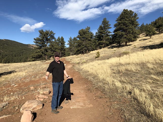
1) Heil Valley Ranch, Boulder County Open Space Parks, Boulder, CO, January 8, 2020 - For the first hike of the year Todd and Alan met up at Heil Valley Ranch to try out a new trail that was just built in the open space area. The new Grindstone Quarry turned out to be a well groomed trail - wide, well maintained and in places paved with stones. A little too easy to really be called a hike - more of a stroll. Where the Grindstone Quarry trail connected to the Lichen Loop and Overland Loop trails we headed back on the Overland Loop trail which was another easy trail. Still, the weather was perfect and it is always nice to catch up with Todd so even if the hiking was easy it was a nice way to spend a couple of hours. A 3.1 mile loop with a mild 300 feet of elevation gain.


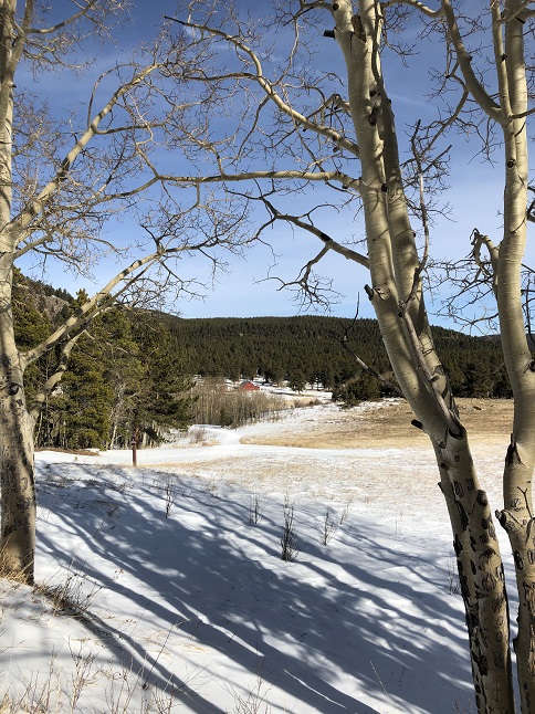
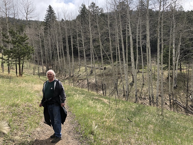
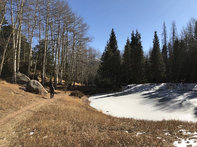
2) Caribou Ranch, Boulder County Open Space Parks, Nederland, CO, January 20, 2020 - Jonna and Alan got out for a short mid-day hike on a Monday so we could stretch our legs and enjoy the beautiful weather. The unseasonably warm weather had melted out a lot of the snow at this altitude which meant hiking on a mostly clear trail but with stretches of ice. The pines and aspens looked particularly sharp against the white snow in the shady areas. 2.7 miles out and back with a mellow 220 feet of elevation gain.

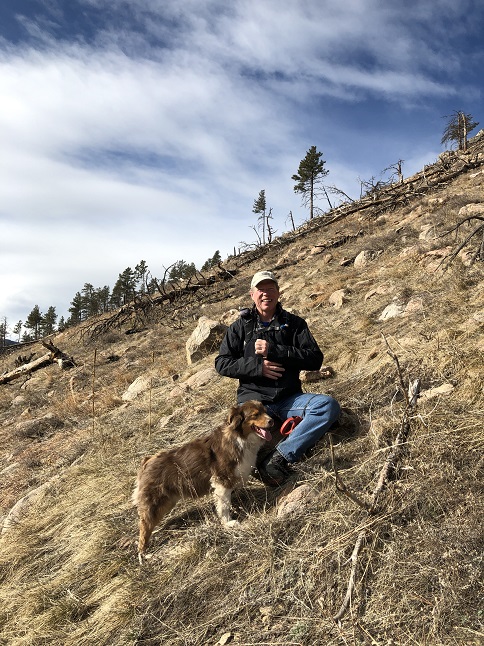
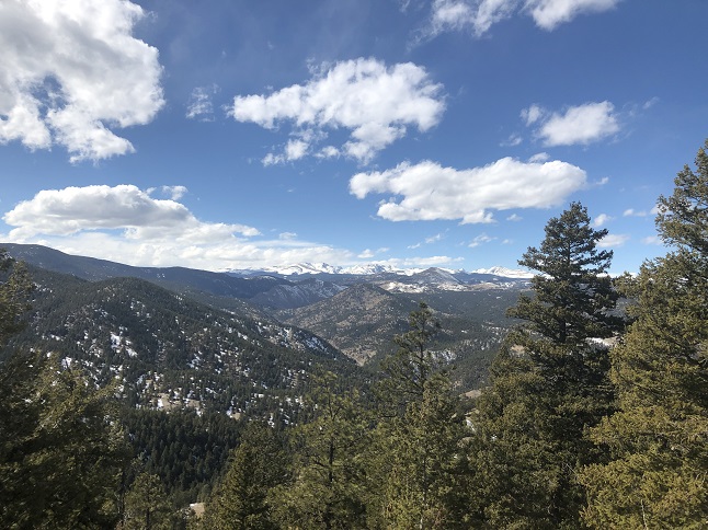
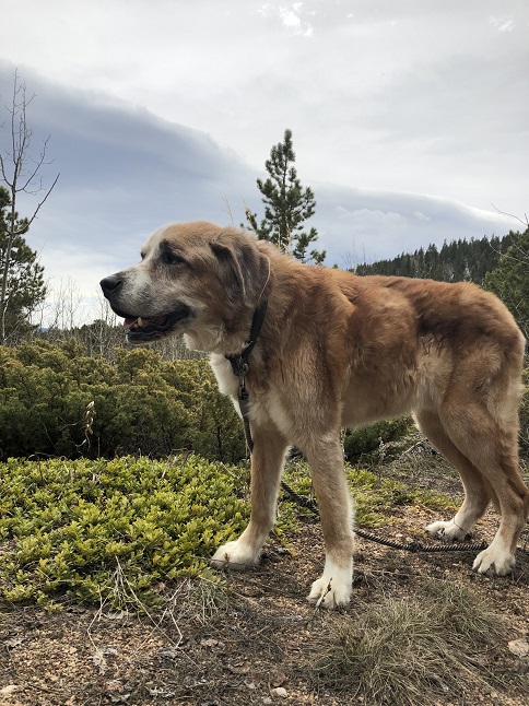
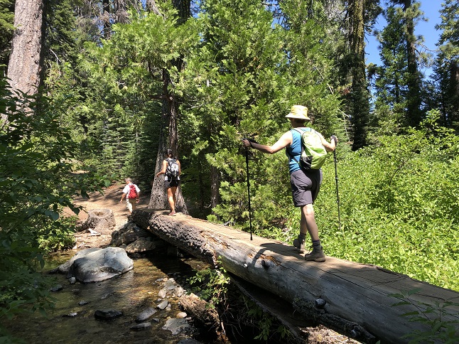
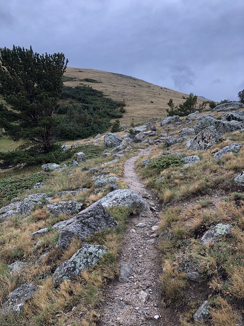
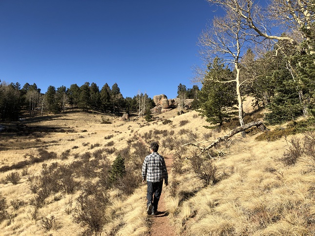
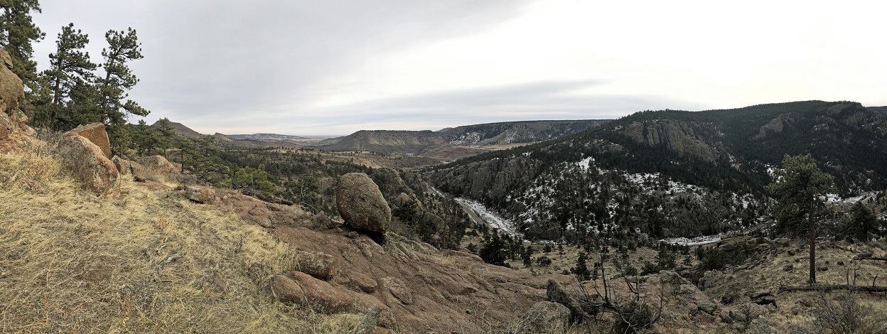
3) Lefthand OHV Trailhead, Arapaho National Forest, Boulder, CO, January 30, 2020 - Todd, Rusty pup and Alan got together for a mid-week hike and decided to check out the Lefthand OHV area. This area has been closed to vehicles since the floods in 2013 but is still open for hiking and biking. The trails were steep so from the trailhead it was a cilmb straight away which meant we had nice views down onto the Left Hand Creek valley. A strung together a bunch of different trails (286, 842, 841, 286D, 843B, 286C and 844) to create a loop on the top of the ridges. Finally, we dropped back down just as steeply as we'd climbed up at the beginning of the hike. We made a final stop at Left Hand Creek so Rusty could drink some fresh snow melt and so we could admire the amazing ice crystals in the places where the creek had frozen. A 4.2 mile loop with a stout 1300 feet of elevation gain.


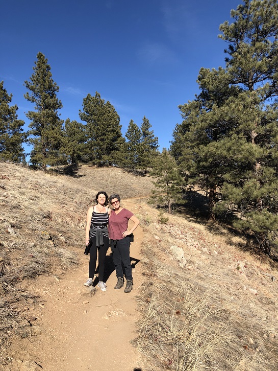
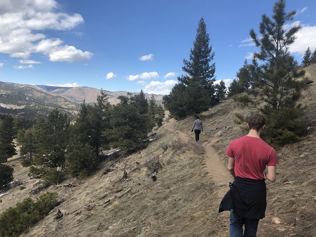
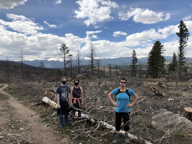
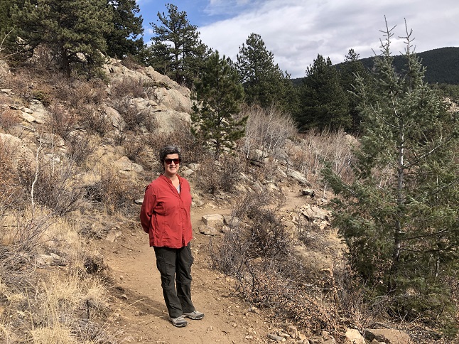
4) Betasso Preserve, Boulder County Open Space, Boulder, CO, February 2, 2020 - With so many people spending their Sunday paying attention to the big sports ball game we decided to take advantage of the (hopefully) empty trails to get in a weekend hike. Unfortunately, the sports ball game started late and about half of Boulder decided to sneak in a mountain bike ride before the game so we ended sharing the trail with a lot of other people. Thankfully, one of those other people was our friend Desiree who joined us for the hike so we had a very nice stroll around the Canyon Loop portion of the trail system. Alan was fighting a head cold so we opted to skip the Benjamin Loop which makes the hike almost twice as long. The unseasonably warm weather meant we were hiking in t-shirts which just felt plain wrong for February! A 3.6 mile long loop with about 500 feet of elevation gain.


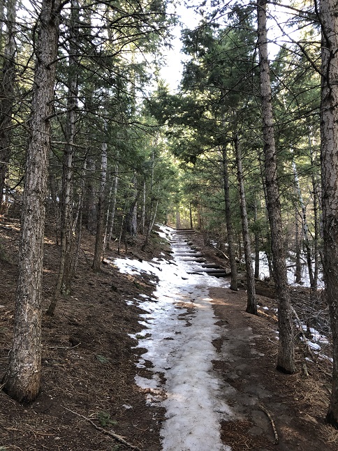
5) Anne U. White trail, Boulder County Open Space, Boulder, CO, February 6, 2020 - Despite a snow storm which dumped nearly a foot of snow on Boulder Todd, pupster Rocky and Alan still headed out to check out the recently re-opened Anne U. White Trail. (This trail was washed out in the 2013 floods and Boulder County spent seven years rebuilding it, just re-opening in the past couple of months.) The trail is still just a dead-end trail but it also still weaves it way back and forth across Fourmile Canyon Creek so it was scenic. There were still loads of tree trunks left in the creek from the flood damage but the trail was only covered with fresh snow. The weather was crisp and cool but much warmer than the single digit temperatures that passed through with the storm. We even had a few minutes of bright sunshine before the skies turned overcast again to herald the next wave of snow expected in the evening. The trail is still a peaceful and scenic place for an easy hike - well, maybe not quite as peaceful when Rocky is urging us to hike a little faster. 3.5 miles with 550 feet of elevation gain.


6) Foothills Trail, Boulder City Open Space and Mountain Parks, Boulder, CO, February 13, 2020 - Todd and Alan found time for another mid-week hike though this one was an afternoon hike after errands filled up our respective mornings. A series of snow storms has dumped a couple of feet of snow in the area so we opted to hike near Boulder to avoid the deeper snow up in the hills. We blindly picked the Fourmile Creek trailhead for this one since neither of us had ever been there before. Unfortunately, it turns out that the only trails that leave from that trailhead are basically neighborhood dog walking trails... flat, mostly paved and dead straight. Despite the uninspiring choices we went anyway and walked the Foothills trail to its end, winding through the upscale Wonderland Hills housing development. However, the one good thing about urban hiking is the ability to pop into a grocery store to buy ice cream. You can't do that hiking up in the mountains! We returned by walking the sidewalks through North Boulder so even less of a hike that the snow-covered paved bicycle trails we'd started with. Still, the company (and the ice cream) were good so we'll mark this one up in the win column. An easy 4 mile loop with an equally easy 350 feet of elevation gain.


7) Caribou Ranch, Boulder County Open Space Parks, Nederland, CO, February 17, 2020 - We didn't get a chance to cross-country ski at all last winter so after a week of steady snow blanketed the mountains we decided to literally dust off our skis and head out to re-learn how to do it. We originally planned go to a secret local trail but found that the trailhead hadn't been plowed so we abandoned that idea since we couldn't park there. So we fell back on the old stand-by...the nearby Caribou Ranch Open Space. This was a good choice since it is a very flat trail which would make for an easy re-introduction to kicking and gliding. We had a gorgeous weather, beautiful scenery and fresh powder on top of enough packed snow to cover the rocks and tree roots. Cross-country ski'ing uses muscles you don't use for hiking so a short ski had us both feeling sore but it was still fun while it lasted. An easy 2.5 miles out and back with a mellow 200 feet of elevation gain.


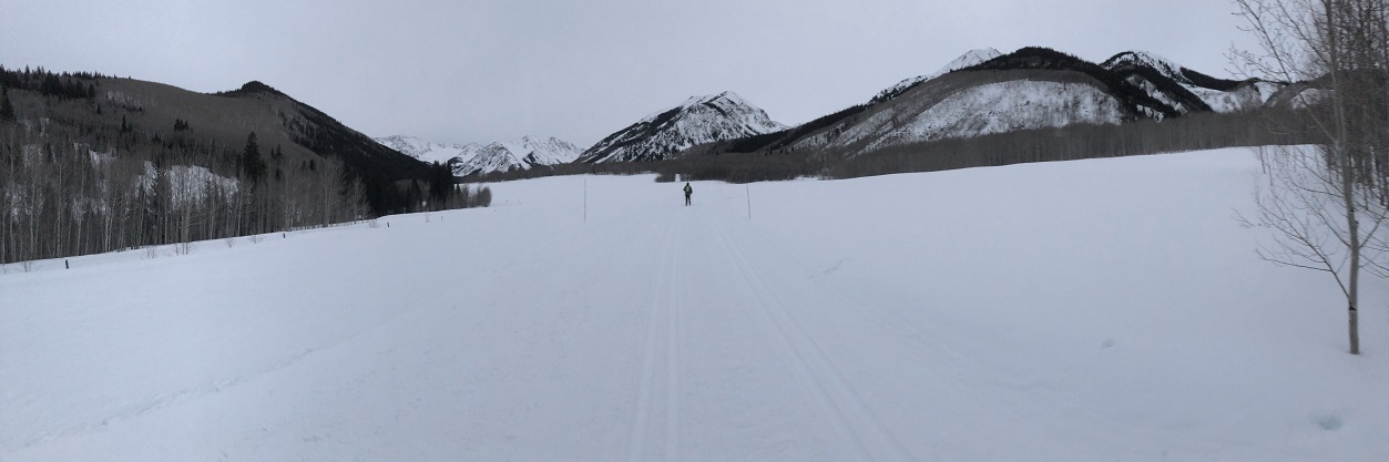
8) Pine Creek Cookhouse, Ashcroft Adventures, Ashcroft, CO, February 22, 2020 - For Jonna's 55th Birthday we headed west to celebrate. Specifically, we drove to the old townsite of Ashcroft, near Aspen, in order to have a special dinner at the Pine Creek Cookhouse. What made this even more special is that the only way to get to the Pine Creek Cookhouse is to cross-country ski, snowshoe or take a horse drawn sleigh. We opted for the ski'ing option. We started after sunset but before it was completely dark so we could enjoy the stunning landscape (and the groomed trail!). We had nice 4 course meal at the restaurant and then ski'ed back in the dark with stars sparkling overhead and coyotes calling back and forth across the valley. 3 miles out and back with a mellow 350 feet of elevation gain.


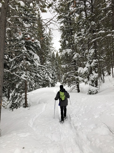
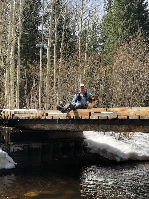
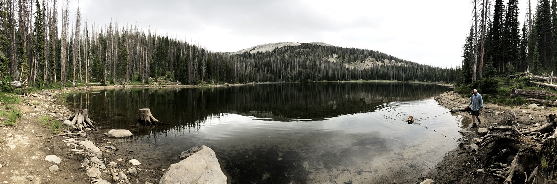
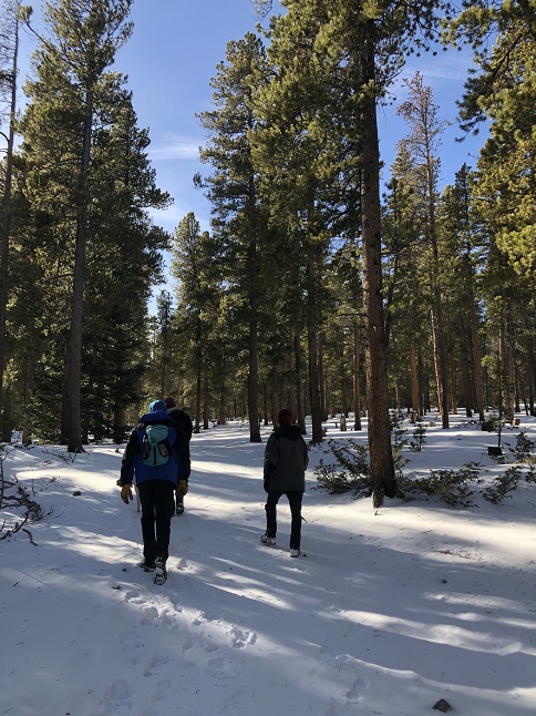
9) Brainard Lake trails, Brainard Lake Recreation Area, Ward, CO, February 27, 2020 - After a few days of snow dumped some fresh powder in the mountains Todd and Alan ventured out for some snowshoeing. We met up at the Brainard Lake Recreation Area's winter parking area and were greeted with a constant arctic blast and blowing snow. Fortunately, as soon as we walked into the trees on the Waldrop trail the wind disappeared and a few rays of sunshine broke through the clouds to light up the snow. Gorgeous! For the entire hike we always planned to put on the snowshoes but previous skiers and snowshoers had packed down a narrow trail so except for where the wind had drifted up freshs now it was never quite deep enough to justify them. We hiked in on the Waldrop trail, then turned east onto the South St. Vrain Trail and hiked along the north side of the South St. Vrain Creek. This section hadn't been used in awhile so we were breaking trail in fresher snow (and found it more difficult to stay on the packed trail - we frequently stepped off the old trail and fell into hip deep snow!) This trail eventually meets the Sourdough Trail and we used that to make the steady climb back up to the parking lot. The snow made the hike a workout but it also made for a beautiful landscape to travel through. We didn't see anyone else the entire time so we had the whole winter wonderland to ourselves! A snowy 5.6 mile loop with around a 1,000 feet of elevation gain.


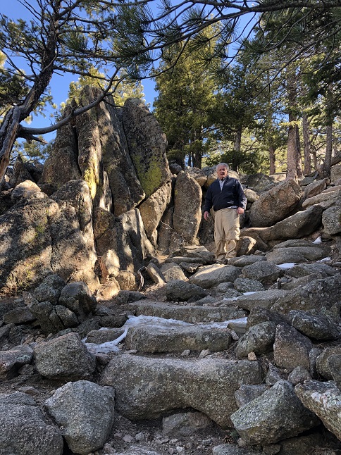
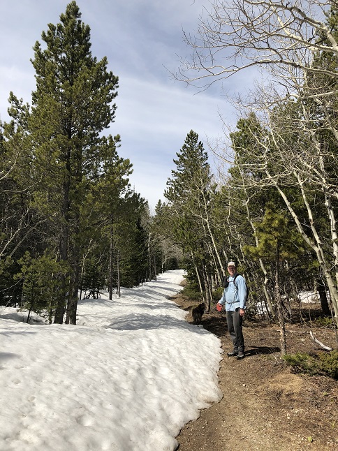
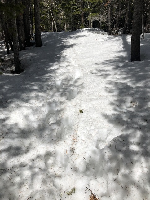
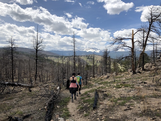
10) Mt. Sanitas, Boulder City Open Space & Mountain Parks, Boulder, CO, March 1, 2020 - Well, this is a rare hike update. For the first time in many years this update will be written in the first person rather than third person from the perspective of a group. That is because I went hiking alone! It turns out I had a free Sunday so I made the snap decision to head down to Boulder and start the annuali spring training hikes. I parked at the Settler's Park trailhead and hiked over the Red Rock's trail to the Mt. Sanitas trailhead. From there I headed up Dakota Ridge trail to the base of the East Ridge of Mt. Sanitas. The climb up to the top was a mix of muddy, icy and rocky. The higher I went up the cooler it got. The mercury was dropping as a snow storm rolled in. From the top I descended via the Mount Sanita trail. To get back over the Red Rocks ridge I took the Anemone trail to return to the Settler's Park parking lot. The snow started falling as I returned to the Jeep so my timing was pretty good. 4.5 miles with 1,500 feet of elevation gain.


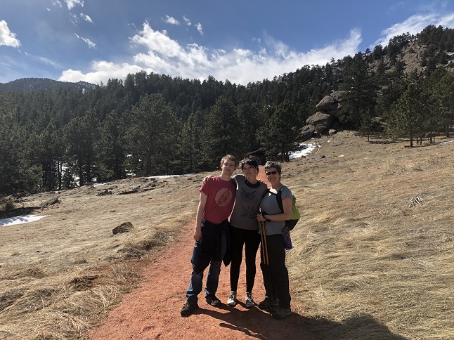
11) Flagstaff Mountain, Boulder City Open Space & Mountain Parks, Boulder, CO, March 8, 2020 - Hike #2 of the annual spring training hikes is in the books. Our friends Desiree and Gaelin joined Jonna and Alan for the hike up Flagstaff Monntain. We started at a new trailhead for us, a little spur trail at the end of Arapahoe Street. From there we went up a litle ways and then joined with the Eben G Fine Park trail that goes up the east face of the mountain. The trail was icy down at the bottom but mainly just muddy. Up at the top we crossed over to the west side of the mountain via the Rangeview trail and then decended on the Tenderfoot trail to Chapman Dr trail. Then it was down the old road to the Chapman Drive trailhead so an "up and over" hike which was a nice change from the usual "up and back down" path. We were fortunate to soak up plenty of Vitamin D since the sun was shining and the temperature was warm. But snow clouds were forming and it was starting to get grey when we got into the car at the end of the hike so we timed it well. It was great to spend time out hiking with our friends. 5.5 miles with 1,700 feet of elevation gain.

12) Hunter Canyon Trail, Bureau of Land Management, Moab, UT, March 15, 2020 - Social distancing rule #1: Maintain at least six feet away from other people. Check! We decided we could socially distance best with a little weekend of desert solitude so we loaded up the car and drove to Moab. Today we got up and hiked the Hunter Canyon trail which is beautiful. (Then again, this is Utah to beautiful is pretty commonplace in these parts...) The trail wound along a creek through mighty red rock canyons. There is an arch to enjoy, the trickle of the water in the creek bed and little buds of green sticking up out of the red sand. Signs of spring even amid the chaos of the outside world. Much better than spending the weekend staring at the wall of our house and stressing over ever increasing coronavirus numbers. 5 miles out and back with 300 feet of elevation gain.


13) Amphitheater Trail, Bureau of Land Management, Moab, UT, March 16, 2020 - For the last morning of our Moab hiking trip we got up early and hit up the Amphitheater Trail that is north of Moab as we drove out of town. The sun was just breaking over the cliffs to the east as we left the trailhead which started to quickly warm up the chilly morning air. The trail followed the gradual climb of a wash all the way up into the massive Richardson Amphitheater. From there the trail climbed up a ridge which gave a spectacular panorama - around the Richardson Amphitheater to the east, then across the desert to the south and then over the Colorado River to the west. The trail then wound back down in a big loop to return to the trailhead. The colors made by the low dawn sun were fantastic. Bright reds, oranges, yellows, greens and grays. Better yet, we made the entire hike without seeing a single other hiker so we had the place to ourselves. A relaxing way to start the day and to de-stress before returning to the craziness of Coronavirus dominated daily life. A 3.1 mile loop with 400 feet of elevation gain.


14) Green Mountain, Boulder City Open Space & Mountain Parks, Boulder, CO, March 18, 2020 - Lyle and Alan both took a brief break from quarantining in our respective homes to check off the third of the annual Spring training hikes. We kept it shorter than normal, starting the hike at top of Flagstaff Mountain instead of at the bottom of Gregory Canyon. We also kept it simply by going up the E.M. Greenman trail to the top and then coming back down the same way. It wasn't the easiest hike - the trail was icier that it has ever been in over 15 years of hiking. Micro-spikes were required! The day started with a bright blue sky but clouds started to rolling in around noon in advance of a coming snow storm. The hike back down was even slicker than the climb up since the morning sun had melted a thin layer of water on top of the ice. We made it back down safely and happy we'd opted for the shorter version of the hike. A little vitamin-D, some fresh air, a chance to get some exercise and clicking another hike off the spring training hike list. Success. 4.6 miles up and back down with 1,400 feet of elevation gain.


15) Ellsworth Creek trail system, Rollinsville, CO, March 21, 2020 - After a few days stuck inside staring out the windows at two feet of fresh snow (and a day spent shoveling it!) we headed out to do some social distancing in nature. We met up with our friends Holly and Rick, then went in search of a trail that wasn't full of stir crazy young people. (We actually met up at the Moffat Tunnel trailhead only to find the place swamped with people so we rushed away from there and headed to a little known local trail instead.) We strapped on our snowshoes and headed out into the snow-covered woods for a short but strenuous hike. It was both lovely and peaceful. A relaxing time spent with friends in the midst of all this craziness. A 2 mile loop in knee deep snow with a mellow 200 feet of elevation gain.


16) Ridge Road trail system, Nederland, CO, March 25, 2020 - Jonna and Alan have been going out most evenings for a short walk around our mountain neighborhood but tonight we decided to venture a little further afield so I'm upgrading it to a "hike". There was still about 6" of snow on the ground left over from last week's two feet of fresh powder. With the warm weather this week all that snow has turned into an icy slush so we sloshed our way through about half the hike. There is an unmarked local trail system on National Forest land near our house so we wandered along that trail system and explored a new section we had bypassed on previous hikes. The burn area from the big fire in 2016 is still pretty barren looking but the stark tree trunks look impressive sticking up out of a field of white snow. Nothing fancy but it is particularly nice to spend time in the outdoors during this time that we are spending so much time stuck in the house. 2.3 miles with 400 feet of elevation gain.


17) East Magnolia trail system, Nederland, CO, March 28, 2020 - This weekend we got together with our friends Holly and Rick for a some more outdoor social distancing. We headed to another of our local trails which we hoped would be empty. Fortunately, that proved to be the case. The trail was a boarderline hikable. In places packed down and frozen, in other places deep enough to posthole through the knee-deep snow. We switched between hiking and snowshoeing as we walked under a perfect blue sky which lit up the pristine white snow. A good time enjoyed in a beautiful place with good friends. 2.9 miles with 325 feet of elevation gain.


18) East Magnolia trail system, Nederland, CO, April 26, 2020 - We've been getting out for little walks in the neighborhood to break up our "stay at home" time but nothing worth claiming was a hike. Well, today we returned to the quiet East Magnolia trail that we hiked a month ago. The trailheads in the front range have been packed so we're sticking to the smaller off-the-beaten-track trails for now. We met up with our friends Holly and Rick, along with pups Buster and Pokey, for a short hike through the melting snow. Nothing fancy but it was nice to get out for some fresh air, to see the first of the spring pasque flowers poking up out of the muddy ground and more importantly to get some social interaction with our good friends! 2.5 miles with 300 feet of elevation gain.


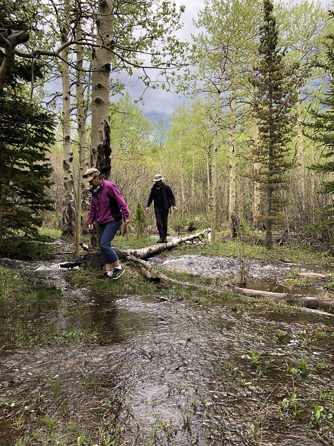
19) South St. Vrain Trail, Ward, CO, May 6, 2020 - With the mountain trails getting swamped with people on weekends I've switched to hiking mid-week in an effort to stick with proper social distancing. Today I joined Todd and Rusty pup to explore a side trail I'd spotted a few years ago off the quiet South St. Vrain Trail. We met up at the trailhead mid-morning and found only one other car in the parking area. Hiking is a "Go". What wasn't expected was a much snow as still covered the trail in many places. Fortunately, the trail gets enough traffic that the snow was packed down so for the most part we could hike on top. However, when we reached the side trail we wanted to explore that ended. The untrafficed snow was soft and crunchy so we immediately started post-holing. After about 40 yards it quit being fun so we scrapped the plan to follow the mystery side-trail and headed back. Maybe we'll try again later in the summer. It was so nice to spend time talking with a friend and to spend a few hours out in nature - listening to the rushing creeks, crunching through snow, seeing the tiny spring buds on the bare aspen trees and noticing the new sprouts of grass emerging from the mud. 5.8 miles out and back with 1,000 feet of elevation gain.

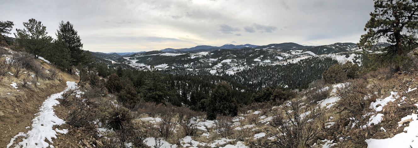
20) Frazer Meadows, Golden Gate Canyon State Park, Golden, CO, May 14, 2020 - It has been nearly two months since Alan and Lyle last got together for a hike so we remedied that today by meeting at a trailhead in Golden Gate Canyon State Park to hike one of our favorite loops there. Specifically, the climb up from the Ole Barn Knoll trailhead on Mule Deer trail up to Frazier Meadow and then north to the junction with Coyote Trail. There there we took Coyote back down off the ridge through Bootleg Bottom to the junction with Elk trail. Finally, we dropped down Elk trail back to the Ole Barn Knoll trailhead. Despite the increasing clouds we managed to avoid the forecasted rain and enjoyed the cooler temperature which was perfect for hiking. It was good to catch up after the two month break nice to spend a few hours out in a beautiful bit of nature. A 5.1 mile loop with around 1,000 feet of elevation gain.


21) Ridge Road trail system, Nederland, CO, May 17, 2020 - Lovely weather helped tempt our friends Desiree and Gaelin up to Nederland to go for a hike with Jonna and Alan this weekend. To avoid all the busy trailheads in the mountains we just hiked the local trails that are within walking distance of our house. This network of informal trails are within nearby Roosevelt National Forest land and crosses through the burn area from the 2016 fire. The stark hillsides now give a decent view of the snow covered Continental Divide to the west and the new open meadows have combined spring snow melt and summer sunshine into hundreds of clumps of pasque flowers. It was nice to hike once again with our friends - a bit of normalcy in this strange time! 3.5 miles with a mellow 400 feet of elevation gain.

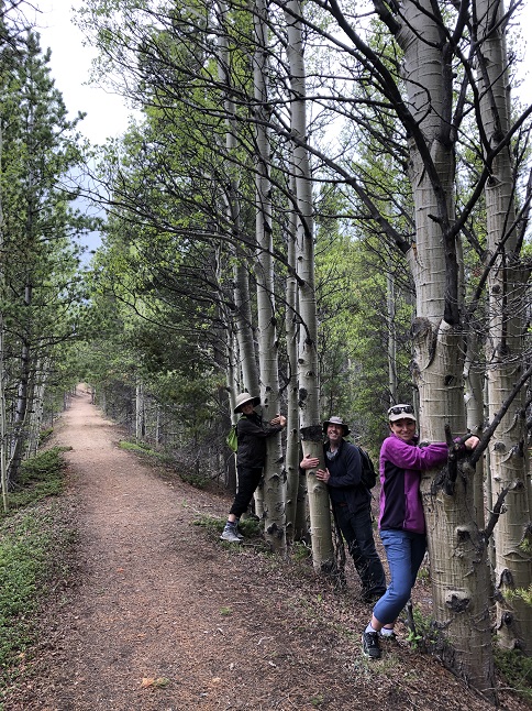
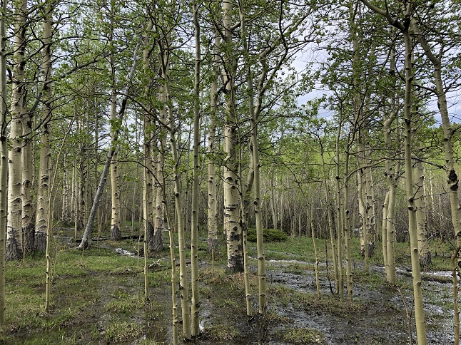
22) Como Creek trail system, Nederland, CO, May 31, 2020 - It is *so* nice to hike with friends these days. I don't really notice the lack of social interaction until I'm spending time with others and then I realize how much I've missed it! Our friends Amy and Michael came up this afternoon to go for a hike and enjoy a socially distanced dinner on our patio. We drove to the nearby Como Creek trailhead hoping it would be empty on a Sunday afternoon but found five cars there. Still, we donned our masks and headed down the trail. We passed four groups of hikers right away and then had the trail to ourselves for the rest of the hike. Pshew! There was a thunder cloud rolling through to the south but we were just far enough away to stay dry. The aspen grove along Como Creek was spectacular - a natural temple to the peace and tranquility of the woods. The ground was squishy with spring melt water but the first of the wildflowers were also starting to dot the landscape. Unfortunately, we also found a trash filled abandoned campsite just off the trail. Grrrrr. I know this is a minor thing with all the chaos in the world but it is infuriating nonetheless. Still, we had a beautiful hike with treasured friends followed by a yummy dinner. A grand way to end the weekend! 2.3 miles with a mild 350 feet of elevation gain.


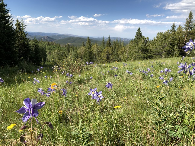
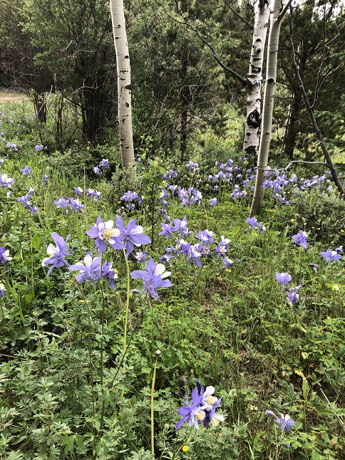
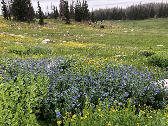
23) Ellsworth Creek trail system, Rollinsville, CO, July 8, 2020 - For the past few years we've been traveling during the summer and have missed seeing Colorado's wildflowers. With our international travel plans pandemic'ed we were actually in our home state in July so today we went out for a hike with the specific goal of seeing some wildflowers. And success! Because the trails have been so busy we headed back to the semi-secret Ellsworth Creek trailhead and it was empty! Score! At the trailhead the wildroses were exploding so we were immediately off to a good start. Within a few steps we'd already spotted a half dozen other types of flowers. And then came the columbines. They were everywhere! Hundreds, no, thousands of them. And more: Indian paintbrush, yarrow, bluebells, larkspur, asters, wallflower, buttercups and many others that we didn't even know the name of. The hike was topped off with beautiful views of the Indian Peaks. I don't regret our travels but it sure was nice to be reminded of how stunning Colorado is in the summer! 4.6 miles up and back down with 850 feet of elevation gain.


24) Ellsworth Creek trail system, Rollinsville, CO, July 12, 2020 - We spent the weekend bragging to our friend Julia about all the wildflowers we saw on our recent Ellsworth Creek hike so today we brought her to see them herself. We'd also bragged about how it was a quiet local's trail. Ooppps! Today we had to contend with a side-by-side, an ATV and a Jeep, as well as a couple of folks car camping. I guess even the secret trails are busy on a weekend these days! Still, the wildflowers didn't disappoint. Even through only four days had passed since we were last here there were a lot more indian paintbrush blooming, loads of Gunnison's mariposa lilies had appeared and many of the purple columbines were starting to look pretty secondhand. Lovely colors and a fun conversation shared with a good friend. 4 miles with 700 feet of elevation gain.
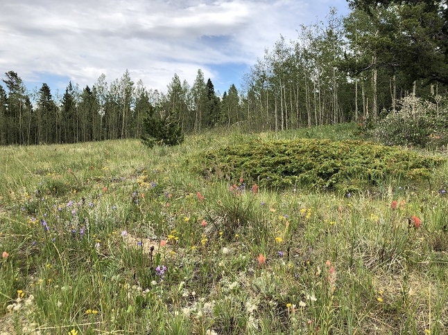


25) Como Creek trail system, Nederland, CO, July 13, 2020 - Back-to-back hikes! Following up on our colorful wildflower hike on Sunday, Monday evening our friends Desiree and Gaelin drove up and we headed to a different "locals" trail. This time we were successful in avoiding other people and we found a bunch of wildflowers along this trail as well. Different from the flowers we'd seen along Ellsworth creek were the red clover, white fairy trumpets, black eyed Susans and the common yellow sunflower. We also watched as rain from dark clouds to the south of us over the Como Creek valley refracted the sunlight into an earie redish color. We got sprinkled a couple of times but the heavy clouds held off on dumping directly onto us so we made it back to the cars mostly dry. It was nice to do an evening hike for a change and good to catch up with Desiree and Gaelin again. 4.5 miles out to the end of the trail and back with a mellow 400 feet of elevation gain.


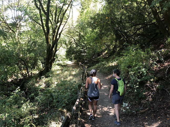
26) MacDonald trail, East Bay Skyline Recreational trail system, Oakland, CA, July 17, 2020 - Jonna and Alan's Pandemic travel continues. After a successful RV trip down to Florida in late June to visit Alan's family and then a week quarantine back in Colorado we hit the road again in mid-July to visit Jonna's family in California. As with our previous trip we confined ourself to the camper for sleeping, eating and using the bathroom so our only interaction with the outside world while enroute was using pay-at-the-pump gas pumps to fill up with gas. We are evening sleeping in the RV at Jonna's brother Jamie's house so despite the threat of the coronavirus we're being pretty careful. However, the whole point is to visit with family so we took niece Rosie out for a hike up in the Oakland hills. She suggested the Macdonald trail and it was a good choice. Not too crowded, a cool breeze blowing and some nice views. We parked at a secondary parking area to avoid the more crowded main lot and then hiked over to the MacDonald trail. Just a short way up we did a side loop on the Bird Trail which kept us away from other hikers and was through lush forest. Once back on the MacDonald Trail we climbed up to the top of a ridge and started to get scenic views. We also got to see goats and sheep. Apparently, the park service is using critters to manage the grass and undergrowth in the hills! We even found a few wild flowers that hadn't yet shriveled in the summer heat. Most of all we enjoyed a couple of hours hanging with our niece so it was perfect! Around 4.0 miles round trip to our turn around point and back with 790 feet of elevation gain.


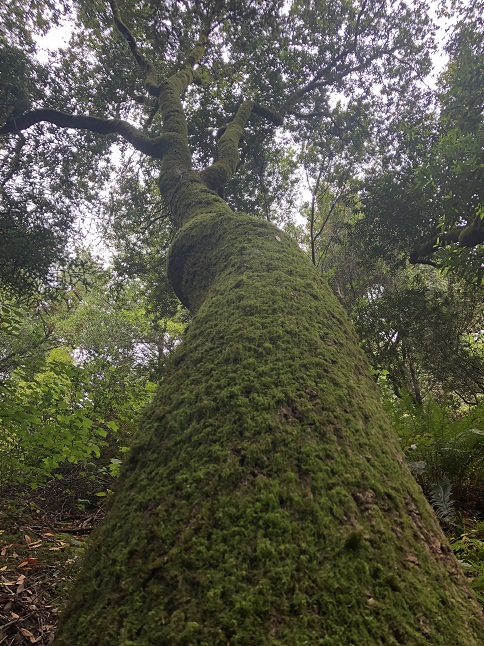
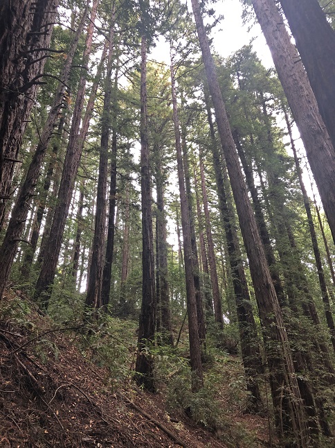
27) West Ridge trail, East Bay Skyline Recreational trail system, Oakland, CA, July 20, 2020 - We had such a nice hike with Rosie that we got out for another hike in the Redwoods above Oakland to start off the new week. ...and as a bonus Jonna's brother Jamie, niece Rosie, nephew Larkin and Larkin's girlfriend Molly all joined us for this hike. We parked at the Roberts Regional Park Redwood Bowl Staging Area parking lot which is just a couple of miles from Jamie's house. The goal was to hike part of the West Ridge Trail which leaves from that trailhead. We wandered down the West Ridge Trai for a ways before turning onto Tres Sendas Trail which dropped us down into the stream valley which is wet enough to support the redwoods. We went down, down, down to where Tres sendas meets the French Trail before turning back. It is amazing that the top of the ridge is relatively dry with a mix of eucalyptus trees and oak. Then 500 feet down it is damp with Redwoods, ferns and moss. On the way back took a slightly different route stringing together Scout's Trail, Castle Park Trail and Bayview Trail. In addition to the lovely scenery we also spotted a couple of deer and a large flock of wild turkeys (the wildlife, even more than the coastal redwoods, is amazing to find just a strone's throw from Oakland and Berkeley.) A rolling 3 mile hike with around 500 feet of elevation gain.

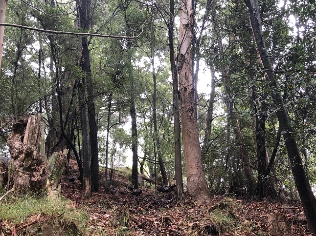
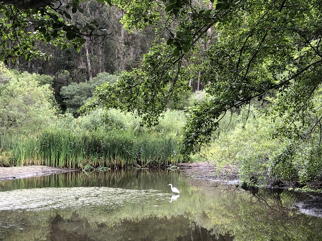
28) Tilden Nature Area, East Bay Regional Park District, Berkeley, CA, July 21, 2020 - Jonna's sister-in-law Kelly had missed out on our first two hikes so we made it back-to-back outings by heading up to the Tilden Nature Area today with her, Jamie and Rosie. We strung together a mish-mash of trails to make a rough loop through the middle of the Nature Area. We parked at the Indian Camp picnic area and encountered a flock of turkeys strutting through the picnic area. Once we started walking we took Wildcat Creek trail around Jewel Lake. The water level was really low so it was more of a muddy pond but there were still ducks, turtles and a striking white heron in the little pools of water that were still there. Next we turned onto Lower and Upper Packrat Trails which climbed up the ridgeline along the southern edge of the park. These trails are a model of urban park planning. A maze of trails all squeezed in between roads, houses and park facilities. You feel like you are in a wilderness but literally a stones throw in any direction you'll hit asphalt. At the top of Upper Packrat we took a left onto Memory Trail which goes through a littel canyon before climbing up the opposite ridge. Once again at the southern edge of the park we turned left onto Selby Trail which is carved into the side of the ridge. It is a roller coaster - up then down then up and then down again. We hiked that all the way to the park's Carousel parking area. We'd planned to continue further to return via the Wildcat Gorge Trail but we had a hard time limit so we made a fast return to the car using a bit of asphalt by walking down Central Park Drive. It was a mostly empty trail which is still a surprise given how close to a major population center the trail is located. It was also a wild place that is different from the mostly redwood forests we've hiked in the last two hikes. This was mostly oaks with dense, dense scrub underbrush. In most places you couldn't see more than 6 or 8 inches on the sides of the trail and the scurrying sound of invisible little critters was ever present. A 3.4 mile loop with 400 feet of elevation gain.


29) Lands End Trail, Golden Gate National Recreation Area, San Francisco, CA, July 22, 2020 - We made it three-for-three by getting out for a third hike over three days (and our fourth hike since we came out to the Bay area!) This time we were joined by our niece Rosie so it was three for our three-for-three. However, this was less a hike and more of a stroll - a nice walk along the edge of the Pacific Ocean on the Lands End trail on a mix of semi-paved trails, dirt trails and even on a road. We started at the Lands End Lookout parking lot through the wind swept trees and soaring sea birds. A beautiful sunlit blue sky and a mild sea breeze made for perfect weather to enjoy the panoramic views on this trail. We had beautiful views of the Marin Headland and the Golden Gate Bridge. We saw a raft of sea lions floating below the Mile Rock Overlook and countless birds, both in the thick forest along the coastal trail and on the rocks just offshore. We returned via El Camino Del Mar road past the Palace of the Legion of Honor and then on the El Camino Del Mar Trail past the USS San Francisco Memorial. Not a challenging feat of outdoormanship but really pleasant morning walk. ...and being an urban trail afterwards we could get yummy Greek take-out for lunch which we ate while people watching in Duboce Park. You can't do that in the back country! A 3 mile loop with a mild 300 feet of elevation gain.


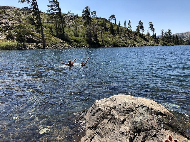
30) Long Lake Trail, Plumas National Forest, Graeagle, CA, July 24, 2020 - After a week in the Oakland/San Francisco area we started our return trip by moving east up into the Sierra Nevada mountains. We stopped in Graeagle, CA to spend a few nights with Jamie and Rosie at Jamie's mother-in-law's cabin. We've visited this area for nearly a decade but always in the winter. This was our first visit to Graeagle in the summer and we immediately headed out for a hike to enjoy summer in the Sierras. We started at the Lakes Basin Campground trailhead and hiked in to Long Lake via the Bear Lakes Loop Trail. This trail highlighted all the great things about the Sierras - wildflowers, massive moss-covered pine trees, clear mountain creeks, a beautiful alpine lake with a stark rocky peak as a backdrop. Add in perfect weather and it was a wonderful hike. Jamie and Rosie jumped into the cold water for a swim but Jonna and Alan opted to sun on the shore instead. A very nice hike and a great introduction to summer hiking in this area. 3.8 miles up and back down with a steady climb totaling 500 feet of elevation gain.


31) Jamison Lake Trail, Plumas-Eureka State Park, Johnsville, CA, July 25, 2020 - Our second day in the Sierras was also Alan's birthday so we headed back out for a big birthday hike. We drove up to Johnsville and parked at the Jamison Mine trailhead in Plumas-Eureka State Park. Straight out of the car we were climbing up a rocky hillside past some of the old Jamison Mine buildings. After we climbed out of the Little Jamison Creek valley the trail flattened out some and became a really lovely trail. The trail went past Grass Lake and the views of Mount Washington across the lake were gorgeous. As with the previous day's trail there were lots of wildflowers, amazing gigantic pine trees and a half-dozen streams. We reached Jamison Lake and all four of us jumped in for a swim. The water was chilly but it was still a fun way to salute Alan's birthday. After a picnic lunch spent enjoying the view (and watching a water snake swim by!) we hiked back down the way we'd climbed up. A wonderful way to celebrate Alan's 53rd trip around the sun! 6 miles round trip with 1,000 feet of elevation gain.


32) Heart Lake, Dipper Lake Trail, Medicine Bow National Forest, Centennial, WY, July 28, 2020 - The last stop on our western loop was in one of our favorite places - The Snowy Range in Wyoming. What made this even better was that our friend Todd and his pup Rusty drove up from Colorado and camped with us for a couple of nights. The Medicine Bow National Forest has some of the most impressive wildflowers we've ever seen and this year was no exception. Todd and Alan headed out for a hike just off FS-103. We drove past South Twin Lake but hit rougher road than expected so we parked and walked the road past North Twin Lake to Dipper Lake. From there we started the actual hike on the Dipper Lake trail to Heart Lake. We didn't get very far before the overcast skies started to drizzle and, for the next couple hours, it rained continuously. Never hard but just a steady sprinkle. However, the rain didn't dampen the scenery because the wildflowers were spectacular! We wandered through the area northwest of Medicine Bow peak - just following the ridges, ponds and lakes. Along the way we spotted a couple of moose and Rusty found a porcupine - we had to hold the poor pup down to pull about a dozen quills out of his snout. Ouch! Eventually, we decided we were chilly and damp enough inside our rain gear that we turned back to the car. Even with the rain it was a stunningly beautiful hike. Once again the Medicine Bow National Forest delivered and this was a perfect way to cap off our two week ramble through the west! A 6.1 mile wander with a mellow 700 feet of elevation gain.


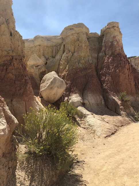
33) Paint Mines Interpretive Park, El Paso County Parks And Recreation, Calhan, CO, August 14, 2020 - Coronavirus has put a hitch in both of our work plans for the Fall so we decided to take the RV out for another trip to turn our unexpected free time into some sightseeing. There have been a couple of sites in southern Colorado that have been on our "to do" list so we pointed the camper south and spent a couple of nights at Pueblo Lake State Park. The first day of our mini-vacation was a visit to Bent's Old Fort - a historical site in the southeastern corner of the state. Then, on our way back home we stopped off at the Paint Mines Interpretive Park - out on the plains in eastern Colorado. There we got out to hike through the park where we enjoyed the colorful and surreal rock formations. Unfortunately, we were there mid-day which mean it was *hot* but also meant that the blinding sunshine bleached out some of the colors. On the positive side that same bright sun really made the white sand really gleam. It was quite crowded and what was really sad was seeing so many of the visitors climbing up on the formations despite many, many signs saying not to. It was an interesting place - nothing spectacular but worth a visit if you set your expectations based on this just being a county park. An easy 2.3 mile walk with a rolling 220 feet of elevation gain.


34) Maryland Mountain, Maryland Mountain Recreation Park, Blackhawk, CO, August 27, 2020 - It has been awhile since Lyle and Alan got together for a hike so when Lyle suggested we check out the newly opened Maryland Mountain Recreation Park that the city of Blackhawk is building it was an instant plan. We parked at the Hidden Treasure trailhead and hiked the only two trails that are currently available - the old Gilpin Tramway railroad bed trail that crosses over the foot of Maryland Mountain to Chase Gulch and then the first singletrack mountain bike trail that climbs the western face all the way up to the summit. We tried to take the hiking only trail down the east face of the mountain but it turns out that trail is only half built which required some steep downhill cross country hiking to drop back down to the tramway trail. Fortunately, we had perfect weather so we soaked up plenty of Vitamin D while enjoying the trails. The summit as so many trees that you don't get grand panoramic views but you can look down on the mega-casinos in Blackhawk so there is certain smug joy in doing that. This is going to be a fantastic series of trails once it is complete - the plan totals about 12 miles of various use trails - but it is nice even right now since so few people are using it. I'm sure we'll be back. A 6.5 mile loop with a 1,000 feet climb up to the top of the mountain.


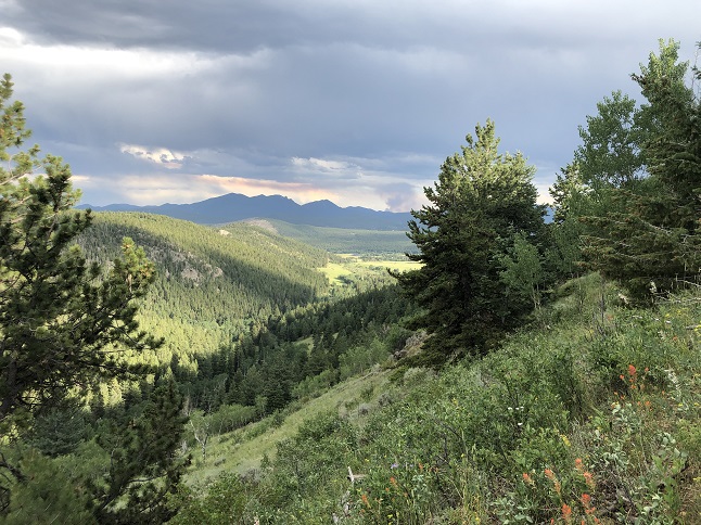
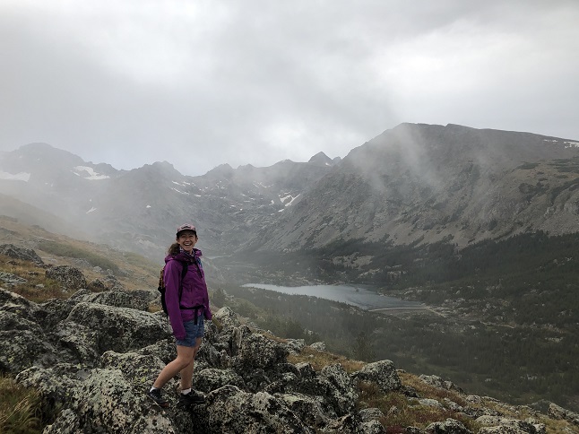
35) Arapaho Glacier trail, Ward, CO, August 28, 2020 - There is a general rule in Colorado that you don't hike up into the high country in the afternoon because of the danger of storms. This rule is true. In fact, it was true today. However, the weather forecast for today showed the afternoon rain would likely stop in the early evening and a little (non-thunderstormy) rain wasn't enough of a deterrent so Julia and Alan headed out to check out one of most scenic trails in the area - the Arapaho Glacier trail. Julia, for those who aren't keeping track, is our friend and frequent house/cat sitter who has been staying with us for the past couple of summers. She is also an avid hiker. Since she hadn't seen this trail before and since she is leaving soon we were willing to risk the rain. We started at the Rainbow Lakes trailhead and it was dumping when we got out of the Jeep. Still, with some faith in the weather forecast we started climbing up the trail and the further west we went and the higher we climbed the more the rain slackened. Yes! By the time we broke out of the trees onto the high alpine tundra above treeline the rain had stopped completely and the clouds were breaking up. This just made the gorgeous views all the more special. It was too late to tarry for too long up in the high country but we both got to enjoy the views before hiking back down the soggy trail to return to the warm heater back in the car. 5.4 miles up and back down with a climb of 1,200 feet.
36) SourDough trail, Ward, CO, September 6, 2020 - The challenge of hiking on Labor Day weekend isn't necessarily the terrain but finding a quiet trail. Our good friend Desiree drove up from Boulder so we could take on that challenge and we found success! We tried a couple of different trailheads but found them packed with cars but our third choice hit pay dirt. There was only one other car at the SourDough trail up by Beaver Reservoir! We decided to hike south over the ridge to Beaver Bog and then continued back up in elevation on SourDough past the Wapiti Trail connection until eventually turning around and returning to the car. It isn't a trail with many scenic vistas but it was nice to wander through the woods and to have the trail to ourselves on a holiday weekend. 4.5 miles with 600 feet of elevation gain.


37) Bear and Lily Lake, Rocky Mountain National Park, Estes Park, CO, September 9, 2020 - Jonna and Alan awoke on September 9th, the date of our 20th wedding anniversary, to find 4 inches of fresh, wet snow on the ground and low lying clouds giving a foggy look to the landscape. We weren't up for a hike but we did want to get out for a walk in our beloved Colorado nature to celebrate. We jumped into the Jeep and took a drive up to Estes Park to enjoy the wintery weather. We then took advantage of our National Parks Pass to drive into Rocky Mountain National Park. In the park we drove up to Bear Lake and lucked into a rare mid-day parking spot so we got out and walked the short, icy loop around a cloud shrouded Bear Lake. It was too crowded to tempt us into further hiking at that trailhead so we started driving back south towards home. Along the way, we stopped at the Lily Lake parking lot since it was nearly empty. We walked the short loop around Lily Lake and were able to enjoy the view a little more since the clouds had lifted enough to allow us to see across the lake. Neither trail qualified as a hike but we just wanted a chance to walk hand-in-hand while appreciating all the beauty around us so a successful outing for celebrating our anniversary! Both lake loops combined were only 1.5 miles long and both are basically flat. Easy walks but that was the point...


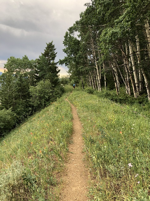
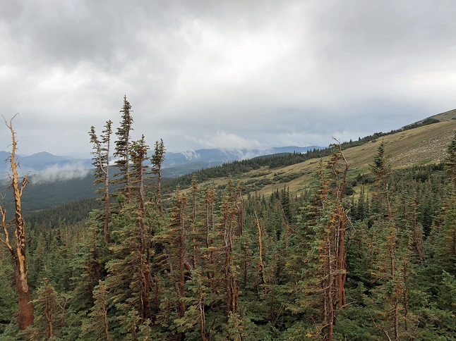
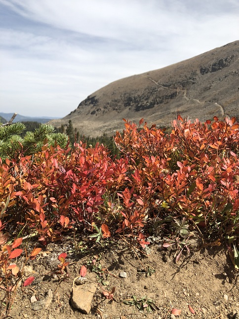
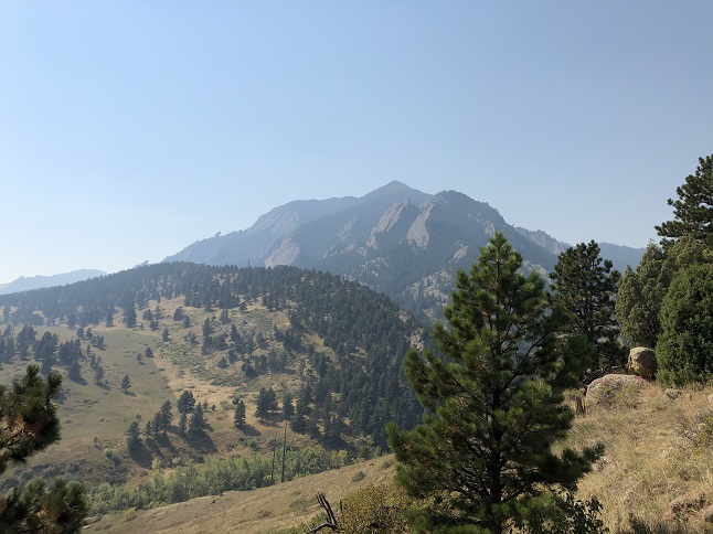
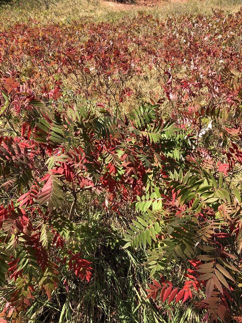
38) Green Mountain, Boulder City Open Space & Mountain Parks, Boulder, CO, September 16, 2020 - I know all our west coast friends will rightly scoff if I complain about air quality so I won't claim the smoke in our area is bad but it is noticeable. That was very apparent today when Lyle and Alan hiked Green Mountain above Boulder. The normal panoramic views of the snow covered Continental Divide and out over Boulder were socked in with smoke haze. Instead of the normal "wow" views it was an eerie white shroud just beyond the tree tops. Still, it was a great day to hike. The trails were relatively empty after a summer with crowds packing all the trailheads. The weather was warm but with a little chill when the breeze blew... Another special aspect was our ability to hike between seasons. Down at the bottom of Gregory Canyon where we started the hike the aspens on the roadside were still bright green and there will still a few late summer wildflowers blooming. But near the top of the mountain all the underbrush was starting to turn orange and brown and some of the aspens were already bare. We seemed to hike into Fall and then return back again to summer. All the while the smoke was a reminder of the terrible fires not only here in Colorado but also further west in California, Oregon and Washington. 5.3 miles with 2,500 feet of elevation gain.


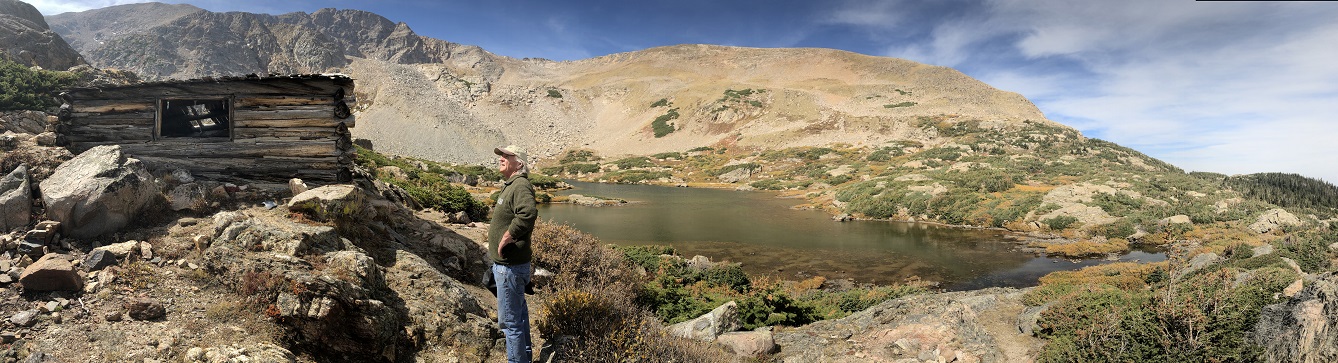
39) James Peak Lake, Tolland, CO, September 24, 2020 - I sometimes forget just how uplifting it is to spend time up in mountains. Then I have a day like today which wows me and helps me remember. Lyle and Alan started the day with the idea of hiking near St. Mary's Glacier. Lyle took his 4Runner up the challenging Kingston Peak road (FS353) but once we got up above tree line it became obvious it was way too windy for hiking on the west side of the Divide. We continued over Kingston Pass and found it was much calmer when we got to the James Peak Lake trailhead. Decision made by the weather! We parked there and did the short but steep drop down into the James Peak Lake valley. Wow! It was fabulous. The fall colors were everywhere. There was still enough water coming out of James Peak Lake to keep the waterfalls flowing. There was still snow in the shady from the storm two weeks ago to highlight the rocky ledges on the mountain above us. Yellow bellied marmots were running from rock to rock with mouthfuls of grass, presumably building up their nests for the coming winter. Pika squeaked from unseen crevices in the scree fields. It has been ages since I was last in this valley and it is still a magical place. We visited both James Peak Lake and Echo Lake before making the sharp climb back up to the truck. All that time on bumpy 4x4 roads may have gotten my insides all jumbled up but hiking up in the high country got my head right! 3 miles down into the valley and back up with a steep 1,000 feet of elevation gain.


40) Bear Peak, Boulder Open Space & Mountain Parks, Boulder, CO, September 30, 2020 - Normally, I post these hiking stories in the third person so that they represent the view of everyone involved. However, today was one of the very rare times Alan went hiking alone so now he, uh, I mean I can now use the rare "I" in writing this up. The Japanese have a concept of shinrin-yoku, or forest bathing, which is deeply connecting with the natural world. After a challenging few days I made the decision this morning to head out for a long hike alone so I could enjoy that connection. I drove down to Boulder, parked in the NCAR parking lot and then struck out to summit Bear Peak. I usually hike this peak every spring but COVID threw a wrench into that this year so really I was just continuing the delayed annual Spring Training Hikes. When I hike this peak in the spring I've worked up to it so I'm in decent shape. In the Fall, well, not so much. Add in all the smoke from the Colorado forest fires and it was a demanding hike. But cool weather, a bunch of snacks and a decent amount of stubbornness carried the day. I went up the steep Fern Canyon trail to the summit and then came back down exactly the same way. I didn't set any speed records but my slow pace meant I had 4 hours to enjoy the woods, rocks, clouds, peaks and all the other natural beauty. Bathing complete! 6 miles up and back down with 2,700 feet of elevation gain.

41) Peak View Pond trail and Revenuer's Ridge trail, Mueller State Park, Divide, CO, November 1, 2020 - Jonna and Alan took the RV out for the Halloween weekend to camp at Mueller State Park outside Colorado Springs. The main purpose was to see how our cats Leon and Kia did with traveling in the camper but we did have time in between cat sitting duties to get out for a couple of hikes inside the park from two trailheads that were within walking distance from our campsite. The first hike was the Peak View Pond loop. A mellow loop winding up and down the hills with views eastward onto Pikes Peak. The second one was the Revenuer's Ridge trail which wasn't very long but had an amazing rock formation as a highlight. Great weather, a scenic landscape and lightly populated trails - a lovely combination for a relaxing weekend trip. We did two short hikes on two different trails which combined to be 4.3 miles of hiking with a combined 400 feet of elevation.


42) Maryland Mountain, Maryland Mountain Recreation Park, Blackhawk, CO, November 7, 2020 - To work off a little post-election stress Jonna and Alan went out for a little walk this weekend. With cold temperatures and possibly snow forecast for Sunday it was also nice to enjoy the warm sunshine before the mercury starts to drop. Jonna hadn't see the new trails in Blackhawk's Maryland Mountain Park so we headed to the Hidden Treasure trailhead and split our hike between the super smooth old Gilpin Tramway railroad bed trail and exploring part of the new hiking only trail that climbs up toward the summit of Maryland Mountain. We didn't push for a big hike but even the short hike and a little vitamin D was relaxing. 2 miles with 350 feet of elevation gain.


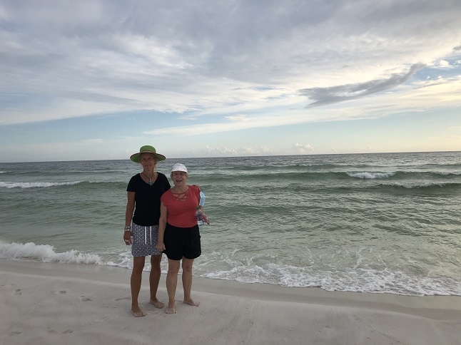
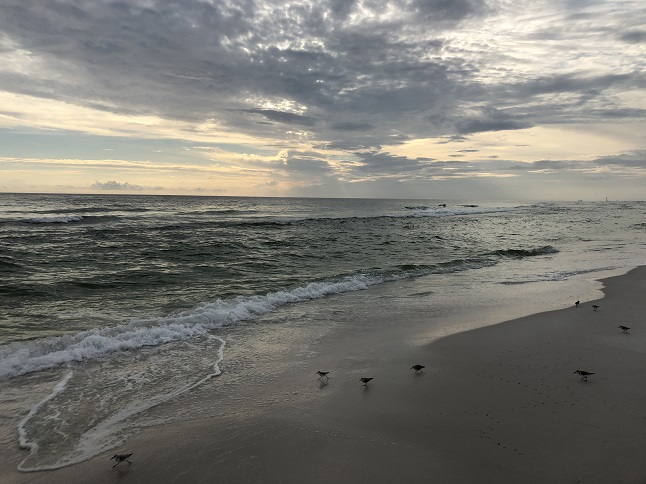
43) Okaloosa Island, Ft. Walton Beach, FL, November 27, 2020 - Here is another atypical hike report. Unlike most of the hike write-ups that take place in the mountains this one is a beach walk while visiting family in Florida. Alan's cousin Kelly was also visiting Florida so Alan, Alan's mom Brenda and Kelly all met up on Okaloosa Island to take a long evening walk on the beach. We started at Uncle Larry's condo and then walked west down the island onto the section of beach that fronts the Eglin Air Force base property. The rolling surf, the frantic sandpipers, the swaying sea oats and the squeak of the white sand made for a soothing environment in which to spend time sharing stories with family. A 4 mile round trip stroll down the white sand beach with a total elevation change of about 3 feet.

44) Deadman's Gulch, Roosevelt National Forest, Lyons, CO, December 10, 2020 - Todd and Rusty the Wonder Pup texted to see if I was interested in exploring a little single track Todd had spotted on the side of the road while driving South St. Vrain canyon. Always! So we met up in Lyons, caravanned to a little pull-out on the side of the road at a climbing area referred to as Deadman's Gulch and then started going up! What looked like a well defined trail petered out pretty quickly into a network of game trails, water run-offs and rocky canyons. We spent two and half hours exploring the area - basically climbing up from one false summit on a ridge to the next just trying to see how high we could climb. All of this is on the shoulder of Coffintop Mountain which peaks to the west. (Deadman's Gulch? Coffintop Mountain? With names like that it should be a killer hike, right?) Once we got far enough up to see Long's Peak to the west and Lyons to the east we decided to call it a day. There was no real destination but we both enjoyed meandering about in a new area just to see whatever there was to see. 3.5 miles of meandering with a stout 1,400 feet of elevation gain.


45) Maryland Mountain, Maryland Mountain Recreation Park, Blackhawk, CO, December 14, 2020 - After a weekend of snow flurries the weather forecast for Monday morning showed sun so Lyle and Alan joined together to spend some time outdoors. We headed back to the Maryland Mountain park that the city of Blackhawk is building to hike one of the new trails that has recently been completed. It turned out to be a good one. It climbs steeply up the southeastern flank of Maryland Mountain all the way to the summit. It is a strenuous climb but the rapid altitude gain means you get some nice views over the surrounding mountains to the majestic peaks to the west. From the top we opted for the long, gradual decent which more than doubles the distance of the way up but winds down the northern ridge before dropping down some huge switchbacks to the west and then looping back around the foot of the mountain. We only encountered one other person out on the trails, enjoyed some nice scenery, found some neat old turn of the 20th century farming equipment and had a chance to catch up with our respective lives. A grand way to spend a Monday! A 6.6 mile loop with a little over 1,000 feet of elevation gain.


46) Ellsworth Creek trail system, Rollinsville, CO, December 24, 2020 - COVID may have changed our plans for the holidays but we can still get together with friends to celebrate with a hike. Our friends Holly and Rick called earlier in the week to see about cross-country skiing or snow-shoeing on Christmas Eve. Well, the weather didn't get the memo and failed to give us a big dump of fresh snow so we had to bail on the skis and snow shoes but that didn't deter us from getting out to get some snow on our hiking boots. We met up at the Ellsworth Creek trail parking area and tromped a short loop through the crusty snow exploring a new section of mainly 4x4 road that we've passed by many times in the past. In a year when human contact has had to be limited it was nice to close out the year sharing stories and enjoying the woods with friends! A short 1.5 mile with 200 feet of elevation gain.


If you enjoyed these you may also enjoy checking out some photos from our 2019 hikes.
