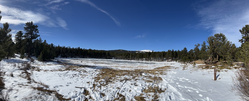
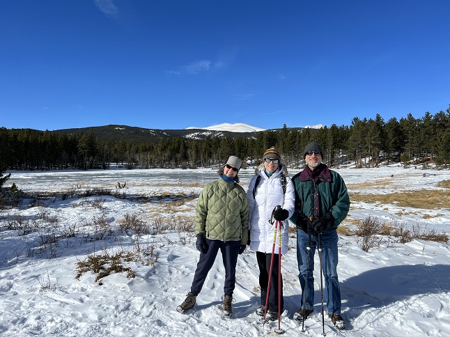
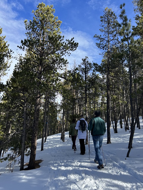
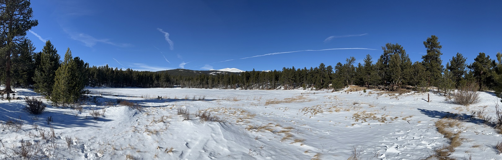
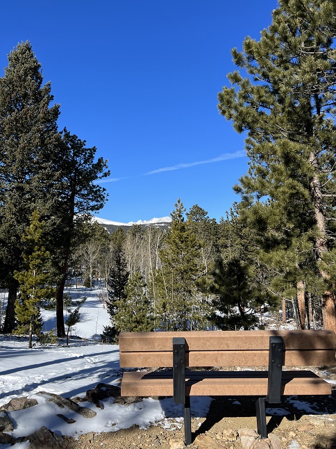
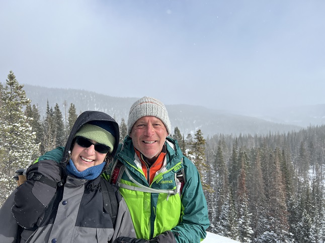
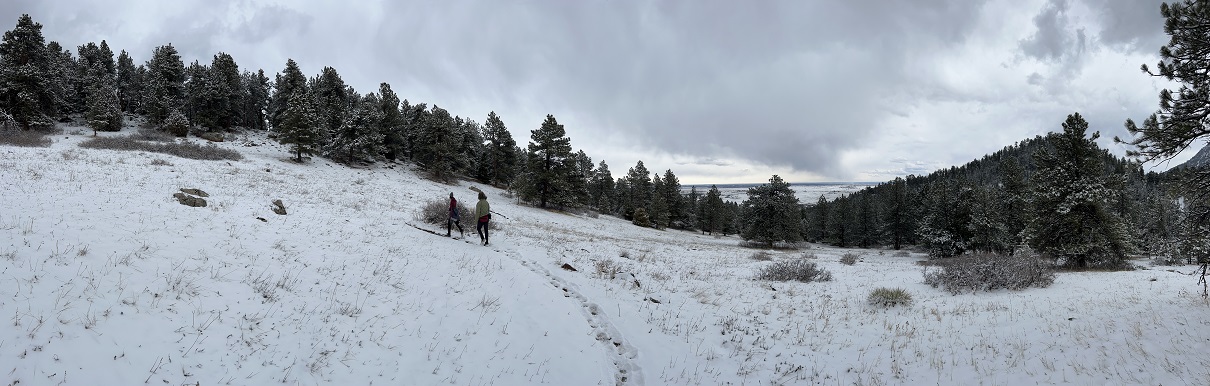
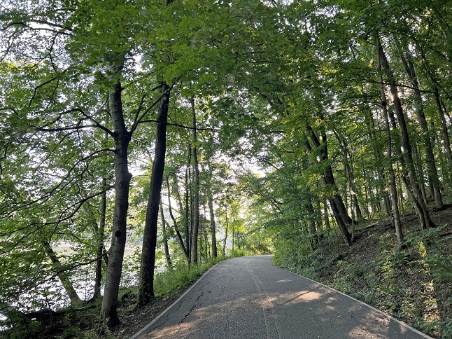
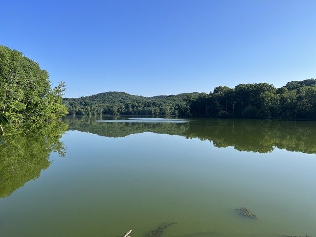
1) Mud Lake, Boulder County Parks & Open Space, Nederland, CO, January 8, 2023 - Our first hike of the new year was a short one but we shared an afternoon stroll around the Mud Lake Open Space with our friends Kristin and Steve so I'm counting it as a "hike". We met up mid-day when it was relatively warm for an early January Sunday and walked a couple of different trails around Mud Lake. It was a little breezy but most of the hike was in the trees where the mild gusts didn't bother us. It was a nice chance to enjoy the great outdoors mid-winter and to catch up on our various holiday experiences. A meandering 1.5 mile loop with around 75 feet of elevation gain.
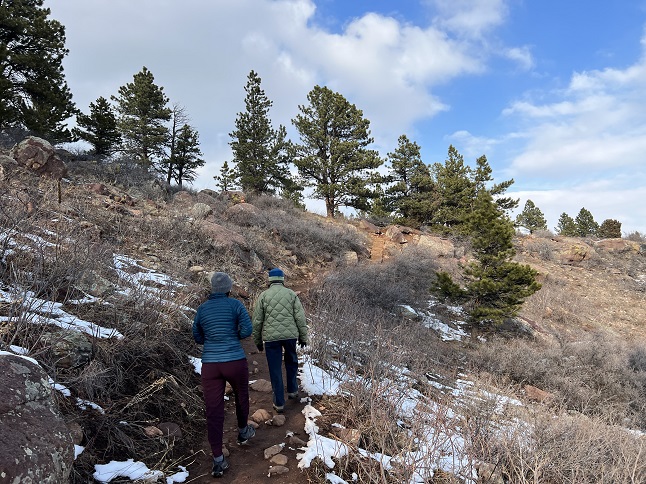
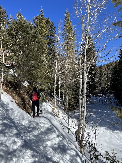
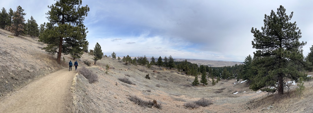
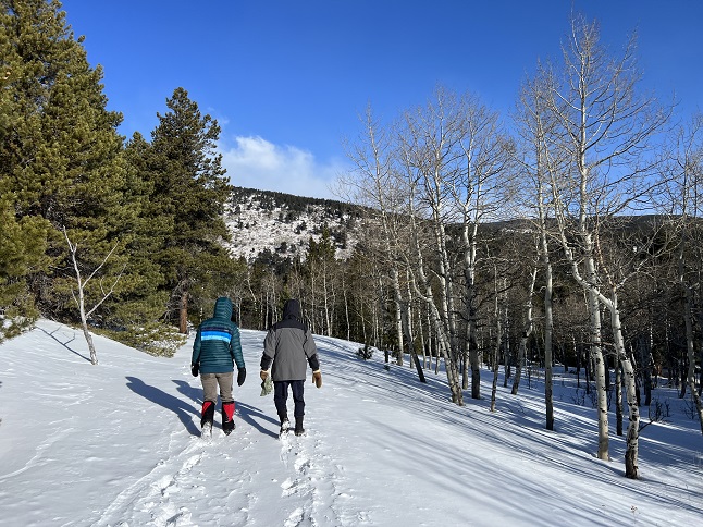
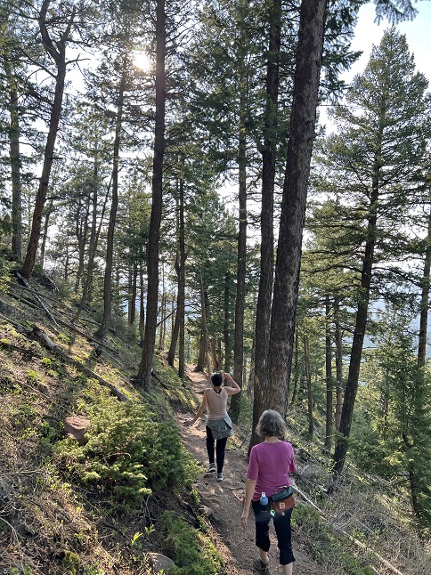
2) Homestead, Shadow Canyon and Mesa Trails, South Mesa Trailhead, Boulder Open Space & Mountain Parks, Boulder, CO, January 9, 2023 - Our hikes in Boulder with our friend Desiree continues in the New Year! We once again met up Desiree at the South Mesa Trailhead for our usual hike, this time with mixed weather. When the sun was out it was reasonably warm but as soon as the sun went behind a cloud and the wind picked up it was bone chilling. The conditions changed about a dozen times while we hiked which meant we were regularly removing or re-adding a layer. The trail was a mix of packed snow, watery ice, mud and even dry ground in places. We did our traditional Homestead Trail going out but then added an extra leg by going up to the bottom of Shadow Canyon before looping back around to Mesa trail. We skipped coming back down on Towhee and instead too Mesa all the way back to the trailhead. We ended the hike with sunlight beaming down and a mostly blue sky. Another enjoyable hike with Desiree and a continuation of a routine we thoroughly enjoyed throughout 2022. A 4.5 mile loop with 900 feet of elevation gain.

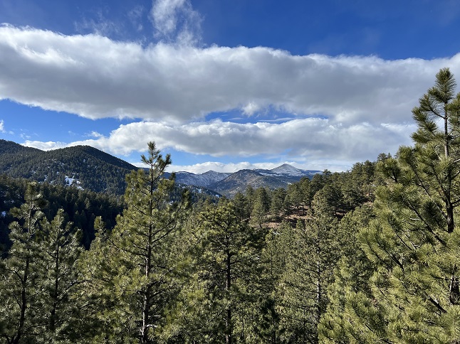
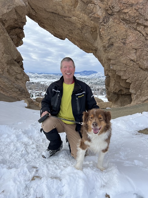
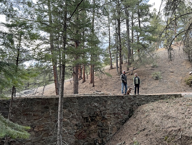
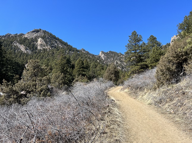
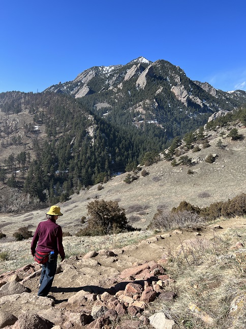
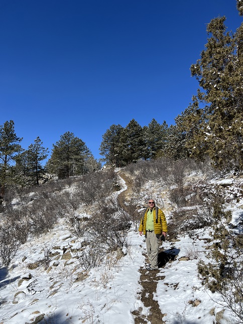
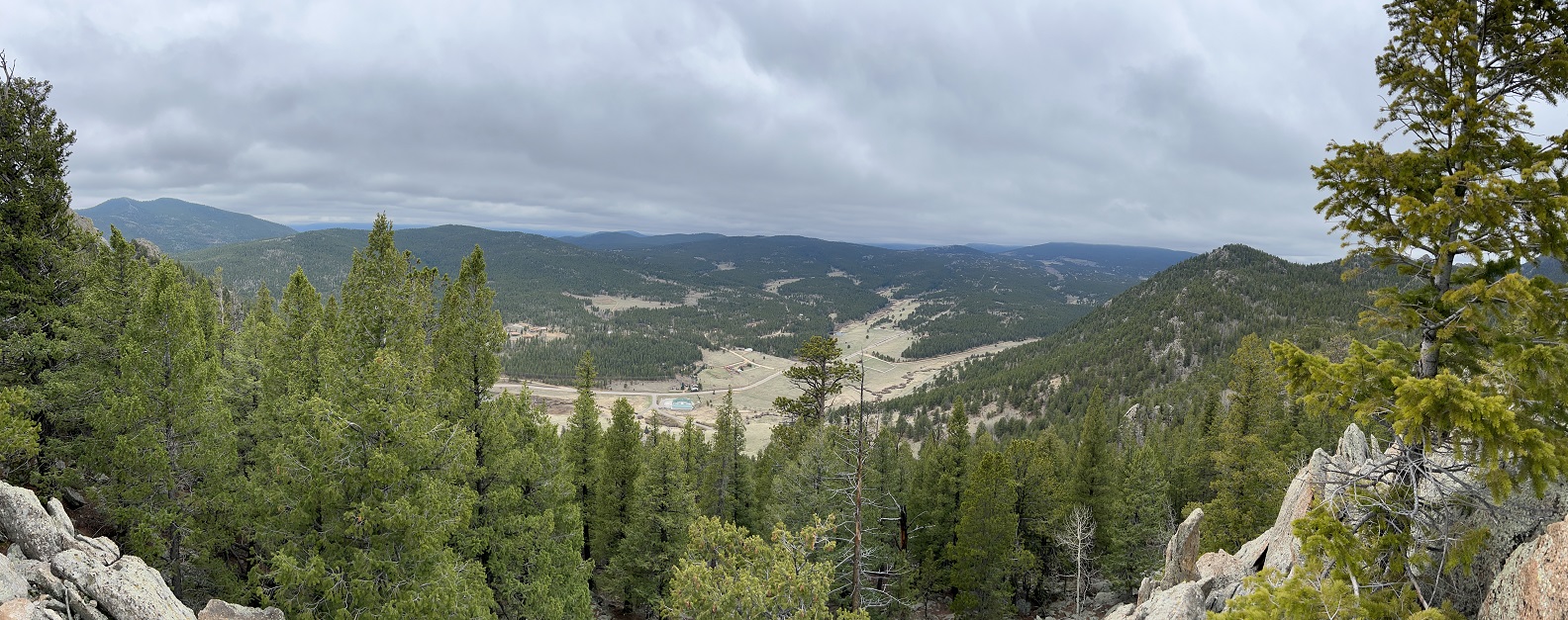
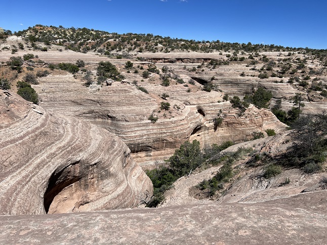
3) Divide Overlook, Chapman Drive/Tenderfoot Trails, City of Boulder Open Space and Mountain Parks, Boulder, CO, January 16, 2023 - Jonna and Alan were heading down to Boulder to run some errands and catch a movie so we decided to head down a little early and do a hike along the way. The Chapman Drive trail is a rather mundane hike - basically a fenced off roadway - but it does have an interesting history as it was build back in the 1930s as part of a series of CCC (Civilian Conservation Corps) projects around Boulder. The old roadway has some beautiful large rock retaining walls supporting some of the sharper switchbacks as the road climbs from Boulder Canyon up to the top of Flagstaff Mountain. About 2/3 of the way up the Tenderfoot Trail comes down and that side trail provides access to the Divide Overlook which gives a decent view westward on the Continental Divide (Honestly, one of the switchbacks on Chapman Drive actually provides a better view but an official "Overlook" makes for a nice hike destination.) We had great weather for a hike and the sunshine had melted out most of the trail (However, the forecast calls for snow every day for the entire upcoming week!) A 4 mile up-and-back hike with 800 feet of elevation gain.
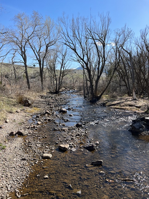
4) Wild Loop Trail and Hunter Loop Trail, Devil's Backbone Open Space, Larimer County Open Space and Trails, Loveland, CO, January 20, 2023 - Todd and pup Rusty were supposed to be off chasing sunshine and warmth in their camper but septic problems at his house have kept him from hitting the road. (Does this prove he is full of ... well, nevermind.) However, since he's still in frozen Colorado we had the opportunity to get together for a hike so we met up today to hike in the Devil's Backbone Open Space just outside Loveland, CO. We didn't really avoid hiking in snow, since the plains actually got a little more snow in the recent storm than the mountains but it was a few degrees warmer to it was worth the drive. The cold weather and fresh snow did keep some hikers off the trails so we only encountered a few other folks which was nice. The Wild Loop Trail, which goes past the scenic Keyhole - "tunnel" through a rocky spine was combined with the Hunter Loop to make a nice loop through the park. In addition to the Keyhole, another highlight was watching the huge "V" patterns of geese that were flying over the park. Some of the flocks contained close to 100 birds and they were fascinating to watch stream overhead. It was a nice hike and I'm sure Todd enjoyed the break from his crappy home problems. A 4.6 mile loop with 600 feet of elevation gain.
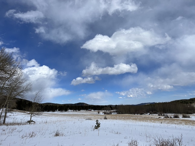
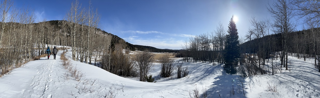
5) Mud Lake, Boulder County Parks & Open Space, Nederland, CO, January 22, 2023 - Jonna and Alan wanted to stretch our legs on a cold but beautifully clear Sunday so we headed over to nearby Mud Lake for a short hike. We did the full Tungsten Loop, the short Kinnickinnick connector trail and the full Kinnickinnick Loop. It isn't particularly long or challenging but it is a lovely area of forest to walk through and the frozen surface of Mud Lake makes for a snow covered meadow mid-winter with snow covered mountains as a scenic backdrop. A 2.2 mile loop with a mild 250 feet of elevation change.
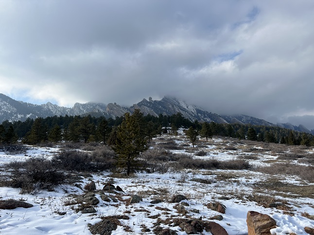
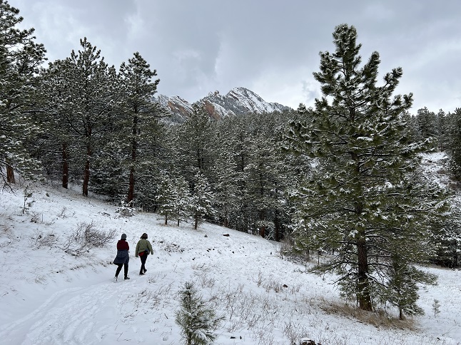
6) Homestead and Mesa Trails, South Mesa Trailhead, Boulder Open Space & Mountain Parks, Boulder, CO, January 23, 2023 - On a moody, cloudy afternoon we met up with Desiree to once again hike from the South Mesa Trailhead. We did the same loop we've single-handedly worn an inch deeper into the ground over the past year. Snow clouds were hanging on the higher mountains but there was still sunshine covering most of the trail. That sun combined with above freezing temperatures was melting out parts of the trail, turning other sections into mud pits and creating sloppy, slippy ice in still other areas. As we got closer to the base of the mountains we got underneath the clouds and immediately the temperature dropped about 10 degrees. Fortunately, we turned back at that point and gradually warmed back up as we re-entered the sunshine. The views of Devil's Thumb poking the bottom of the low flying clouds and the misty snow covered FlatIrons were scenic highlights. Another day that keeps our tradition of hiking with Desiree intact. A 3.2 mile loop with 600 feet of elevation gain.
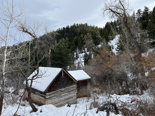
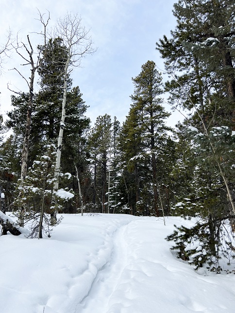
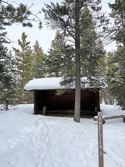
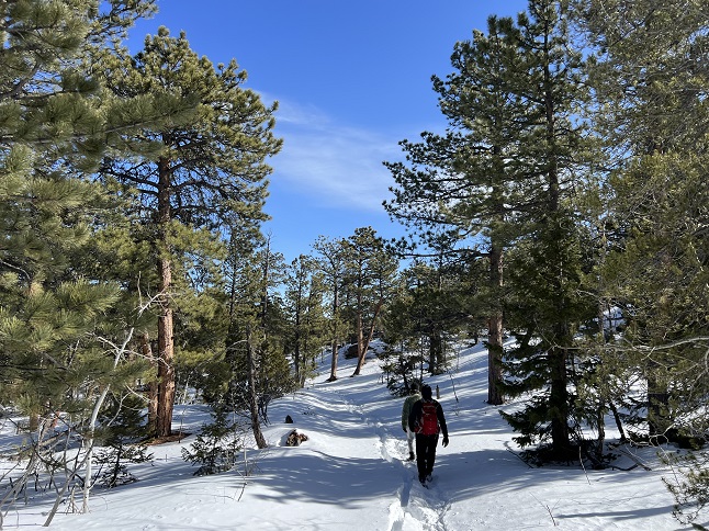
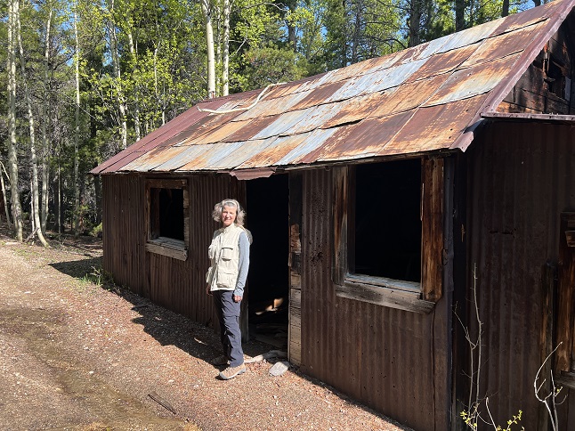
7) Shelter #1, Beaver Trail, Golden Gate Canyon State Park, Golden, CO, January 24, 2023 - Alan is a hiking fool right now - three straight days of hiking! Lyle and Alan headed into nearby Golden Gate Canyon State Park to hike a trail we haven't been on in about 8 years - the Shelter #1 trail. This is one of the least used trails in the park and was a trail we would regularly hike from the Visitor Center parking lot but a couple of years ago the trail was re-routed and we hadn't been on it since then to check it out. With only ankle deep snow we braved just hiking it with not traction or flotation footwear. It was slippery on the steeper sections but otherwise just fine with just hiking boots. The sun was playing hide-and-seek with the clouds so the temperature fluctuated from around 18 degrees to around 25 degrees depending on whether the sun was out or not. The climb up was slow and steady but the snow covered pine trees and bare aspens provided beautiful scenery for a leisurely pace. We stopped briefly at the camping shelter but the cold temperature motivated us to keep moving. The way down was much steeper and provided opportunities to try the sport of boot skiing, something I'm not particularly graceful at but managed to keep from falling so there must be some latent talent there. It was a nice hike with good company and a good workout to start getting in shape for the upcoming hiking season. A 3.6 mile loop with 1,050 feet of elevation gain.
8) Chautauqua, Bluebell-Baird, Mesa and Enchanted Mesa Trails, Chautauqua trailhead, City of Boulder Open Space and Mountain Parks, Boulder, CO, January 27, 2023 - Snow and cold weather are on the way so Jonna and Alan met up with Julia down in Boulder to do a little loop in Chautauqua Park while the weather was favorable. We met up at the Chautauqua office on Friday afternoon, strapped on our boot traction cleats and climbed up the hill on the Chautauqua trail towards the first FlatIron. From there we turned south on the Bluebell-Baird trail along the base of the FlatIrons to where it met up with Mesa trail. We dropped down the hill and then looped back to Chautauqua village via the Enchanted Mesa Trail. It was overcast and a little breezy so a little chilly but the conversation was warm so we made it back to the parking lot without feeling too uncomfortable. A 2.8 mile loop with 650 feet of elevation gain.
9) Homestead and Mesa Trails, South Mesa Trailhead, Boulder Open Space & Mountain Parks, Boulder, CO, January 29, 2023 - BBBBbbbbbrrrrrr... We have another 2023 hike in the books and this one was a cold one. The temperature was in single digits and a low lying cloud cover meant we were hiking inside a snow cloud. Desiree, Gaelin and Gaelin's friend Annabell met Jonna and Alan at the South Mesa Trailhead on a foggy/misty afternoon with snow flakes sort of materializing in the air around us and with the mercury hovering around 8 degrees. We were all wearing multiple layers but when it is this cold I think we were all instantly chilled as soon as we got out of the cars. Despite the frozen noses and ice-covered hair we stuck it out and hiked our normal loop by going up the Homestead Trail until it connected with the Mesa Trail and then looping back to the trailhead on Mesa. Everything was covered in snow and ice. The trees looked ghostly in all white and the front range mountains were wispy when they were visible through the fog. A light dusting of snow gave the icy trail some traction so the actual hiking wasn't too bad and thankfully there wasn't any wind but hiking in single digits is a challenge no matter what. I think we all enjoyed accomplishing the full loop which was very much in doubt when we first stepped out of the warm cars at the trailhead. We rewarded ourselves with an early warm dinner afterwards. (As a side note, when we drove away from the trailhead I suddenly felt chilled deep in my chest. The reason turned out to be that my beard got covered in ice as my breath froze. Once I got back in the car and cranked up the heater my beard ice melted which dripped cold water through the front of my unzipped jacket and onto my chest. Hah!) A 3.2 mile loop with 600 feet of elevation gain.
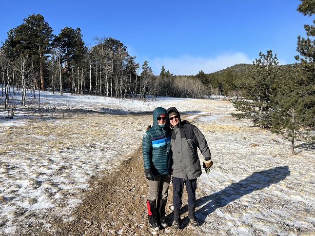
10) Miller Rock, Ceran-St. Vrain trailhead, Jamestown, CO, February 4, 2023 - Jonna's brother Jamie came out to visit us in Colorado and we have been out hiking every day. Our first hike was a short walk which didn't really count as a "hike" but today we returned to a trail we did with Jamie back in 2019 - The Miller Rock loop from the Ceran-St. Vrain trailhead. There was snow on the ground but not enough to require snow shoes. Instead we hiked the loop in ankle deep powder. It was clear and sunny with mid-40s for temperature but with gusting wind so warmth varied depending upon whether we were in the sun, in the shade, in the trees or out in the open with the breeze. Fortunately, the views were worth dealing with zipping and unzipping jackets, donning and removing hats and fiddling with gloves whenever the conditions changed. A nice Colorado winter hike with lots of great family bonding. 6.3 miles out and back with 1,100 feet of elevation gain.
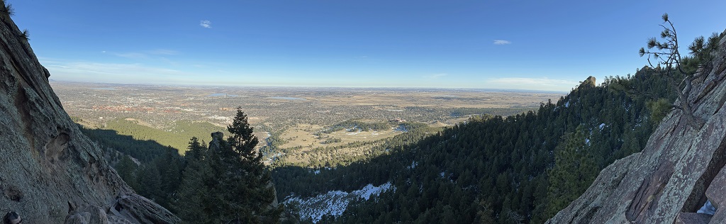
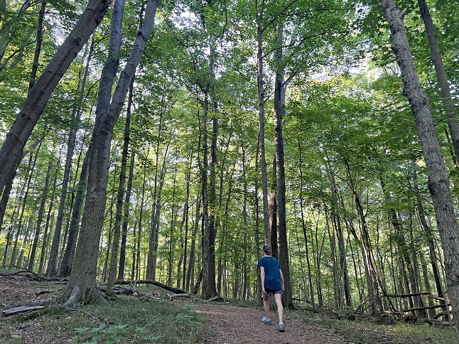
11) Mt. Sanitas, Boulder City Open Space & Mountain Parks, Boulder, CO, February 5, 2023 - We are maximizing the hiking while Jamie is visiting. Today we gathered Desiree, Lyle, Jamie, Jonna and Alan together to do the first of the annual Spring training hikes - Mt. Sanitas. Lyle, Jamie and Alan started at the People's Crossing trailhead and hiked over the Red Rocks ridge to the entrance to Sunshine Canyon. We then met up with Desiree and Jonna at the Mt. Sanitas trailhead. We immediately split up again with the guys taking the Dakota Ridge north while the gals took the Sanitas Valley trail. We all re-assembled at the bottom of the Mt. Sanitas East Ridge trail but Lyle had to turn back there which left the four of us to make the climb up the east face of Sanitas. The bottom of the trail was a sloppy, muddy mess but it dried into hard dirt after the first switchback and was in great condition most of the way up. The little loop onto the north side of the mountain was a little icy but much better than it has been in past years. Once we made it to the top it was a little cool but as always we had a lovely view out over Boulder. The long, steep decent down the south ridge was completely dry and now contains some brand new steps built by some hardworking trail crew last summer that made some of the challenging sections much easier. Once back at the Mt. Sanitas trailhead Jamie and Alan continued back through the People's Crossing park while Jonna drove around to met us at the trailhead. A perfect day for a hike and a great start to getting fit to hike some big mountains later this summer. 4.7 miles with 1,600 feet of elevation gain.
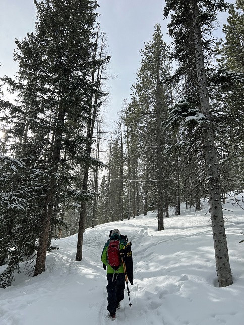
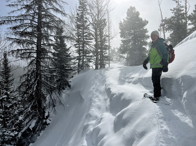
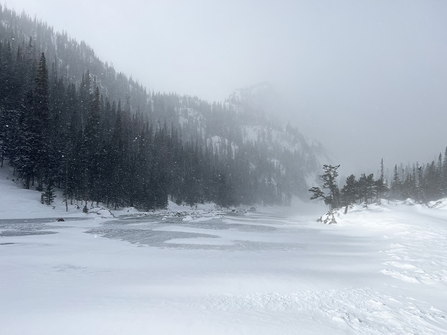
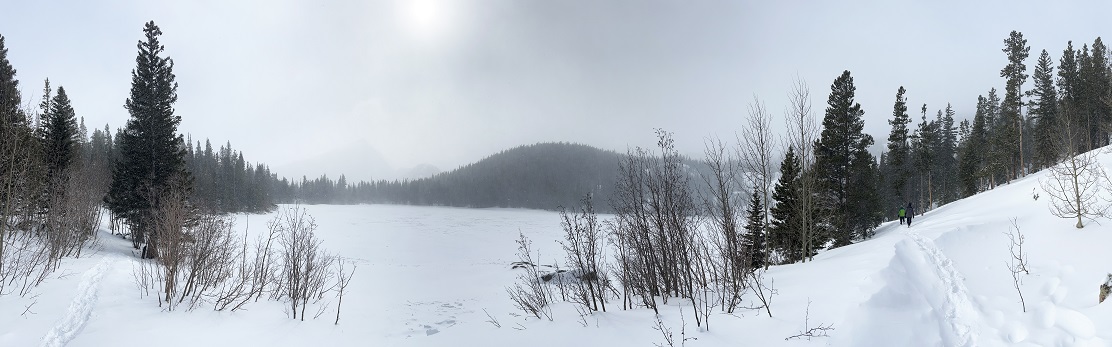
12) Dream Lake, Bear Lake trailhead, Rocky Mountain National Park, Estes Park, CO, February 6, 2023 - Another energetic day with Jamie visiting! Today we woke up early, dusted off our snowshoes and headed up into Rocky Mountain National Park to find some deep snow. We got to the Bear Lake parking area early (there were only about a dozen cars there...I've never seen it that empty before!) and, after a quick side trip to see frozen over Bear Lake, we headed up the trail to Nymph Lake. This section of trail was packed down enough we didn't need the snow shoes but after we crossed Nymph Lake we strapped them on. We also got a little lost since the trail from Nymph Like to Dream Lake was covered with blown snow but with the help of the GPS we eventually found the right route. We broke trail the whole way from Nymph to Dream going over a 10,000 foot ridge. Once we dropped down to Dream Lake we were at the east end of a valley and the wind (and snow) were howling down off the Continental Divide. We all agreed that going the additional half mile to Emerald Lake straight into that spray of ice just wasn't worth the discomfort so we turned back and returned to Bear Lake. However, after putting the snowshoes back in the car we did post-hole our way all the way around Bear Lake just to add a little more trekking to our day out in RMNP. A gorgeous morning spent in a pristine winter wonderland. A meandering 3.7 mile loop with 750 feet of elevation gain.
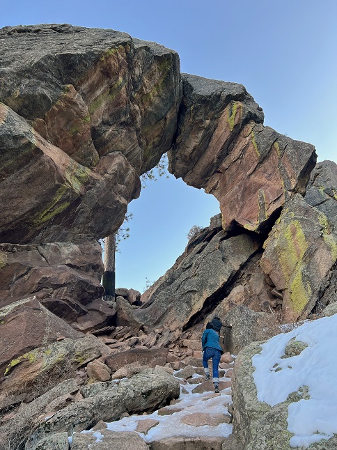
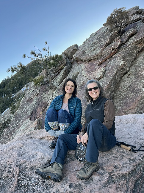
13) Royal Arch, Chautauqua Park, City Of Boulder Parks and Recreation, Boulder, CO, February 12, 2023 - It has been seven years since any of us last hiked the Royal Arch trail down in Boulder so with some big sports ball event occupying most of the US Desiree, Jonna and Alan decided it was a good time to re-visit it. (We'd tried to hike it a couple of times in 2022 but the trail was closed so this was also the first time in awhile that we even had the option so it was nice to get reacquainted with an old trail friend.) We all met up in the Chautauqua parking lot in the afternoon just as the mid-day hikers were bee-lining it for home to plug into their TVs. There were still a few folks out on the trails but compared to a normal weekend it was positively deserted. What was on the trail was ice. There were a few sections that resembled a natural bobsled run and it was tricky both going up and coming back down. Jonna and Alan had our traction cleats but Desiree left hers in the car. I think this trail may have made her a believer in the magic power of these little strap on boot cleats! Despite the challenging trail conditions the view from Royal Arch down over south Boulder, Superior and Westminster was worth it. We took it slow going back down and made it without injury so the hike was a success in multiple ways! 4 miles to the Arch and back (which includes hiking to my far distance parking spot!) with 1,400 feet of elevation gain.
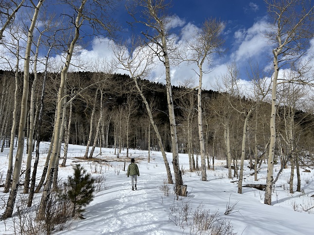
14) Caribou Ranch Open Space, Boulder County Open Space Parks, Nederland, CO, March 5, 2023 - We are back from our trip to The Netherlands which means it is time to jump back into our training for our bike hiking trip planned for this winter. Fortunately, we have places like Caribou Ranch Open Space just around the corner from our neighborhood so we can make a quick trip over to hike the loop there when we have a free afternoon. Recent snow storms had left a few inches on the ground and this being a busy trail meant it was hard packed so we just put on our micro-spikes for traction. We skipped all the side attractions of this trail and just used it for exercise but it is still scenic place to get out and enjoy being in the mountains. A 4.2 mile loop with 250 feet of elevation gain.
15) Homestead, Shadow Canyon and Mesa Trails, South Mesa Trailhead, Boulder Open Space & Mountain Parks, Boulder, CO, March 6, 2023 - To continue our training we managed back-to-back hikes. This time we met back up with our friend Desiree at our traditional spot - the South Mesa trailhead. We started out with the same loop we've been hiking with her for the past year but this time we made a bigger loop by taking Homestead Trail to Mesa Trail, then branching off on the Shadow Canyon trail all the way up to the bottom of Shadow Canyon. We then continued north on the Shadow Canyon Trail to where it re-intersected with the Mesa Trail. From there we took Mesa all the way back to the trailhead. Warmer spring weather had melted out all the snow and ice on the lower part of the trail but melting and re-freezing had turned the upper part into a bobsled track. We managed to avoid the worst parts of the slick ice but it was a bit skethchy in places. We also had to deal with a large temperature fluctuation since we started with warm sunshine but then had the mercury drop quickly once the sun went behind the mountains. Parts of the trail that were wet when we hiked in were starting to freeze over when we hiked out. It was a chilly hike but I think we were all happy to have doubled the hiking compared to our traditional loop. A 5.6 mile loop with 1,200 feet of elevation gain.
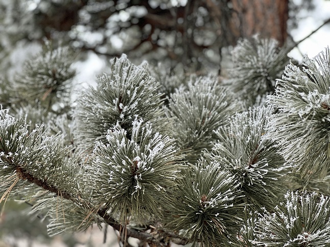
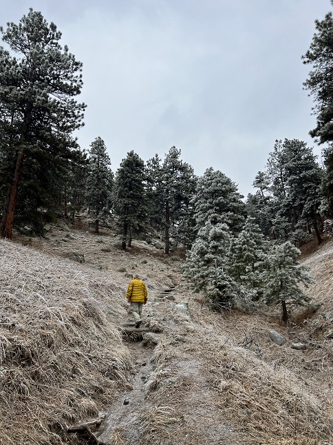
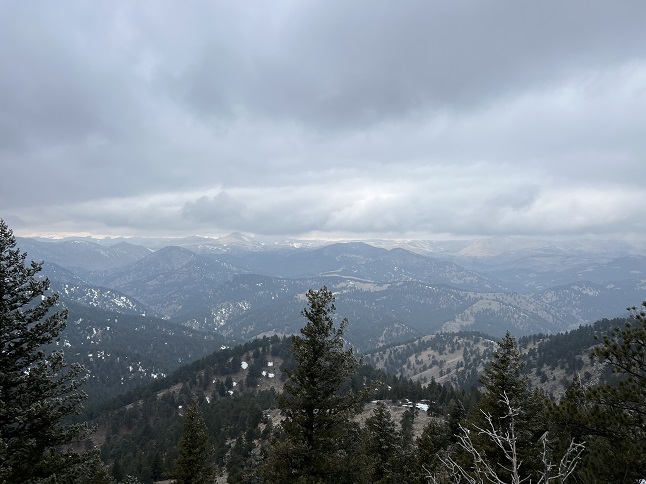
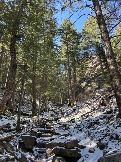
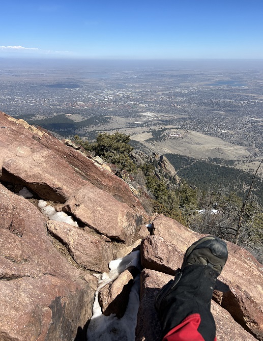
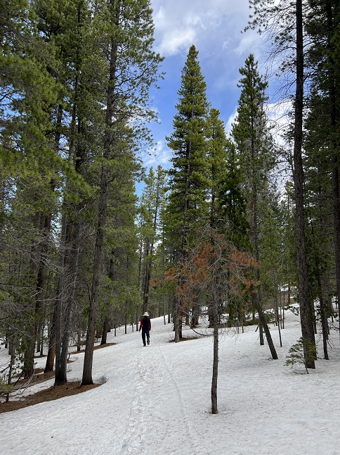
16) Flagstaff Mountain, Boulder City Open Space & Mountain Parks, Boulder, CO, March 8, 2023 - Okay training hike #2 (of 5) is in the books. Lyle and Alan met up at Boulder's Eben G. Fine Park in the morning of a cold week day for our annual trek up Flagstaff Mountain. There was hoar frost coating the pine trees and low lying clouds that covered the peak of neighboring Green Mountain. It was gonna be a chilly hike! The good news is that below freezing temperatures meant that the lower parts of the trail, which have historically been thick, goopy mud at this time of the year were frozen solid. The bad news is that some parts of the trail, particularly higher up the mountain, were covered in treacherous sheet ice. Even with microspikes on our boots we were sliding around in places. We started up on Viewpoint trail which took us up to Panorama Point. From there we took the Panorama Point trail up to Crown Rock where it connected with the Flagstaff Trail. Some of the places where Flagstaff Trail makes a steep climb to cross Flagstaff Road were nearly impassable - big rock steps that were coated in 1/2 of perfectly clear glass ice! Once we reached the summit, Alan took off to speed walk the RangeView/Ute Trail loop while Lyle started back down. Lyle made good time so it took until Panorama Point (over halfway down) before Alan caught back up. By the afternoon, as we came down, the temperature peaked above freezing which melted out the top 1/2 inch of mud on Viewpoint Trail so we still ended the hike with dirty boots but it was nothing compared to the 2 inches of sticky muck we've had to scrape off our boots in years past. As intended, this was once again a great hike to help train up for more hiking later in the year. However, it was also a beautiful hike with the mist drifting through the trees, the ends of pine needles painted with frost and usual spectacular views out over Boulder. A 6.5 mile up and back down trail with 1,800 feet of elevation gain.
17) A web of trails with names like "Haggis" "North Sheep Mountain" and "Elk Trickle", Johnny Park, Pinewood Springs, CO, March 9, 2023 - Despite being sore from hiking most of this week, I managed to dredge up a little extra energy to hike one more time. This time I met up with Todd and Rusty the Wonder Pup to hike a new-to-me loop in the Johnny Park OHV area. Fortunately, Todd took it easy on me so we hiked a short newly cut-in mountain bike trail and then made a cross-country short cut to circle back to a series of trails that brought us back to the trailhead without doing the much longer full loop. Still, About a quarter of the loop was in knee deep snow. This snow was crusty on top and powdery underneath so we were post-holing to get through it making it slow going. Between going off-trail and hiking snow-covered trails I'm not exactly sure which trails we did or didn't hike on. Nonetheless, it is always fun to hike with Todd and Johnny Park always offers up some scenic panoramas so it was worth summoning up the reserve energy to get out there. A 3.5 mile loop with 800 feet of elevation gain.
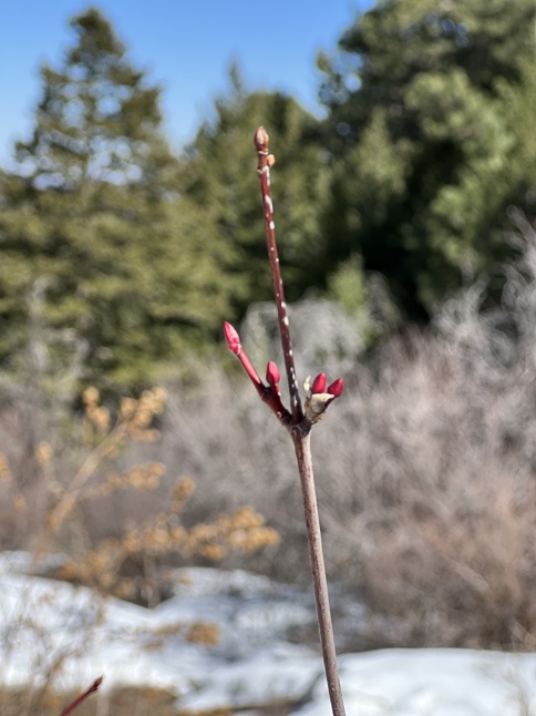
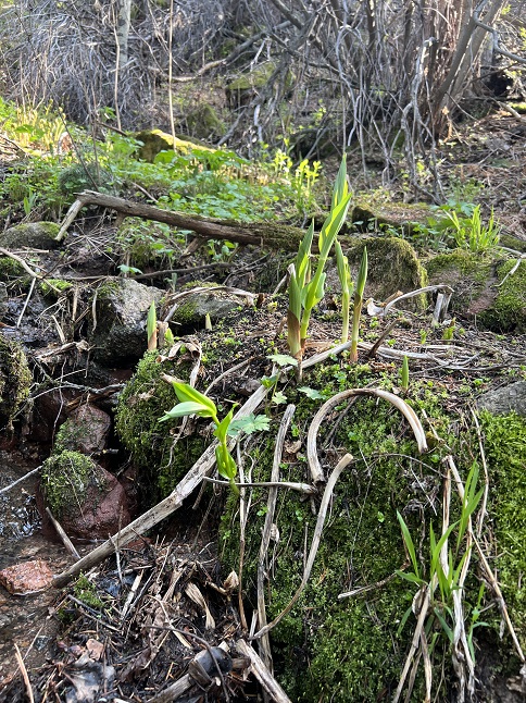
18) Homestead, Shadow Canyon and Mesa Trails, South Mesa Trailhead, Boulder Open Space & Mountain Parks, Boulder, CO, March 12, 2023 - We are hovering on the doorstep of Spring. This day gave us three different weather conditions in just a couple of hours. We started the afternoon off with clear skies but cold weather. Then the sun started to work its magic and the temperature jumped about 10 degrees in maybe an hour. But then clouds came streaming over the mountains, the temperature dropped again and sparse snowflakes began to fall as we returned to the trailhead. This hike as a near carbon copy of the one we did a week ago. Once again we met up with our friend Desiree at South Mesa Trailhead and did the same "long" loop from last week - hiking up the Homestead Trail, then going up Mesa Trail and then the Shadow Canyon Trail to the bottom of Shadow Canyon. We then continued on the Shadow Canyon Trail until it reconnected with the Mesa Trail which we took back to the Trailhead. The trail conditions were basically the same as well with dry dirt at the bottom and slippery ice on the upper sections. There we just a few bushes starting to show tiny little buds on the ends of their branches but no big signs of Spring yet. A 5.8 mile loop with 1,200 feet of elevation gain.
19) Realization Point, Flagstaff Mountian, Chapman Drive/Rangeview/ Tenderfoot Trails, City of Boulder Open Space and Mountain Parks, Boulder, CO, March 15, 2023 - Todd, Rusty-pup, Jonna and Alan all met up for an evening hike at the base of Boulder Canyon. The Chapman Drive "trail" is really an old road build by the CCC (Civilian Conservation Corps) back in the 1930s but it has been closed off to vehicles so it is a quick and easy way up for hikes and bicyclists to go up the back side of Flagstaff Mountain. Since sunlight can reach the road-wide trail most of the snow/ice had melted off but there were still a few slushy/icy spots where trees shielded the trail. Once we got up to the top and switched to the Rangeview trail the namesake panorama of the snow-covered Continental Divide was terrific. As we took the Tenderfoot trail back down to Chapman Drive for the return to the trailhead the evening "Golden Light" was lighting up the pine trees. A great little loop and a chance for Todd and Jonna to catch-up since we haven't all hiked together in about year. A 5.1 mile hike with 950 feet of elevation gain.
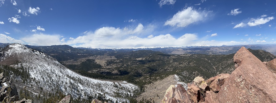
20) Green Mountain, Boulder County Open Space & Mountain Parks, Boulder, CO, March 17, 2023 - Today was the day for Annual Spring Training Hike #3 and the only one of the five hikes that is scheduled in advance - The "Hikin' O' The Green" on St. Patrick's Day. It snowed the night before and snow was forecast for the evening but there was a windows of blue sky in the morning so "All ahead full"! Some of the enthusiasm was scrubbed off when the thermometer showed 13 degrees and even more when hiking buddy Lyle had to cancel to deal with a home repair emergency which meant I had to dig deep to push on solo. Despite the figurative headwind I parked at the bottom of Gregory Canyon mid-morning and started up Amphitheater trail. What was immediately apparent was that the way up, which was on the north side of the mountain was going to be snow and ice the whole way as very little sunlight makes it to this trail when the winter sun is so low in the south. The climb is steep - gaining 2,500 feet in a little over 2 miles - so I was huffing and puffing and sweating. All of which was obvious because my breath was visible as I exhaled and my beard was covered in ice. I'd unzipped my jacket as the climb was generating a lot of bodyheat but the outside of my shirt was covered in frost where the sweat froze as it wicked up off my skin. From Amphitheater I crossed to Saddle Rock trail and from there to E.M. Greenman. The snow was deeper on each as I gained altitude. It was a slow grind up the final switchbacks to the summit but it was a relief to finally stand in some sunshine - my beard ice even started to melt! I enjoyed the usual views - to the east out over south Boulder and to the west towards the Continental Divide. To the west I could see the clouds of the forecasted snow storm covering the tops of the highest peaks. I descended via the West Ridge trail to Ranger and then down Ranger to Gregory Canyon. What was a relief was getting to the top of Gregory Canyon and finding the trail completely melted out and that the bright sunshine had pushed the mercury up above freezing. Dry trail for the final leg! It was a rewarding day to know I could find the motivation to do a big hike by myself on a day when conditions could easily have convinced me to stay home. A 5.2 mile loop with 2,500 feet of elevation gain.
21) Homestead, Shadow Canyon and Mesa Trails, South Mesa Trailhead, Boulder Open Space & Mountain Parks, Boulder, CO, March 19, 2023 - The first definite sign of spring as appeared! On our hike today we spotted the first tender buds on the ends of some bush branches - bushes we had walked past last week and not seen a thing! Desiree, Gaelin, Jonna and Alan all met up to continue our weekly tradition of hiking from the South Mesa Trailhead. After a week with a little snow and a lot of sunshine the trails are continuing to improve. Homestead Trail was almost entirely dry and the worst parts of the Shadow Canyon trail were passable though still icy in spots. We had a beautiful spring day with lots of blue sky, some warm sunshine and just a little breeze which wasn't an issue since most of the hike is protected by trees. It was great to catch up with Gaelin who was home from college for the weekend and good, as always, to check in with Desiree. A 5.8 mile loop with 1,200 feet of elevation gain.
22) Caribou Ranch Open Space, Boulder County Open Space Parks, Nederland, CO, March 25, 2023 - If one existed, we could have earned our "Hardy Hiker" award today. Julia spent the night at our house and wanted to get in a morning hike before heading back down the mountain. This meant we were up with the sun in order to hit the trails at 8am. What we encountered at the trailhead was 20/20 weather. That is to say 20 degrees temperature and 20 mph winds. BBBbbbbrrrrr... Nonetheless, we layered up, strapped on our boot traction devices and ventured out into the swirling snow that was being kicked up by the wind. We were the only car in the parking lot and didn't see anyone else for the entire hike which meant we were either particularly brave or particularly foolhardy. The wind was gusting so strongly and the snow drifting so quickly that we were actually breaking trail in both directions. The footprints we put in the snow on the way in had already filled in by the time we started back! Despite the cold conditions, it was actually a pretty hike. The spring sun was warm when it hit our face (which was appreciated since the wind was freezing our cheeks!) and the contrast of white snow, blue sky and green trees was particularly stark. A good hike and fun way to spend time with Julia. A 4.2 mile loop with 250 feet of elevation gain.
23) Homestead, Shadow Canyon Spur and Mesa Trails, South Mesa Trailhead, Boulder Open Space & Mountain Parks, Boulder, CO, March 27, 2023 - An overnight storm dropped a couple of inches of fresh snow along the Front Range but that didn't dissuade us from joining Desiree for a mid-day hike at the South Mesa Trailhead. Fortunately, the sun was trying to break through the low-lying clouds which pushed the temperature up enough to start melting some of the snow and kept it from being too cold to enjoy. The Flat Irons looked gorgeous with a layer of snow on them and the pine trees were equally pretty dusted with white. We opted to hike the medium version of the loops we do from this trailhead - hiking up the Homestead Trail, switching to the Shadow Canyon Spur trail and taking that over to Mesa Trail, which we then took back to the trailhead. Another nice afternoon hike. A 4.5 mile loop with 1,000 feet of elevation gain.
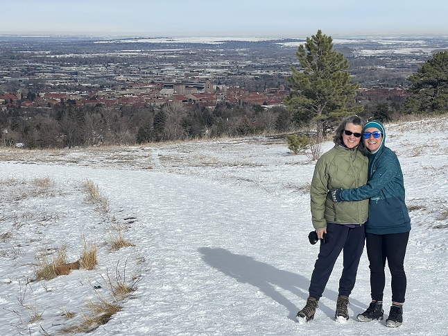
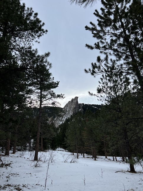
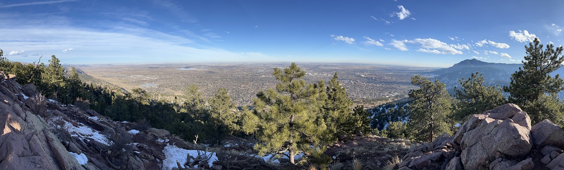
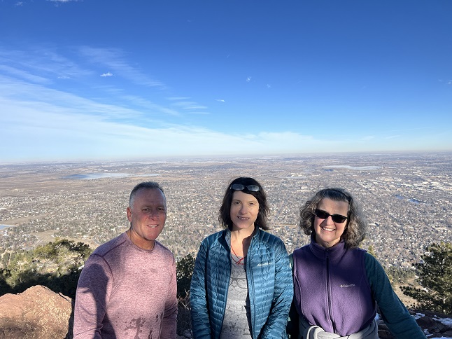
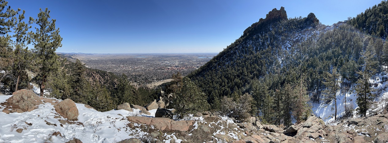
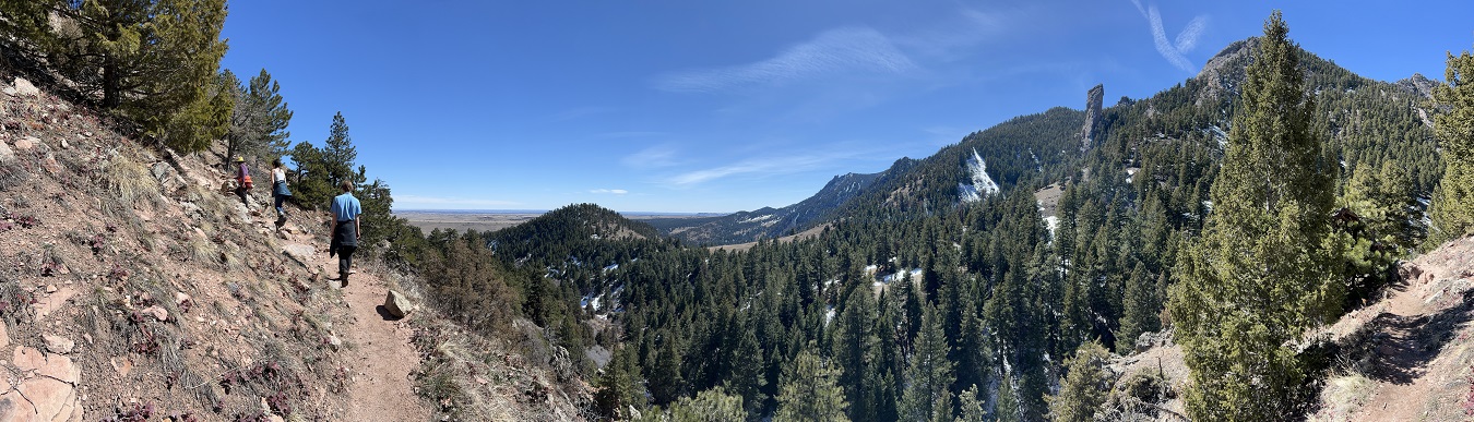
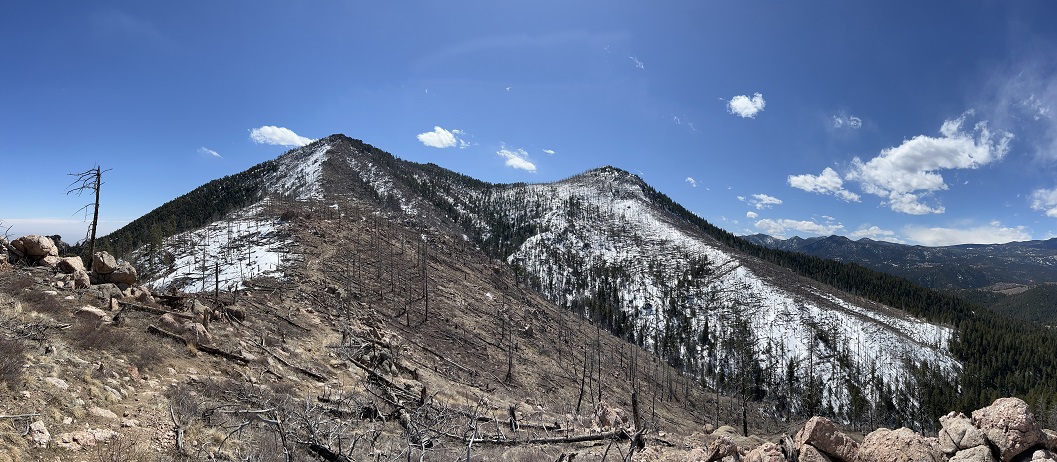
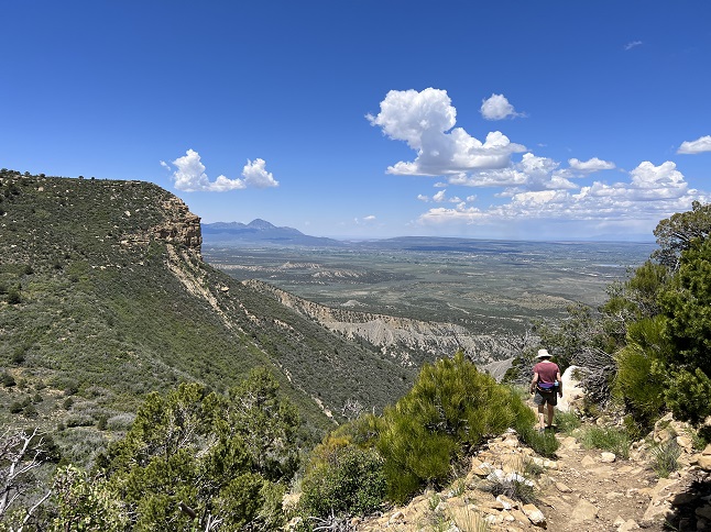
24) Bear Peak, Boulder Open Space & Mountain Parks, Boulder, CO, March 30, 2023 - The fourth of the Annual Spring Training Hikes is in the book and it was challenging one. Bear Peak is always my favorite of the five Boulder peaks because the view from the top is so spectacular. However, unique pressure and wind conditions had trapped the infamous "Brown Cloud" - when an inversion traps particulate matter in the air. The day started looking like a fog was hanging over Boulder. The hike started at NCAR, up on Table Mesa, so just above the layer of the haze. To the west was pristine blue sky but to the east was a wall of brown. Jonna and I took the usual route to start: The NCAR trail west to Mesa trail, then turning south to where Bear Canyon splits off heading west. After an hour of hiking, Jonna turned back since she had commitments in the early afternoon so I continued on alone. Fortunately, the Bear Canyon trail was in great shape - mostly dry and as the sun got higher in the sky it was warm enough to shed some layers. The final climb to the peak is via the West Ridge trail which was mostly clear of snow and ice, though there were some strong gusts of wind as the inversion to the east started to break up. This was good for scenic views but the breeze dropped the temperature a bit. The view from the top was mixed. It was still a little hazy over Boulder but the view west was just as amazing as always. The snow-covered mountains just popped in the sunshine. The challenge of the hike was getting back down again. I chose the North Ridge/Fern Canyon option which is shorter but more steep. Descending via the North Ridge trail is often tricky in the spring but this was the worse I've ever seen it. It was either wet ice or slushy snow. Every small step turned into a semi-controlled slide, even with traction on my boots and hiking poles in my hands. This section of trail is so steep that trying to stop or steer was often as much luck as skill - trees were hugged, rocks were aimed for and in the worse sections a fall was the only way to regain control. Note: throwing your elbow onto a rock is *not* a smart way to find the traction necessary to stop a slide! It was basically a one mile long slip-n-slide down to the top of Fern Canyon. Fortunately, Fern Canyon turns east and the difference in trail conditions was immediately apparent. I considered dropping to my knees to kiss the dirt and rock. There were still a few icy sections but after the North Ridge it was a breeze. At the bottom of Fern Canyon I rejoined the Mesa trail and took that back north, then turned back east on the NCAR trail to return to the trailhead. I was very happy to just sit in the seat of my Jeep for a little while and finally give my legs a rest! It was a big hike but once again I was proud I'd had the will power to do it on my own. Oh, and when I got back home in the late afternoon it started snowing! Well, I'm sure that it being a Thursday means it was quiet. Did I miss anything by being away from the news for the day? :-) A long 9 mile loop with 2,700 feet of elevation gain.
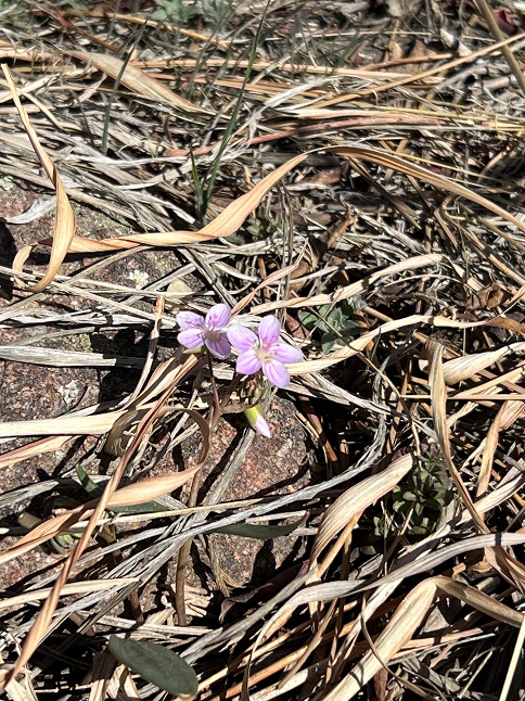
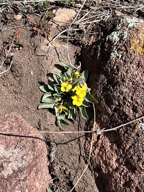
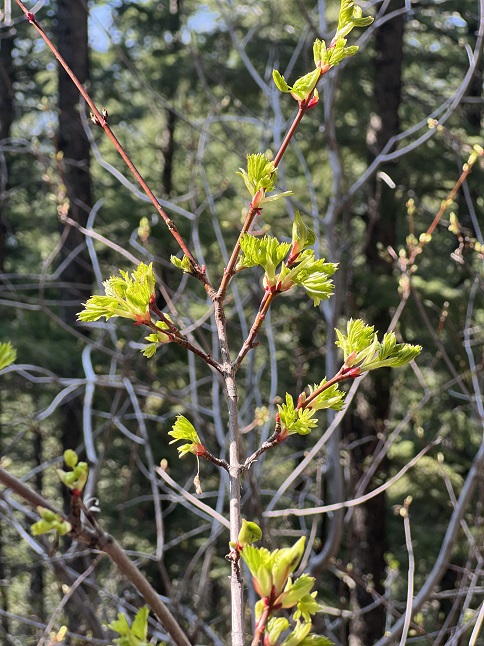
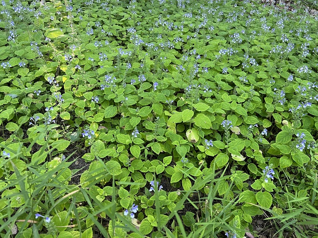
25) Homestead, Shadow Canyon and Mesa Trails, South Mesa Trailhead, Boulder Open Space & Mountain Parks, Boulder, CO, April 2, 2023 - The first tiny little wild flowers of the spring have poked their pedals out of the ground! There were only a couple and they were very small but nothing says winter is starting to fade quite like seeing the first wildflower of the year. We met up with Desiree for our usual Sunday hike - The Homestead/Shadow Canyon/Mesa Trail loop from South Mesa Trailhead but this time we started in the morning rather than the evening. Wow, is that trailhead a different experience at 10am! In the evenings it is quiet but in the morning it is mayhem - cars jockeying for parking spots, dogs running rampant, people standing around talking oblivious to the vehicles trying to navigate the parking lot, etc. Fortunately, most of the people are headed straight down Mesa trail so we left the craziness behind once we turned onto Homestead Trail. The trails are now mostly dry so not only has the snow and ice melted but the resulting mud is drying up as well. The weather was warm (70s?!?!) and the sky was so blue it looked unnatural! Like someone turned up the color saturation on the world. Most of the grass and shrubs are still grey-brown but those few little flowers proved that Spring is here! The usual 5.8 mile loop with 1,200 feet of elevation gain.
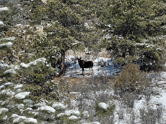
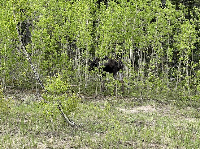
26) Maryland Mountain, Hidden Treasure Trailhead, Maryland Mountain Recreation Park, Blackhawk, CO, April 6, 2023 - The day after a spring snow storm dropped 5" of wet snow on the mountains, I met up with Lyle for a hike on Maryland Mountain. The mercury showed 25 degrees when I left the house in the morning but the bright sun warmed things so it was quite comfortable on the exposed southern flank of the mountain but a little chilly when the trail got up into the shade of the pine trees. The parking lot and trails were empty. The only other hiker we saw was an adolescent moose we ran into halfway up the mountain. It was quite the rude hiker - hogging the trail on a ridge top that made circling around difficult. Fortunately, after a 10 minute nervous standoff the moose stepped off the trail on the downhill side of the ridge allowing us to make a side circle on the uphill side. Because we just hiked up and back down the same trail we encountered the moose on our descent as well but it was still off to the side so we could actually go past on the trail. I love seeing critters on our hikes and seeing this moose was a highlight but for a couple of minutes when we first came across it we were both a little worried. That moose started walking slowly towards us which had Lyle and I looking for the biggest trees nearby we could hide behind! When we backed up a little the moose seemed content we weren't a threat and strolled away. *Then* I could appreciate how cool it was to spend time with such an impressive animal. The hike itself was a mix of fresh snow, slushy snow and mud. The views on the way up were beautiful but, as always, the summit is covered in trees so the views are pretty limited. Still, a good hike and we came away with a good moose story. A 4.2 mile up and back hike with 900 feet of elevation gain.

27) South Boulder Peak, South Mesa trailhead, City Of Boulder Open Space & Mountain Parks, Boulder, CO, April 12, 2023 - Today was the day to do the final and most strenuous of the five annual Spring Training Hikes - South Boulder Peak. Jonna and Alan met at the South Mesa Trailhead - The same trailhead we use for our weekly hikes with Desiree. We got started mid-morning and re-traced the loop we have done so, so many times over the past couple of years: We hiked the Mesa Trail to where Homestead Trail branched off to the west. We used it to climb up the foothills to where it re-joined Mesa trail. After another very short bit of Mesa trail we took the Shadow Canyon Trail fork and used that to continue the climb to the bottom of Shadow Canyon. This is where we split up. Jonna continued our usual loop to return to the trailhead but Alan continued west up the super steep Shadow Canyon. I rarely provide stats but Shadow Canyon is the kind of challenge that the stats help paint the picture. In slightly over a mile the trail climbs over 2,000 feet and most of that is in half a mile because the climb lessens slightly for half of the last half mile. That kind of elevation gain is a thigh killer. I was feeling pretty good halfway up the climb, since I hadn't seen many other hikers, but then two trail runners *jogged* past me going up knee high stone "steps" which took quite a bit of the wind out of my sails. Nonetheless, I persisted and made it to the top where I had a gorgeous view for 360 degrees. I ate an apple, soaked in the scenery and gave my legs a chance to recover. Then I started down. If the way up works the thighs, the way down is a knee crusher. I used hiking poles to reduce some of the pounding but it is still a workout going down that steep trail. Once I popped (dragged?) out of Shadow Canyon I followed the Shadow Canyon trail to the north until it met back up with Mesa Trail. Then I turned east on that and started my return trip. When I got to where Towhee Trail made a shortcut towards the trailhead my battered legs convinced me to take advantage of shaving a little distance off the loop. I managed to get back to the trailhead without limping too badly and never have I been more happy to sit in the driver's seat of my Jeep. The older I get the more strenuous these Spring Training Hikes are becoming so I was pretty pleased that I completed them all once again...I think I've been doing these trails every spring for nearly 20 years now! An 8.8 loop with 3,000 feet of elevation gain.
28) Hurricane Hill trail, Nederland, CO & Homestead, Shadow Canyon cutoff and Mesa Trails, South Mesa Trailhead, Boulder Open Space & Mountain Parks, Boulder, CO, April 16, 2023 - How about two hikes in one day! In the morning we did a hike from the house with Julia where we did most of the loop around Hurricane Hill. The trail was covered in snow from a storm two days ago so we were slipping and sliding on snow covered ice for most of the trail. In the afternoon we drove down to Boulder for our weekly hike with Desiree. This time we did the "medium" loop since everyone was feeling a little low energy. The Homestead/Mesa/Shadow Canyon cut-off trails were all completely dry and the early evening sun kept the temperature warm Two different hikes on two different trails and with two different hiking partners. A great way to spend a day. Combined we hiked 8 miles with a combined 1,000 feet of elevation gain.
29) Lookout, Hobbit and Observatory Trails, West Magnolia trail system, Nederland, CO, April 19, 2023 - Jonna and Alan headed out to do a morning hike but ran into a few difficulties that turned it into more of a leg stretch than a decent hike. Our first obstacle was that the trail we initially choice was closed for two months to protect spring migratory birds and elks which are calving. So we switched destinations and headed to the West Magnolia trail system which we have generally avoided for the past few years because of the combined crowds of mountain bikers and summer campers. This early in the year the campground is still closed and most of the high altitude mountain bikers haven't come out of hibernation yet so we figured it was safe to re-visit. We started hiking on the Lookout trail and found typical spring conditions - a mix of dry trail and places where snow berms covered the trail 3 and 4 feet high. Once we switched over to the Hobbit Trail and moved into the trees trail conditions got more challenging. The trail was almost completely covered in knee deep snow which was soft inside but topped by a thin crust. Classic post-hole conditions which is like walking through a non-lethal minefield. Most of the time you can float on top but every now and then you break through. This makes for tiring and frustrated hiking so after about an hour we turned back. We exited via the Observatory trail which was completely dry but which is crazy to hike because it is made for mountain bikers rather than hikers which means it meanders all over the place to go over even the smallest ridge so we ended up hiking in near circles to get to the parking area which was visible about 300 yards straight downhill. Despite the abbreviated hike we still got to enjoy the sunshine and blue skies while watching dark clouds hover over the Continental Divide. We are now at home eating lunch, looking out the window at the dark clouds overhead and watching it snow. What a difference a couple of hours makes! A short 2.6 mile loop with a mild 450 feet of elevation gain.
30) Button Rock, Pinewood Springs, CO, May 2, 2023 - With the snow finally melting out in the high country it was time to hike get back up into the mountains. Todd and Alan met up in Pinewood Springs and drove to a little parking area on the western edge of the community. From that informal trailhead we started west which meant climbing up. We climbed straight up the eastern face of Button Rock to the top. From the summit there are terrific views: looking west to Long's Peak and looking east all the way out to the plains. We spent some time taking photos and then settled down to enjoy the view, the stunning weather and a well deserved snack. However, we had more in mind so rather than returning the way we came we instead continued north dropping down from the peak, going over a ridge and then doing another steep climb to very near the summit of neighboring Button Rock Mountain (Yes, Button Rock and Button Rock Mountain are two different peaks...confusing, I know.) The view wasn't as spectacular there but still provided a panoramic sweep to the southwest of ridge after ridge of rocky terrain. From the summit of that peak it was down, down and more down - dropping all the way back via a continuous and strenuous decline to where the Jeep was parked. A fun hike with gorgeous views and great time hanging out with Todd. A 6.7 mile loop with 2,300 feet of elevation gain.
31) Green Mountain, Boulder County Open Space & Mountain Parks, Boulder, CO, May 7, 2023 - After a couple of weeks off Jonna and Alan were back on schedule doing a Sunday hike with our friend Desiree. However, we mixed things up this time by meeting at the top of Flagstaff Mountain and hiking south from there summit neighboring Green Mountain. We did a loop by going part way up Ranger Trail and then turning on EM Greenman trail. We used that to climb all the way to the top. After a break to enjoy the sunshine and scenic views we came down the West Ridge trail to where it meets Ranger trail. We turned onto Ranger and took that all the way back to the trailhead. We started up under dark clouds but those passed by without dropping any rain and for the decent we and mostly clear sky so we lucked out with the weather. A nice hike and a chance to hear about Desiree's recent trip to France. A 4 mile loop with 1,500 feet of elevation gain.
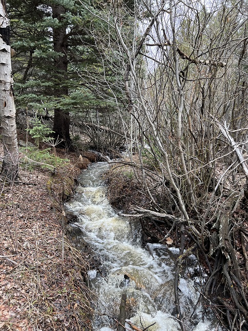
32) Ralston Roost, Black Bear trail and Horseshoe trail, Golden Gate Canyon State Park, Golden, CO, May 13, 2023 - After three days of mostly being indoors while it rained in the mountains Jonna and Alan needed to get out and stretch our legs. Despite it being gray and cool and overcast we borrowed a State Park pass from the library and drove to Golden Gate Canyon State Park. One of our favorite hikes in the park is the climb up to Ralston Roost via Black Bear. The trail starts with a climb up a small drainage with a little stream running down it before starting to wind up the hillside to a rocky ridge. Then it is a steady ascent up that ridge with increasingly better views out over ponds along Golden Gate Canyon State Park Road. Finally, you reach Ralston Roost with it's panorama looking west onto the Continental Divide (which, today, was covered by low lying clouds!) From there the trail drops down to the edge of Frazier Meadows before descending a drainage with a decent sized stream flowing through it. With all the recent rain the stream was boiling with water which made for a relaxing sound as we hiked down. Fortunately, the dark clouds held their moisture and we completed the loop without getting rained on. A 4.6 mile loop with 1,100 feet of elevation gain.
33) Betasso Preserve, Canyon and Benjamin loops, Boulder County Open Space, Boulder, CO, May 17, 2023 - A quiet mid-week hike is always a treat but this week it was extra special because we got to spend the morning with our friend Gaelin who is home from college for Spring Break. We met up at the Betasso Preserve parking lot and then did the long hike that combines both the Canyon and Benjamin loops, as well as the short connector trail that links them. The hike was all the better cause we had perfect hiking weather - a warm spring day with a bright blue sky sprinkled with big fluffy white clouds. A mid-week morning hike means mostly empty trails and since it was Wednesday it was "hikers only" so we didn't have to dodge mountain bikes. This all combined into a nice hike filled with lively conversations, scenic views and plenty of vitamin-D. We topped it off with a leisurely patio lunch in Boulder. A rolling 7.3 mile figure-8 loop with 700 feet of elevation.
34) Green Mountain, Boulder County Open Space & Mountain Parks, Boulder, CO, May 21, 2023 - After a week off we resumes our Sunday evening hikes with our friend Desiree and this week with Gaelin along as well. We again decided to hike Green Mountain starting from the trailhead at the top of neighboring Flagstaff Mountain. Smoke from the big forest fires in western Canada has been blanketing the front range this weekend and today was no exception. From up on the mountains there appeared to be a fog layer over Boulder but the air it was much cleaner (and cooler!) at the altitude where we were hiking. The hike was gloriously green. All the rain early last week, combined with sunshine for the past couple of days, has really kicked the spring growing into gear. There were the first wildflowers and sprouts of green grass and tiny fresh leaves on the trees. Even the moss in the wet areas was a vibrant green. The views from the top of Green Mountain were muted by all the smoke but if you squinted you could still make out the mountains to the west. An enjoyable hike and another great bit of time spent with our friends. A 4 mile loop with 1,500 feet of elevation gain.

35) Owachomo Bridge, Natural Bridges National Monument, Blanding, UT, May 24, 2023 - The bridges/arches in Natural Bridges National Monument are praise worthy! Jonna and Alan took the camper out for a little tour around the Four Corners region and started out with a day of hiking in Natural Bridges NM. We opted to hike the Kachina-Owachomo Loop, starting at Kachina Bridge parking lot then hiking all of Armstrong Canyon to Owachomo Bridge. Then we took the Mesa trail "over the top" to get back to the Kachina Bridge parking lot. This was the perfect time of year to do this hike - the temperature was cooler (though still warm on the more exposed Mesa trail in the mid-day sun), the wildflowers were poppin' and there were still pools of water in the bottom of canyon (many filled with cute tadpoles!). We also hiked down to Sipapu Bridge separately before doing the loop hike so we checked all three of the natural bridges off. A beautiful day of hiking in a remote and sparsely visited place. Oh, and as a bonus - no cell signal! A 6.7 mile loop with 700 feet of elevation gain.
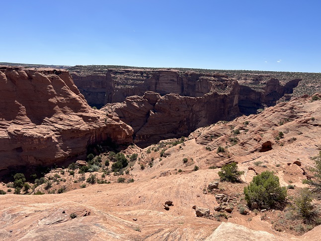
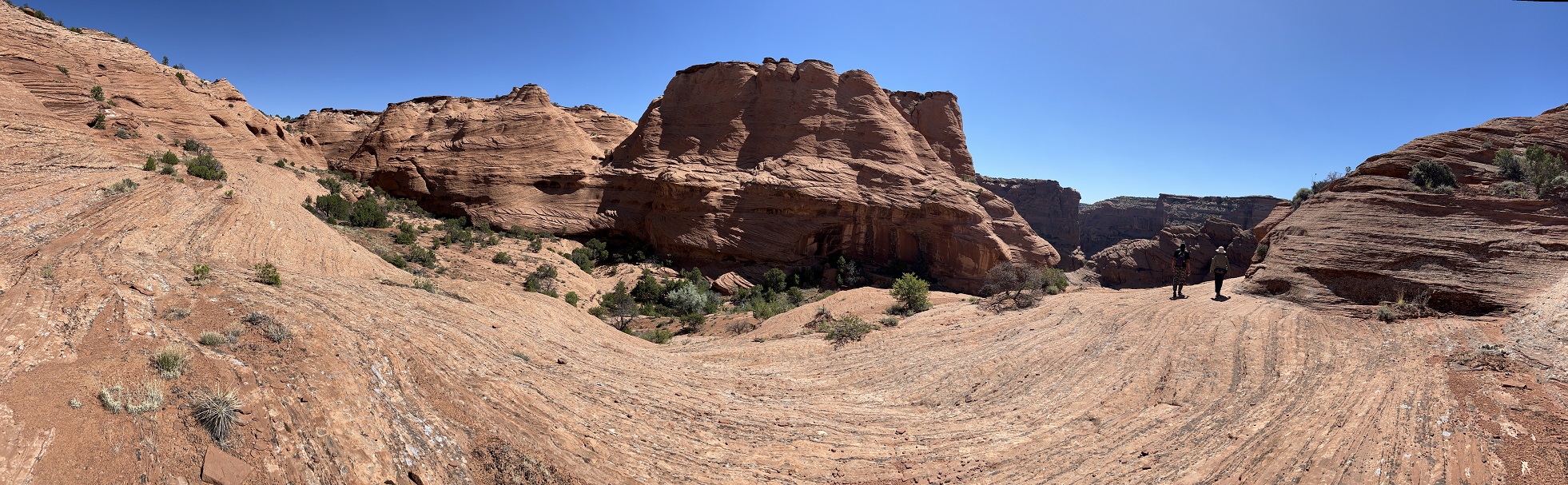
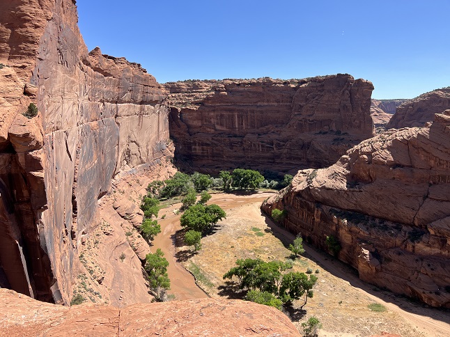
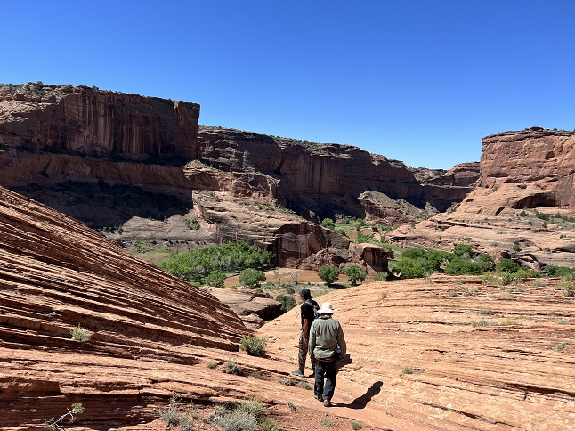
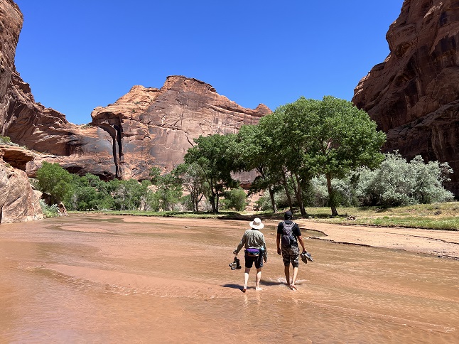
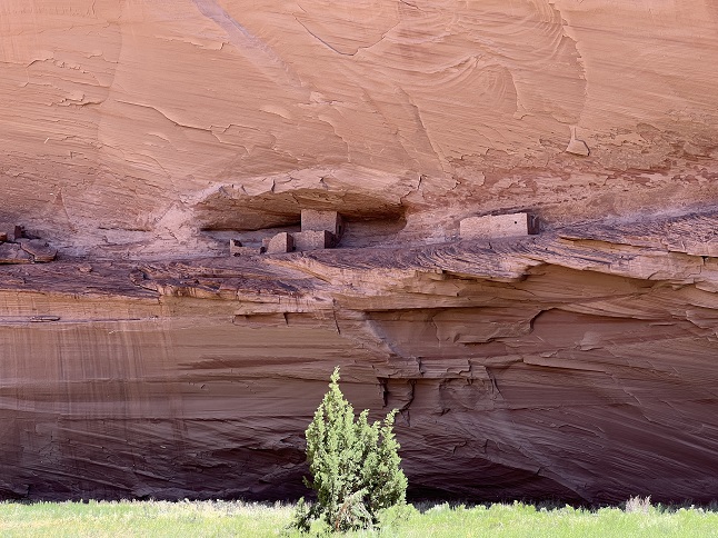
36) Bear Trail, Canyon de Chelly National Monument, Chinle, Arizona, May 26, 2023 - During our loop around the Four Corners area we scheduled two nights in Canyon de Chelly which gave us a full day to see the Canyon. Access into the canyon requires a native guide so we hired Bryan Teller of Antelope House Tours to lead us on a four hour hike on the Bear Trail. We hiked from the rim to canyon floor with spectacular views the whole way. Then we took off our boots and walked along the canyon floor, criss-crossing through the wash, to the Ledge House cliff dwellings. We probably spotted a dozen different cliff dwellings throughout the hike and saw a few farms owned by Navajo families that still live down in the remoteness of the canyon. It was a stunning landscape in which to hike and made all the better by learning some Navajo history and culture along the way. A 4.2 mile down and back hike with 500 feet of elevation gain.
37) Church Rock Loop Trail, Red Rock State Park, Gallup, New Mexico, May 27, 2023 - After leaving Canyon de Chelly we headed to a campground in Gallup so we could recharge the batteries and tend to the tanks on our RV. Next to the Red Rock State Park campground was a short loop trail so we headed out in the afternoon to explore. We thought the loop would go around Church Rock but instead it was a loop along the rim of the canyon that lead up towards the monolith. Fortunately, that canyon was quite scenic and the view of Church Rock towering overhead was beautiful. The afternoon weather was great and we managed to get back to the camper just as the late afternoon wind was starting to gust. A nice, if quick, hike. A 2.4 mile lollipop loop with a mellow 300 feet of elevation gain.
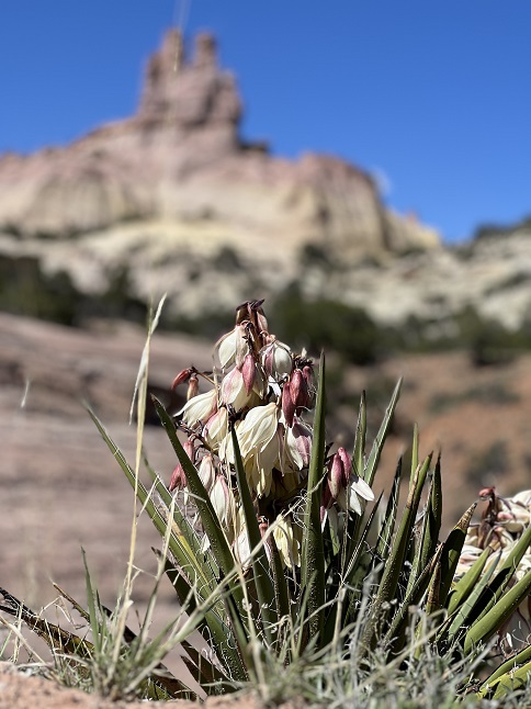
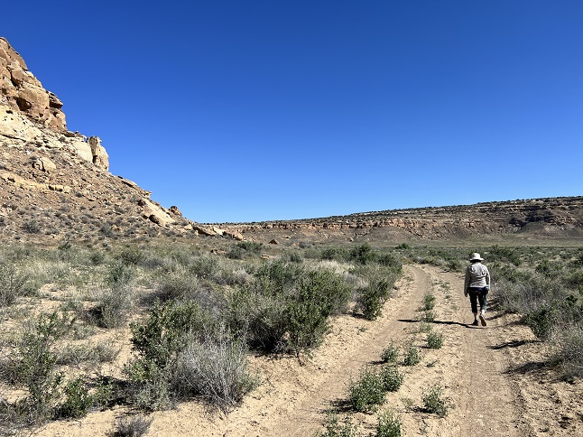
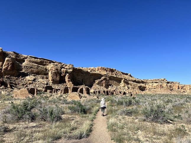
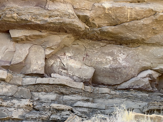
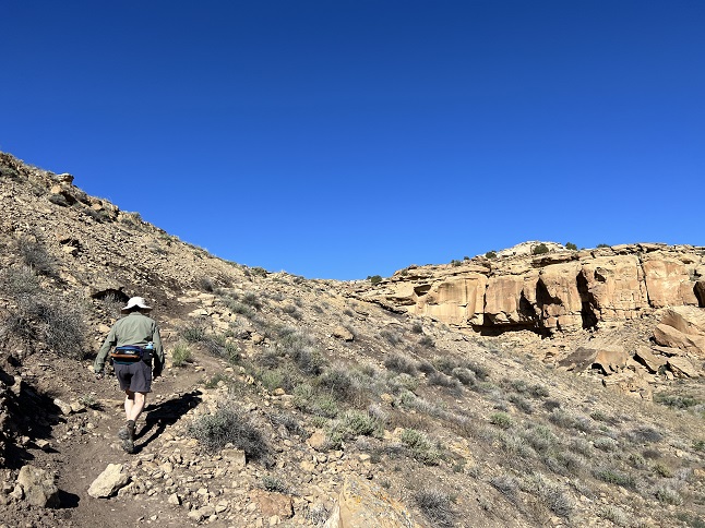
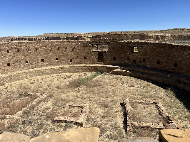
38) Wijiji Trail, Chaco Canyon National Historical Park, Pueblo Pintado, New Mexico, May 28, 2023 - Our next destination was Chaco Canyon. After rattling our teeth out with a 30 mile drive on washboard dirt roads to get to the campground we were ready to stretch our legs and calm our nerves. Across the road from the campground was the Wijiji Trail with curved along the base of a mesa to one of the 800 year old pueblo ruins. The "trail" was just a dirt road but the landscape was covered with wildflowers and provided the sort of vast panoramas that the desert southwest is famous for. In addition to the Ancestral Puebloan site there was also a rock wall decorated with petroglyphs. The highlight of the site itself was three story high north rock wall. A 3.2 mile out and back hike that was basically flat with only 50 feet of elevation gain.
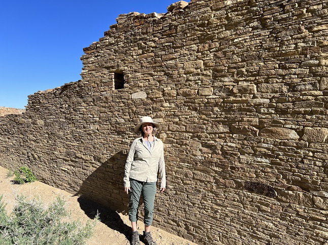
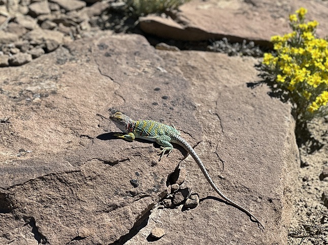
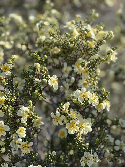
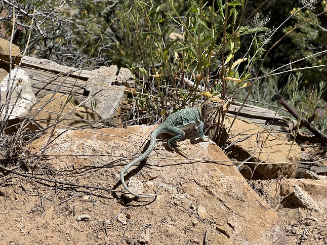
39) Pueblo Alto Trail, Chaco Canyon National Historical Park, Pueblo Pintado, New Mexico, May 29, 2023 - For our first full day in Chaco Canyon we got up early and headed to the most popular trail in the park - the Pueblo Alto Trail. The trailhead starts at the Pueblo del Arroyo ruins, goes past the Kin Kletso ruins, overlooks both the Pueblo Bonioto and Chetro Ketl ruins and climbs up out of the canyon to visit both the Pueblo Alta and New Alta ruins. Can't beat that for impressive sights on a hike! As if that wasn't enough the whole canyon rim was covered with a wide variety of colorful wildflowers. Gorgeous! And the cherry on top was seeing a couple of stunning desert reptiles - a bull snake and a collared lizard. This was a fantastic hike! A 5.9 mile loop with 350 feet of elevation gain.

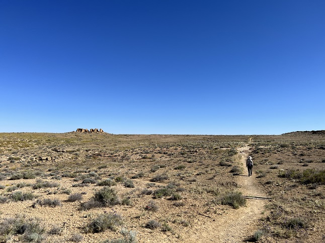
40) South Mesa Trail, Chaco Canyon National Historical Park, Pueblo Pintado, New Mexico, May 30, 2023 - After loving the Pueblo Alto trail hike the previous day we decided to get up early on our second day to try a second loop in the park - The South Mesa trail. This one started at the Casa Rinconada ruins before climbing up the southern rim of Chaco Canyon to go across the top of South Mesa to the Tsin Kletzin ruins. From there the trail loops back to the northwest before dropping down into a side canyon before circling back east to the trailhead. The landscape on top of South Mesa was drier but still covered with wildflowers. The Tsin Kletzin site was unexcavated but the mound covering most of the site provided a nice panorama including loop north across Chaco Canyon to the north rim. The hike ended with Casa Rinconada - the Great Kiva which is an impressive site. Not as amazing a hike as the Pueblo Alto hike but it was still a good way to see more of Chaco Canyon. A 4.6 mile loop with 500 feet of elevation gain.
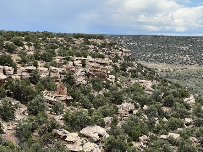
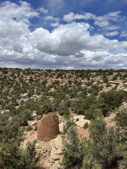
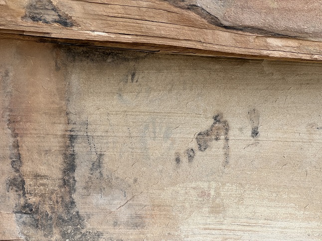
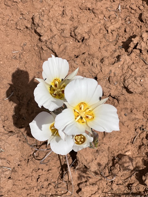
41) Painted Hand Pueblo Trail, Canyons Of The Ancients National Monument, Cortez, Colorado, June 1, 2023 - After Canyon de Chelly and Chaco Canyon we probably had low expectations for Canyons of the Ancients National Park. We were mainly driving through on our way to Hovenweep but we did stop in a few places to see sights and do a short hike. Fortunately, the archeological sites of Lowery Pueblo and Painted Hand Pueblo were interesting. The quick hike out to Painted Hand went along the top of a canyon which had a wide variety of wildflowers including hundreds of Mariposa Lillies. These white and yellow flowers really popped against the bright orange sand and pink rock. The main feature of the pueblo site was a tower built on top of a large boulder that had hand print rock art on its base. A short hike but with excellent scenery. A 2 mile mini-lollipop loop with an easy 50 feet of elevation gain.
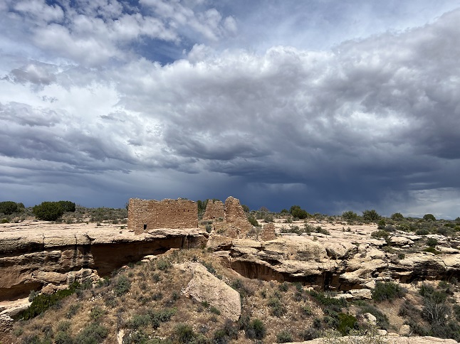
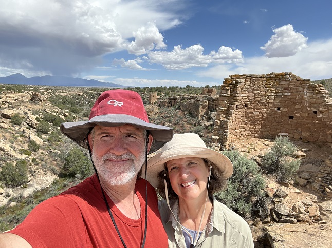
42) Square Tower Trail, Hovenweep National Monument, Blanding, Utah, June 1, 2023 - Our morning hike at Painted Hand Pueblo was short enough that after we got settled in at the Hovenweek campground we immediately headed out to do a second short hike. We started at the campground and hiked over to the Visitor Center. Behind the Visitor Center is the Square Tower Trail which is a short loop that packs in a whole lot of sights. There are nearly a dozen building ruins scattered around the canyon rim most visible the entire time we were hiking. The highlight was the Hovenweep Castle with its high walls which looked particularly dramatic with a dark rain cloud hanging directly overhead. Despite the threatening clouds to the north we had bright sunshine and a cool breeze for the hike. This was a trail which delivered a high bang for the buck in terms of seeing so much on such a short hike. An easy 2.5 mile loop that was basically flat except for a 75 foot high climb while crossing the canyon.
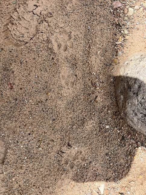
43) Sand Creek Trail, Canyons Of The Ancients National Monument, Cortez, Colorado, June 2, 2023 - We had only reserved a single night in Hovenweep so we didn't have time to do another hike there but as we headed east back into Colorado we did make another stop in the Canyons Of The Ancients to hike the Sand Creek Trail. We got another early start and the weather was amazing - cool temps, bright blue sky with just a few fluffy white clouds and just the lightest of breezes. The trail was also amazing - climbing from the parking lot to the mouth of the canyon and then winding on a inner ledge which was lined with archeological sites. The windflowers were the best we'd seen yet on this trip. They were just spectacular. We hiked north on the Sand Creek Trail to the point were it starts a steep climb up out of the canyon. At that point we stopped to eat a snack and noticed fresh paw prints in the sandy trail. It had rained here the previous evening so we could tell the kitty had come through during the night or earlier this morning. Maybe a young mountain lion or, more probably, a bobcat. We turned back at this point because the morning's fluffy clouds had turned into heavier cloud cover and the breeze was starting to pick up. The rain held off and we took the time to check out a couple of side spur trails on the way back that we'd skipped as we hiked north. This may have been my favorite hike thusfar on this camper trip. A 9 mile out and back with a mild 600 of elevation gain.
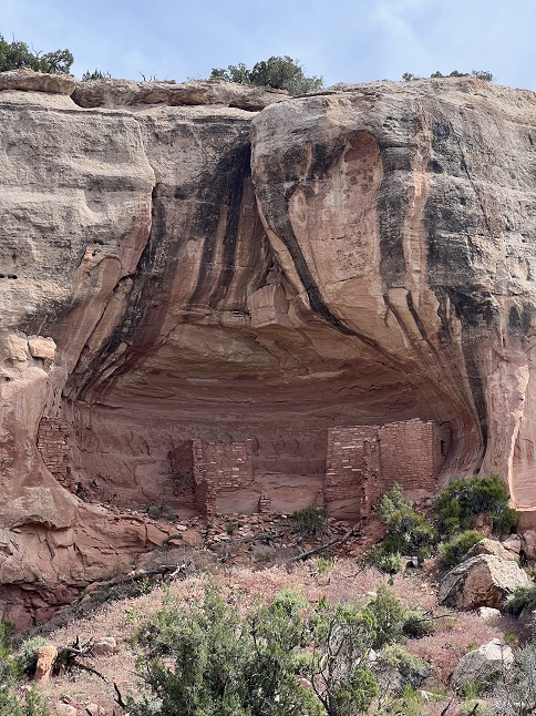
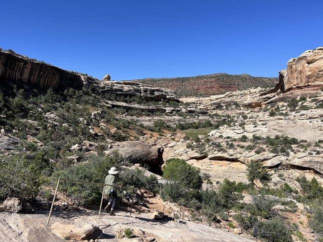
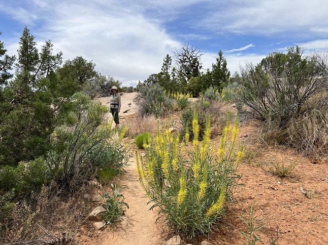
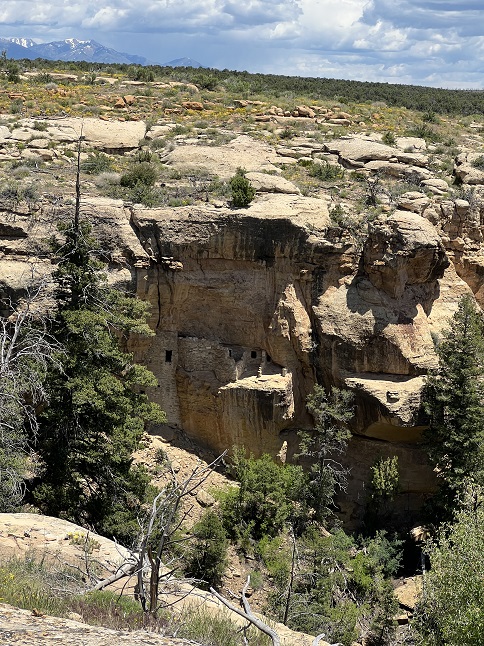
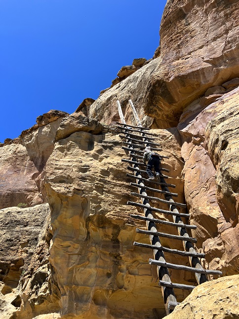
44) Johnson Canyon trails, Ute Mountain Tribal Park, Cortez, Colorado, June 3, 2023 - Online research on things to do down in the southwestern corner of Colorado turned up tours in the Ute Mountain Tribal Park but honestly I had some reservations about doing another guided hiking tour with so much free hiking available in this area. However, since the price was reasonable we decided to give it a try and signed up for a full day guided tour. There were eight of us in total being guided by Wolf who has been guiding tours in this area for 40 years. The day was split between two hikes, one in the morning and a second in the afternoon. The first was on the south rim of Johnson Canyon, a side canyon to Mancos Canyon. From on top of the rim we climbed down on to a ledge were we visited two different sets of ruins, Fortified House and She House. We spent about 2 hours in this area and, in addition to the ruins, we also saw places were channels had been chipped in the rock rim to direct rain water and were dams were built to collect water. We drove around to the north rim of the same Johnson canyon were we all ate the snacks we'd brought for lunch and then did a hike down onto the ledge on that side. There we visited five different ruin sites including Lion House and the spectacular Eagle's Nest. These ledges below the rim run for miles and various levels are tied together with wood ladders. Our guide told us stories about each site, pointed out many interesting features at each and the highlight was when we partially uncovered an 800 year old sacred pot that was hidden in one of the kivas. Spending 7 hours with Wolf was fantastic and allowed us to learn about not only the Ancestral Puebloans who built the villages in this area 1200 years ago but also the modern Utes who live in this area now. Well worth the price and one of our favorite experiences of this trip. Combined the two hikes into the canyon were 5.9 miles in length with a total of 550 feet of elevation gain.
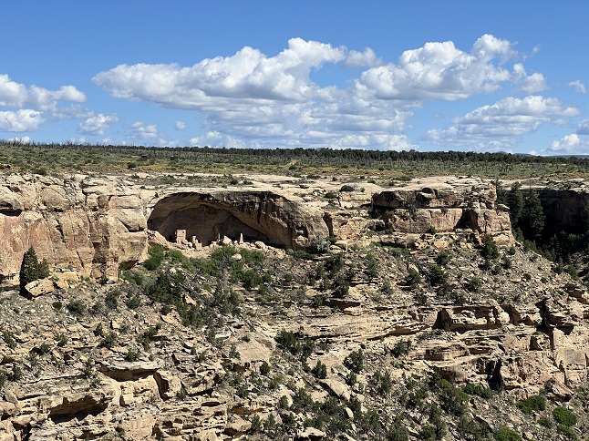
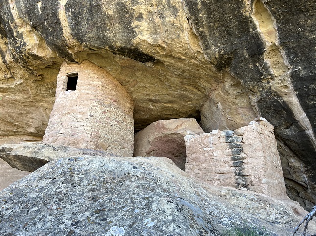
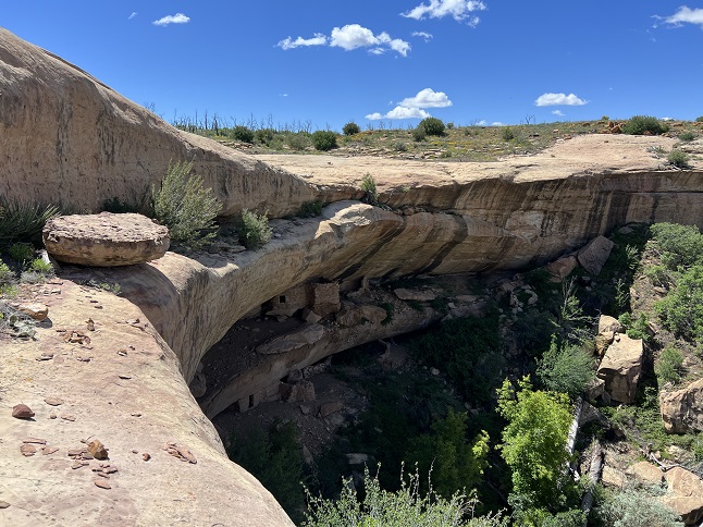
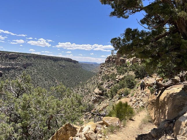
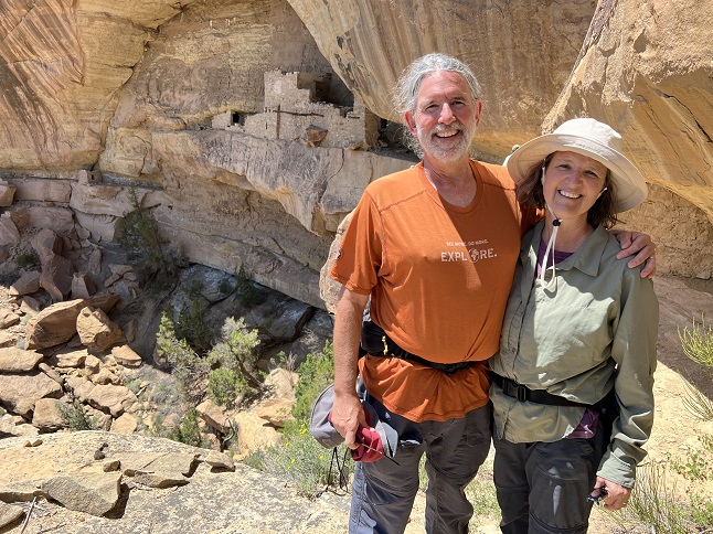
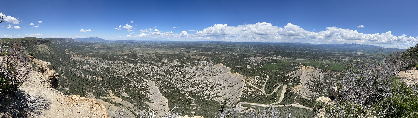
45) Point Lookout Trail, Mesa Verde National Park, Mancos, Colorado, June 4, 2023 - After so many days of back-to-back hiking we woke up tires and strugglingfor motivation but after finding a coffee shop where we could buy some caffeine we managed to find energy to do another hike, albeit a short one. We drove into nearby Mesa Verde National Park and headed for the campground where the Point Lookout trail climbs up a towering knife ridge called, naturally Point Lookout. The trail has over two dozen switchbacks as it goes western face of the ridge and then levels off on top to go all the way to the north end where there is a near 360 degree panorama looking across Mancos valley to the San Juan and La Plata Mountains. We stood on the edge of a 600 foot high ledge and basked in the expansive view. It was a short (but steep!) hike that normally wouldn't make the hiking page but given our lack of motivation in the morning we thought it was an decent accomplishment for the day. A 2.2 mile up and back down trail with 550 feet of elevation gain.
46) Coyote Hill Loop #314 Trail, Pagosa Ranger District, Pagosa Springs, Colorado, June 6, 2023 - What is probably the last hike of our Four Corners trip was a nice one. We spent the morning doing a 3 hour guided tour a Chimney Rock National Monument but during all the time we spent on that (very good) tour we actually only walked about a mile. So after having a picnic lunch near the Chimney Rock visitor center we drove to a trail system that is northwest of Pagosa Springs to do one of the hikes there. We chose the Coyote Hill Loop trail and it was a great pick. This trail is at a higher elevation than we've been previously on this trip and the alpine wildflowers were in full bloom. There were purple, pink, yellow and white flowers carpeting the hillsides and the marshy low points were filled with big patches of purple irises. The San Juan mountains and Pagosa Peak were prominent features on the horizon. We had sunshine and warm temperatures but dark clouds were forming as we hiked and rain was forecast for the evening so we were lucky to have such perfect hiking weather. A fine way to finish off our two weeks of hiking while on the road! 3.5 mile loop with 450 feet of elevation gain.
47) Homestead, Shadow Canyon and Mesa Trails, South Mesa Trailhead, Boulder Open Space & Mountain Parks, Boulder, CO, June 9, 2023 - We are back from our trip and immediately back to our weekly hikes with Desiree and Gaelin. We managed to dodge and afternoon rain squall by meeting up late in the afternoon at the South Mesa Trailhead just after a dark storm cloud rolled through. There has been rain most days over the past two weeks and all that moisture has turbocharged the plant grown along the Front Range. The trail seemed almost tropical in places with hip high grass, a colorful tapestry of wildflowers, bushes heavy with berry buds and pine trees loaded with pine cones. Everything was verdant and lush. We did our "long loop" going up Homestead to Mesa, then taking Shadow Canyon trail around the west side before returning via the Mesa and Towhee trails. The variety and sheer quantity of wildflowers was amazing. We were all in positive spirits before the hike and the beautiful landscape just boosted it. A fine way to finish off the week! A 5.8 mile loop with 1,200 feet of elevation gain.
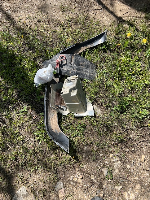
48) Ellsworth Creek trail system, Rollinsville, CO, June 14, 2023 - In order to avoid the daily afternoon rain storms, Jonna and Alan got up early to get in a quiet mid-week morning hike before the dark clouds rolled in. In the hopes of seeing some high country wildflowers we headed to one of our "locals only" trails - The Ellsworth Creek trailhead - and made the climb up to the meadow above the old Ellis Lode Mine. However, we were too early and the only flowers out were tons of dandelions and a handful of early bird bluebells. The meadow was full of healthy green shoots but no flowers yet. We did spend a little extra time exploring a single track that we'd by-passed during (many) previous hikes and then decided to decent via a slight longer route so we could hike along a burbling creek for a while. What was a downer is that we hauled out so much trash that we had to leave some of it behind because we couldn't carry it all. It is sad that some forest users leave trash behind and even sadder that other hikers walk past it without packing any out. If anyone wants any broken 4x4 parts or some brass rifle cartridges we have a fresh selection from which you can chose. A 5.2 mile "figure eight" loop with 950 feet of elevation gain.
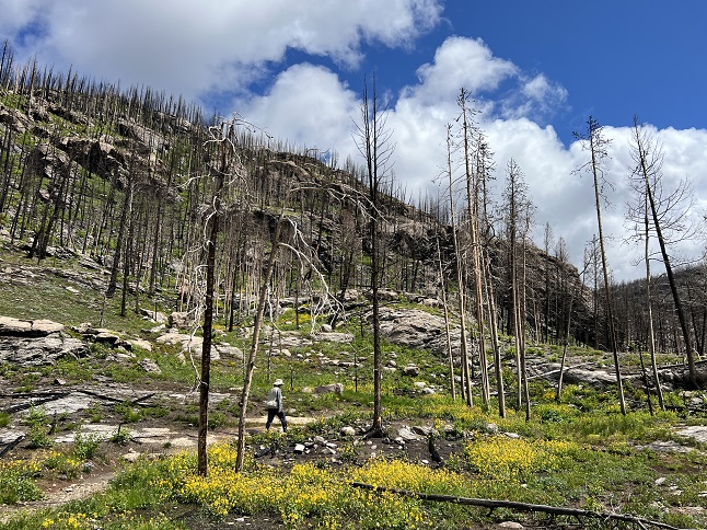
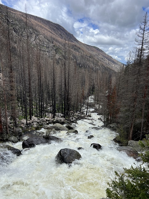
49) Cascade Falls, Continental Divide National Scenic Trail, North Inlet Trailhead, Rocky Mountain National Park, Grand Lake, CO, June 16, 2023 - With the weather forecast once again calling for afternoon rainstorms Jonna and Alan got up early in order to get in another morning hike in order to beat the weather. The weather app said the rain would roll in later on west side of the Continental Divide so we made the trek over Trail Ridge Road in Rocky Mountain National Park to Grand Lake. There we found the North Inlet Trailhead and a section of the Continental Divide National Scenic Trail going north into the National Park past Cascade Falls. This area was badly burned by the East Troublesome fire in 2020 and the entire area is covered with thousands of burned tree trunks. However, the lack of tree cover means rain and sunshine reaches the ground and the result is an amazing display of wildflowers, both in variety and quantity. It was neat to steadily gain elevation and watch the types of wildflowers change as we went up. Near the trailhead there were loads of Tall Chiming-bells. Then, it shifted to Purple-Fringe. Next were Columbines, Snow Buttercups and Golden Banner. Near the top of the hike there were Wild Roses and Shooting Stars. However, throughout it all were the bright yellow Heartleaf Arnica flowers. Entire hillsides just glowed yellow with all the Arnica blooming. It was a stark contrast to see the devastation of the blackened tree trunks surrounded by the vibrant flowers. The trail made a steady but mild climb up to Cascade Falls where North Inlet Creek cascades down about 50 feet through huge granite boulders. We had planned to eat a snack while enjoying the view from the top but clouds of mosquitos convinced us to make a quick retreat. The return was pleasant and we spotted a few critters on our way back down. We got back to the trailhead by noon, beating the rain, and grabbed lunch in Grand Lake before driving back over Trail Ridge Road through rain, hail and fog. A 7.2 mile out-and-back with a surprisingly mellow 600 feet of elevation gain.

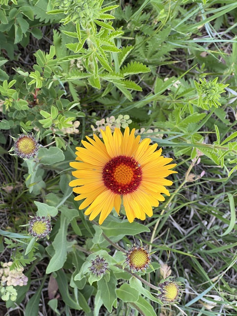
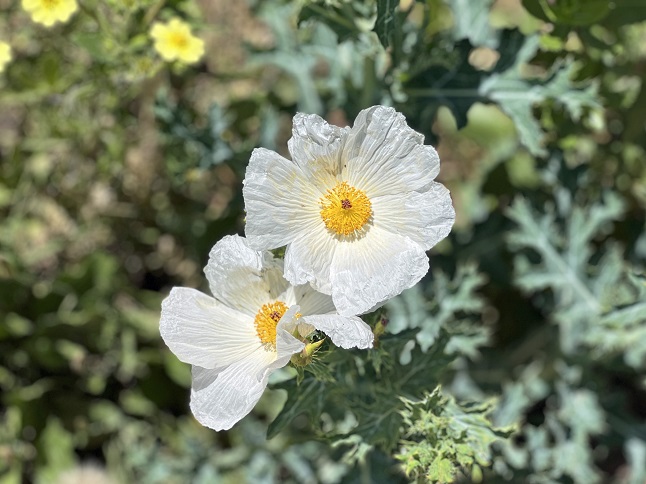
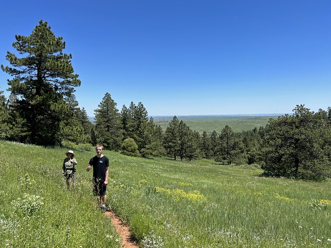
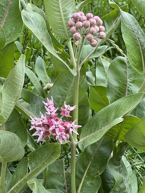
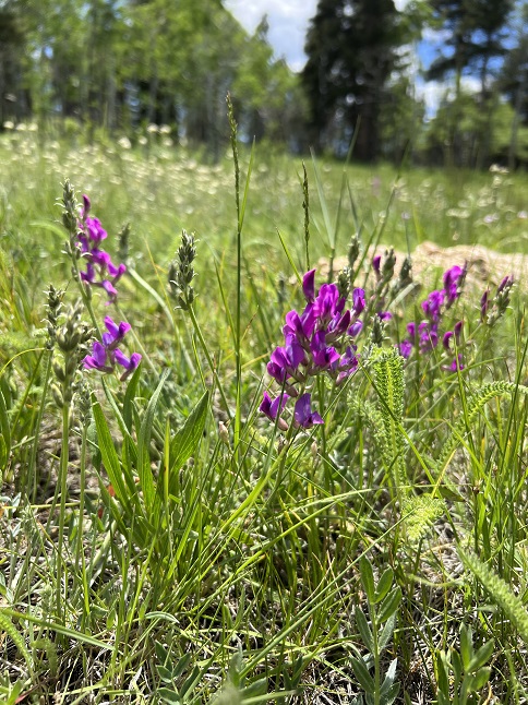
50) Homestead, Shadow Canyon Spur and Mesa Trails, South Mesa Trailhead, Boulder Open Space & Mountain Parks, Boulder, CO, June 19, 2023 - All our recent hikes have been highlighted by the copious numbers of wildflowers that are blooming this summer. In an effort to continue that trend we returned to our "regular" weekly hike to see what new flowers are opening there just ten days after our previous visit. Desiree, our normal hiking partner, was busy but her son Gaelin was free and joined us for the hike. We started at our usual South Mesa Trailhead and immediately found that thousands of yellow Cinquefoils had popped open in the fields at the lower elevations. However, the variety of wildflowers was impressive as well with Penstemon, Flax, Alpine Daisies and Thistle covering the blue/violet portion of the color palette. Mariposa Lilies, Yarrow, Cow Parsnip, Trailing Daisies, Alpine Phlox and the spectacular Crested Prickly Poppies added white to the mix. Finally, Globemallows, Dandelions, Blanketflower and Buttercups helped the Cinquefoils with the yellows. With the prolific blossoms there were frisky butterflies, bees, beetles and flies all jumping from flower to flower. Gaelin even spotted a baby bunny rabbit in some bushes at one point so we were veering pretty close to an idealized Disney landscape territory... These flowers won't stick around long though because the temperature was pushing 90 degrees and after weeks of rainy weather the switch to baking sunshine will wilt them quickly so we were happy we got to enjoy them on our hike. A 4.5 mile loop with 1,000 feet of elevation gain.
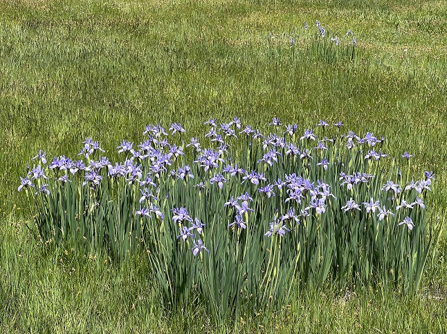
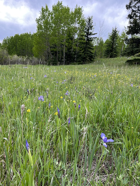
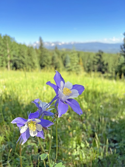
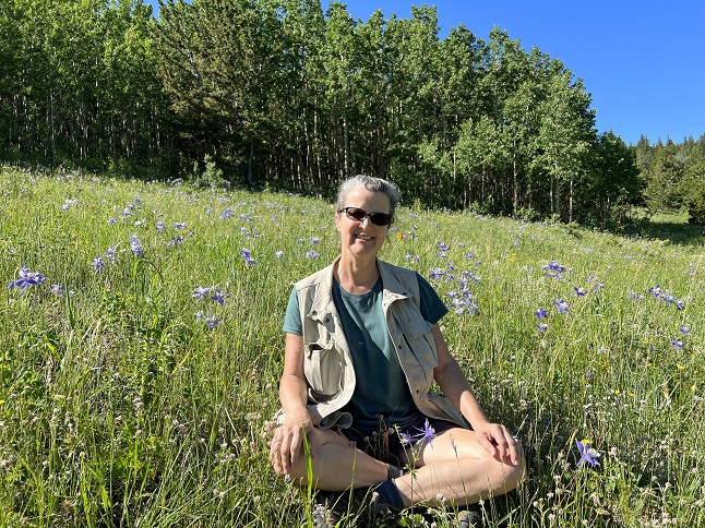
51) Mule Deer Trail, Golden Gate Canyon State Park, Golden, CO, June 20, 2023 - Despite waking up to cool temperatures and overcast skies which looked like rain Jonna and Alan decided to head out for a long hike. We decided to re-trace the route of our first hike together 25 years ago in Golden Gate Canyon State Park. We continued with the reminiscing by stopping for a mid-hike snack at Panorama Point which is where we were married back in 2000. As for the hike itself, the wildflowers at these higher elevations are more subtle - there are flowers out but they are tiny little flowers on the forested hillsides. The meadows in the center of the park had larger, more colorful flowers of which the purple irises were the highlight. Lucky for us the rain held off and as we hiked north the clouds burned off and the sunshine warmed the air so we had perfect weather for the second half of the hike. As we neared Panorama Point we came across two young moose munching on aspen leaves but they completely ignored us so we could watch them for a bit. The view from Panorama Point was as stellar as always and eating our snack while recalling our wedding day made for a nice break. The hike back down to where we started at the Ole Barn Knoll trailhead was lovely with beautiful blue sky overhead and the rocky south ridge of Tremont Mountain to the east. Overall a great hike at a place with plenty of sweet memories. A big 8.8 mile loop with 1,100 feet of elevation gain.
52) Radnor Lake State Park, Brentwood, TN, June 27, 2023 - Even on vacation we need to get out and do some hiking so we got up early in the morning on our last day in the Nashville area and explored a nearby state park. Radnor Lake State Park is small but it does have a few loops of hiking trails and, best of all, there isn’t an entry free. We did the loop around the lake and added a climb up onto Gainer Ridge to make it a little longer. The lush forest (and the high humidity!) were quite the change from the mountains of Colorado and the deserts of the southwest where we have been hiking lately. We saw a deer, some squirrels, some chipmonks and a ton of rich Nashville housewives - all out enjoying the woods. A good chance to stretch our legs and to see another side of Nashville. A 4 mile loop with 375 feet of elevation gain.
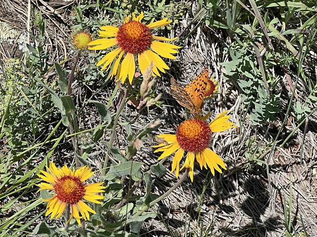
53) Homestead, Shadow Canyon and Mesa Trails, South Mesa Trailhead, Boulder Open Space & Mountain Parks, Boulder, CO, June 30, 2023 - We returned with Desiree to our old faithful trail, the Homestead Trail, after two weeks away to see what was happening with the wildflowers and were again wow'ed with how things had changed in just a couple of weeks. In early June the predominant wildflowers were blue and purple. Now it is the yellow flowers that have taken over and the white blossoms are starting to come on strong. We hiked our "long loop" and it was also neat to see how different flowers exist at different elevations. Another highlight of the hike was seeing two Eastern Yellow-bellied Racer snakes coiled up together taking in the sun on top of a rock. Some of my favorites from this hike were the pink Showy Milkweed, purple Beebalm (aka Wild Bergamot) and the white Carolina Larkspur. Another good hike with more beautiful wildflowers. A 5.8 mile loop with 1,200 feet of elevation gain.

54) Caribou Ranch Open Space, Boulder County Open Space Parks, Nederland, CO, July 2, 2023 - A gloriously sunny Sunday tempted us out to hike, even though we normally avoid the busy trails on weekends. Our favorite local trail is the loop at Caribou Ranch which is just a couple of miles from our house. It closes in the spring to give the local elk a quiet place to birth their calves and the park just re-opened for the summer so we headed there to see what the wildflowers were like in the meadows there. We were surprised to find that whlle there was a wide variety of flowers blooming there were weren't great numbers of any one species. We walked the loop and enjoyed spotting all the different flowers - we saw well over a dozen different types - and enjoyed soaking in some Vitamin D from the sun up in a bright blue sky. The various tributaries of North Boulder creek that flow through the park were all dancing through their rocky beds and the old ranch buildings all gleamed with relatively fresh paint. A 4.2 mile loop with 250 feet of elevation gain.
55) South St. Vrain Trail, Ward, CO, July 3, 2023 - Hiking on the Monday of a holiday weekend is just as busy as a Sunday. Alan joined Todd and Rusty pup for a Monday morning hike at a relatively out of the way trailhead but since it was a holiday we were the seventh and eighth vehicles parked at what I'd hoped would be an empty trail. Oh well... Nonetheless, we had awesome weather so we ventured forth despite the hikers and campers on the trail. A couple of years ago, Todd and Alan hiked this trail hoping to reach a lake up the shoulder of a nearby peak. That hike was a bust as deep snow turned us back. So we thought we'd give that another shot. No snow this time but instead we found that the side trail up to the lake has been closed so we stuck out once again. It was still a nice hike but it didn't quite live up to expectations. A 6 mile out-and-back with 900 feet of elevation gain.
56) Anchor Mine, Caribou townsite, Nederland, CO, July 12, 2023 - Jonna and Alan are back from a week long motorcycle trip and are immediately back to hiking. We got out for a mid-week, mid-day hike on a trail we hadn't visited in six years - the Anchor Mine trail from the Caribou townsite trailhead. Technically, this hike is a combination of the FS-505 road and the FS-128 trail. What was a bonus is that the National Forest Service had closed FS-505 so we got to hike on an empty road - one that is often heavily used by OHVs - 4x4, ATV and offroad motorcycles. We were surprised to find so few wildflowers at the higher elevations but most of the hike is in thick pine forest so perhaps the lack of meadows is the main reason for so few flowers. Even with the lack of wildflowers the Anchor mine site itself is one of the prettiest mines in the area and we enjoyed looking around there. We also explored the short trail above the mine that leads into the Indian Peaks Wilderness area. A longer hike above the mine is now on the future "to do" list. A 3.3 mile out and back hike with 450 feet of elevation gain.

57) Forest Lakes trail, James Peak Wilderness Area, East Portal Trailhead, Tolland, CO, July 14, 2023 - Longtime friend Todd got a new vehicle - no more driving that old POS - and wanted to show it off. So he drove his fancy Rivian electric SUV to my neck of the woods and let me give it a spin. Even though he had an afternoon commitment we squeezed in a short hike up at the East Portal trailhead. We didn't have time to make it all the way to the Forest Lakes but we did hike part way up that trail. In the open areas there were plenty of wildflowers, the creeks were all gushing with snow melt and mountain sides were all covered with green trees. A quick one but still a favorite area to hike. A 4 mile out-and-back hike with 650 feet of elevation gain.
58) Ellsworth Creek trail system, Rollinsville, CO, July 15, 2023 - Weekend hiking in our part of the Front Range is always a challenge and this weekend proved that. We'd intended to get up early on in order to hike one of our semi-secret "locals only" trails. However, the weekend madness that is the Hessie and Fourth of July trailheads around the little town of Eldora have now lead to the entire road being closed off. After weaving our way through the hoards parking at the High School in order to take the shuttle into Hessie we were turned back - no one was allowed up the road, even if we weren't going to the Hessie or Fourth of July trailheads. So we fell back to an old faithful - the Ellsworth Creek trailhead. Other than a few dirt bikers meeting up in the parking lot it was quiet and empty. We tried out a long loop, using some of the western trails that I haven't been on in at least 20 years. We started by hiking our usual route up to the Ellis Lode Mine, then to the flower filled meadow above that and then up to the viewpoint on the ridge above that. But instead of returning via that same route we instead continue West and then made a loop to the north. The trail our maps showed connected back towards the trailhead didn't appear to exist so we did a half-mile cross-country to head back in the right direction. The wildflowers were beautiful, the views scenic and the weather perfect. The only downside was once again we ended up carting out a big load of trash left by some of the folks who come into this area to off-road and shoot. We filled a trash bag and then filled our pockets, packs and hands but still couldn't carry everything we found. It is sad to see so much trash in an area we love to hike but at least we're packing some of it out each time we hike there. A 6.1 mile loop with 1,000 feet of elevation gain.
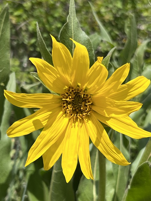
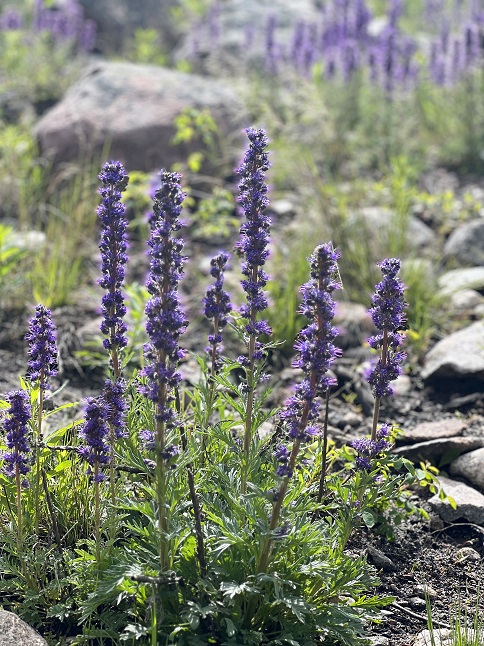
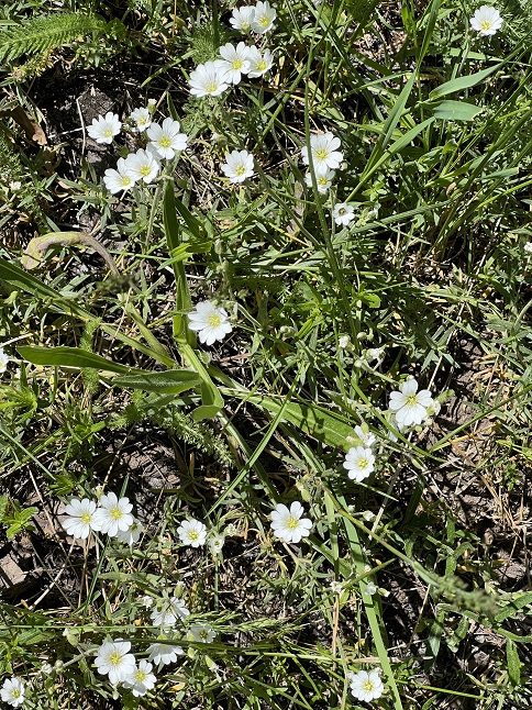
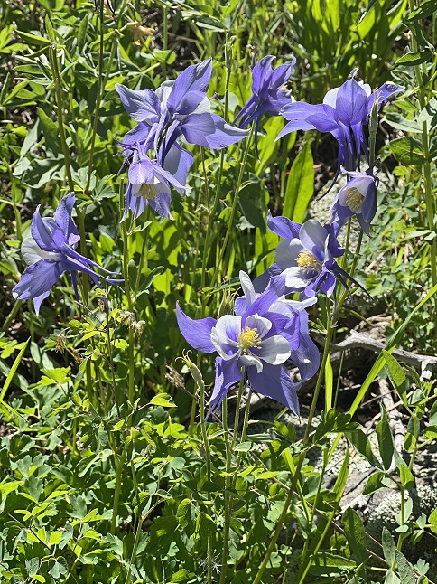
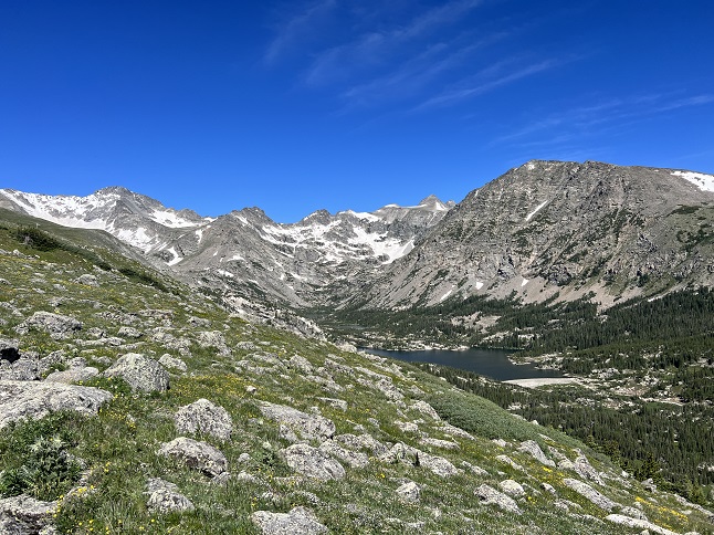
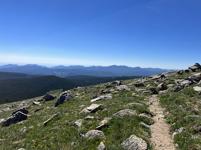
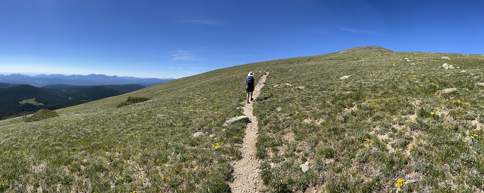
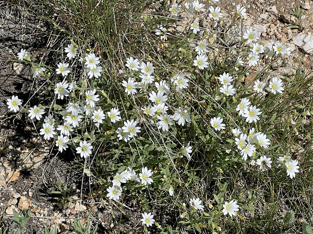
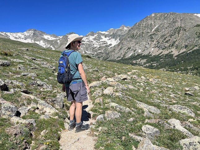
59) Arapaho Glacier trail, Rainbow Lakes Trailhead, Roosevelt National Forest, Ward, CO, July 17, 2023 - Since we missed out on hiking up into the high country this past weekend we gave it another shot Monday morning and wow, what a success! We returned to one of our absolute favorite trails - The Arapaho Glacier trail (aka FS-905) from the Rainbow Lakes trailhead. The climb up onto the shoulder of south Arapaho Peak is a nice hike through a pine forest but the real jewel of this trail is once you get above treeline. The view of Mt. Albion, Arikaree Peak and North/South Arapaho Peaks with the line of Triple Lakes, Goose Lake, Island Lake and Silver Lake down below is always jaw dropping. Then we continued to climb up through the glorious alpine tundra which was filled with little micro-flowers, butterflies flitting about and birds hopping between the rocks. The temperature was comfortably warm - this on a day when I'm sure it was sweltering down on the plains - and there wasn't a cloud in the sky for most of the hike. Even the mundane squirrels and chipmunks we saw down in the trees as we hiked out seemed to be a little cuter than usual after being in such a gorgeous landscape at the apex of the hike. Last year at this time the tundra was covered with the Old Man Of the Mountain flowers but the few still in bloom this year looked positively geriatric. However, the standout this year was seeing the fragile little Mouse-Ear Chickweed flowers nestled among the rocks. Lovely! A 6.3 mile up and back with 1,400 feet of elevation gain.
60) Windy Peak trail, Golden Gate Canyon State Park, Golden, CO, July 20, 2023 - Despite predictions for rain most of the day, Alan and Lyle met up at Golden Gate Canyon State Park to get in a morning hike. Fortunately, we timed it perfectly. Starting late enough that the skies had cleared from a big overnight thunderstorm and finishing just as rain drops started falling as afternoon rain clouds started rolling in. We decided to try out some trails we hadn't hiked in about a dozen years - the Burro & Mountain Lion trails that go up Windy Peak in the eastern part of the state park. There were fields of wildflowers all along the trail, particularly near the beginning of Burro trail, but the highlight was visiting the old Tallman Homestead - an old ranch from the 1880s with a small mill pond and some outbuildings. It was a steady climb from the trailhead up the western shoulder of Windy Peak and much of the trail was lined with colorful blossoms and beautiful aspen trees. A nice hike and a good chance to catch back up with Lyle after not hiking with him for a few months. A 5 mile up and back hike with 900 feet of elevation gain.
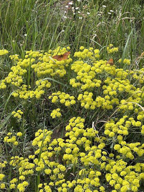
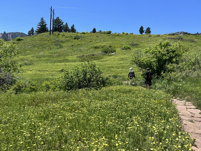
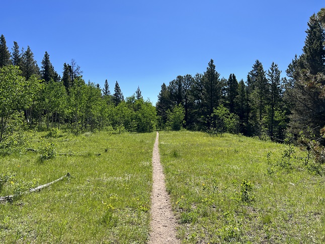
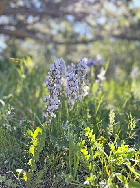
61) East Magnolia trail system, Nederland, CO, July 23, 2023 - Our friends Steve and Kristin drove up from Boulder to see us (and to escape the heat down below!) and, after eating lunch together, we went for a short wildflower walk. The Lollipop loop, combined with a short section of the Indian Peaks Traverse trail, provides a short hike around a hilltop which is partly open meadow and part tunnel through a row of pine trees. The variety of wildflowers in the meadow section was amazing and we all enjoyed spotting all the different flowers. An afternoon thunderstorm was rolling in and we timed our walk perfectly to get us back to the cars just as the thunder started shaking the ground. Not a big hike but it was a beautiful after-lunch stroll with some beautiful wildflowers to cap off a nice afternoon together. A relaxed 1 mile loop with a mild 150 feet of elevation gain.
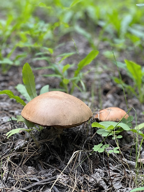
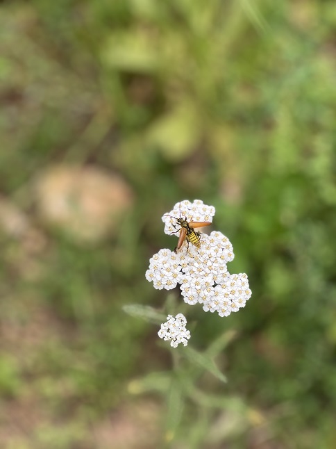
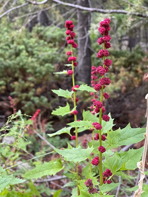
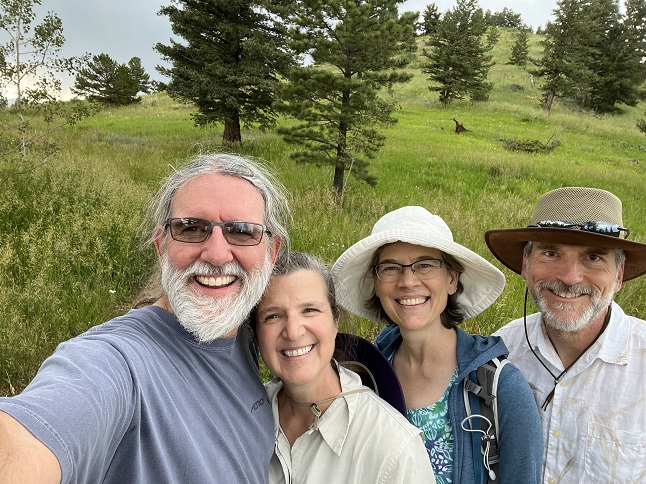
62) Diamond Lake, Indian Peaks Wilderness, 4th of July trailhead, Eldora, CO, July 24, 2023 - We generally avoid hiking in the high country after noon since summer thunderstorms can roll in quickly. However, today the weather looked promising and a mid-week afternoon seemed like a good opportunity to find parking at the extremely popular 4th of July trailhead so we made an exception. We drove up around 2pm and found a parking spot mere feet from the trail. There were some big thunderheads to the north but the sky to the west was clear so we took the risk. It has been many years since we last did the hike to Diamond Lake so it was fun to re-visit it. Since this is in a Wilderness area the trail is just barely developed - a few bridges over the larger creeks and streams - but otherwise it is just a narrow track through the forest. In the places were winter avalanches have knocked down the trees there are hillsides covered with lush wildflowers and the same along the banks of the streams cascading down the steep mountainsides. It was a terrific hike! When we got up to Diamond Lake it was clear that dark clouds were coming over the Continental Divide fast so we made an abrupt turn-around and immediately retraced our route. We stayed ahead of the clouds for the return trip and got back to the car without any drama. A really splendid afternoon in the mountains! A 5.2 mile up and back hike with 1,200 feet of elevation gain.
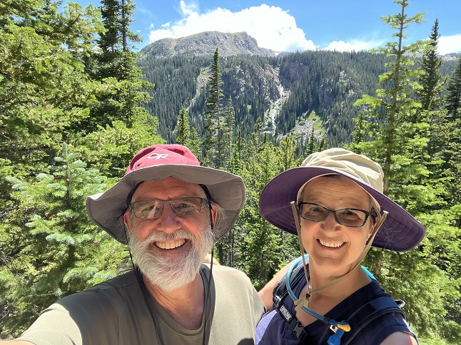
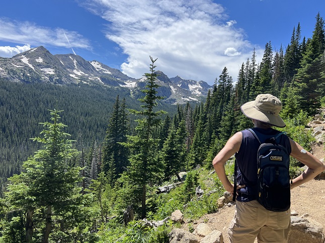
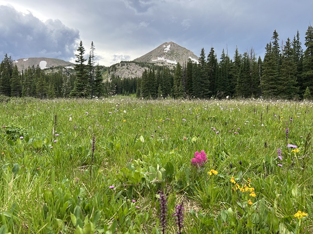
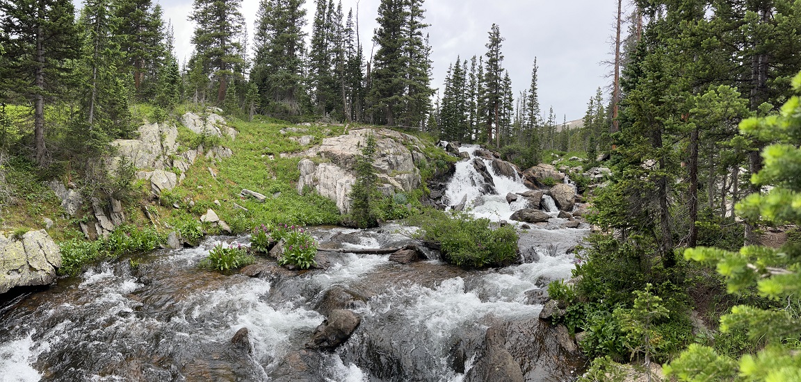
63) Lands End Loop, Golden Gate National Recreation Area, San Francisco, CA and Sunset Loop Trail, Joaquin Miller Park, Oakland, CA, July 28, 2023 - We are visiting Jonna’s brother Jamie in the Bay Area and decided to split up a day of hiking into two short-ish hikes. For the morning we drove into San Francisco (from Oakland) to do a quick walk on Ocean Beach and then to hike the Lands End loop from the Sutro Baths parking lot. There was a low hanging fog bank over the bay so we could only see the lowest parts of the Golden Gate bridge but the views onto the rocky headlands were still picturesque. Afterwards we grabbed a delicious lunch (Yank Sing - Yum!). Then, in the evening we made a quick drive up the hill from Jamie’s house to Joaquin Miller Park where we hiked another loop - this time up the Sunset trail starting at the Pinewood picnic area and then hiking through the redwoods along the Sinawik Trail beside Palo Seca Creek. Then we changed to the Sunset Loop trail to return to get a slightly different view. Both were enjoyable hikes and when combined they add up to a decent day’s mileage and elevation. Lands End was a 3.4 mile loop with 561 feet of elevation gain. Joaquin Miller was 2.4 miles with 250 feet of elevation gain.
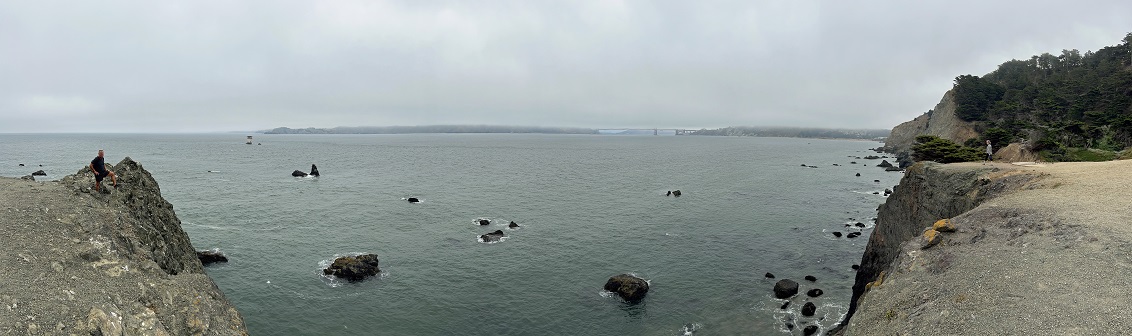
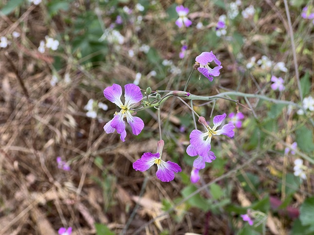
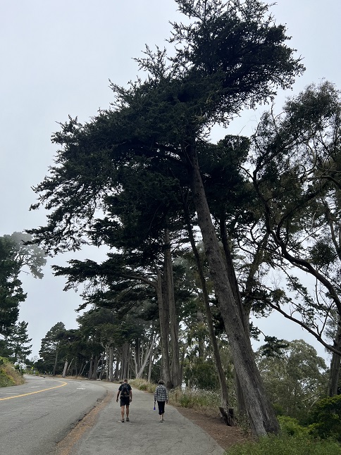
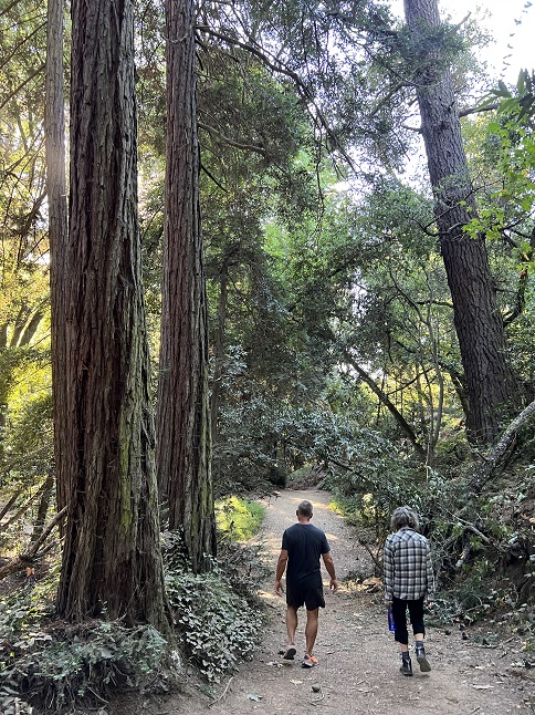
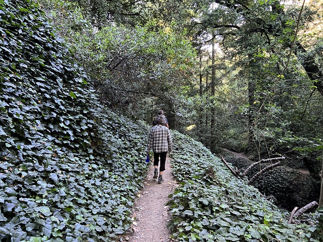
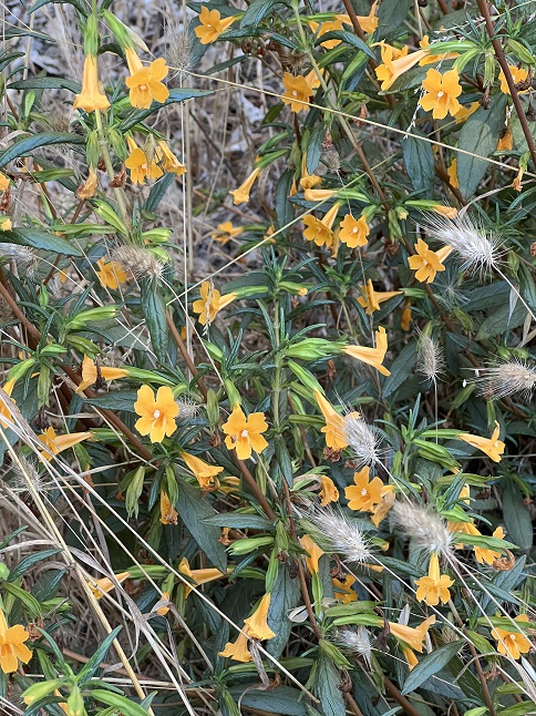
64) Todd Creek Redwoods, Sanborn County Park, Saratoga, California, July 29, 2023 - Our friend Krista invited us on a hike in her neck of the woods so Jamie, Jonna and Alan made the hour long drive from Oakland to the south Bay area for an early morning hike. We started at the Sanborn County Park main entrance and immediately went *up*. We combined a few different trails: The Nature Trail, the San Andreas trail, the Lower Madrone trail, the Upper Madrone trail, Sanborn trail and Skyline trail, to climb all the way up to Skyline Drive. This brought us through different forest zones - pine, redwoods and oak. All beautiful environments for a hike and with a lot of elevation gain which was good for our training. Once up to Skyline trail we went to the end of the trail hoping for a scenic view at Sunnyvale Mountain but the loop around the "peak" didn’t offer any panoramic views. We took a slightly different series of trails back down mainly using the Sanborn trail for the descent. My highlight for the hike was seeing a giant eagle's nest up in one of the redwood trees along Skyline trail. The nest was easily 10' in diameter. It was too high up to tell if it was occupied but it was impressive regardless. We all had an enjoyable time socializing and taking in the landscape. A 10.03 mile loop with 2,211 feet of elevation gain.
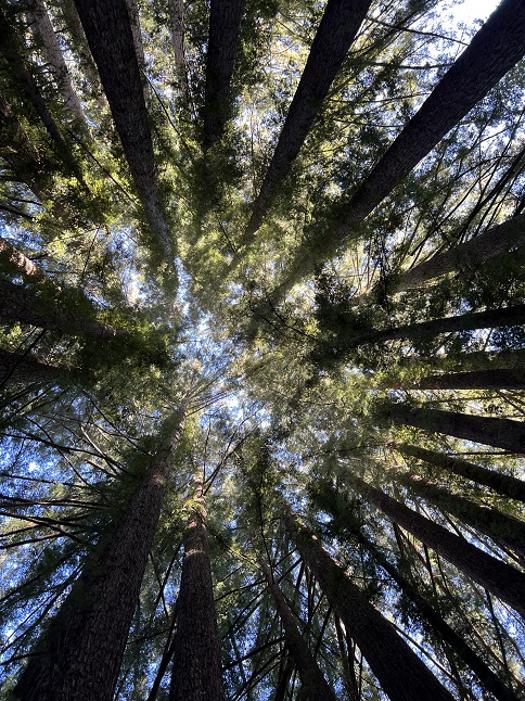
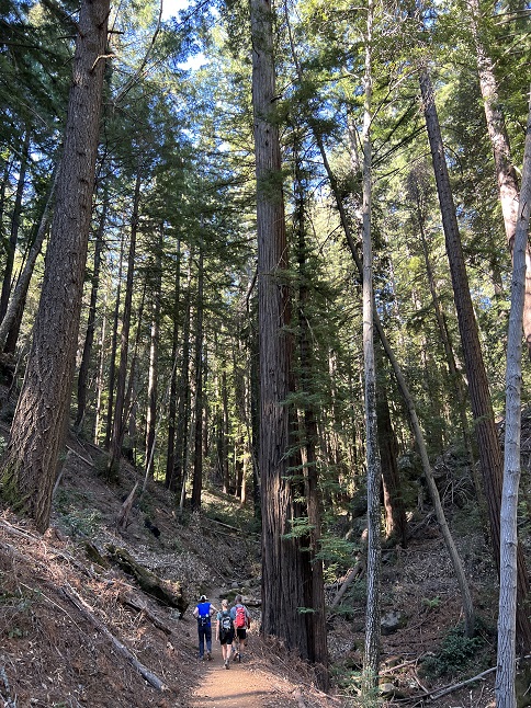
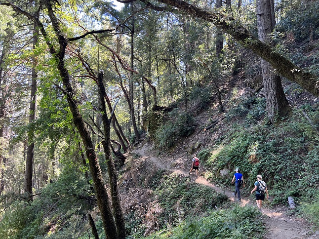
65) Coastal Fire Road trail, Golden Gate National Recreation Area, Muir Beach, California, July 31, 2023 - Jamie, Jonna and Alan headed out to hike another excellent Bay Area trail today but this one was up in the Marin headlands just below Mt. Tamalpais. We started at Muir Beach and took the Coastal Fire Road trail south climbing up onto the rolling hillsides above the rocky cliffs. We then dropped all the back down to the water following a steep water drainage down to Pirate's Cove. After enjoying the little beach and the crashing waves we headed back up to the top of the hills and continued south to the Tennessee Valley. From there we again dropped back down to the water at Tennessee Beach. We had our snacks while surf pounded the beach and boomed against the sheer cliffs bookending the beachfront. Once again we made the ascent up the hills and turned back north. This time we turned inland where we picked up the Middle Green Gulch trail that descended down into a hidden valley where the Green Gulch Zen Center is nestled down at the bottom. The trail goes through their fields so we got to see bountiful fresh veggies which primed us for a post-hike lunch. We finished with a short section of the Kaashi Way trail to return to the trailhead. A scenic hike in a very different landscape from our earlier hikes and thankfully cool due to the marine layer fog drifting inland off the Pacific Ocean. A 8.54 mile loop with 1,926 feet of elevation gain.
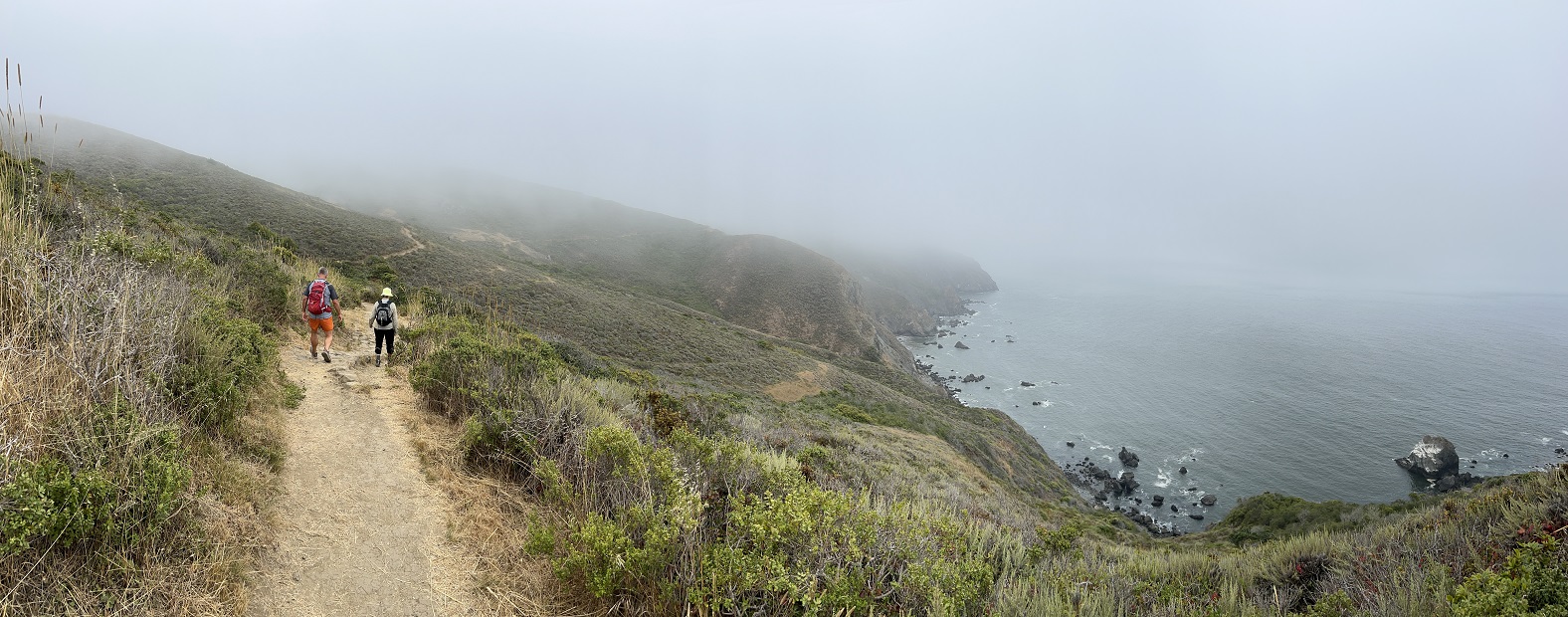
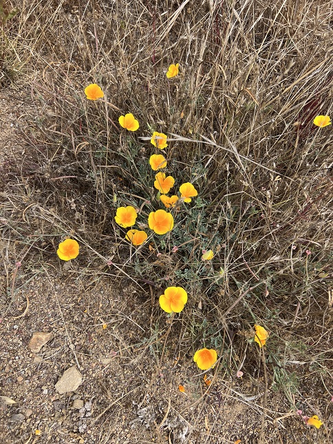
66) Spring Trail, Reinhardt Redwood Regional Park, East Bay Regional Park District, Oakland, California, August 2, 2023 - Jonna and Alan capped off our Bay Area trip with, what else, another hike. Jamie drove us up the ridge behind his neighborhood to the Redwood Gate of Reinhardt Redwood Regional Park. We strung together a series of trails: Stream Trail, Mill Trail, French Trail and Tres Sendas Trail to make a big loop. The entire Redwood Creek valley is idyllic - a trickling creek with towering redwood trees and hillsides covered in ferns and giant clover. It would only have been mildly surprising to see a dinosaur pop out of the trees. Jonna commented that it was like walking through Muir Woods National Park but without all the crowds. We had originally planned to just do a short loop to stretch our legs before sitting on a plane for the afternoon but we enjoyed it so much we ended up doing a much longer loop. An excellent way to cap off our week of training hikes with Jamie and we are all three in good shape for our upcoming Patagonia trip! A 7.04 mile lollipop loop with 1,434 feet of elevation gain.
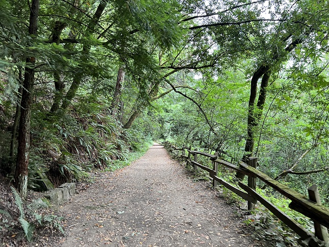
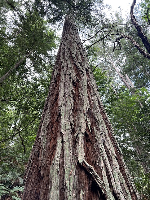
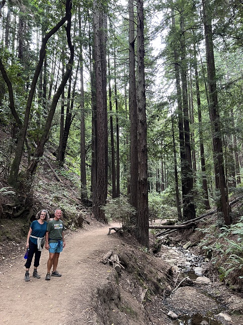
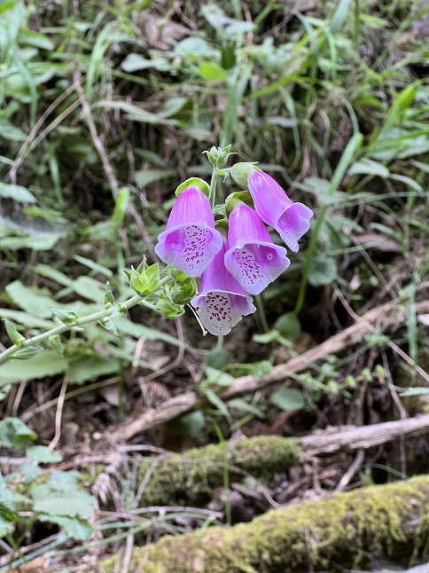
67) Green Mountain, Boulder County Open Space & Mountain Parks, Boulder, CO, August 7, 2023 - Our friend and longtime hiking companion Gaelin just got back from his European summer vacation so Jonna and Alan headed down to Boulder to join him for a hike so we could hear all about it. We did a hike we've done many times before - the Green Mountain summit starting from the top of neighboring Flagstaff Mountain. We had a perfect day for it with cool-ish summer temperature and a clear sky. The trail was relatively empty so we only saw perhaps a dozen other people. Can't beat a beautiful day and an empty trail! We went up Ranger trail to the Greenman Connector. Then used that to hop over to Greenman trail which we took all the way to the top. After enjoying the views from the summit we descended via the West Ridge trail to the top of Ranger and then hiked all the way back to the trailhead on that. A great time catching up with Gaelin and a nice mountain hike to boot! A 4 mile loop with 1,500 feet of elevation gain.
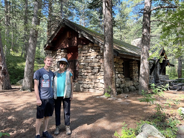
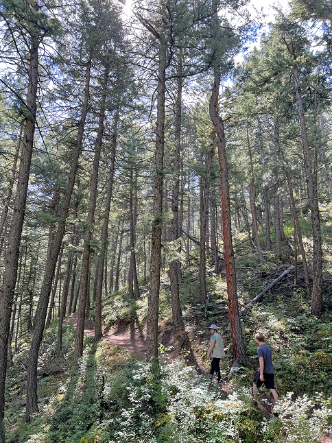
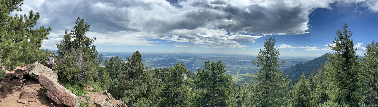
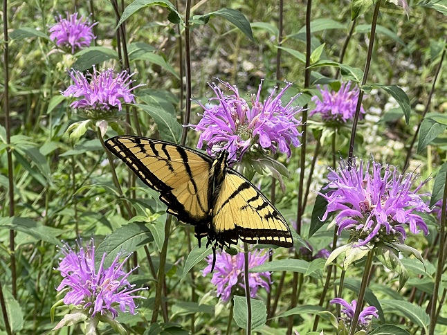
68) Como Creek trail system, Nederland, CO, August 8, 2023 - Jonna and I took advantage of a quiet, overcast afternoon to squeeze in another hike. We headed to nearby the Como Creek trails which is a favorite local trail but one we hadn't visited yet this year. We parked on the Peak-to-Peak highway and hiked down to Como Creek, then crossed it to pick up the old Switzerland Trail railroad bed. We hiked that south all the way to the border of Caribou Ranch Open Space. There are still a lot of colorful wildflowers along the trail but they are looking pretty ragged - most had been beaten by the wind and cooked by the sun. However, the late summer flowers like the Black-eyed Susans and the Nodding Onion flowers were fresh and beautiful. It was good to see one of our old haunts again and to have a cool mid-afternoon hike. A 4.4 mile out and back with 325 feet of elevation gain.
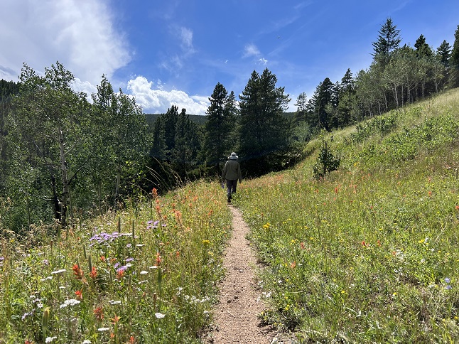
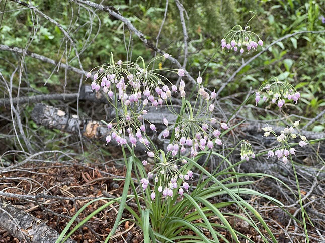
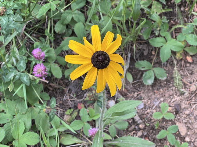
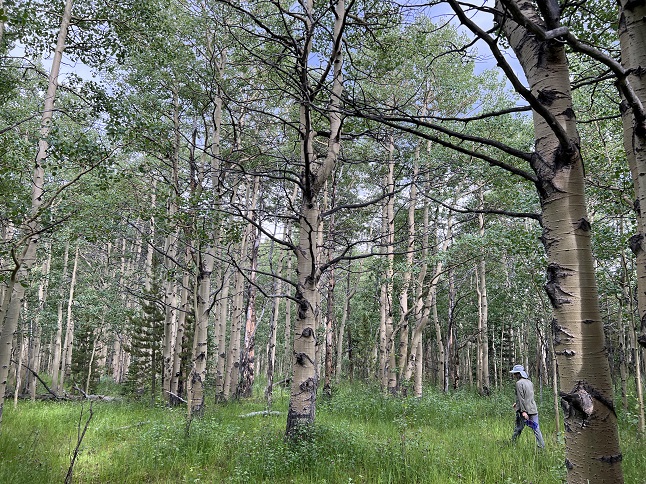
69) Crater Lakes, James Peak Wilderness Area, East Portal Trailhead, Tolland, CO, August 11, 2023 - We know that hiking during a weekend means crowded trails. That is doubly so for the East Portal trailhead which has become crazy popular so we got up early on Friday morning to try to beat the rush. We found the large parking lot half full so we quickly parked and headed up the trail to stay ahead of the rush. Our destination was the Crater Lakes which are a series of lakes hanging on two rocky shelves high up above South Boulder Creek. The hike in on the Roger's Pass trail runs through a narrow valley created by South Boulder Creek which is a rare environment that is so wet that moss hangs from the tree branches. The Crater Lake trail branches off and makes a big climb up the north side of the valley and then follows a drainage into a big bowl high up on a shelf. In this bowl are the lower two Crater Lakes, both pretty blue pools shimmering with sunlight, ringed by wildflowers and dappled by leaping rainbow trout. After enjoying the marvelous views we made another steep climb up to a second shelf where the upper Crater Lake is located. The trail up runs up another drainage but this one contains a series of cascades and waterfalls. It was splendid! Then, in the midst of all this beauty, we spotted a giant White-Lined Sphinx Moth (aka the Hummingbird Moth) sucking nectar out of a cluster of Columbine flowers. Amazing! A 8.1 mile up-and-back hike with 1,900 feet of elevation gain.
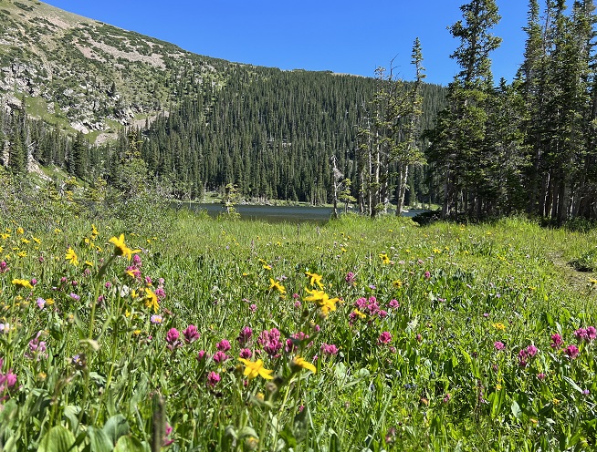
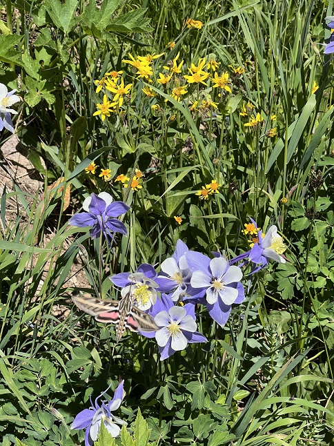
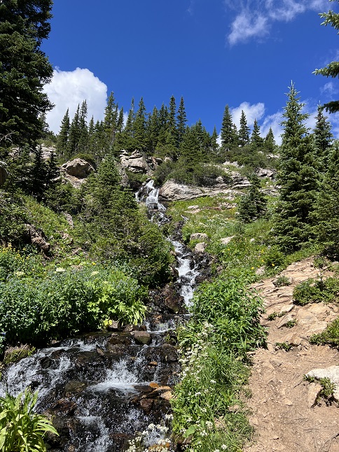
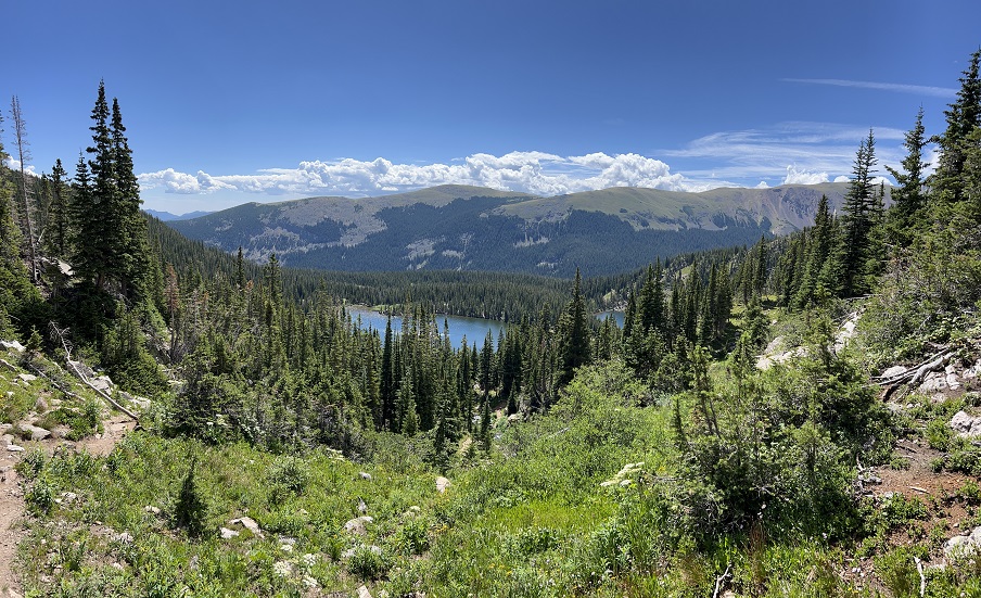
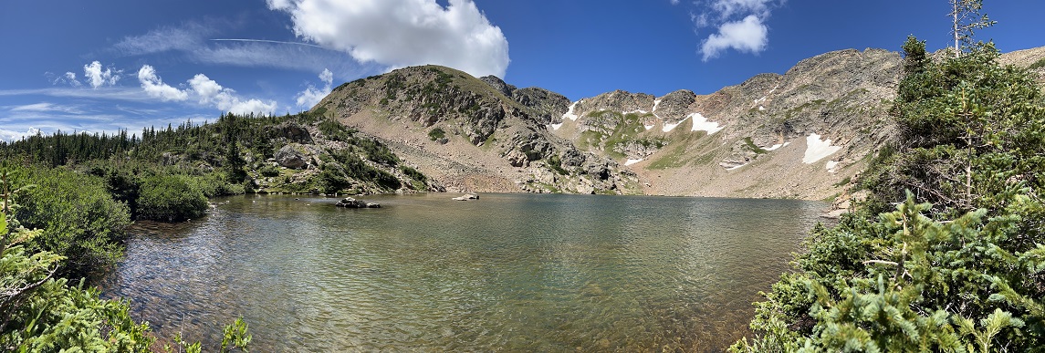
70) Mesa Trail, City Of Boulder Open Space & Mountain Parks, Boulder, CO, August 14, 2023 - Jonna had an appointment down in Boulder in the morning so Alan drove down to meet her for lunch and an afternoon hike afterwards. We dropped a car off at the South Mesa trailhead and then drove around to Chautauqua Park so we could through-hike the Mesa Trail. It was the hottest part of the day (for our friends living in FL, TX and AZ we should define ours terms - hot in this case means 79 degrees) but still comfortable enough for hiking especially since most of the trail is in through the shade of a pine forest. We actually started on the Chautauqua trail before branching off onto Mesa trail which we stayed on all the way to the South Mesa trailhead. We could see clearly that summer is starting to come to a close. All the grass along the trail had gone to seed, the yucca plants had big seed pods ready to open up, most of the wildflowers are wilted from the sun and some of the wild rose plants already had colorful rose hips forming. It may still feel like summer but the first signs of the coming Fall are starting to appear. A one-way 7.2 mile through hike with 1,100 feet of elevation gain.
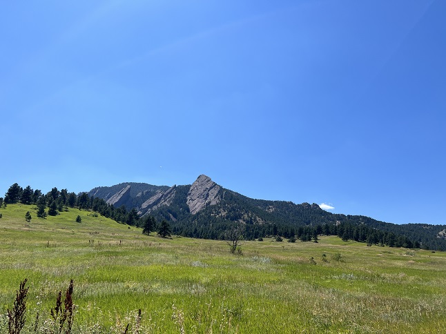
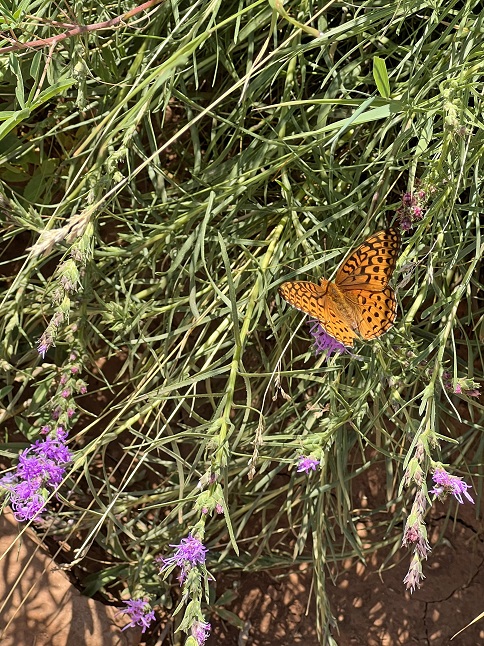
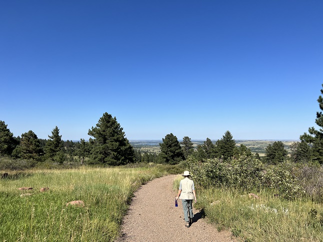
71) North Fork Big Thompson River Trail, Comanche Peak Wilderness, Dunraven Trailhead, Glen Haven, CO, August 15, 2023 - Whew! It was back-to-back long hikes for Alan, thanks to Todd and Alan meeting up to hike the North Fork Big Thompson River Trail. The original plan was to do an easy hike since Rusty the wonder pup was feeling tired but at the last minute Todd decided Rusty should have a rest day so we switched our plans to do a longer hike instead. The North Fork Trail runs beside the northern branch of the Big Thompson River for awhile and then begins to climb up northern side of the valley offering views down on the river. The middle section of the trail goes through a burn area which is filled with burnt tree trunks and thus no shade. With temperatures in the upper 80s it was toasty out in the direct sun and for some reason this open area was filled with biting horseflies. No stopping to catch our breath on the uphill climb! We turned back where the trail entered Rocky Mountain National Park but the trail continues for another 9 miles to eventually hit Lost Lake in RMNP. It was nice to revisit an area neither of us had been into for at least a decade. A 9.1 mile out and back hike with 1,400 feet of elevation gain.
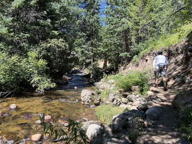
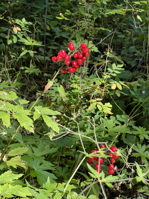
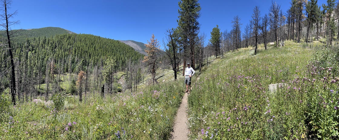
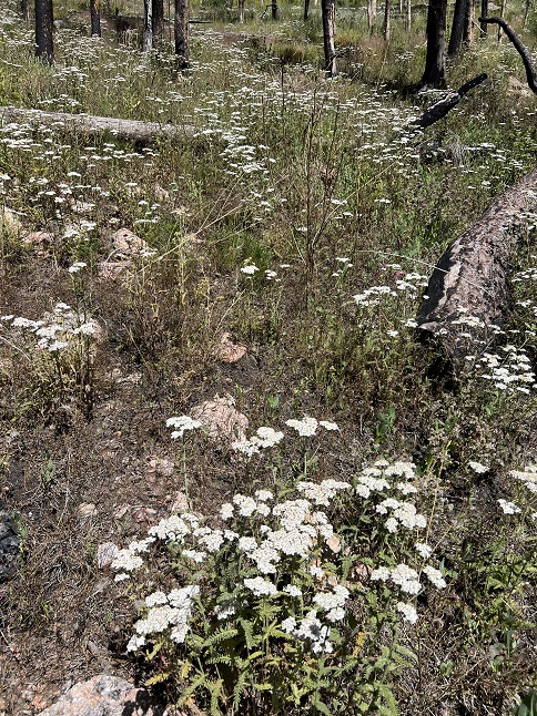
72) Forest Lakes trail, James Peak Wilderness Area, East Portal Trailhead, Tolland, CO, August 18, 2023 - Jonna and Alan were at it again doing a another training hike gradually building up to bigger and bigger hikes to prep for our Fall trip. Last week's hike up to Crater Lakes wow'ed us with all the vibrant wildflowers still hanging on at higher altitudes so we returned to that area today. We again started our hike from the East Portal trailhead but this time selecting the Forest Lakes side trail to climb north to a big bowl that contains two alpine lakes. We have hiked to the lower Forest Lake many times but it has been about a decade since we made the longer hike all the way up to the upper Forest Lake. There were still wildflowers in the marshy areas, particularly along the stream that connects the two lakes. It was partly cloudy and breezy up high so we didn't stick around long, just long enough to enjoy the views across each lake. Another splendid hike up into the high country! An 8 mile up-and-back hike with 1,700 feet of elevation gain.
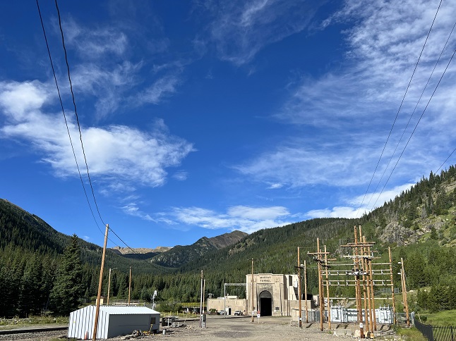
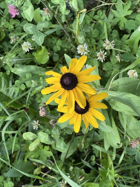
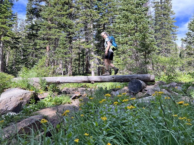
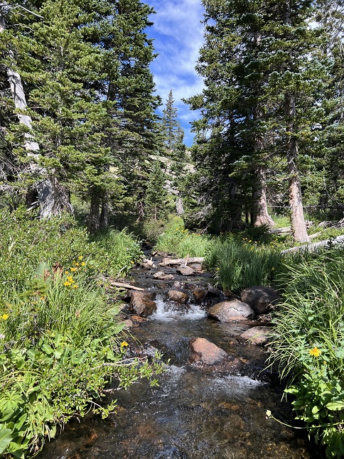
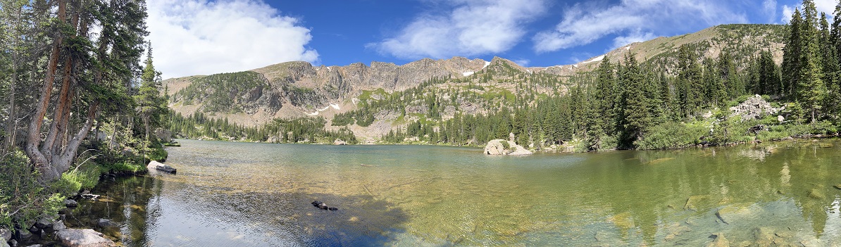
73) Anchor Mine, Caribou townsite, Nederland, CO, July 12, 2023 - Cousin Chi is starting CU-Boulder next week so she and her Mom, Alan's cousin Michelle, and her brother Sam came out a week early to get her moved into her dorm and to spend some time in Colorado. Jonna and Alan brought the family out for a hike up to the Anchor Mine (since Michelle's maiden name is "Anchors".) Most of the wildflowers had wilted away but there were still a few Indian Paintbrush and some Hare Bells that were hanging in there. This is probably the easiest hike in the area to get up to treeline so we also got to show them a little of the alpine tundra. Michelle was inspired to do some impromptu yoga beside a stream that winds among the mining buildings but then a passing rain cloud encouraged us all to head back down. We braved the cold shower and, as the clouds broke up, we were partially dry when we got back to the trailhead. A nice excursion into the mountains and a fun photo-op with the "Anchors" family standing next to the Anchor Mine sign. A 3.3 mile out and back hike with 450 feet of elevation gain.
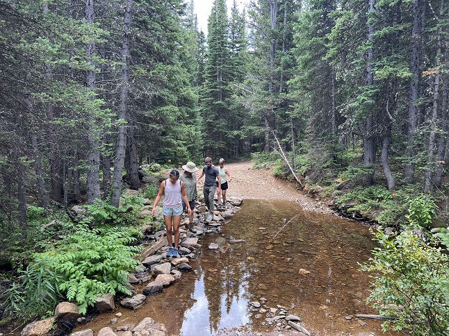
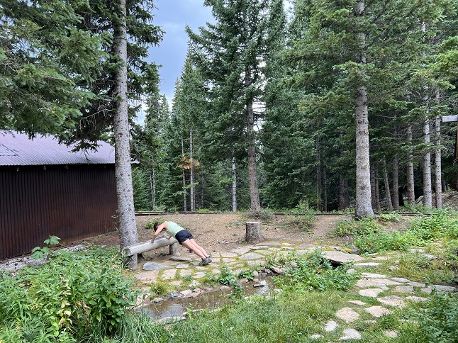
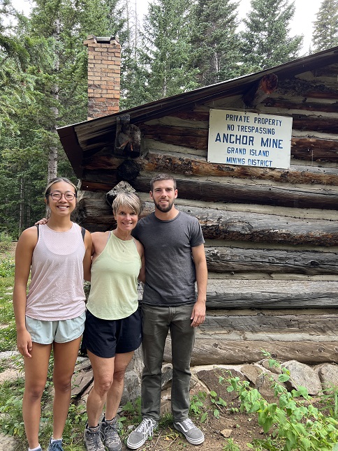
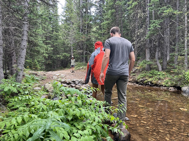
74) Bear Peak, Boulder Open Space & Mountain Parks, Boulder, CO, August 24, 2023 - With my cousins visiting from Florida I really wanted to bring cousin Sam out for a big hike so he could experience the Colorado mountains. While bringing a fit young Marine out for a strenuous hike may not have been my wisest thought the fact that he is such a polite and generous young man saved me from the humiliation that could have occured. Instead, we had a great hike up Bear Canyon trail without Sam complaining once about how much I was slowing him down. The truth only became apparent on the final ascent to the top of Bear Peak when I finally convinced him to go ahead and he zoomed up despite the trail climbing the last 750 feet in just 1/3 of a mile. Then he took off and climbed the nearby South Boulder Peak as well while I caught my breath sitting atop Bear Peak. He wins the hiking Gold Star! We did get to spend some time enjoying the panoramic views - both of the Continental Divide to the west and over Boulder to the east - before heading back down. We did the super steep descent down the Fern Canyon trail and looped back to the NCAR trailhead via Mesa and NCAR Trails. I think we both enjoyed our time in the mountains and I was thrilled to get to share these scenic vistas with my cousin Sam! A long 9 mile loop with 2,700 feet of elevation gain.

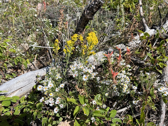
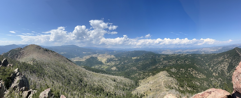
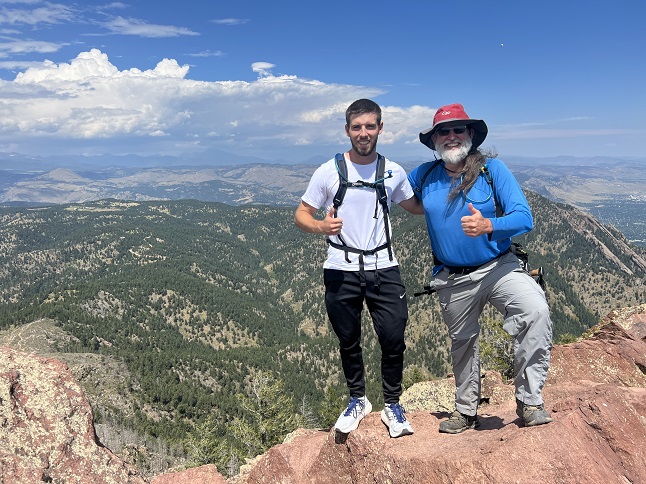
75) Homestead, Shadow Canyon Spur and Mesa Trails, South Mesa Trailhead, Boulder Open Space & Mountain Parks, Boulder, CO, August 27, 2023 - We have returned to a trail we hiked regularly at the beginning of the year but haven't returned to for a couple of months - the Homestead Trail just outside Boulder. We met up with our frequent hiking partner Desiree at the South Mesa Trailhead under a baking mid-day sun. There were clouds forming over the front range mountains but the temperature when we started hiking was pushing 90. This meant the first half of our hike was physically draining as the heat sapped our strength (and sweat!) However, the sunshine (and periodic afternoon rain storms) have kept the hillsides lush and green delaying the dusty dry brown that is the norm for this time of year along the front range. The further west we hiked the more that thunderheads formed so we decided to do the "medium" loop which shortcuts the climb up to the bottom of Shadow Canyon. As we took the turn from the Shadow Canyon Spur trail back onto Mesa trail the first raindrops started falling. Thankfully, the clouds and the moisture dropped the temperature about 10 degrees which was much appreciated. The rain stayed just intermittent drops as we headed back to the trailhead but at the bottom of the Towhee Trail it picked up enough we stopped to put on our rain jackets. However, by the time we got back to the trailhead it slowed down again which allowed us to ditch the rain gear. We always enjoy hiking this loop but the real treat is having a frequent opportunity to catch up with our friend. A 4.5 mile loop with 1,000 feet of elevation gain.
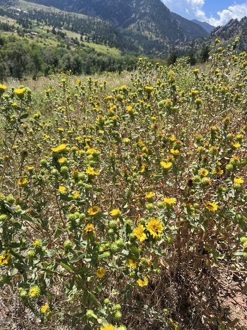
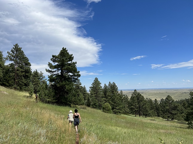
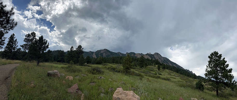
76) Heart Lake, South Boulder Creek Trail No. 900, James Peak Wilderness Area, East Portal Trailhead, Tolland, CO, August 28, 2023 - The weather forecast called for mid-day rain so Jonna and Alan were up early in order to get in a long hike but be down from the high country by the time the storms rolled in. Fortunately, out day went exactly to plan! We headed back to the East Portal Trailhead to give the third of the three hikes accessible from there a try: Heart Lake. This is a longer hike and one that goes right up to the base of the Continental Divide at Roger's Pass. We consciously wanted to pay attention to all the beauty of this trail, especially as the wildflowers of summer have given way to the first signs of Fall. Rather than colorful blossoms the highlights of the trail were bushes loaded with wild raspberries, tiny little wild strawberries, a variety of different mushrooms, shrubs weighed down with red, orange and purple berries, wild onions and a dozen different species of native grasses all bent over with dry seeds. An overnight rain and swelled South Boulder Creek into a raging torrent and rejuvenated countless small streams that trickled down the valley sides. The wet summer boosted bright green moss and lichens which hung from the trees and covered the rocky trail. We made it up to Roger's Pass Lake before noon and had a glorious time hiking through the alpine tundra in massive bowl surrounding Heart Lake. However, tall thunderheads were visible to the west so we kept our sightseeing quick and headed back down. The clouds move fast up high and a rain squall caught up to us about 1/3 of the way back down. We put on our rain gear and kept hiking but 20 minutes later it had passed so we could peel the rain jackets back off for the rest of the hike. This has long been a favorite hike but it has been quite a few years since we made the long trek up to Heart Lake so it was particularly rewarding to enjoy such a beautiful place once again. A 9.3 mile up and back with 2,200 feet of elevation gain.
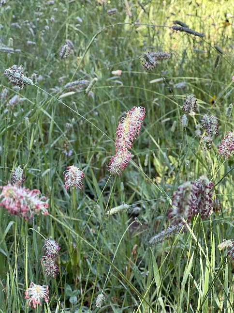
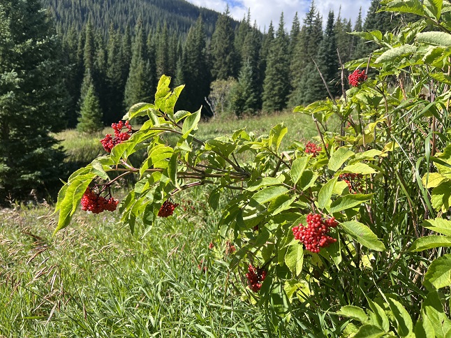
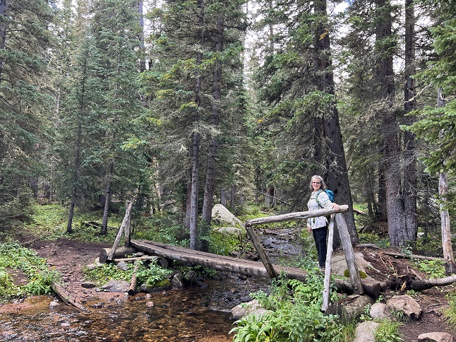
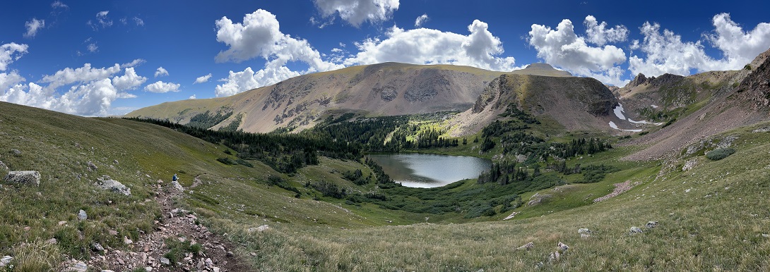
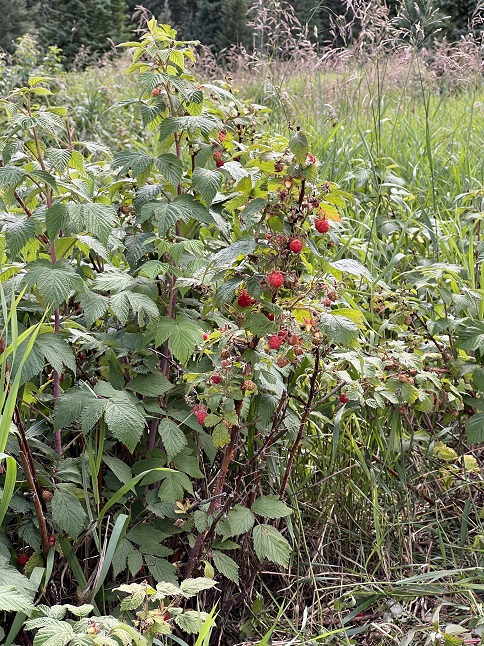
77) Bluebird Lake, Wild Basin Trailhead, Rocky Mountain National Park, Allenspark, CO, September 2, 2023 - Normally we would steer clear of Rocky Mountain National Park on a holiday weekend but we decided to get up early on the Friday of Labor Day weekend and drove up to the Wild Basin part of RMNP so we could get in before 9am when the daily Reservation window starts. We were surprised to see the parking lot was only about 1/2 full which meant the trails wouldn't be too busy. Yay! Our goal was to do a long hike so we headed out hoping to make it up to Bluebird Lake. It is easy to see why this area is part of the National Park - the hike starts following North Saint Vrain Creek and going past Copeland Falls. Then we switched to the trail beside Cony Creek going up to Calypso Cascades. From there we headed west on the Lion Lake Junction trail which crosses Ouzel Creek at Ouzel Falls. The trail continued to climb up to the split where the Ouzel Lake trail turns off to head up toward Ouzel Peak. The Ouzel Creek valley to the northeast of the peak ascends into a giant forested bowl and is high enough you can see Long's Peak to the north and all the way back down to the Wild Basin trailhead. It is very scenic! When we hit the trail split either going down into the bowl to Ouzel Lake or continuing up to Bluebird Lake we decided we have the energy to keep climbing. Fortunately, the trail started turning up little rewards to keep us going - first, big bunches of wild raspberry bushes loaded with fruit. Then a string of Yellow-bellied Marmot colonies echoing with their alarm chirps. We passed a RMNP trail crew who were out improving some sections of the trail and the results of their work was pure art. They were master stone masons with the aesthetic sense of Van Gogh. Beautiful work! Finally, as we neared Bluebird Lake we encountered patches of snow lasting year round way up at 11,000 feet. The melting snow was feeding vibrant patches of wildflowers which were still hanging in this late in the year. The colors were gorgeous purple: Columbines, Harebell, Monkshood & Northern Gentian; blue Chiming bells; pink Indian Paintbrush, yellow Cinquefoils and Heartleaf Arnica; white American Bistort. And, of course, the big payoff was Bluebird Lake itself. This stunning blue gem sits up high in a bowl with Copeland Mountain, Ouzel Peak, Isolation Peak and Mahana Peak all surrounding it. Glorious! It was a long hike with a tough climb at the end but it was worth it! A 13 mile hike with 2,550 feet of elevation gain.
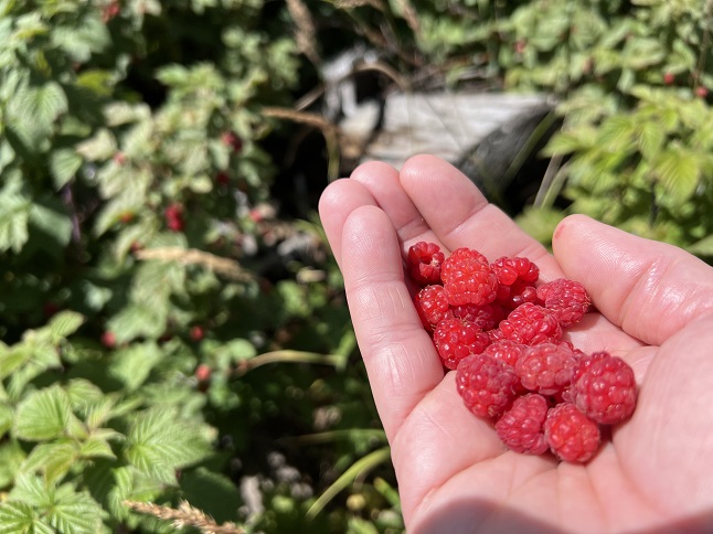
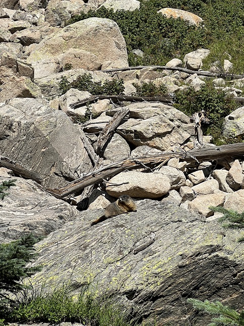
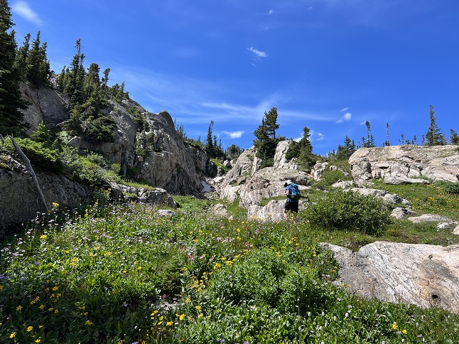
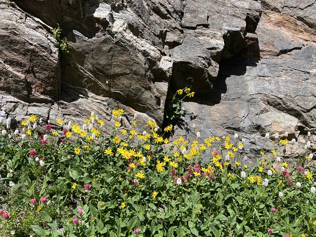
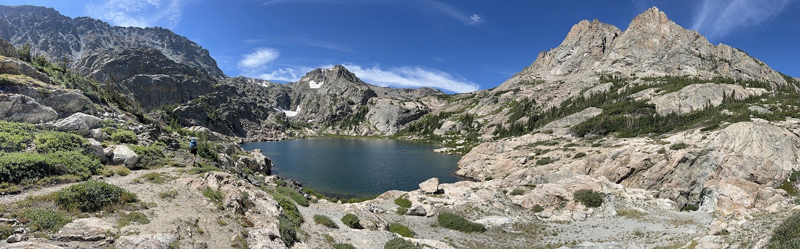
78) Sourdough Trail, Roosevelt National Forest, Nederland, CO, September 6, 2023 - After the last few hike have been big and pretty spectacular hikes, today we fit in visit to one of the run-of-the-mill local trails - the Sourdough trail just a few miles north of our house. This trail lacks the stunning views, incredible landscape and iconic Rocky Mountain scenery that I've been sharing from our recent hikes. It is instead a pleasant trail that winds through the pine forest that blankets much of the Front Range. No "Oh Wow!" moments but a nice place to stretch our legs and get in some more mileage as we trail for our upcoming hiking trip to Patagonia. Even the highlight was pretty mundane - we stopped to watch a fluffy young squirrel dig the seeds out of a pine cone. A 5 mile out-and-back hike wiht 800 feet of elevation gain.
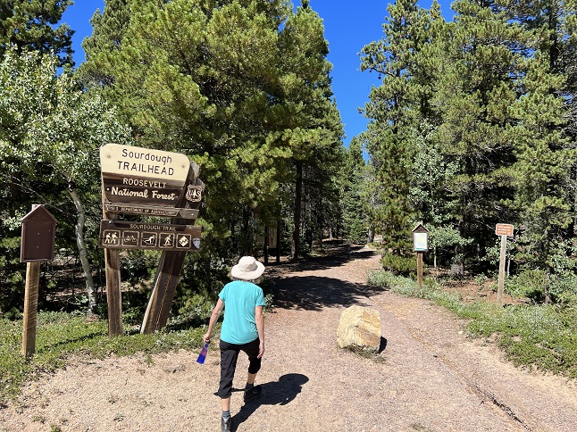
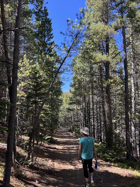
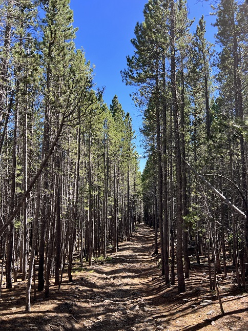
79) Pear Lake, Wild Basin Trailhead, Rocky Mountain National Park, Allenspark, CO, September 2, 2023 - We loved our hike into beautiful Rocky Mountain National Park so much last Friday that we decided to do it again this Friday. We picked a different destination this time - Pear Lake. We've done the hike into Finch Lake a few times over the past 25 years but have never done the hike past that up to Pear Lake so now that we're doing longer hikes we gave that a try. We started at the same trailhead as last week and thus enjoyed the same sights for the first couple of miles of the hike - North Saint Vrain Creek, Copeland Falls, Cony Creek and Calypso Cascades. However, at that point we turned south on Finch Lake Cutoff Trail. As we climbed out of the North Saint Vrain Creek valley we got a spectacular view of both Longs Peak and Mount Meeker to the north. Then we turned onto the Finch Lake-Pear Lake Trail and continued to climb. When I first hiked this trail around 25 years ago there had recently been a fire that had leveled about a mile of this trail. Now, after all this time, a forest has grown back in filling this once barren hillside with pine and aspen. It was a heartwarming vision of what the area near our house that burned in 2016 will one day look like again. The trail dropped down in the valley that contains Finch Lake but after a quick look we continued past that which involved a steady climb up the Cony Creek valley and then forking off to follow the Pear Creek valley up to Pear Lake, which sits in a bowl just below treeline on the south side of Copeland Mountain (Bluebird Lake, which we hiked the previous week, was less than a mile away to the north but on the other side of the 13,166 foot tall Copeland Mountain). It was a little too breezy to hang out by Pear Lake for long so we backed a little way down Pear Creek where we had a picnic lunch listening to the burble of the creek. We reversed back down past Finch Lake and to the Finch Lake Cutoff Trail junction. From there we turned south and followed the Finch Lake Trail all the way back down to North Saint Vrain Creek and to where we'd parked. It was another long hike and we were once again exhausted when we got back in the car but it was also very satisfying to visit another remote lake in the natural utopia that is Rocky Mountain National Park. A 14 mile loop with 2,700 feet of elevation.
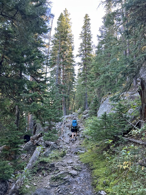
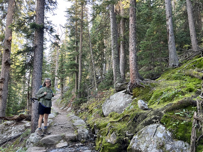
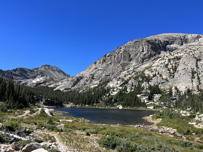
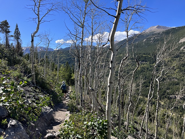
80) Green Mountain, Boulder County Open Space & Mountain Parks, Boulder, CO, September 15, 2023 - We had planned to do another big Friday hike but an overnight rainstorm and a forecast for low-lying clouds in the mountains meant we would have to look for hikes down in Boulder for our next training hike. We decided to do the full hike up Green Mountain because even though it isn't super long it has plenty of elevation gain. We started at the Gregory Canyon trailhead and took the Amphitheater-Saddle Rock- EM Greenman trail up. The sky was overcast and the hike was a drippy, humid and muddy slog which felt very out of place for Fall in Colorado. The climb up was slow but we eventually made it to the summit. Up at the top if felt like our hats were scaping the bottoms of the clouds! After a quick stop to catch our breath we started back down via the West Ridge trail to Ranger Trail. We took that all the way to the top of Gregory Canyon and then decended via the Gregory Canyon trail. There is a reason this is a good training hike - the steep climb up grinds the quads and the equally steep drop back down pounds the knees. We rewarded ourselves afterwards with an all-you-can-eat Indian buffet in order to refuel. A 5.2 mile loop with 2,500 feet of elevation gain.
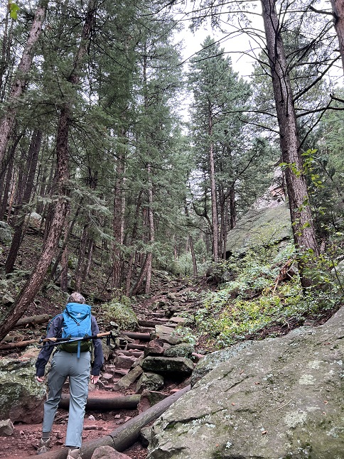
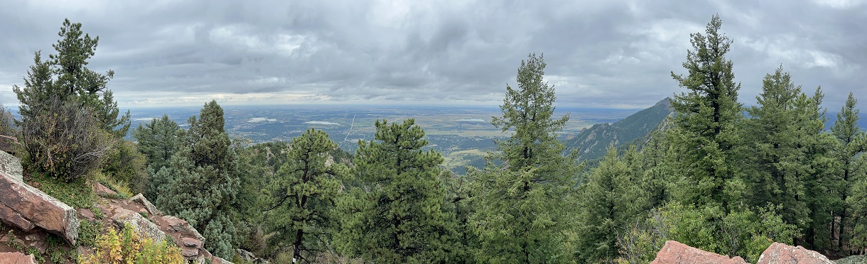
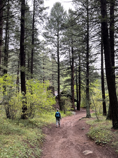
81) Green Mountain, Boulder County Open Space & Mountain Parks, Boulder, CO, September 17, 2023 - It has been almost a month since we joined our friend Desiree for a Sunday afternoon hike and this weekend found us all free so we got together to remedy that. Despite our just having hiked Green Mountain on Friday, we headed there once again but this time starting from the top of neighboring Flagstaff Mountain which cut the elevation gain in half. There was a little touch of Fall in the air which was particularly appreciated after the hot days earlier this summer. There was also a touch of Fall on the ground as some of the bushes' leaves were starting to yellow and bright red and purple berries showed that plants were trying to get seeds in the ground before winter arrives. We did our usual hike together - going up Ranger trail to the Greenman Connector trail, then taking that over EM Greenman which took us to the top. Unlike a couple of days ago, we had mostly blue skies today so we got to enjoy the panoramic views from the top on this hike. We came back down the West Ridge trail to Ranger and took that all the way back to the trailhead. Basically back-to-back hikes on the same mountain just two days apart but with different weather, different starting points and a lot more conversation. A 4 mile loop with 1,500 feet of elevation gain.
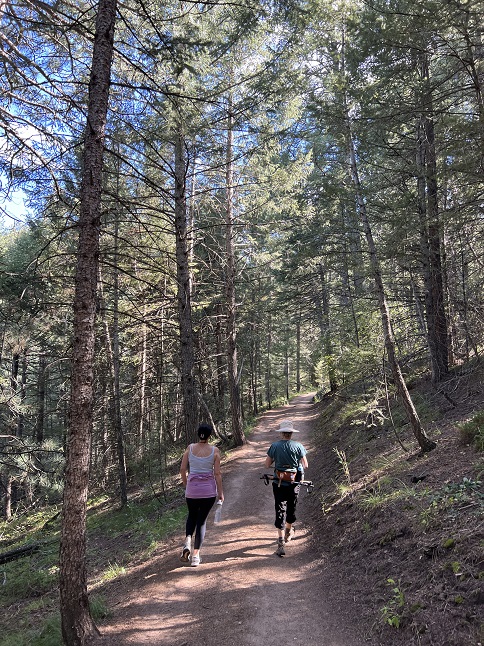
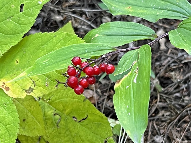
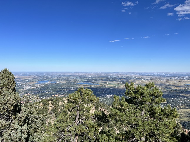
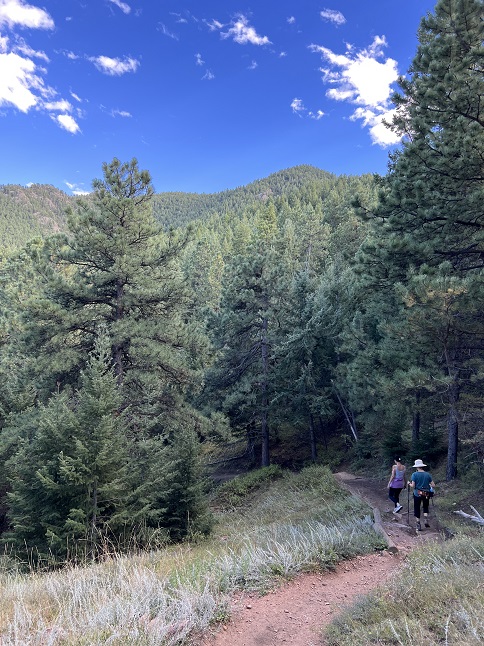
82) Thunder Lake, Wild Basin Trailhead, Rocky Mountain National Park, Allenspark, CO, September 20, 2023 - It was time for another long hike so we headed to what has become our Fall favorite - the Wild Basin section of Rocky Mountain National Park. This time our goal was Thunder Lake and due to some time constraints we had to get before the sun in order to get an early start. We started at the now very familiar Wild Basin Trailhead and once again followed the main trail alongside North Saint Vrain Creek. However, we took the camp ground trail that continued up the North Saint Vrain valley rather than going up to Calypso Cascades as we have on our previous hikes here. At the top we continued on the Thunder and Lion Lakes trail until the trail split to go to those two different destinations as which point we veered towards Thunder Lake. It was so early we only saw five other hikes and three of those were hiking out so it felt like we had the National Park to ourselves! Well, except for the mother Moose and calf we saw as we approached the lake. Fortunately, they went their way and we went ours without any drama. We didn't stick around at the lake for long because a breeze blowing down from the mountains made it quite chilly but we did get to enjoy the views of Tanima Peak, Pilot Mountain and Mount Alice all encircling the lake. The afternoon sun warmed us back up on the way back down and some of the small mammals were out moving, allowing us to see a squirrel to complete the Rocky and Bullwinkle sighting for this hike. The real surprise though was running into ex-coworker (and avid hiker) Jennifer. We both hike so much it was probably inevitable we would run into each other on a trail at some point but it was still a treat to see her smiling face coming down the trail. We had a brief chat but we needed to keep moving to get back home on time so continued our descent. We made it back to the trailhead on schedule and definitely called this one a success - a beautiful alpine lake, some animal sightings and a surprise visit with an old friend! A 12.3 mile up and back hike with 2,250 feet of elevation gain.
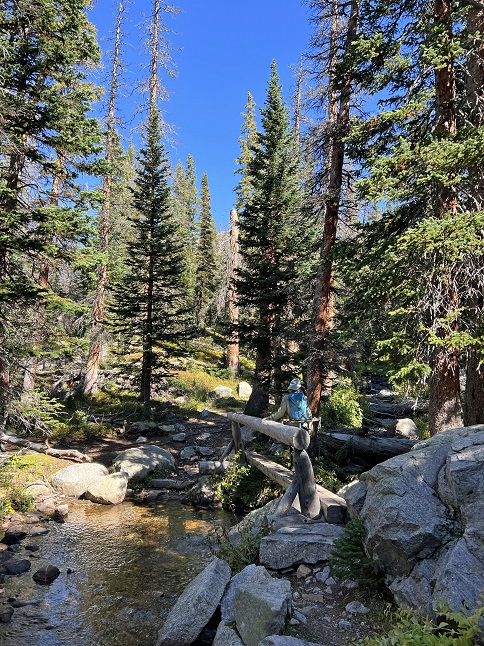
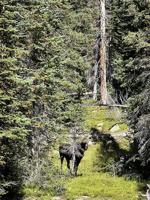
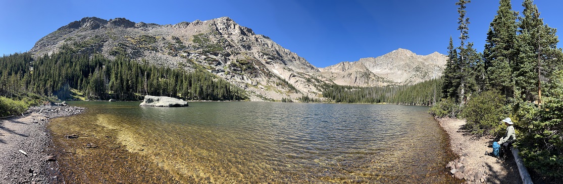
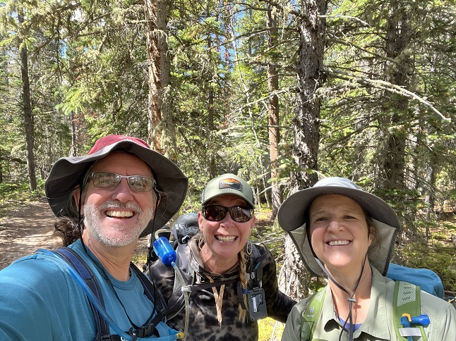
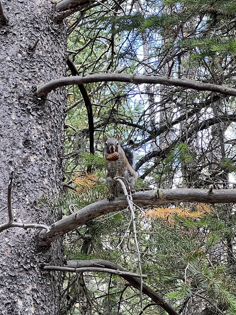
75) Homestead, Shadow Canyon Spur and Mesa Trails, South Mesa Trailhead, Boulder Open Space & Mountain Parks, Boulder, CO, September 24, 2023 - We got together with our friend Desiree for another Sunday evening hike but this one had the added importance of being a pre-birthday outing for Desiree so we made it a shorter hike so we had time for a nice celebratory dinner afterwards. However, we still did the "middle" loop of the three we've made standard hikes from the South Mesa Trailhead. The birthday surprise was finding fields of late summer wildflowers still blooming in the shady areas around the trail - tiny little white and yellow daisies and bright purple flax. This was contrasted with the yellow and red leaves starting to dominate the ground cover and the tall stalks of brown grass with light tan seeds waving in the intermittent breeze. The sun is starting to set earlier and earlier so the sun dipped behind the Front Range peaks while we hiked which provided some nice lighting as beams of light speared between the mountains. A pleasant loop and a fun way to help Desiree celebrate another year! A 4.5 mile loop with 1,000 feet of elevation gain.
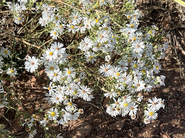
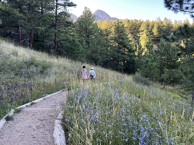
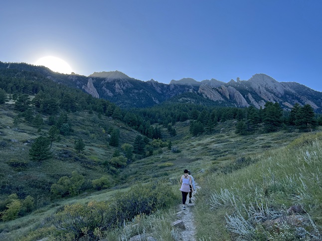
76) Como Creek trail system, Nederland, CO, September 26, 2023 - This is really more of an evening stroll than a hike but with Fall fully on display it was still an outing worth sharing. Our summer roommate Julia has moved out for the year but came back up to spend a couple of evenings enjoying Fall in the mountains so we headed to nearby Como Creek for a post-dinner walk. The big aspen grove wasn't quite to peak colors but with the sun just dipping below the mountains it still gave a golden glow to the Como Creek valley. We walked a little way down the trail to the Caribou Ranch overlook which was particularly beautiful with sunset giving both Tremont and Thorodin mountains a purple hue, the clouds reflcting a little pink light all contrasted with some yellow aspens dotting the hillsides and bright red wild rose bushes on the ground. Finally, it was all highlighted by a bright 3/4 phase moon shining down from above. A 2.2 mile out and back with a very mellow 275 feet of elevation gain.
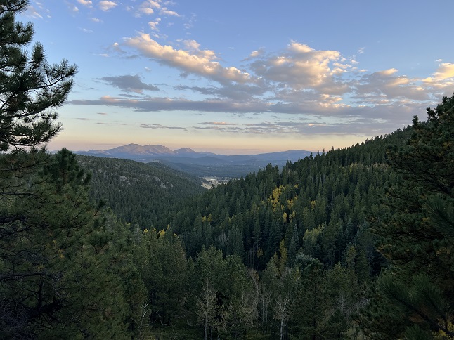
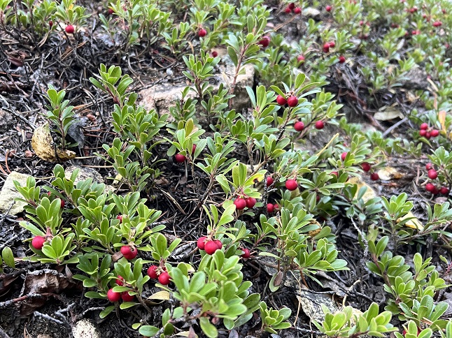
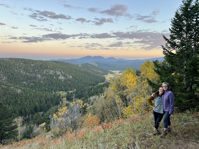
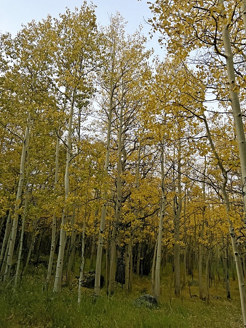
77) Kenny Mountain, Big Elk Meadows, Pinewood Springs, CO, September 27, 2023 - Todd and Alan did a hike today that doesn't do justice to the raw stats. The numbers seem easy but the hike was as challenging as it was fun. It has been a few years since we did a true exploration - no trail, no studying topo maps before hand. Just show up in an area, pick a peak off in the distance and an see if we can find a way to get there. In this case, we drove into the Big Elk Meadows area and went to a burn area left over from the 2003 fire. From this vantange point we could see Kenny Mountain and the various peaks on its southern shoulder. We picked out a craggy, rocky point and started climbing... and I do mean climbing. At times we were using hands and feet to scramble up rock faces. It took two and a half hours to get all the way up to destination despite it only being a couple of miles from where we parked the Jeep. It was fun to try to read the terrain, pick out routes to climb up and then to finally reach the goal where we were rewarded with a grand panorama over the entire valley. From there we had a better view to pick out an easier way down but it was still an adventure because of all the downed trees from the fire 20 years ago. We finally got back to the starting point almost four hours after staring out but were both happy with our morning's accomplishment. A four mile loop, mostly going straight up 1,600 feet and then coming right back down.
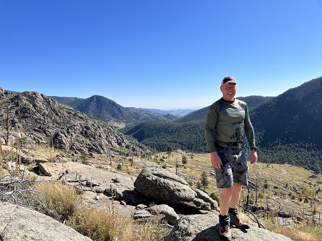
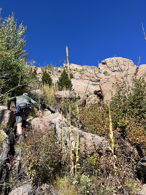
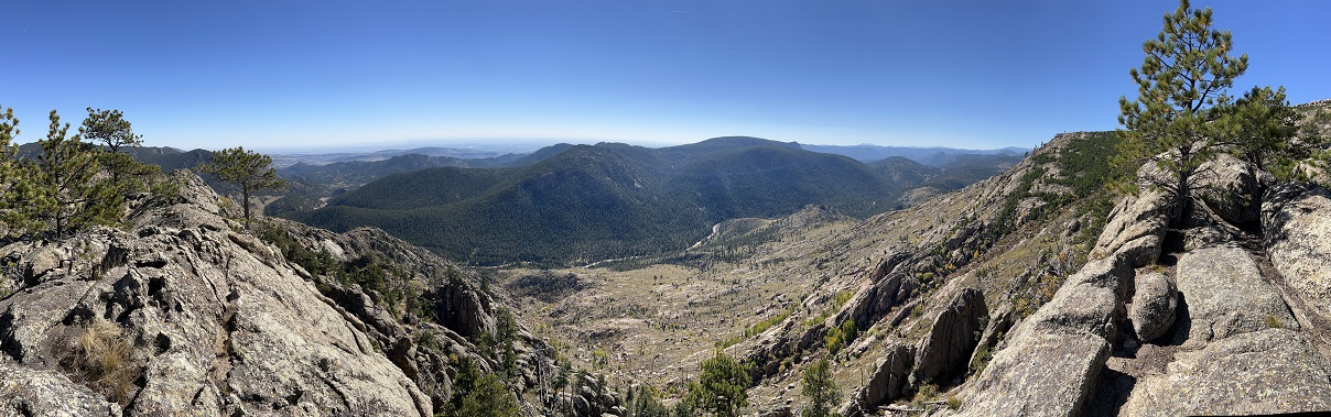
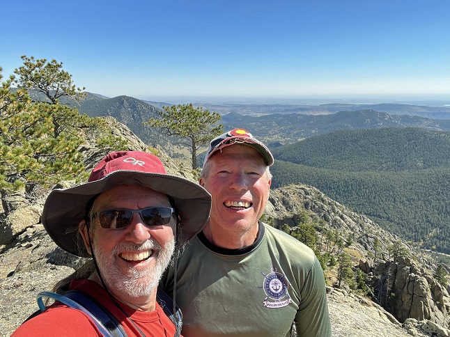
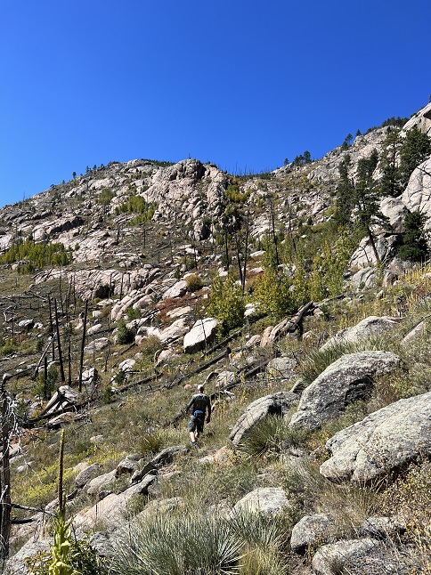
78) Twin Sisters, Rocky Mountain National Park, Estes Park, CO, September 29, 2023 - It was time for another Friday training hike for Jonna and Alan but an evening commitment meant we had to aim for a shorter hike so we could be done by the early afternoon. To that end we headed for a hike that used to be an annual destination but that had fallen off our hiking schedule a dozen years ago - Twin Sisters Peak on the edge of Estes Park. We again got an early start which meant we got one of the few parking spots at the actual trailhead which saved us the 1/2 mile hike up from the Lily Lake Visitor Center. This was also our first time on this trail since the 2013 flood which caused a huge mud slide on the western face of the mountain. The Rocky Mountain National Park trail crews had to rebuild the trail system including crossing the slide zone. While the scar is harsh to see it did open up the forest so we got a nice view of the mountains to the west as we were ascending. The hike to the top is strenuous but the views from the top were worth it. It was overcast when we started but the clouds broke up as we were climbing so we had warm sunshine on the peak. We sat up top and took in the gorgeous panorama of Longs Peak and Mountain Meeker, the Continental Divide stretching north and south, and the bird's eye view out over the town of Estes Park. Due to our tight schedule we only stayed up top long enough to eat a snack before starting our descent. The sunshine lit up the smattering of yellow aspens on the western side of Twin Sisters making them more eye-catching then they had been on our way up. It was an ideal training hike and a lovely Fall outing. A 7.3 mile up and back with 2,300 feet of elevation gain.
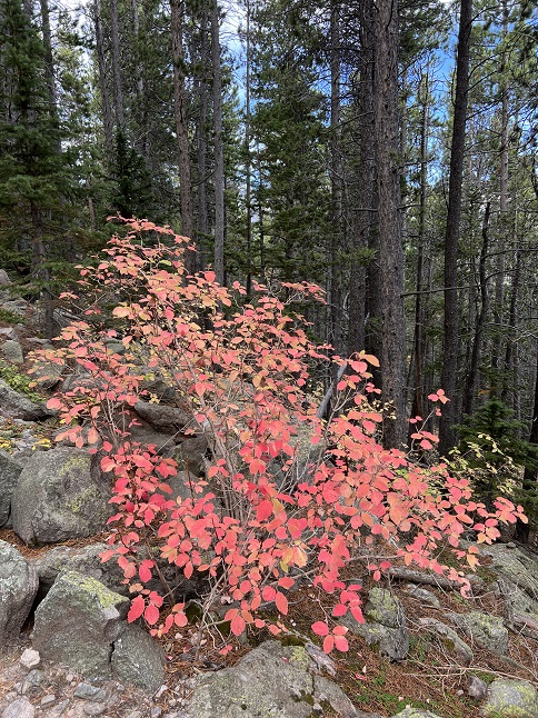
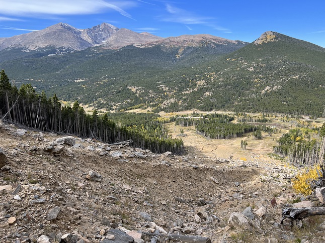
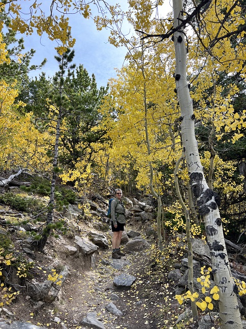
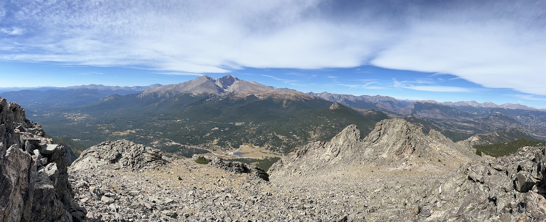
79) Homestead, Mesa and Towhee Trails, South Mesa Trailhead, Boulder Open Space & Mountain Parks, Boulder, CO, October 1, 2023 - Jonna and Alan had a very busy Sunday but still found a little time to squeeze in a short afternoon hike with our friend Desiree. We met up at at our usual South Mesa Trailhead meeting stop but between us all being tired and our having an evening commitment we decided to just do the "short" loop (hiking up the Homestead Trail to where is meets Mesa Trail, then coming back to the trailhead on a Towhee Trail.) It was quite warm despite being well into Fall so we had the contrast of summer temperatures but autumn colors on the landscape - a palette heavy on red, yellow and brown. Nothing fancy but another chance to click off a few miles and to share an afternoon chat with our friend. A 3.2 mile loop with 600 feet of elevation gain.
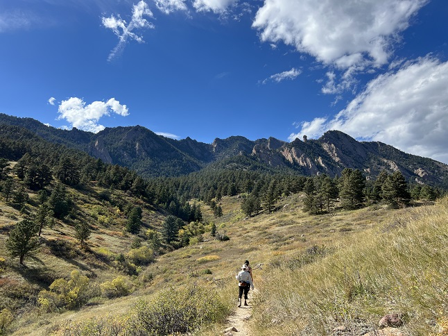
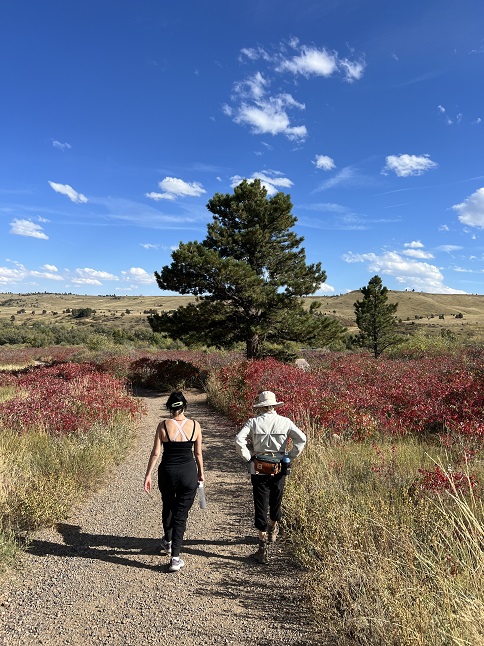
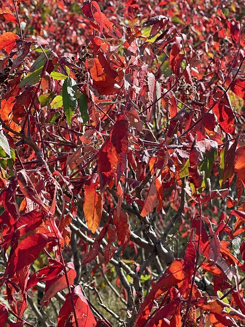
80) Buchanan Pass Trail, Roosevelt National Forest, Camp Dick Trailhead, Peaceful Valley, CO, October 2, 2023 - Jonna and Alan had planned to do another big hike on Monday morning but after a busy weekend we were feeling pretty drained so we took the morning off and didn't get out to hike until just before lunchtime. As a result, we cut back our goal for the day and went for a more moderate hike instead. The plus of this is that we headed for a trail we hadn't been on in something like 15 years - The Buchanan Pass trail starting at the Camp Dick trailhead. This is a trail that leads into a network of trails, including going over Buchanan Pass if you go far enough, so it can be as long a hike as you want but the elevation gain is very gradual so it makes for easy hiking. The trail runs alongside the Middle fork of St. Vrain Creek. We had nice Fall colors - most of the aspens had already dropped their leaves but the ground cover and creek-side bushes were all draped in yellow, orange, red and brown. As we neared the spot where we planned to turn around there were actually some open areas where we could enjoy the views of both Sawtooth and St. Vrain Mountains. After a break to eat our snacks (and for Jonna to soak her feet in the creek) we turned back down the trail to return to the trailhead. It was a lovely hike that gave us more distance training but was also mild enough we didn't push ourselves beyond the amount of enery we had available. The final bonus was that the clouds that rolled in while we hiked held off one dropping rain until the very moment we got back to the parking lot! An 8 mile out and back hike with a mellow 1,000 feet of elevation gain.
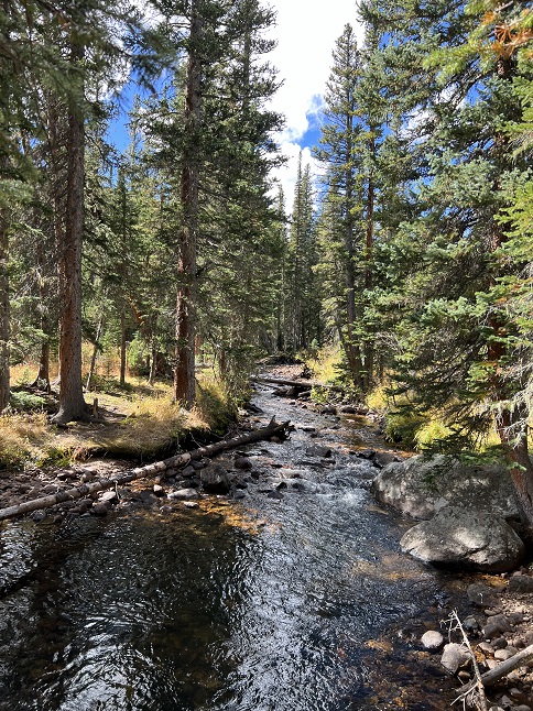
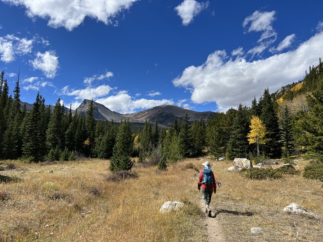
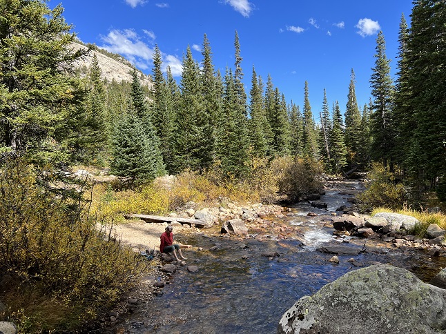
81) Ralston Roost, Horseshoe Trail and Black Bear Trail, Golden Gate Canyon State Park, Golden, CO, October 6, 2023 - Another Friday hike but this time we had the treat of joining our friend Marni and her pup Daisy on a trip to enjoy the last of the Fall colors in Golden Gate Canyon State Park. We did the Ralston Roost hike that Jonna and I have done many times but we mixed it up by doing the loop in reverse from the route we have traditionally done. This meant a more gradual climb up Horseshoe Trail but then a steep decent on Black Bear Trail. At the mid-way point we added a side trip into Frazier Meadows where the Fall colors were particularly striking. In addition to all the autumnal leaves we also had a proper Fall atmosphere due to low-lying clouds providing fog at the higher elevations and bringing a crisp, biting chill to the air. It was a perfect October hike, a great opportunity to spend time with our friend and it inspired us, when we got back home, to fire up the wood stove for the first time this Fall. A 6.3 mile loop with 1,300 feet of elevation gain.
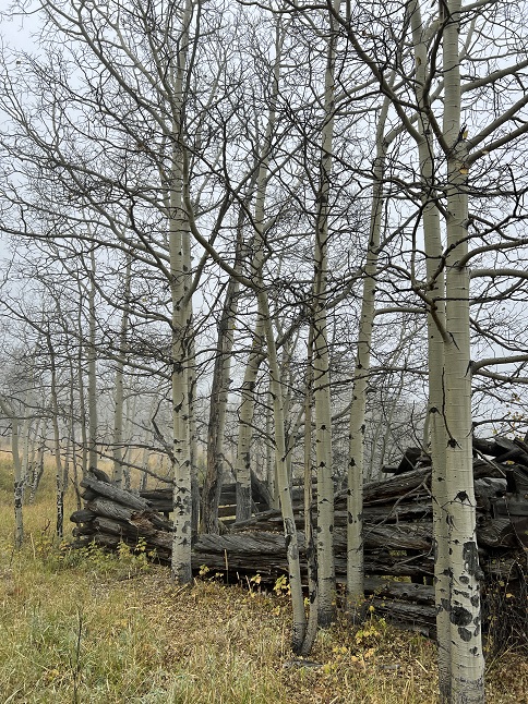
82) Estes Cone, Lily Lake Trailhead, Rocky Mountain National Park, Estes Park, CO, October 9, 2023 - After a relaxed weekend, primarily determined by having gotten our COVID and Flu vaccines, we were back hiking first thing Monday morning. We again headed to Rocky Mountain National Park but this time we started from the Lily Lake trailhead with Estes Cone being our destination. This isn't a super long hike but the final climb up to the peak is nature's own StairMaster so it was another good training hike. We got started early and with Fall firmly in place that meant there was frost on the ground. It took over an hour for the sun to finally break over the top of Twin Sisters to the east and get us some sunshine with which to warm up. As the hike went along the temperature steadily grew but so did the breeze so the chill felt about the same. Up on top the wind was gusting pretty strongly but we managed to find a protected area where we could enjoy our snacks and sneak a peek of the amazing panoramic view. Then it was back down off the peak and then the steady decent as the trail wound around the south flank of the mountain to return to Lily Lake. Another scenic hike and some more steep elevation gain to give our legs a workout. A 7.5 mile up and back with 2,300 feet of elevation gain.
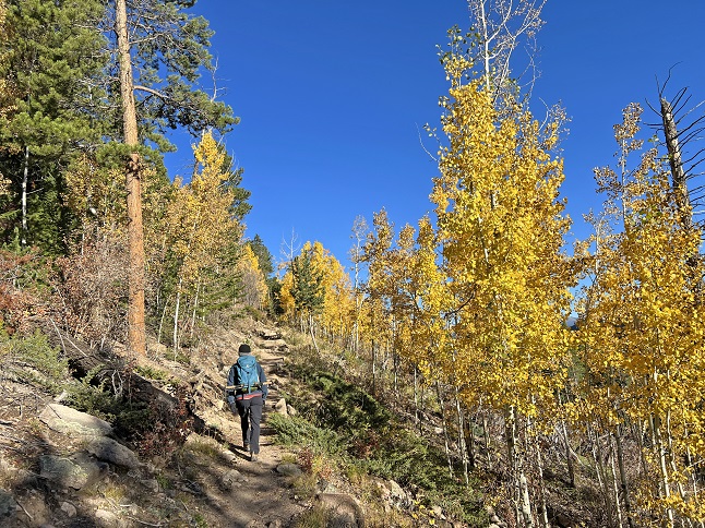
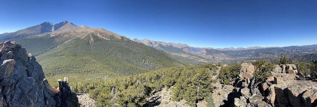
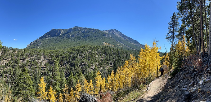
83) Blue Lake, Mitchell Lake Trailhead, Brainard Lake Recreation Area, Ward, CO, October 11, 2023 - We had planned to hike Mount Audubon today but Brainard Lake Recreation Area limits entry and the earliest entry reservation we could get was at 11am. By that late in the morning storm clouds were hovering over the Continental Divide which scrubbed the idea of hiking a 13,000 foot peak. However, since we were at the Mitchell Lake trailhead we opted to hike the easier Blue Lake trail as a fall back. This turned out to be a beautiful hike and watching the blue sky overhead steadily fill in with dark clouds proved we'd made a wise choice. However, we timed it perfectly because as we arrived on the edge of Blue Lake snow flurries started up. We skipped the extra hike up to Little Blue Lake and turned back. The snow was on-again, off-again for our return to the trailhead. We enjoyed the ominous look of a high alpine lake encircled by Mount Audubon, Paiute Peak, Mount Toll and Pawnee Peak all swirling with snow flakes. It was like being inside a gigantic snow globe! However, the highlight was the colorful ground cover in the marshy area betweeen Mitchell and Blue Lakes - it was like someone dumped paint cans of all the perfect autumn colors over the hillsides and the reflections in the small ponds in this area doubled the effect. A quiet mid-week hike into the Indian Peaks Wilderness and our first taste of the coming winter. A 6 mile up-and-back hike with 1,000 feet of elevation gain.
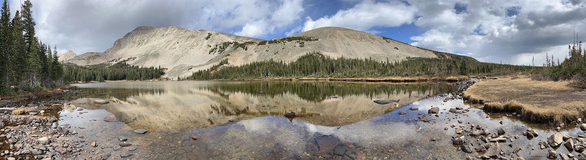
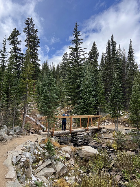
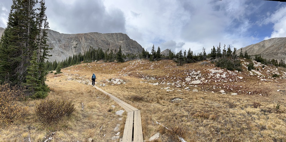
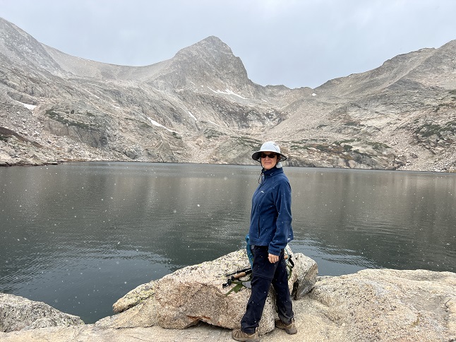
84) Caribou Ranch Open Space, Boulder County Open Space Parks, Nederland, CO, October 13, 2023 - With family arriving on Friday afternoon we didn't have a full day available hiking but we still got out to do one of our local loops. A cold front rolled through mid-week and the weather on Friday was still pretty cool despite it being a beautiful sunny day. Alan wasn't paying attention and wore a short sleeve t-shirt for the hike which resulted in us speed walking the trail trying to generate some body heat! The Caribou Ranch Open Space is always a great place to enjoy mountain scenery and Fall is a perfect time to hike there. The old meadows of the DeLonde Ranch are filled with dry grass and edged with colorful wild rose bushes and bone white aspens. A lovely, if chilly, hike right in our town's backyard. A 4.2 mile loop with 250 feet of elevation gain.
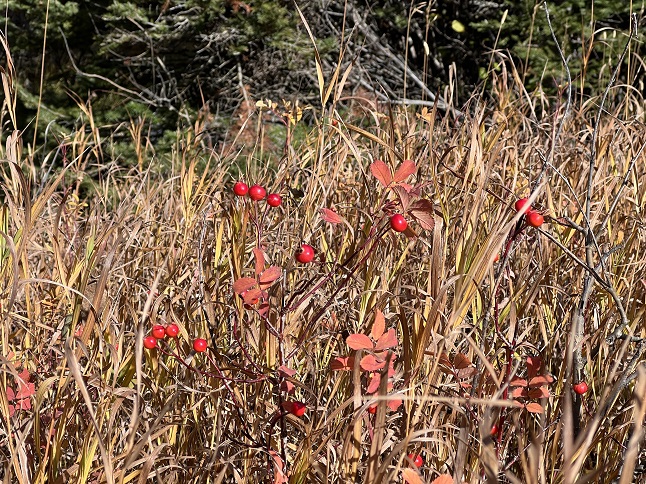
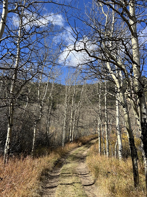
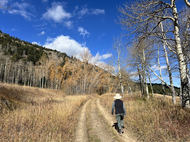
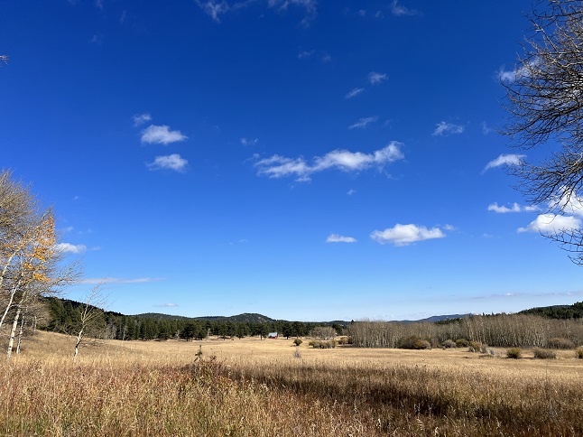
85) Bear Lake & Bierstadt Lake, Bear Lake Road Park & Ride, Rocky Mountain National Park, Estes Park, CO, October 14, 2023 - Alan's cousin Michelle, her husband Steve and their son Sam were visiting Michelle's daughter Chi for parent's weekend at CU-Boulder. The whole family stayed with Jonna and Alan and Michelle's nephew Wesley and his new wife Beeca drove up from Denver to join us all for a Saturday outing into Rocky Mountain National Park. Our original plan was to hike Emerald Lake from the Bear Lake trailhead but a recent snow storm had left enough ice on the trail that we scratched that idea after walking the little loop around Bear Lake. Instead, we retreated down into the valley, enjoyed picnic and then did the Bierstadt Lake hike from the Bear Lake Road Park-n-Ride trailhead. This trail has a steady climb all the way to Bierstadt Lake where we were treated to a perfect alpine like crowned with a view of the snow covered mountains to the south. A great day out in the mountains while surrounded by the warm company of our joyous family. A combined 4 miles with 950 feet of elevation gain.
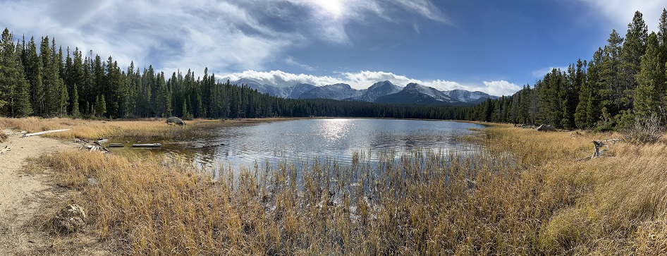
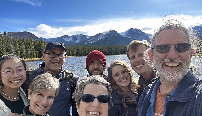
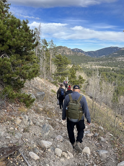
86) Homestead, Mesa and Towhee Trails, South Mesa Trailhead, Boulder Open Space & Mountain Parks, Boulder, CO, October 15, 2023 - To cap off our weekend with visiting family we took Sam out to to do our regular Sunday hike on the Homestead and Towhee trails from the South Mesa Trailhead. We usually do this hike in the afternoon but this time went do early so we could finish up the hike in time for lunch before waving the whole family off to the airport. As a result, we got there during peak hike time which meant the trailhead parking was packed. We ended up parking on the road which added a 1/4 mile to our hike. As a result, we opted for our "short" loop - hiking up Mesa to Homestead Trail, then up Homestead Trail to where it re-joins Mesa Trail. We then turned back towards the trailhead but then used Towhee Trail to short-cut across and re-join Mesa Trail near the trailhead. We had gorgeous weather and there were still quite a few grasses, bushes and trees with colorful Fall leaves. And, of course, the Flat Irons on were highlighted against a clear blue sky. All scenes we were thrilled to share with Sam. We were running a little late on the return so we sent Sam running ahead to get the car with a plan for him to pick us up in the trailhead parking lot. We barely made it - not because of time but because Jonna almost stepped on a 2 1/2 foot long rattlesnake! Needless to say, we were happy we could go straight to lunch without having to stop by the Emergency Room on the way for a dose of anti-venom! It was a beautiful morning hike that we were happy to share with Sam and the little dose of excitement helped make it a little more memorable. A 3.2 mile loop with 600 feet of elevation gain.
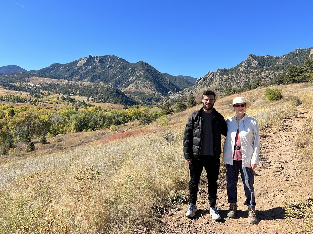
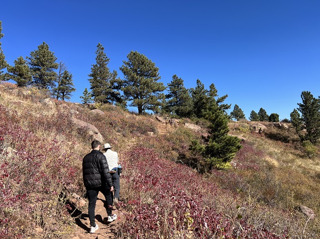
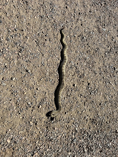
87) South Boulder Peak, South Mesa trailhead, City Of Boulder Open Space & Mountain Parks, Boulder, CO, October 16, 2023 - Jonna and Alan had planned to do a big hike in Rocky Mountain National Park all day Monday but something came up that required us to be in Boulder in the afternoon so we changed up to trade a long distance training hike for one with a lot of elevation gain. We returned to the South Mesa Trailhead, which we'd hiked the previous day, but this time we set our sites on South Boulder Peak. This meant doing the steep Shadow Canyon which is where we'd get our elevation training. We followed our usual "long loop" route which we've hiked so often our footsteps have probably worn a groove in the trail - Up Mesa to Homestead, Homestead to where it rejoins Mesa. Then branching off on the Shadow Canyon trail to the base of Shadow Canyon. However, unlike our usual loop, this time we actually went *up* Shadow Canyon. Jonna hadn't been on this trail in a very long time (Alan hiked it in the Spring as the last of the five Spring training hikes) so it was her chance to get re-acquainted to the big rocky steps that make up the mile long climb which gains 2,000 feet of elevation getting up to the saddle between Bear Peak and South Boulder Peak. Fortunately, we had beautiful weather and after making the long climb we got to enjoy the 360 degree panorama from the top. Then it was time to work our knees on that descent. When we got back down Shadow we decided to take the most direct route back to the trailhead so we came back down Mesa trail to Towhee and then used that to cut off some of Mesa Trail's curves. As always after this hike, we were happy to get back to the car where we could sit down for awhile! A 8.1 mile up-and-back hike with 2,950 feet of elevation gain.
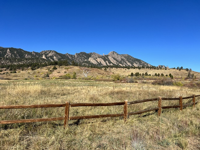
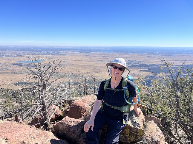
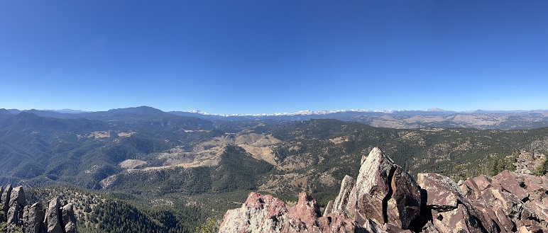
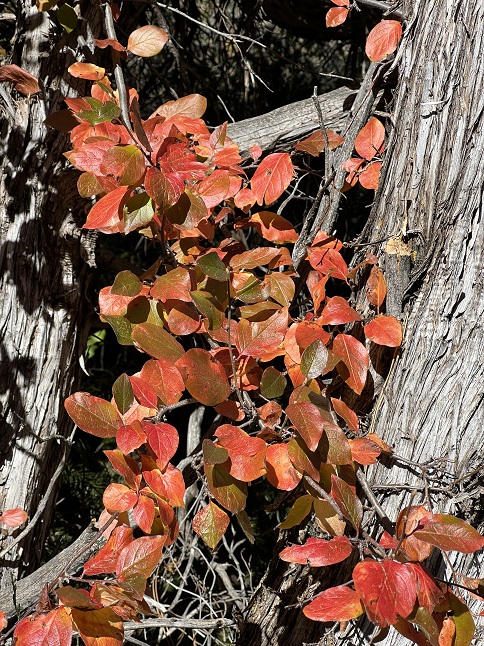
88) Lion Lake #1, Wild Basin Trailhead, Rocky Mountain National Park, Allenspark, CO, October 24, 2023 - Jonna and Alan headed out mid-week for the last long training hike before our big Patagonia trip. At this point we are in as in-shape as we are going to get. For ths hike we headed back to Rocky Mountain National Park Wild Basin Area and once again headed up the trails we've hiked four previous times this summer - The main trail along North Saint Vrain Creek up to the campgrounds shortcut. Then the Thunder Lake-Lion Lake trail to where that trail splits. Over the past few months we have hiked all the trails in this area, except the one up to Lion Lakes so it was satisfying to turn onto a new trail we have never hiked before. The climb from the main trail up to Lion Lake is a steep climb and it took us further into the back country than any other hike we've done this year. The big reward was that once we got a mile away from the trailhead we had the place to ourselves and spent nearly 4 hours hiking in a National Park without seeing another person. It was magical! ...and we got a payoff because Lion Lake #1 is gorgeous. It is nestled in a big bowl completely surrounded by peaks - Mount Alice looms large across the lake but Chief's Head Peak and Pagoda Mountain are equally pronounced to the north. Then smaller Pilot Mountain and Tanima Peak are the backdrop to the South. Finally, Mount Orton was behind us to the east completing the encirclement. It was majestic! However, it was getting late in the day so we skipped continuing the climb up to Lion Lake #2 and Snowbank Lake - They are definitely on a future "to do" list given how beautiful this area is. We rushed back down which was tough on the knees but got us back to the trailhead and back home just in time to meet our evening commitment. It was a great hike and hopefully sends us off to the southern hemisphere with confidence we can do the hikes we have planned in Patagonia. A 12.3 mile up-and-back hike with 2,600 feet of elevation gain.
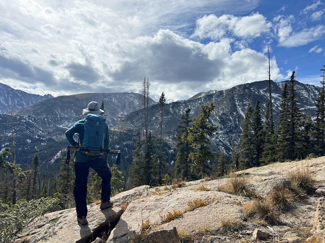
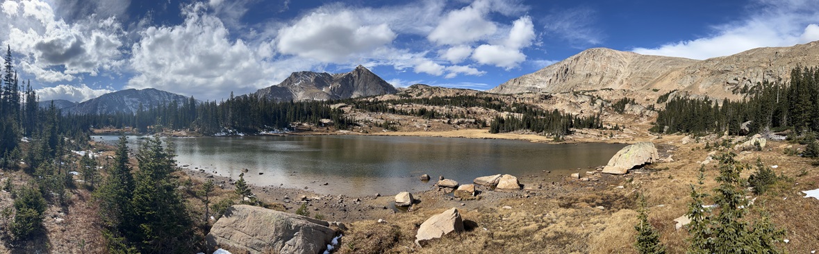
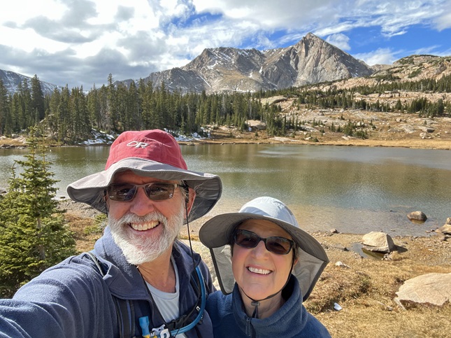
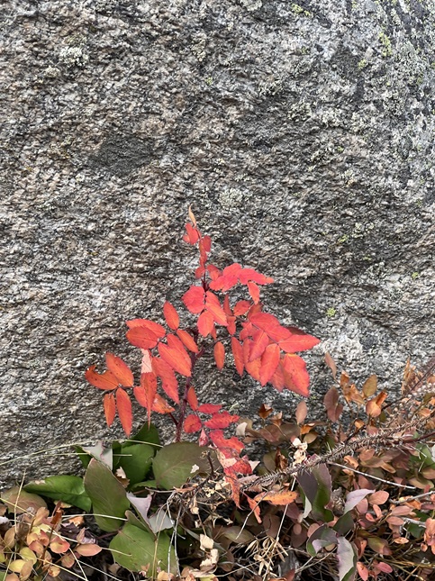
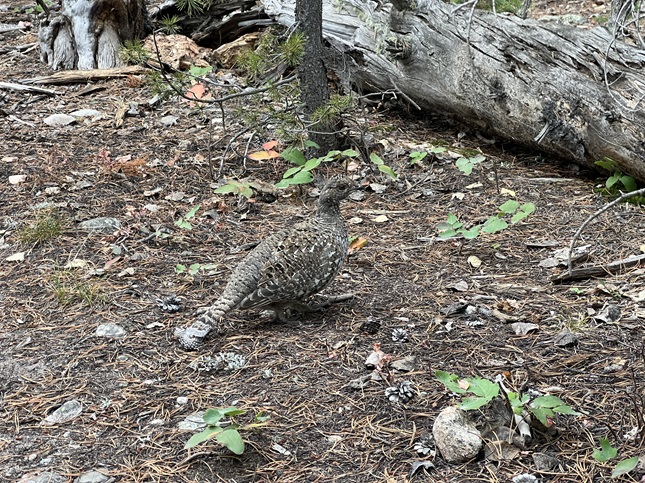
89) Cerro Villegas, Dina Huapi, Argentina, November 5, 2023 - Today we finally got to hike in Patagonia and it was a great experience. The original plan was to hike Bella Vista, a big Andean mountain right on the Argentina-Chile border but the late season snow storms and low lying rain clouds this morning forced us to change. I am a little disappointed we didn’t get the Top-of-the-World experience on top of a snow-covered Andean peak but we definitely made the right call. We got picked up in the morning by our guide Javier and he was doubtful about the conditions on Cerro Bella Vista or the alternate neighboring Cerro Goye. So instead of heading west to the big peaks we instead drove to the eastern edge of Nahuel Huapi Lake where it empties out into Rio Limay. This river is a deep turquoise color which was very beautiful. From the trailhead on this end of the lake we could see that the western end was completely socked in with rain and all the peaks were covered with clouds. Hiking there would be cold, wet and have no visibility. Where we were was overcast and a little breezy but clear of rain. We started our hike along the river and the views were lovely. In a few places cherry trees (non-native) were covered in delicate blossoms which were dropping into the surreally blue river. After about half a mile we turned and started to climb out of the river valley. There must not be a spanish word for "switchback" because the trail builders clearly didn't know about them. If they wanted to go up a mountain they built a trail straight up! We huffed and puffed about a 1,000 feet to the top of a ridge and then turned east to start up Cerro Villegas. It is a rocky peak but the mountain's sides are the same sandy terrain as the pampa - the grasslands that stretch all the way from the Andes to the Atlantic Ocean. Big clumps of grass, spring wildflowers and some low shrubs - nothing taller than knee high. As we climbed we spotted some cool animals: First was a herd of wild Guanacos (similar to a llama), then some Red Hawks hunting for rodents that live in the grass. Higher up we spotted a pair of Andean Eagles playing in the thermals. A lovely aerial dance. However, the highlight came when we reached the summit. First off was the weather. As we climbed the clouds broke up and when we reached the top we had a window of perfect blue sky above us. Across the lake it was still nasty but we had perfect skies. Second was the view. While the mountains to the west were covered by clouds we had gorgeous snow covered peaks to the north. To the east was a seemingly endless roll of hills which eventually flatten out to the pampa. To the south were mid-sized mountains but directly below us was a line of little ponds where we could still see the herd of Guanacos grazing. Finally, the highlight - an Andean Condor - a fully grown adult with a 9 foot wingspan came floating past us. Maybe 50 feet off the peak and below us so we were looking down onto his or her back. Just riding the wind. After about a 1/4 mile it caught a thermal and shot a few thousand feet up in altitude and then glided off to the west high out over the lake. It was AWESOME! While we were up on the summit three more condors came by but none of them were so close. I was buzzing from the experience as we started down. We took a different route to descend which went by a "cave" that was on the southwest side of the mountain. The cave was an area where softer rock had collapsed leaving an concave overhang in the face of a cliff. We climbed up and rested for a bit in the shade enjoying the view through the window. Then we climbed back down to the riverside and retraced our tracks to the car. It was a very scenic hike with a strenuous enough climb to feel like we earned it and some amazing animal sightings. An excellent start to our Patagonia hiking! A 7.5 mile loop with 2,400 feet of elevation gain.
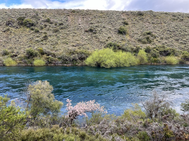
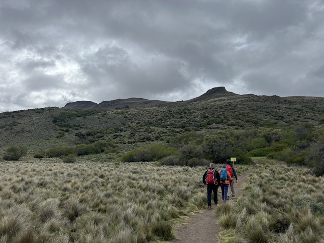
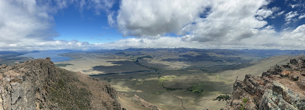
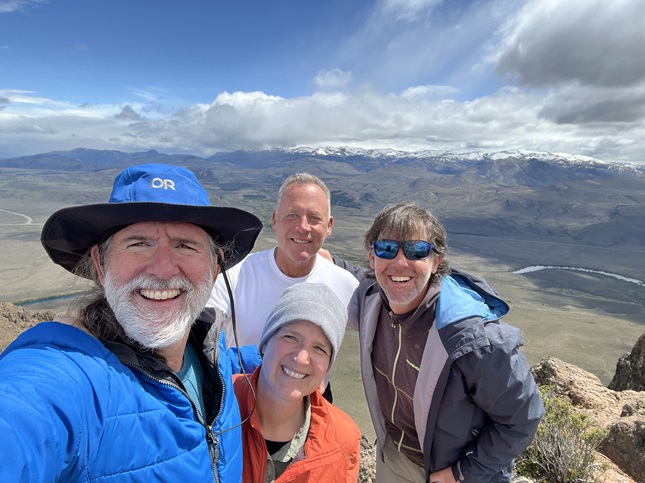
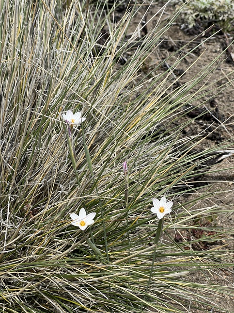
90) Parque Nacional Alerce Andino (Alerce Andino National Park), Lenca, Chile, November 8, 2023 - Chile is a very narrow country in this region - with less than 100 miles spanning the Andes Mountains in the east to the Pacific Ocean in the west. In this area the Bolivian jungle merges with the coastal rainforest and runs right to the edge of the ocean. A rare, slow-growing, long living tree - the Alerce - is found. It is now believed that the Alerce is the oldest tree in the world surpassing the Bristlecone Pines of the western US. There are a few national parks in this region created to protect these trees and their environment and we visited one of them today. We got up early, had a modest breakfast at the hotel and were picked up at 9am by Luis, a guide with LS Travel. We needed box lunches for our day long adventure so Luis gave us a driving tour of Puerto Varas while a deli whipped up our food. We picked up our bagged sandwiches and started the hour long drive south-west through Puerto Montt and then up into the rainforest that grows outside the fishing village of Lenca. The park is a humble recreation area with a small parking lot and only a single ranger on duty. When we pulled in and parked there was a tiny grey fox begging for food in the parking lot. Incredibly cute but heartbreaking that it is so accustomed, and probably dependent, on handouts from tourists. There was also a bus unloading a group of students so we hustled to get on the trail ahead of them. The rainforest was amazing from the first step out of the parking lot. It is a lot like the Olympic Peninsula in Washington state. Just a massive organic sponge. Every living thing is growing on some other living thing and had other smaller living things growing on it. You step back to see the macro view and then go to a tree trunk to get the micro view and it looks basically the same. From trees to ferns to micro-algae it is a multi-layered world painted with every variation of green possible. We hiked the Salto Río Chaicas trail which runs along the Chaicas River. There was a constant chatter or birds and the croak of frogs, mixed with the sounds of the rushing river and the drip-drip of water out of the forest. Fortunately, it wasn't raining and the sun was threatening to break through the clouds as we hiked in. The same snow and rain that have been flooding Argentina on the other side of the Andes has also fallen here so in places the trail was covered by pools of water and in many places had been turned into soft, squishy mud. We hiked all the way to Salto Río Chaicas - a decent waterfall that was crashing through a narrow gap in some hard rock. Luis, the guide, said he hadn't seen it rushing with this much power in at least 20 years! At the waterfall the trail turned into a wooden boardwalk with a long flight of stairs climbing up the hillside out of the river valley. At the top of the stairs was an Alerce tree - Alerce Milenario. This particular tree is a little over 3,000 years old. It is similar to a Giant Sequoia but a little smaller. It is still a big tree but more the size of a Coastal Redwood while having the distinctive shape of the Sequoia. It was a beautiful tree and Luis explained that it was prized by European settlers because it has such a dense grain making it a very hard wood and mostly water proof. As a result most of them were cut down at the end of the 19th and early 20th centuries which is why they are protected today. Literally as we were looking up at this majestic giant the clouds separated and the sun shown down lighting up the whole tree. Stunning! We had our lunch at the base of the tree and then headed back as the school kids caught up to us. Thankfully, the sun stayed out so for our hike back to the trailhead we got to see the rainforest with rays of sunshine spearing down through the canopy. We got back in Luis’ car and then he gave us a quick driving tour of Puerto Montt including a stop at a viewpoint up on a hill overlooking the city. A 6 mile out and back hike with a modest 300 feet of elevation gain.
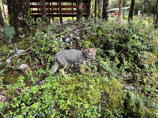
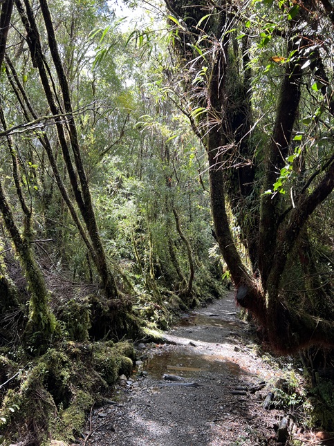
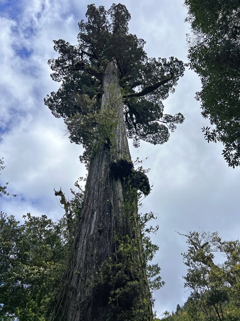
91) Mirador Base Las Torres, Parque Nacional Torres del Paine, Cerro Castillo, Chile, November 11, 2023 - Jonna and I have been training all year to prepare for two big hikes on this trip and the first of those hikes was today. I’m not gonna lie - this was a strenuous hike - but wow was all the training worth it! The day started early with us getting up at 6am to grab a quick breakfast at the hotel and get our gear together for our 6:30am pick-up. Our driver for today was Rodrigo, the same driver we'd had the day before on a bus tour, and our hiking guide was a young guy named Vicente. There were just five of us doing the hike - a Chilean gentleman named Hernando who was celebrating his birthday and a woman named Evelyn who is an Argentinian travel agent from Buenos Aires. It had rained most of the night but that had petered out by sunrise leaving everything wet and the air temperature pretty chilly. All that rain was snow up on the mountains with the snow-line only about 400 feet above the elevation of the town. However, the clouds were hanging just a couple of hundred feet above that so we couldn't see the tops of the mountains. The drive into Torres del Paine takes about two hours so we relaxed and tried to rest to make up for waking up so early. Just as we passed into the park it started to rain again - it wasn't looking great for our hike. By then time we drove out to the Torres del Paine welcome center the rain stopped so back to looking okay to start our hike. Our driver Rodrigo would be waiting for us which seemed crazy since we would probably be hiking for eight hours but I think he has to be available in case any of us had a problem and had to turn back early. We each stuffed the contents of our provided box lunches into our packs and hit the trail. The first mile of the trail runs along the front of the mountains and is roughly level. As we hiked the clouds inched a little higher which gave us a tantalizing glimpse of the bottom of the mountains which were towering over us. The next section of the trail was a mile with a steep climb up the side of a ridge - no switchbacks just a steep, rocky trail kind of like uneven stairs. The heartening thing was that we seemed to be pushing the clouds up as we climbed; for every hundred feet of elevation we gained the clouds seemed to rise an equal amount. At the top of the ridge we turned into the Rio Ascencio valley. The trail is up high on the rim of the valley which provided a beautiful view up the valley with the rushing, cascading Rio Ascencio down in the bottom. The other outstanding part of this view is that some small creeks were tumbling down the sides of this valley out of the low lying clouds in long waterfalls. Magical! The next mile was actually going downhill into the bottom for the valley where the Refugio Chileno - a warming hut - is located. We stopped for 15 minutes to use the restroom and to eat some of our box lunch. Despite the cold temperatures we had built up a lot of body heat from the climb up to the top of the ridge but going downhill and then standing around on the deck dropped our core body temps so we started hiking again. At this point we reached the snow line but also switched from the pampas grassland into the Chilean rainforest so suddenly there were trees and bushes. There was also a lot of water coming down so the trail started to regularly cross bridges over creeks and streams. We were also getting drips of melted snow, globs of wet snow and even mini-flurries when tree branches would shake loose fresh snow. It was wild to be getting snowed on under the canopy of a rainforest! Again, magical. The trail was again climbing upwards but with a rolling landscape as we went up a hill and then dropped back down on the other side to cross another water drainage - all while gaining elevation as we continued up the river valley. After another couple of miles we reached the final climb - where we turned away from the river and made a mile long super steep climb up into a hidden bowl. At this point the clouds had quit rising and it started to snow - we'd easily experienced all four seasons thusfar on this hike. The clouds and snow were also demoralizing because hiking up into a cloud when the landscape was so spectacular wasn't the destination we were hoping for. Nonetheless. We enjoyed the stunning wintery landscape we could see and just kept climbing up. Step by step we ascended out of the rainforest and into the rocky scree field on the very shoulder of the tallest mountains in the heart of the park. It was slow going because the trail was slick with snow and wet granite rocks. We gained about 1,200 feet in this last mile! I don't put any stock in mystical "luck" but we sure seem to have more than our fair share on our hikes on this trip. Just as we reached the top where a small lake sits at the very base of the namesake of this park - the Torres del Paine (The Blue Towers) - the clouds parted like misty curtains to let the glorious sunshine beam down on all three of the towers. Literally, 15 minutes before the distinctive spears of rock were shrouded and a cheer erupted from the hikers at the lake when the white mist cleared. As new people arrived they immediately said "Wow!" at the sight. We found a place where we could stare in awe at the scene while eating the last of our lunch. Now, this is probably the time to admit that we did not enjoy this trail in solitude. This is a very popular trail and there were probably a hundred other hikers at the lake when we arrived. I joked that the park service needs to install stadium seating and assign seats. It was kind of crazy. And during the hike our little group of five could immediately become a group of twenty or more on the steepest uphill sections when one slow hiker would back up traffic until a wide enough part of the path could be reached so faster hikers could pass. Still, even with the crowds the scenery at the lake was incredible. We stuck around for about half an hour before starting our descent. With 20 minutes of our starting down the clouds closed back up and it started snowing again. We timed it perfectly! The steep section was tricky to go down. There were still a lot of slow moving hikers climbing up which meant we had to negotiate passing on a steep, slick and narrow trail. Many of the uphill hikers were getting panicked because the park rangers close the trail at 3pm and sweep everyone out from the lake at 4pm so some of the slower hikers were pushing that deadline. We also felt bad because the clouds might not clear again before 4 which meant even the hikers that made it to the lake might not get the amazing views. By the time we were back down into the rainforest the stream of uphill hikers trickled out and we suddenly had the trail to ourselves. The snow stopped again but now the trail was muddy from all the melting snow. All the little creeks were now swollen and cascading down with gusto which made each bridge a great sightseeing opportunity. We made great time all the way back to the Refugio where we stopped to rest for a bit. Unfortunately, the wind suddenly kicked up which dropped the temperature so we had to quickly resume hiking to get our body heat back up. The climb up out of the Rio Ascencio valley was strenuous after all the hiking we'd done so it was rewarding to creast the ridge at the top. Even more rewarding was the panorama looking down from there with the turquoise water of Lago Nordenskjöld in the foreground and the snow covered mountains in the background. Wow! From here is was the final steep downhill - tough on exhausted knees - and then the mile of flat trail back to the Welcome Center. As we hiked this last section all the clouds just evaporated and suddenly all of the mountains we'd just hiked were clear and bathed in sunshine. We stopped to take it all in. Another "Wow" moment. My reward at the trailhead was to buy a Coke in the gift shop. It tasted GREAT! The trail we hiked was just one third of the famous "W" trail and also part of the longer "O" trail. While this was tough it was also stunningly gorgeous and helped me understand why so many people from all over the world come to Patagonia specifically to hike these trails. A 13.8 mile up and back hike with 3,100 feet of elevation gain.
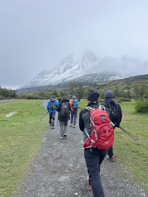
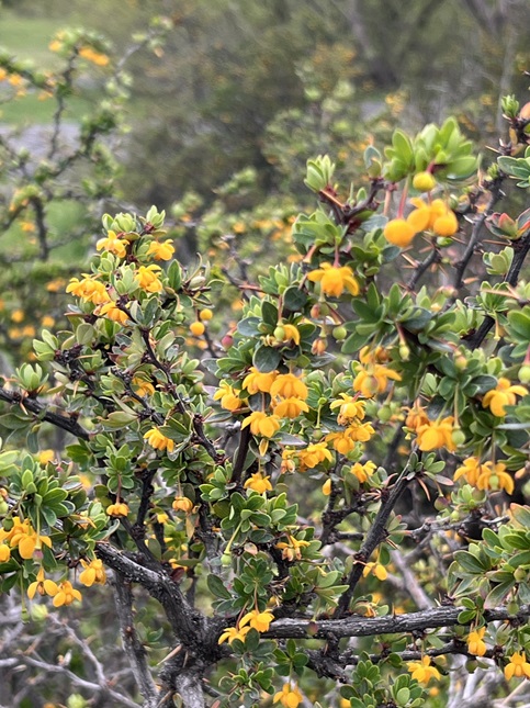
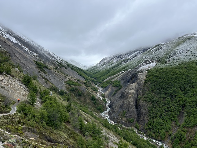
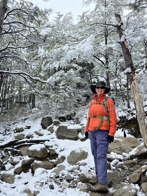
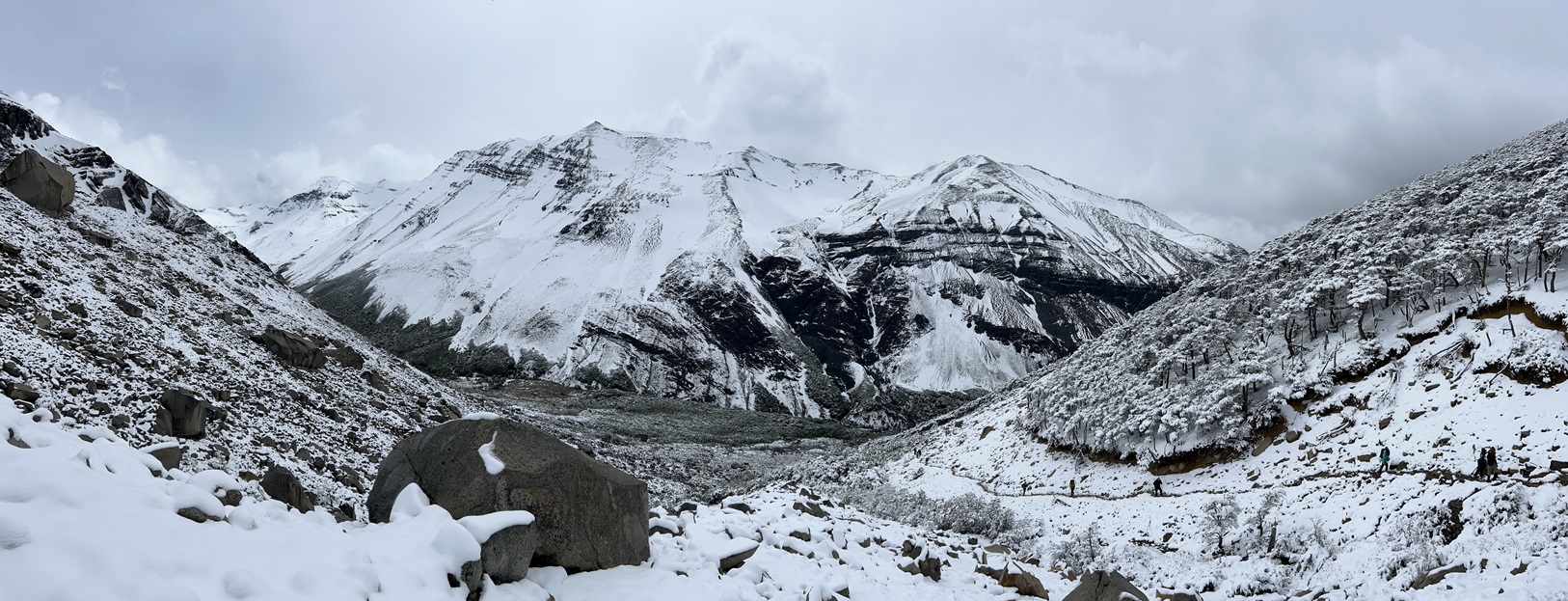
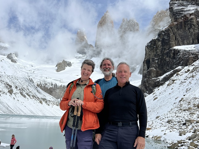
92) Mirador del Fitz Roy, Laguna de los Tres, El Chaltén, Argentina, November 15, 2023 - The indigenous Tehuelche people called the large, rocky mountain near here "Chaltén" which translates to "Smoking Mountain" presumably because clouds that form over the Southwest Patagonian Ice Field often cover its peak. It was named Fitz Roy, after the captain of HMS Beagle, by European cartographers. Our biggest hike of our Patagonia trip was hiking to the Mount Fitz Roy viewpoint just west of the city of El Chaltén. There is a trail, Sendero Monte Fitz Roy, that leaves from the north end of town that climbs up to the viewpoint. However, there is another trail as well from a trailhead called Rio Electrco about 15 kms north of town (a new trail that replaced a previous one at the nearby El Pilar hostel.) We paid a taxi to drive us up to Rio Electrico so we could do this as a through hike rather than an up-and-back. There was snow overnight but the sun was trying to break through the low-lying clouds and that was melting the fresh snow on the ground. This left the trail muddy but clear. The beginning of the trail is in a wide stoney valley with a braided river. We crossed this, then climbed up onto a ridge where the new trail connected with the original El Pilar trail. From this point we had about 2 miles of steady climb. Near the end of this stretch we started to catch glimpses of the Piedras Blanco glacier through the trees. The highpoint of this ridge was a viewpoint looking at the giant blue ice wall of this hanging glacier. Gorgeous! At this point we had gained enough altitude that we were up to the snow-line so the trail, trees and ground were all covered with fluffy fresh snow. Periodically, a cloud would blow through spitting out sleet but would be followed by an opening up to clear blue sky and sunshine. The trail next came out of the Andean forest and into an open field covered with low bushes. This was our first glimpse of the cluster of spires that is Mount Fitz Roy. The highest peak was covered in cloud but the lower peaks were visible. At this point this trail merged with the Sendero Monte Fitz Roy trail coming up from El Chaltén. There is a low glacial moraine ridge with the Poincenot campground on top which we hiked over then through the Rio Blanco valley and finally we were at the foot of Fitz Roy at the Rio Blanco campground. From this point it would be a very steep climb on a very crowded trail. The trail is narrow but has two-way traffic with very cold people trying to get down quickly and very eager hikers trying to go up for our own view of Fitz Ray. This was pretty frustrating - not least of all because it is so steep which means wildly different hiking speeds as some people charge up (or down) while others tentatively take each step or stop to catch a breath. This is like the "conga lines" on the 14ers in Colorado but with a soundtrack from the Tower of Babel because so many people from all around the world are hiking. Hello, Hola, Konnichiwa, Nihao, Bonjour, Namaste, etc. We managed to keep a surprisingly steady pace - something I’d worried about all night - and made it to the crowded ridge line above Laguna de Los Tres. The lake was completely frozen over and layered with fresh snow as were all the mountains that create the bowl for the lake. Clouds were rushing over the peaks so sometimes you could see most of them and a few minutes later they would be completely shrouded. There is a hanging glacier just to the right of the tallest peak but it was as much imagination as actual sight. Jamie and I made the short descent to the shore of the lake and then the climb up the south ridge for the overlook onto Lago Sucia. This lake is 1,000 feet lower in elevation and wasn’t frozen. When a ray of sunshine would poke through the clouds the lake would light up with the most magnificent dark blue color. Stunning. When we retraced our path back to Jonna we were all pretty chilled so it was time to start down. Enough people had walked on the trail to compress the snow into ice so the first quarter mile descending was treacherous - with about 200 people trying to elbow past each other on a super slick, rocky slope with just barely enough room for one person. Not getting the perfect view of the peak was a bummer but dealing with the cluster of that final climb put more of a damper on the day. Don't get me wrong, the views were incredible but I don't think I'd ever do this trail again. There are plenty of beautiful places in the world that don't require going through that kind of chaos. Once we were back down to the campgrounds the trails were clear of snow, mostly cleared of hikers and much less steep. We still had five miles of hiking to do but at least our nerves could recover. The Sendero Monte Fitz Rio trail basically follows a creek valley down. It was very pretty with snow-covered mountains towering overhead to the north and the Andean forest on the hillsides to the south. At the halfway point the trail splits giving you the option you make a short climb up the southern valley wall to visit Lago Capri - a scenic lake with a mountain on the opposite shore. A picturesque side trip that added a little elevation but not much mileage to our hike out. The final two miles of the trail was a steady decline - just the thing to anger knees already sore from the rocky drop down from the Fitz Roy viewpoint. I was limping at the end when the arthritis in my knee caps got inflamed and my energy (probably from the head cold) dropped. Once I could look down on the town I was in death march mode - just one foot in front of the other. The last bit, walking a few blocks through town on concrete sidewalks, was a blur. As soon as I got into the hotel room I stripped off the yucky hiking gear, took a quick shower and then collapsed into bed where I stayed for the next 16 hours. I did it, in fact all three of us did, but I was quite aware I was the weakest hiker on that day. Thanks to Jonna and Jamie for accommodating me! A 14.3 mile loop with 3,100 feet of elevation gain.
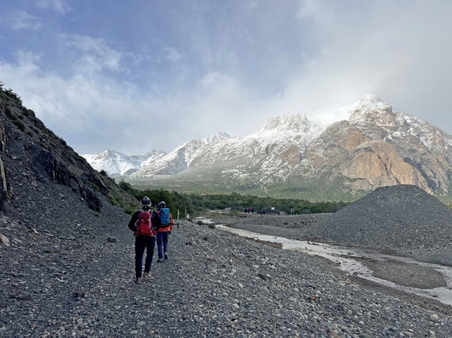
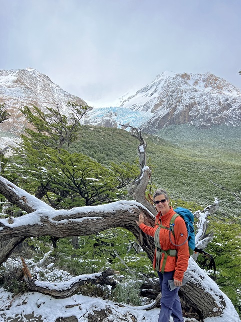
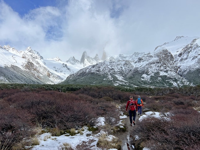
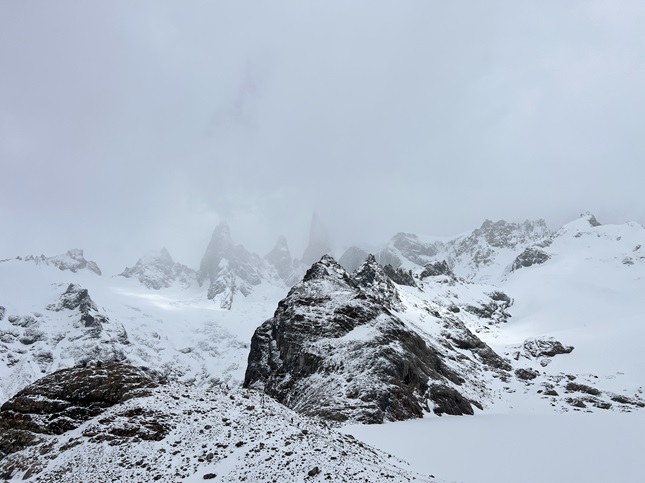
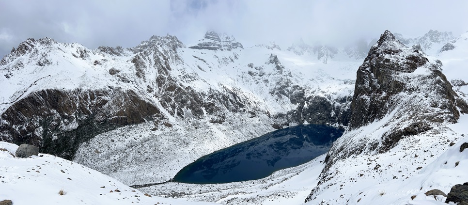
93) Coastal Path, Parque Nacional Tierra Del Fuego, Ushuaia, Argentina, November 19, 2023 - The final hike of our Patagonia adventure was part of a guided group hike in Tierra Del Fuego National Park. We did a river rafting/float in the morning and then, after lunch, were dropped off along Ruta 3 for the hike. There were twelve of us hiking plus our guide Sebastian. The full Coastal Path trail runs 9.5 miles in length, which would have been fine with me, but this was not a group of regular hikers. So the reason we were dropped off along Route 3 was to hike out to the shore of Lapataia Bay and pick up the trail at approximately the halfway point. We then turned east and hiked to end of the trail at Bahia Ensenada Zaratiegui. This trail is through the sub-Antarctic forest - unique zone found only for a few miles on Tierra Del Fuego sandwiched between the 3,000 foot snow-covered peaks of the Andes Mountains and the ferocious sea of the Drake Passage to the south. Only four types of tree exist in this landscape and all are different species of the Nothofagus tree. The ground is very marshy and cold all year round so trees have shallow roots and grow slowly. Dead and down trees also decay very slowly - the guide pointed out stumps of trees cut when the park was created 70 years ago which have degraded very little. There are also practically no native land animals in this harsh environment so the wildlife is all birds and sea animals. The trail itself was very muddy but every half mile or so it would pop out onto a pebble beach. In these viewpoints the majesty of the landscape was apparent with dramatic mountain peaks all around. The guide, Jonna, Jamie, a lady from Buenos Aires and I all had a much faster hiking pace than the others so we had to slow down and take stops in order to keep the group together. If only we could have hiked by ourselves we could have done the whole trail. Argh! We encountered an intermittent stream of hikers doing the trail in the opposite direction but also had stretches where it was just us and the forest. The temperature warmed gradually throughout the afternoon - from a cold and humid mid-30s when we started to a partly sunny but still chilly low 40s. As long as we were moving I was warm and actually removed layers during the hike which was the opposite of most of our activities in Ushuaia where we just kept adding (or wishing we could add!) layers. It was a very scenic hike and as a nature stroll it was excellent. However, it reminded me that guided group hikes aren't my preferred way to enjoy the outdoors. A 4.3 mile one-way hike with a rolling 400 feet of elevation gain.
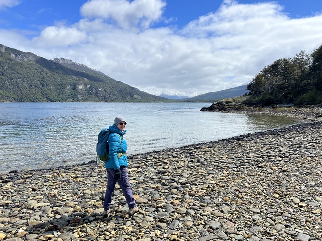
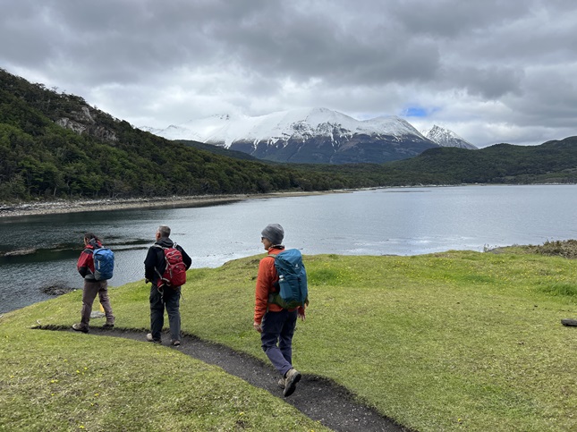
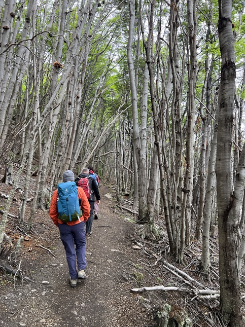
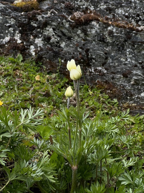
94) Bobbcat Ridge Natural Area, City of Fort Collins Natural Areas Dept, Masonville, CO, December 13, 2023 - Todd and Alan got together for a nice mid-week and end-of-the-year hike. The weather was iffy with grey clouds hanging low in the sky but the forecast said no snow should fall so we headed north to give it a try. We chose the Bobcat Ridge Natural Area just outside Masonville, CO. When we got to the parking lot the top of the ridge was covered by the clouds which meant they were just a few hundred feet above us. We started up the Ginny Trail which meant we were immediately going up. The meadows along the front of the mountains were wet and the trail was muddy but as we gained altitude the moisture turned into frost and ice. Soon all the grass was coated with a layer of white hoar frost - an ice crystal layer formed by moisture in the air combined with a freezing wind. As we continued to climb we went up into the cloud layer at which point ice crystals started forming on us. My beard, eyebrows and any hair sticking out from under my hat were turned into ice. At the top As we continued to climb we went up into the cloud layer at which point ice crystals started forming on us. My beard, eyebrows and any hair sticking out from under my hat were turned into ice. At the top of Ginny Trail we reached the high point and turned north onto the Power Line Trail. We started to drop back down but the hill we'd been climbing was shielding us from a slight breeze and once we rounded it the temperature seemed to drop a few degrees. Additionally, the trail here was covered in a thin layer of ice making footing tricky. As the trail came down the ridge the trail conditions improved and we dropped down out of the cloud. Near the bottom of the ridge we turned onto the Valley Loop Trail which was buddy but clear of ice and frost. That took us back to the bottom of Ginny Trail where we returned to the trailhead. A good hike and uniquely beautiful with everything up high covered in hoar frost. A 9.7 mile loop with 1,600 feet of elevation gain.
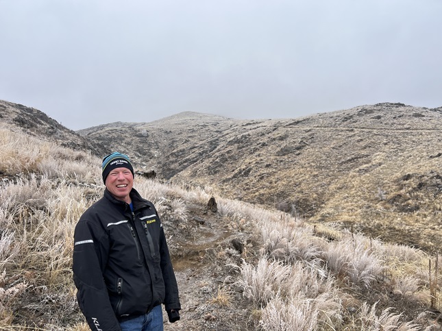
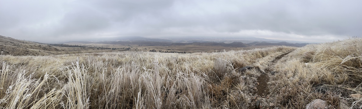
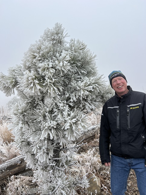
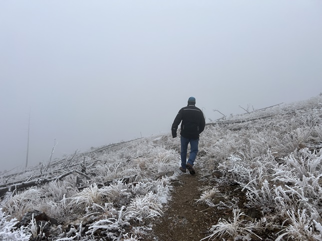
95) Homestead, Mesa and Towhee Trails, South Mesa Trailhead, Boulder Open Space & Mountain Parks, Boulder, CO, December 17, 2023 - We managed to sneak in another hike before the end of the year and it was appropriate that what may be our last hike of 2023 was once again meeting our friends Desiree and Gaelin on a Sunday afternoon to hike at the South Mesa Trailhead. We've hiked this trail 16 previous times, usually on Sunday afternoon/evening so closing our year's hiking here allows us to bookend seeing the changes that take place on these trails throughout the seasons. We were all feeling a little run down to we did our "middle" loop that involves going up Homestead Trail to Mesa Trail, then going up Mesa a little ways up the Shadow Canyon trail. We cut across on the Shadow Canyon Spur Trail to reconnect with Mesa where we headed back towards the trailhead. Then we used the Towhee trail to shortcut that in order to loop back to the beginning. It gave us all a chance to catch up on life and to watch the sun set behind the Front Range mountains. A 4.5 mile loop with 1,000 feet of elevation gain.
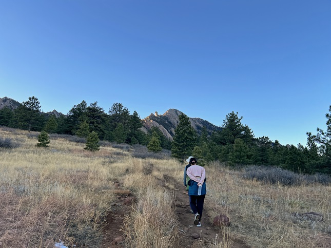
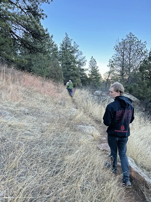
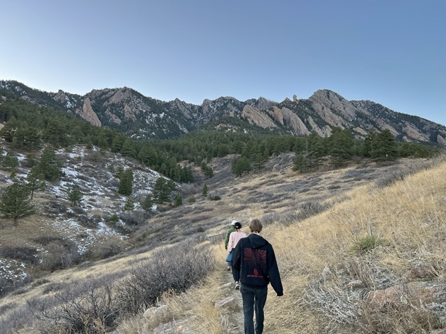
96) Caribou Ranch Open Space, Boulder County Open Space Parks, Nederland, CO, December 30, 2023 - In an effort to break the holiday sloth, Jonna and Alan headed over to nearby Caribou Ranch Open Space to stretch our legs. The trail was mostly packed down snow - right on the verge of requiring microspikes but we managed to do the whole hike without putting ours on. It was a cloudless blue sky overhead which contrasted nicely with the white ground and the bare bone-white aspen tree trunks. A 4.2 mile loop with 250 feet of elevation gain.
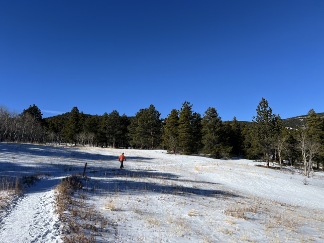
97) Homestead, Shadow Canyon and Mesa Trails, South Mesa Trailhead, Boulder Open Space & Mountain Parks, Boulder, CO, December 31, 2023 - We finished off 2023 with a final hike for the year, again joining our friends Desiree and Gaelin for our traditional Sunday afternoon loop at the South Mesa Trailhead. This was the eighteenth time we hiked this trail this year so we definitely once again experienced the cycle of the seasons on this trail. The day was a little chilly but that apparently kept the crowds away so we had mostly quiet trails for our hike. Most of the recent show had melted away but in places the trail was slippery with packed down ice. We did have nice views of the Flat Irons for the hike, as well as loads of chit-chat so we could finish of the year seeped in friendship. Best wishes for a 2024 filled with good healthy, plenty of happy times and lots of good hikes! A 5.6 mile loop with 1,200 feet of elevation gain.
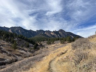
If you enjoyed these you may also enjoy checking out some photos from our 2022 hikes.
