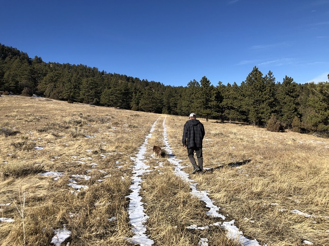
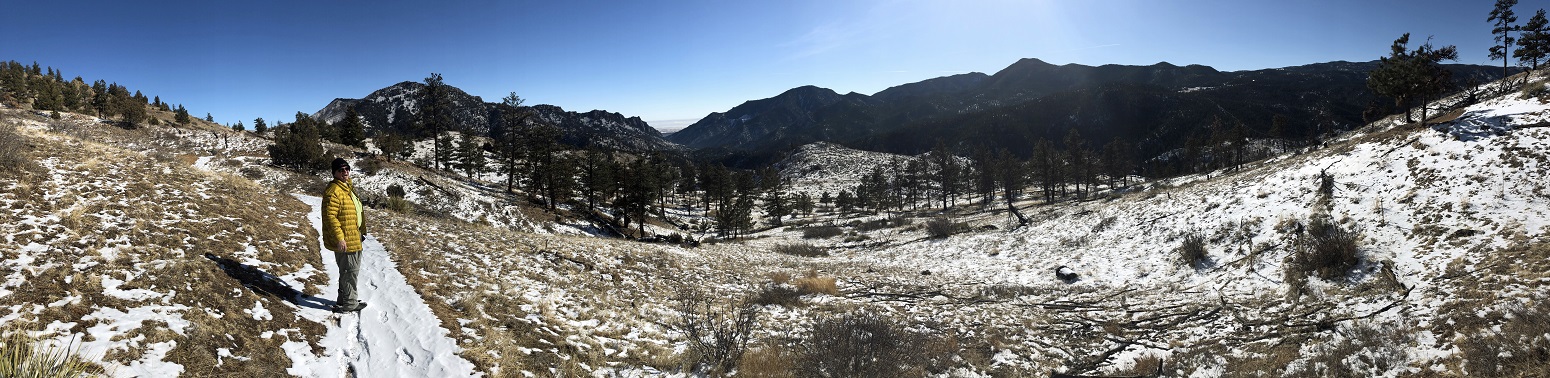
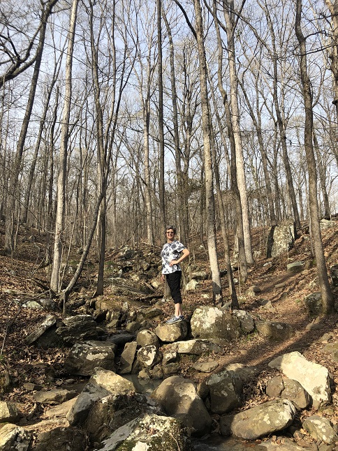
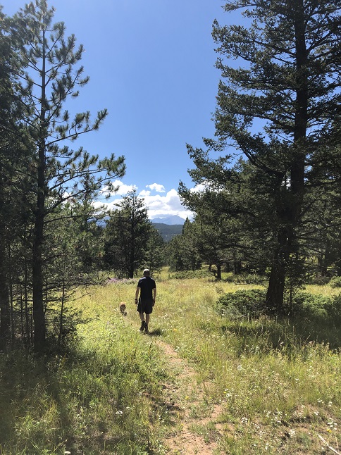
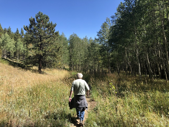
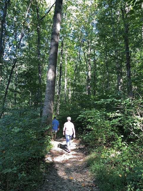
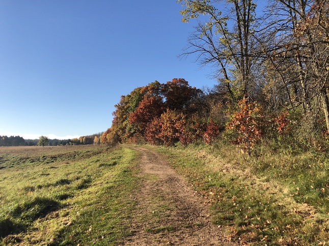
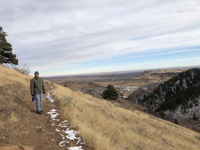
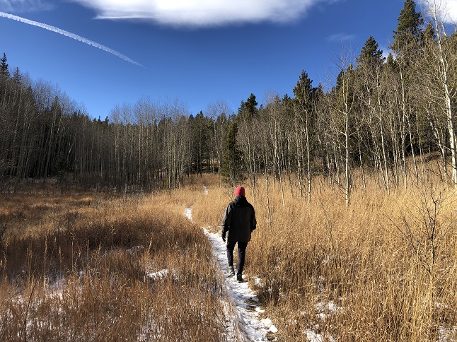
1) Lone Star Mine, 105 Forest Service Road, Rollinsville, CO, January 1, 2021 - What better way to celebrate the start of a new year (and the end of 2020!), as well as Rusty pup's 12th birthday, than by getting out for a hike in the Colorado mountains? My buddy Todd sent an email mid-week asking if I'd be interested in a hike on 1/1 so we could let Rusty run free in the woods as a birthday celebration. Naturally, I jumped at the chance. We met up in Rollinsville and then drove together to a parking area where Forest Service Road 105 branches off the Rollins Pass road. We parked and then headed up into the National Forest. With a decent layer of snow on the ground and no one else around, Rusty was able to explore to his puppy heart's delight while Todd and I followed along. We made a few stops to take pictures and to give Rusty treats but mostly we just wandered through the forest enjoying the sights. We hiked in as far as the Lone Star mine before turning back. A perfect way to start out 2021 and hopefully a great doggy day out. 4.5 miles out and back with 1,000 feet of elevation gain.


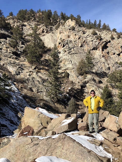
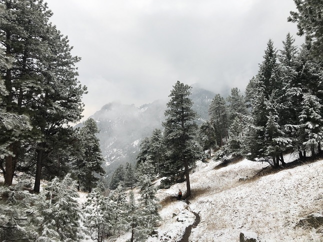
2) Deadman's Gulch, Roosevelt National Forest, Lyons, CO, January 3, 2021 - A month ago, Todd and Alan explored a web of trails in South St. Vrain Canyon around Deadman's Gulch. Well, anywhere there is a web of trails there is a good reason to return to explore more. Todd had seen a well used, unmarked trail in the area so we headed back today to see where it went. Wow, what a find! There is seldom a better way to spend a day than just wandering in the mountains and this trail provided a very scenic way to do just that. Better yet, the weather was warmer than expected thanks to clear skies and a bright sun shining down - this mean shedding layers as we hiked but meant we could stay out as long as we wanted. We followed a drainage for about a mile before the trail switched to switchbacks that went up, up and more up. At the top was a gorgeous lookout on top of a very steep cliff going about 800 feet straight down. Impressive! Since we were loving this area so much we kept climbing and eventually circled back around on the edge of Coffintop Mountain to the area we'd explored back in December. On the way down we headed further east to check out a different part of that area as well. It was so steep that we didn't cover a lot of ground mileage-wise but we definitely got in whatever are the daily recommended amount of stair steps. A 5.4 mile loop with a hefty 1,500 feet of elevation gain.


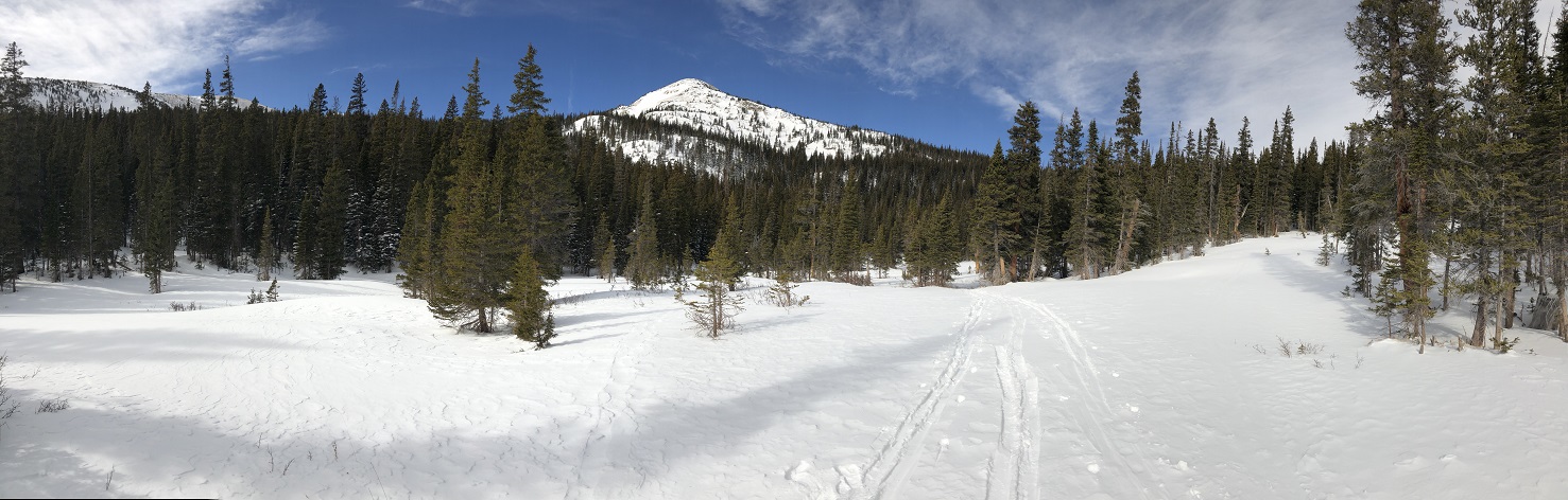
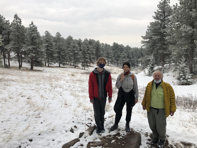
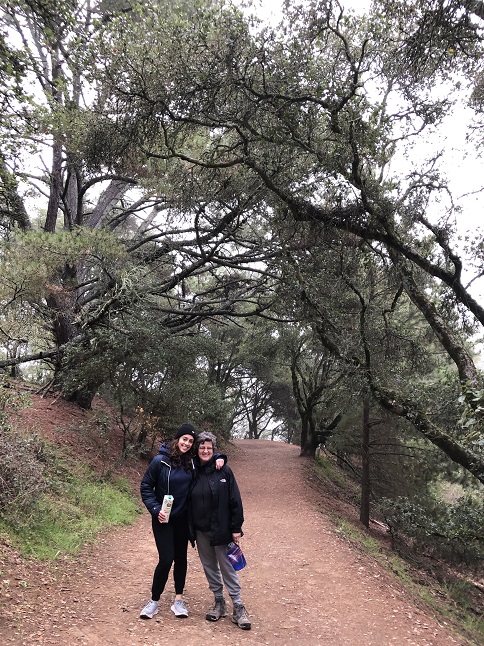
3) Forest Lakes trail, East Portal trailhead, Tolland, CO, January 7, 2021 - For my hiking buddy Lyle's birthday we got together for a celebratory hike in one of his favorite areas. We meet up at the East Portal trailhead and hiked up the Heart Lake trail, then split off on the Forest Lakes trail. Despite a decent base of snow on the ground the trail was pretty well packed down so we just hiked (no snow shoes or skis). We ended up turning back a little under half a mile from the Forest Lakes because the trail was getting soft and the hiking was getting more difficult. It was also getting windy as we gained altitude and with the temperature just a little above freezing it was getting chilly. A beautiful area, a nice hike and some great camaraderie to celebrate Lyle's next trip around the sun. 5.7 miles with 1,100 feet of elevation gain.


4) Bluebird Loop trail, Caribou Ranch Open Space, Nederland, CO, January 11, 2021 - After a slow day around the house Jonna and Alan made a quick trip to nearby the Caribou Ranch Open Space in order to stretch our legs with a sunset hike. It was cold out and the trail was covered in packed snow but there weren't many people on the trail so we mostly had the place to ourselves. We hiked the entire loop but with the temperature dropping we didn't made the side trips to see the Bluebird Mine nor to North Boulder Creek. A 4.2 mile loop with 250 feet of elevation gain.


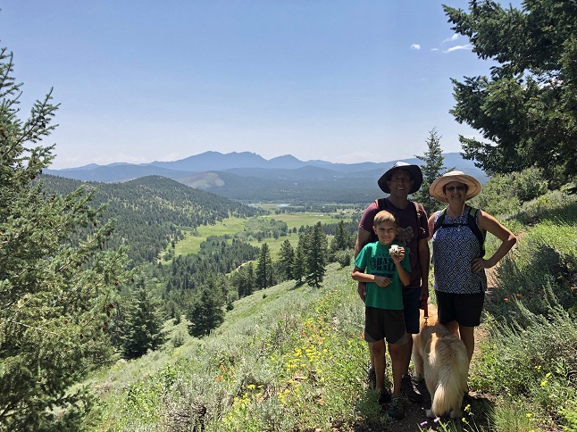
5) Buchanan Pass trail, Camp Dick Campground, Peaceful Valley, CO, January 17, 2021 - Our friends Holly and Rick invited us to join them for a Sunday hike this weekend. We've had a few days of blustery, cold days so we avoiding the wind was a prime goal for picking where to hike. We decided to try the Buchanan Pass trail which starts at the western end of the Camp Dick campground. The road into the campground is closed in the winter so we ended up walking through the camping area to get to the trailhead. Unfortunately, the wind howling down from Buchanan Pass was sweeping through the open campground made for challenging conditions. Combine that with Jonna recovering from a recent medical procedure and we ended up cutting the hike short. Still, it was nice to get together with our friends and to breath some fresh air. 3.6 miles out and back with a mellow 300 feet of elevation.


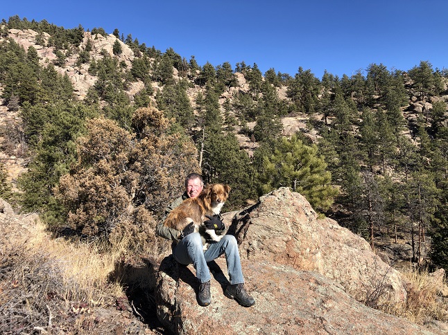
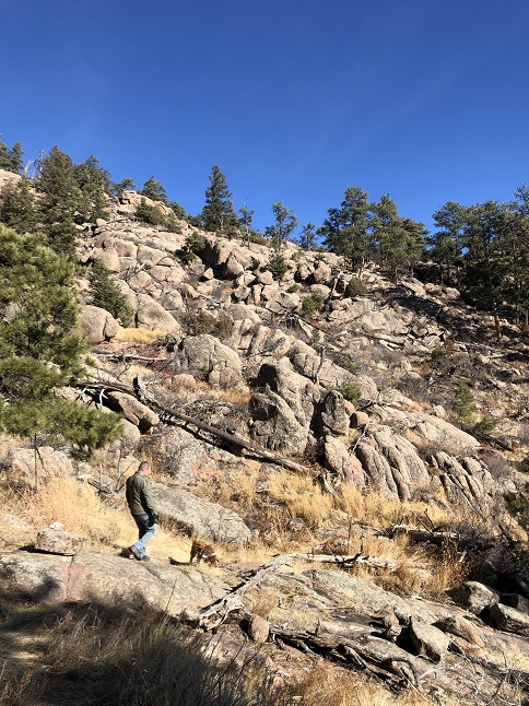
6) Smuggler Mine, Roosevelt National Forest, Lyons, CO, January 18, 2021 - Hikes on two days back-to-back! Todd called Alan again with a new unmarked trail in St Vrain canyon that he wanted to explore. So off we went, along with Rusty pup the mega-hiker, to check it out. This one turned out to be an old abandoned mining road that lead up a beautiful little canyon to the Smuggler Mine site and then continued to climb on from there into the Cal-Wood Environmental Education Center. Once we hit the border of Cal-Wood we turned back, not wanting to trespass onto their land. However, we could see evidence of last summer's massive forest fire which started on this land not far from where we turned around. With snow clouds dropping snow over the high mountains what was probably an amazing view when we reached the top was just a wall of white. No scenic panorama but we were pretty pleased with ourselves for making the steep climb up and even more pleased we found a less challenging way back down. 4.5 miles with a 1,2000 feet climb, including a near vertical 300 foot high cliff at the top.


7) Homestead and Towhee Trails, South Mesa Trailhead, Boulder Open Space & Mountain Parks, Boulder, CO, January 22, 2021 - Errands brought us down to Boulder in the morning so we took advantage of the nice weather and weekday morning sparseness at the parking lot to hike from the normally busy South Mesa trailhead. We tried to stay off Mesa Trail since it is usually packed with trail runners so we hiked out on the Homestead trail and then came back via the Towhee trail. The morning sun was still lighting up the Flatirons and making the ice crystals glitter on the frozen surface of south Boulder creek. There were other hikers out but nearly everyone was wearing masks and staying a safe distance away. A nice walk through a scenic area and plenty of sunlight so we got a good dose of vitamin D. A 3.2 mile loop with 600 feet of elevation gain.


8) Homestead and Towhee Trails, South Mesa Trailhead, Boulder Open Space & Mountain Parks, Boulder, CO, January 25, 2021 - Ever heard of deja view? It is sort of like deja vu but in this case it the feeling that you've hiked a scenic trail before. Well, we definitely had deja view today. We met up with our good friend Desiree at the South Mesa Trailhead and did the same hike that we did this past Friday. However, it is a nice trail so doing it all over again was a bonus and really we were focusing on catching up with Desiree so the hike was just an excuse to spend time together. We met up mid-day in order to beat a (small) snow storm that was scheduled to start in the evening and we got to watch the clouds spill over the big mountains to the west as we hiked. We started under blue skies and it was starting to cloud over when we got back to the trailhead. We did the same loop as our previous visit. Left the parking lot on Mesa trail, then turned onto the Homestead trail to hike out and then came back via the Towhee trail. We all enjoyed the same great views of the Flatiron and out onto the plains towards the town of Superior. The same 3.2 mile loop with 600 feet of elevation gain that we did three days earlier.
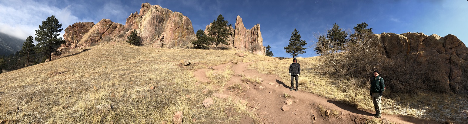
9) Walker Ranch Loop, Boulder County Open Space, Boulder, CO, January 27, 2021 - The 2021 hiking season is off to a great start. To keep at it, Lyle and Alan met up at the Crescent Meadows Parking Lot (which is technically in Eldorado Canyon State Park) in order to hike the Walker Ranch Loop (which is technically a Boulder County park). The previous day's snow had put down about an inch of fresh powder but it was already melting out in the places with decent sun exposure. ...and fortunately, the sun was out which provided some warmth to counteract the periodic gusts of wind that were quite brisk. We slipped and slid (and at times fell...ouch) our way around the entire loop only seeing three other people silly enough to be out on such a slick trail. Still, the scenery was worth it with the snow covered Rockies to the West and the plains visible down the canyons that stretched out to the east. A 8.2 mile loop with 1,400 feet of elevation gain.


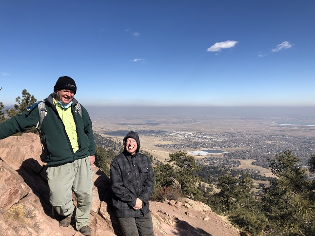
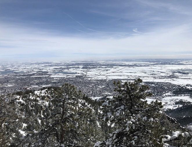
10) Mt. Sanitas, Boulder City Open Space & Mountain Parks, Boulder, CO, February 8, 2021 - It has been over a year since all three members of The (unofficial) Mid-week Retiree Hiking Club all got together for a hike. But this Monday morning Lyle, Todd and Alan gathered at the Settler's Park trailhead in Boulder to start the annual spring training hikes. What made this hike interesting was that Boulder was experiencing a temperature inversion. A layer of very cold air was trapped on the plains with warmer air above it. So we started the hike with temperatures in the teens and with the grass covered in ice crystals from frozen dew. Then, as we hiked up the mountain the air got progressively warmer. Looking out over the plains you could see the dust and smog trapped and with clear air above. Fascinating! Fortunately, the sun was out so the temperature for most of the hike was perfect. We hiked what has become the normal route - Over the ridge at Settler's Park via Red Rocks trail then up Sanitas Valley on Dakota Ridge. From there it was straight up the east face of the mountain to the summit. The knees always take a beating on the long decline down the south ridge. Then back over Settler's Park but this time via Anemone Trail to return to the trailhead. It was a fun time with plenty of entertaining conversation though it was sad to see that the thin air on top of the mountain appeared to seriously degrade Todd's memory of certain object facts about our past motorcycle trips... 4.5 miles with 1,500 feet of elevation gain.


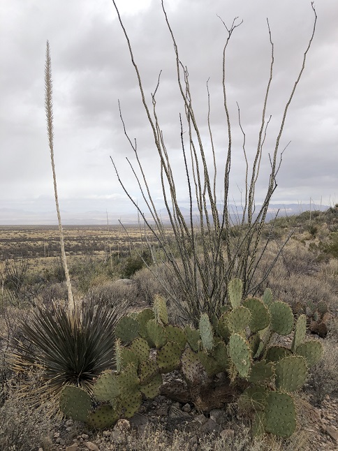
11) Foothills Trail, Kartchner Caverns State Park, Benson, AZ, February 16, 2021 - I know it is unusual to go to a park dedicated to a cave and then spend your time above ground but COVID restrictions limited the tours and we couldn't get a reservation to go underground. However, we could camp in the campground and so we saw what we could of the park by hiking a loop around the mountain that contains the caves. The desert landscape the trail traversed provided a wide variety poke-y things to see. Golden Barrel cactus covered in needles, Prickly Pear cactis with long barbs, ocotillo sticks covered in rose-like thorns, yucca with protruding spears, agave with sharp saw blades and even small trees with little hooks on the branches. It was scenic but you definitely get the idea that the plants in this landscape doesn't what you around. How many pointy things can you see in this picture? A 2.7 mile loop with 500 feet of elevation gain.


12) Various trails from the Mica View trailhead, Saguaro National Park East, Tucson, AZ, February 17, 2021 - One of the highly anticipated destinations, once we decided to head west into Arizona, was Saguaro National Park. The saguaro cactus is the symbol of the desert southwest so seeing them in person was a must do. So as we drove into Tucson we turned north and drove to eastern section of Saguaro National Park. We drove the 8 mile scenic drive but along the way we stopped at the Mica View picnic area and took a stroll in the saquaro cactus forest. Scattered amongst the barrel cactus, the prickly pear, the ocotillo and the mesquite trees were the tall, iconic saguaro. Bright green, hard as oak and covered with thousands of sharp needles the cactus are striking. We had perfect weather and the trail was surprisingly sparse with other hikes given this is a national park. An easy 2 mile loop with a nearly flat 70 feet of elevation gain.


13) Victoria Mine Trail, Organ Pipe Cactus National Monument, Lukeville, AZ, February 18, 2021 - A rare solo hike so I once again get to type in the first person! Jonna needed to catch up on some rest so I donned my hiking gear and took off on the hiking trail that leaves from the campground. The trail goes south through the desert practically up to the Mexican border where there are ruins of an old gold mine. The highlight is hiking through the namesake organ pipe cactus though there are plenty of other types as well - barrel, prickly pear, saguaro, etc. The mine site has a number of old shafts, the remains of a stone building and a lot of rusty bits. The weather was perfect (sorry Colorado friends) and it was different to be hiking in the desert so a great way to spend the afternoon. 5 miles out and back with a rolling 500 feet of elevation gain.


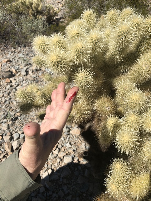
14) Desert View Trail, Organ Pipe Cactus National Monument, Lukeville, AZ, February 19, 2021 - With the temperature up in the 80s we weren't up for a long hike but there was an easy desert interpretive trail at the nearby group camping area so we walked over there mid-day and hiked that loop. This trail provided our first view of mammals! We saw a jack rabbit and then just a few minutes later spotted a coyote. That timing probably wasn't a coincidence. The trail was nice through the Sonoran desert and with a dozen or so informational signs about the various plants. Jonna got a little extra education about the "jumping" cholla cactus. Ouch! A 2.2 mile loop with 140 feet of elevation gain.


15) Green Mountain Trail, Mount Lemmon, Coronado National Forest, Tucson, AZ, February 21, 2021 - ...And now for something completely different. After a week of hiking in the desert, we drove up onto Mount Lemmon outside of Tucson and entered an entirely different world (or at least different climate zone.) We found parking at the Green Mountain/Bug Springs trailhead and decided to hike up (Green Mountain trail) rather than down (Bug Springs). Wow, what a different landscape: Pine trees, oak trees, shrubs and even grass. There were still a few cactus but the cooler temperatures and winter snow means life at the high elevations on Mount Lemmon is very different from in the desert below. The first part of the hike paralleled the Mount Lemmon Highway but at the General Hitchcock campground the trail turns up a creek bed and starts to climb. We hiked up this valley for a little ways before encountering a skunk. We decided that was a good time to turn around and the skunk seemed to agree. It headed uphill and we returned downhill to the car. 2 miles with 800 feet of elevation gain.


16) Hawks Trail & Dixie Mountain Loop Trails, Desert Vista Trailhead, Phoenix Sonoran Preserve, Phoenix, AZ, February 22, 2021 - While visiting our friend Robin in Phoenix she offered to bring us out for a hike on one of her local trails. the Desert Vista Trailhead is one the northeastern edge of the city and is part of a city managed nature preserve. The highlight of the hike was seeing a mama Great Horned Owl sitting on her nest that was built in the arms of a seguaro cactus. The trail was a roller-coaster climbing up a ridge before passing over a notch between two hilltops. It then dropped down into wash while looping around to the north of the hills. We hiked partway around before turning back. It was another nice hike through the desert but made different by sharing the hike with a friend we haven't seen in years. 2.5 miles with around 500 feet of elevation gain.


17) Stock Bypass Trail, Gila Cliff Dwellings National Monument, Gila Hot Springs, NM, February 24, 2021 - After visiting the stunning Gila Cliff Dwellings we decided to stick around longer and do some hiking. Right in the main parking lot the aptly named West Fork Loop trail heads west along the west fork of the Gila River so we struck out on that. About a quarter mile down the trail it meets up with the Stock Bypass trail which loops back around to the north. This trail rolls up and down over ridges and through a large burn area before connecting with the road that goes into the main parking lot. The final 3/4 mile of the hike is just walking the road back to where we'd parked. The burn area made for open vistas looking across the river onto the cliffs that contain the dwellings. Further down the trail it gets into unburnt pine forest that crosses little washes/dry drainages. The variety of plants in this area is a stark contrast with the desert down at lower elevations. It was cool, bordering on chilly, in the morning but the sun kept climbing in the sky which slowly brought the temperature up and melted any remaining ice on the trail. 3.5 miles with 280 feet of elevation gain.


18) Flagstaff Mountain, Boulder City Open Space & Mountain Parks, Boulder, CO, March 12, 2021 - Spring training hike #2 is in the books and just in time with a big snow storm that is expected to drop multiple feet of snow scheduled to hit in the evening. Lingering clouds from the previous night's much smaller snow fall were still clinging to the front range peaks when Desiree, Gaelin, Lyle and Alan all met up in Boulder mid-day for the hike. We all caravanned to Boulder's Eben G. Fine park and then started up the Viewpoint trail. It was clear right away that the 1" or so of snow had melted quickly and turned the trail into a muddy mess. The gooey muck piled up on the bottoms of our boots until we were basically walking on platform hiking boots. Thankfully, the higher we went the more actual snow we encountered (along with more rocky trails) so we were able scrap off the excess mud. The low lying clouds also become an issue once we switched to Flagstaff Trail and we gained more altitude. We eventually climbed into them so the normally fantastic views down onto Boulder and of the Continental Divide on the west side of Flagstaff were instead walls of grey. After hiking a loop at the top via the Range View and Ute trails, we returned the way we had come up. The clouds were breaking up a little on the way down so we got some cool views of the Flatirons sticking up out of ethereal mist. We arrived back at the cars in the late afternoon in the same platform mud boots we'd started with earlier. Still, it was a pretty hike with the fresh snow and a good workout with the slick trails. 6.3 miles with 1,700 feet of elevation gain.


19) Green Mountain, Boulder County Open Space & Mountain Parks, Boulder, CO, March 17, 2021 - Spring training hike #3 for 2021 is in the book! As it turns out, not even something like a little snow storm (well, actually a big snow storm) can stop the intrepid hikers Lyle and Alan from completing our annual Hikin' 'O The Green. Just a couple of days after two feet of wet snow was dumped on the front range the trails were still piled high. We decided that the added difficulty of hiking in the snow necessitated starting from the top of neighboring Flagstaff Mountain rather than at the bottom of Gregory Canyon like we usually do. Despite the shorter hike it was still a challenge but we persevered going up Greenman trail and coming back down on Ranger trail. It started off overcast and cool but the sun steadily broke through the clouds and by the time we reached the top to look down on Boulder we had blue skies overhead. While the scenic views were nice it was actually the snow covered forest we hiked through that made it a special hike. A 4.1 mile loop with 1,400 feet of elevation gain.


20) Ozark Highlands Trail, Lake Fort Smith State Park, Mountainburg, AR, March 23, 2021 - Jonna and Alan are on another RV adventure this time taking a meandering route down to Florida going through Kansas, Oklahoma, Arkansas, Tennessee, Mississippi and Alabama along the way. One of the focuses of the trip was explore the Ozark mountains in Arkansas as we passed through that area. We stayed in the Lake Fort Smith State Park campground and from there did a hike on the Ozark Highlands Trail along the western short of Lake Fort Smith. It was a lovely day for a spring hike and the tiny shoots of green plants poking up through the matt of brown leaves on the forest floor showed that winter has come to an end. We had blue sky, warm sunshine and a few beautiful flowers to highlight the hike. A 2.8 mile out and back hike with a mild rolling 250 feet of elevation gain.

21) Pedestal Rocks trail, Pedestal Rock Scenic Area, Ozark-St. Francis National Forest, Ben Hur, AR, March 25, 2021 - Jonna and Alan's second hike in the Ozarks was in the middle of Arkansas. After a scenic drive through the heart of the Ozarks we stopped off at a National Forest trailhead to see the Pedestal Rocks. It had been a rainy drive but the rain stopped as we arrived at the trailhead parking area so the hike was mostly dry, if a little drippy and muddy. The pedestal rocks were interesting to see and the higher sections of the trail provided a panoramic view of the mountains to the north. Another nice hike which helped cement the Ozarks as a great destination for outdoor adventures. A 2.7 mile loop with 250 feet of elevation gain.


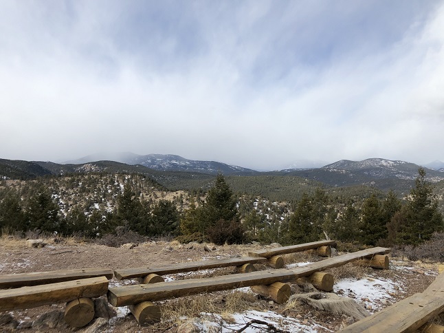
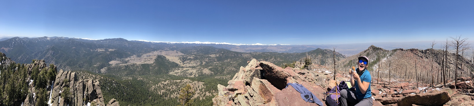
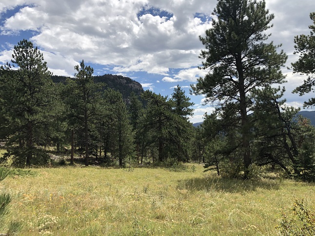
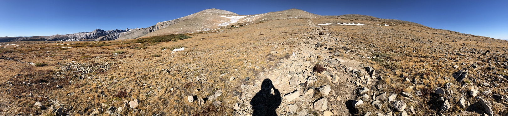
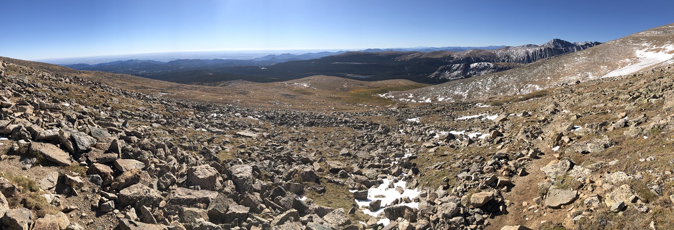
22) Bear Peak, Boulder Open Space & Mountain Parks, Boulder, CO, April 25, 2021 - Annual Spring Training hike #4 up Bear Peak turned out to be far more challenging that expected. Alan and Rick met up at NCAR and, because of heavy snow the previous week, we decided to take the longer but more gradual climb up Bear Canyon. The higher we went up the more the trail was covered in snow. The last couple of hundred feet of elevation was quite tricky but we slithered our way up. The view from the peak was spectacular. Stunning panoramas of both the Continental Divide to the west and looking out over Boulder to the east. The challenging part turned out to be coming back down. We'd planned to descend via Fern Canyon but the people who'd come up that way were telling horror stories of the icy trail conditions. That meant we needed to return via Bear Canyon - a trail that is 2.5 miles longer than Ferm Canyon. We gritted our teeth and headed back down the way we'd come up. The snow and slush meant descending was slow going but the trail got better the further down we went. It was a long, tiring hike but we made it. Thankfully, it was a great day for hiking so we had great views and warm sunshine to ease the strain. 11 miles up and back down Bear Canyon with 2,700 feet of elevation gain.


23) Ralston Roost, Bear trail, Golden Gate Canyon State Park, Golden, CO, May 2, 2021 - Lyle and Alan headed out Sunday morning to get in a hike before the forecasted afternoon thunderstorms rolled in. We started from the Ralston Roost trailhead in Golden Gate Canyon State Park and headed up from there. There was blue sky when we began the climb but the higher up the ridge on Bear trail that we went the darker the skies became. As we reached the top snow started falling and thunder began to roll through the valley. We'd originally planned to hike a loop but being at the highest point of the hike just as the lightening and thunder got started convinced us we should turn back rather than press on. As it turned out, this was just a leading band of snow which was followed by more blue sky but that wasn't clear until we were halfway back down. Still, we did the smart thing so we'll feel good about that even if it shortened our hike. 4 miles with 1,100 feet of elevation gain.


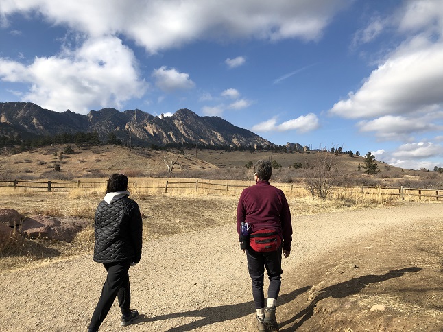
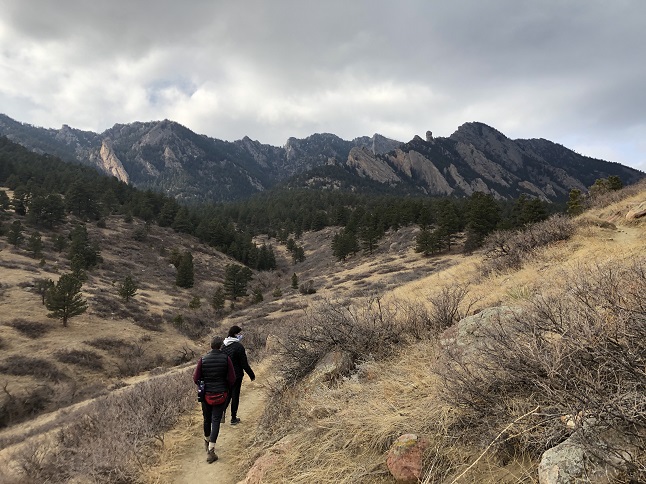
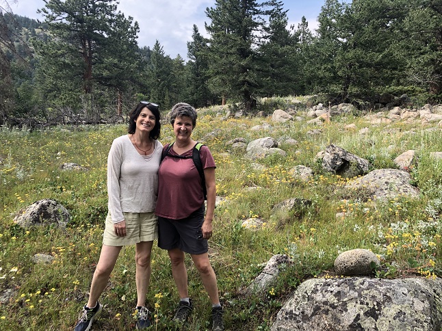
24) South Boulder Mountain, South Mesa trailhead, City Of Boulder Open Space & Mountain Parks, Boulder, CO May 6, 2021 - Okay, the last of the five spring training hikes is done! Friend Julia and Alan decided to tackle South Boulder Mountain and it turned out to be a perfect day to do it! The weather was cool and there wasn't a cloud in the sky just beautiful blue as far as the eye could see. We started at the South Mesa trailhead and took Homestead, Mesa and Shadow Canyon trails on the way up. Shadow canyon was surprisingly green for this early in the season. Clearly the alternating late spring snow storms and sunny days have worked their magic. The burn area at the top of the canyon is still pretty bare with just a few baby pines starting to pop up in places. But the burned mountain top made for amazing views to the west. Iphone photos never do the Continental Divide justice but in person the panorama of snow covered mountains was fantastic. There is sometimes wind on top of the mountain peaks but not today so we had a leisurely lunch while enjoying the scenery. Then it was the long trek back down. Once we got to the bottom of Shadow Canyon we took Mesa and Towhee trails back to the trailhead. What a terrific way to spend a Thursday and a great way to welcome Julia back to Colorado! 8.3 miles with 3,000 feet of elevation gain.


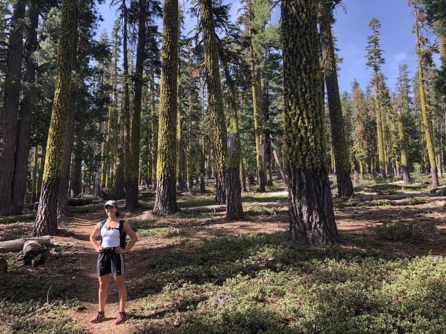
25) Mt. Elwell, Smith Lake trailhead, Plumas National Forest, Graeagle, CA, June 5, 2021 - While visiting family in Graeagle, CA Alan was able to get out for a hike with brother-in-law Jamie and niece Rosie. We decided to try to climb nearby Mt. Elwell, a peak Jamie and Rosie had tried to summit a couple of times over the past couple of years but had always been turned back by deep snow. We parked at the Smith Lake trailhead and hiked in on the Smith Lake trail until the Mt. Elwell trail split off. That trail lead up into the typical beautiful pine forest that is common in the Sierras. Big trees covered with bright green moss. Backdrop that with a clear blue sky and it is a lovely landscape for a hike. As we gained altitude we hit more and bigger patches of snow but we were always able to over or around. The final climb up to the peak was a slippery slope of snow which lead onto field of loose rock. Despite the tricky footing we all made it to the very top and were rewarded with an incredible panorama across all the lakes in the area with the big peaks of the Sierras standing majestically on the horizon. An excellent hike with terrific hiking partners! 8.6 miles out and back with 2,000 feet of elevation gain.


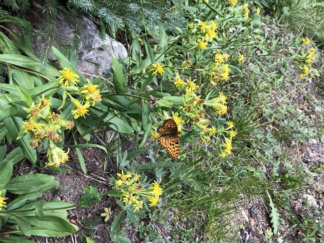
26) Homestead and Towhee Trails, South Mesa Trailhead, Boulder Open Space & Mountain Parks, Boulder, CO, July 5, 2021 - Desiree invited Alan to join her on one of her regular evening hikes. We met up at the South Mesa trailhead to hike a loop that is very familiar to us both. Up Mesa trail for a short distance, then west on Homestead trail to the point it rejoins Mesa trail. From there we hiked a short ways on up Mesa towards Shadow Canyon before turning back. On the way back down we veered off onto Towhee Trail and took that back to where it meets back up with Mesa Trail near the trailhead. It is normally a very crowded section of trail but on a weekday evening it was much quieter. The sun set while we were hiking but there was still enough light out to enjoy all the colorful wildflowers that were covering the lush green hillsides. The combination of abundant sunshine and frequent afternoon rain storms have clearly worked their magic with the flowers. A peaceful hike and a nice chance to catch up with Desiree! 3.9 mile loop with 700 feet of elevation.


27) Como Creek trail system, Nederland, CO, July 18, 2021 - We had the pleasure of hiking with our friends Jay and Thomas (and their pup Jackie) on a glorious Sunday morning after they made the trek up into the mountains from Denver. We brought them to one of our favorite places to enjoy the wildflowers in our neck of the woods - the Como Creek trail. The flowers were still poppin' and the bright sunshine made them all the more colorful. In addition to the wildflowers we also shared exploring the mining and railroad history of this area. Finally, we enjoyed the scenic vistas looking out over the Como Creek valley. A fine way to spend the day! 3.1 miles out and back with a mellow 375 feet of elevation gain.


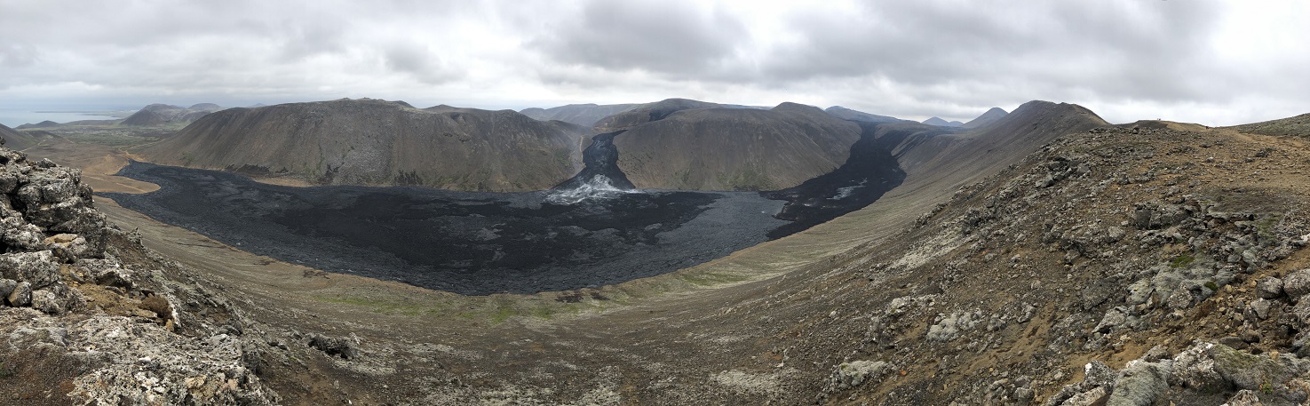
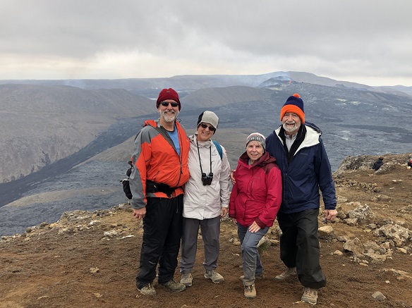
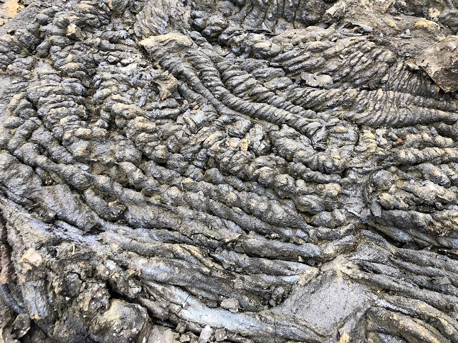
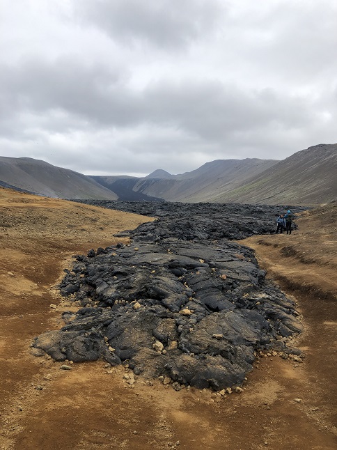
28) Fagradalsfjall, Reykjanes Peninsula, Iceland, August 9, 2021 - Want to do a cool hike? Step 1, find an active volcano and then hike to the top of a nearby peak so you can watch the lava erupt out of the crater. Fortunately, Iceland provided us with an erupting volcano when the Fagradalsfjall volcano started erupting in March 2021 so we just had to supply the hiking. We did just that today. We extended our rental car for an extra day so we could make the one hour drive south out of Reykjavik. We paid for parking in a lot at the mouth of a valley and started hiking. The lower part of the trail was an old dirt road and it led to the leading edge of the lava flow where new black lava was mostly cool but still steaming in places. From there a single track trail started climbing up a ridge with a series of increasing higher summits. The first climb was the most tricky - steep, sandy and covered with roller rocks. After that the trail continued to climb but a little less steep and with more rock ledges we could use as steps. We got to the trailhead so the trail was relatively empty with just clusters in the more challenging areas. Up at the top, the crater was maybe a mile and a half away with the black lava flows pouring down the hillside into the valley. Up at the crater red hot lava was spewing up out of two vents on the rim of the crater and periodically a jet of lava would shoot straight up out of the center of the main crater. So cool! We stayed up at the summit watching the awesome lava show for about 45 minutes before deciding to head back down. It was slow going but we all made it back to the old road safely where we made a side trip over to the face of the lava flow to see it up close. Afterwards, we returned to the car to bask in what a tremendous experience we had just had. 4.5 miles up and back down with 1,000 feet of elevation gain.

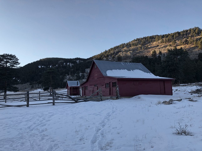
29) Bluebird Loop trail, Caribou Ranch Open Space, Nederland, CO, August 15, 2021 - With Jonna and Alan back from our summer trip to Iceland and our friend Desiree back from her summer trip to Switzerland we all got together for a hike so we could swap stories. Desiree agreed to drive up to Nederland so we decided to head to a local favorite, the Caribou Ranch Open Space just outside town to hike the Bluebird Loop trail. There were some dark clouds overhead and it sprinkled a few times but the clouds never unloaded and instead just provided enough shade to keep the temperature cool. The last of the summer wildflowers were in bloom so while it wasn't the same grand display of color we'd been blessed with in July it still made for a nice backdrop to the hike. Otherwise the trail provided the same sights we are accustomed to: The babbling creek, the quaking aspen trees, the quaint barn and farmhouse at the homestead and the views of the forested hillsides. Always a nice hike and better when sharing it with our friend. A 4.2 mile loop with 250 feet of elevation gain.


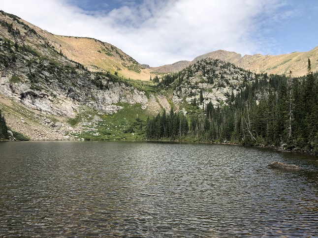
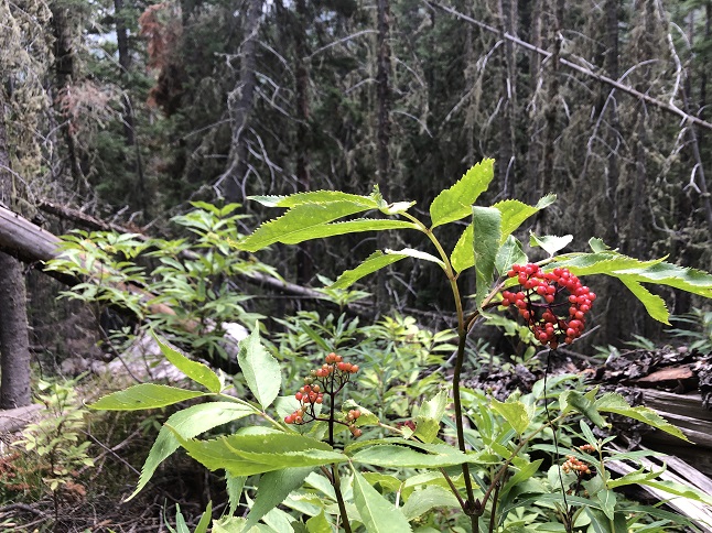
30) Crater Lakes, East Portal trailhead, Tolland, CO, August 18, 2021 - Lyle and Alan headed up into the high country to enjoy what we thought would be the the last of the wild flowers. However, what we found was that they were still going like gang busters up in the wet ground around the high altitude lakes. We met up at the East Portal trailhead early in the morning - a good decision since the parking lot was much more manageable than it is on the weekends. We hiked up to the meadow and started to see big patches of blooming wildflowers which was a much lower elevation that we expected to still have flowers blooming. From there we hiked the Boulder Creek Trail up to where the Crater Lakes trail splits off to the north. This trail climbs steeply up the side of the Boulder Creek valley so while the Crater Lakes are only about a mile off the trail it is a steep trail to get there. We visited two of the lower lakes, enjoying the view of the mountain ridges to the northwest reflected in the water (and watching the more ambitious hikers attempt the climb up to the third lake). We headed back down mid-day with the goal of beating the increasingly darkening clouds that were rolling in. In addition to all the wild flowers there were also a bunch of plants starting to show red berries so it was a nice mix of summer and fall. 6.3 miles up and back with 1,500 feet of elevation gain.


31) Bluebird Loop trail, Caribou Ranch Open Space, Nederland, CO, August 22, 2021 - For the second Sunday in a row, we found ourselves out hiking the Bluebird Loop trail at the nearby Caribou Ranch Open Space. This time it was the delightful opportunity to hike with our friend Holly and her visiting family. Specifically, Holly's niece Megan, partner Emily and kiddo Kai were out visiting Holly in Colorado and Holly and Rick wanted to bring them out for a local hike. They were kind enough to invite us to join them all at Caribou Ranch which gave us an opportunity to catch up with Megan after we last hiked with her way back in 2010! It was a warm summer day with the sun shining down through a bright blue sky filled with big, fluffy white clouds. We hiked the Bluebird loop stopping at the old Bluebird Mine to show off the buildings of the old silver mine and stopped again at North Boulder Creek for a picnic alongside the cascades. We finished up the loop seeing the Delonde homestead buildings and then returned to the trailhead. It was fun to hike with little Kai, great to meet Emily and fantastic to catch up with Megan again. 5 miles with 250 feet of elevation gain.


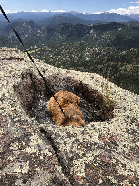
32) Kindred Spirit trail, Johnny Park, Pinewood Springs, CO, August 23, 2021 - Todd had a trail in Johnny Park he wanted to show off so Alan headed to Pinewood Springs for a Monday hike. We met up at Todd's place and then drove into the Johnny Park OHV area on County Road 47 and then headed up the Button Rocks B 4-wheel drive spur to a small parking area. Todd, Rusty-pup and Alan started the hike from there heading first down toward Rattlesnake Gulch but then turning to start up the side of Button Rock Mountain. As we started to quickly gain altitude we could look over the opposite ridge to see Long's Peak and Mount Meeker dominating the horizon to the west. It was steep climb up onto a ridgeline directly below the peak of Button Rock Mountain. Out on the edge of this ridge was a rocky promontory which was our destination. As we made the last bit of the climb it was immediately clear what a spectacular viewpoint this ridge provided. There was a 360 degree panorama! Looking to the south was the Ralph Price Reservoir with Coffintop Mountain as a backdrop. To the west was the magnificent Continental Divide with Long's Peak and Mount Meeker front and center. To the northwest were the peaks of Rocky Mountain National Park and to the southwest were the mountains in the Indian Peaks Wilderness Area. Behind was Button Rock Mountain and then to the east was Pinewood Springs and the back of the Lyons Sandstone ridge. Fantastic views! Rusty was pretty happy too since there was a bathtub sized hole filled with mucky water which Rusty gleefully wallowed in to cool off while we enjoyed the scenery. We descended via a different route, doing part of the Button Rock Mountain loop before turning down an old 4WD road/trail which dropped back down to where we'd parked. It wasn't a particularly long hike, though it did have a steep elevation gain, but overwall the effort versus reward ratio was very, very positive! A 4.1 mile loop with 960 feet of elevation gain.


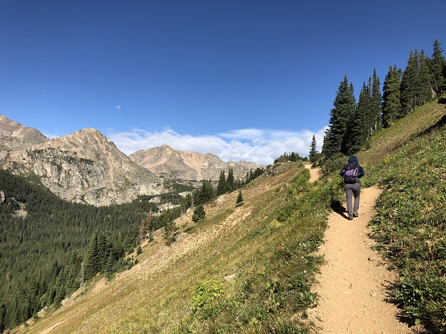
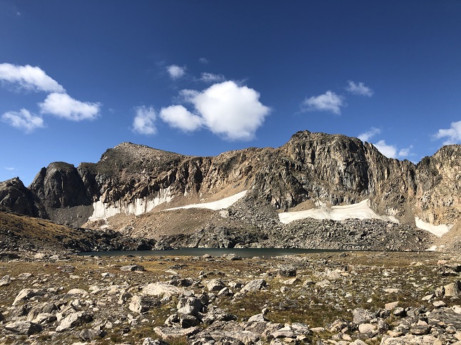
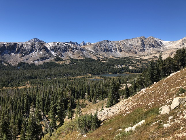
33) Lake Dorothy, Arapahoe Pass, 4th of July trailhead, Eldora, CO, August 26, 2021 - Getting up above treeline in the back-country is always a special experience. Housemate Julia had never been up the Arapahoe Pass trail so Alan and she headed out early on a weekday to enjoy the 4th of July trailhead without all the weekend craziness that has generally kept us away. It was a perfect morning to show off one of the best trails in the front range - cool with clear skies and just a few fluffy white clouds to add contrast to the scenery. The trail is a steady climb that crosses a handful of streams. The streams were still running which was a testament to how much rain we've received this summer. This also meant there will still a surprisingly large number of wildflowers still in bloom, though most were looking pretty sun baked. We stopped at the old 4th of July mine on the way up and, of course, enjoyed the spectacular panorama looking west over the pass, but our main target was Julia's desire to photograph some pikas. Fortunately, the talus fields around Lake Dorothy are perfect habitat for pika - a veritable pika wonderland. As soon as we hiked up to the lake the tell-tell squeaks of pika were heard all around us. We spent about half an hour following the warning calls while Julia snapped photos of the cute little critters with her DSLR camera. With a good collection of shots and some dark clouds starting to form to the west we decided it was time to head back down. This hike really is a gem. The valley to the east of the pass is lush green and filled with little ponds. The stark mountains of the Indian Peaks Wilderness fill the eyeline to the north. In the west there are row after row of peaks stretching to the horizon. And the bowl with Lake Dorothy hovers overhead to the south. It is truly a fabulous place and I am very thankful that Julia's interested in seeing it provided the excuse to hike up there today. A 7 mile up-and-down hike with 2,000 feet of elevation gain.


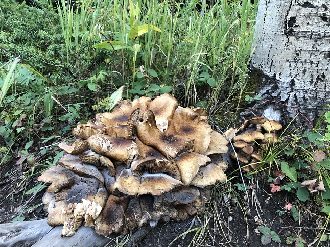
34) Ellsworth Creek trail system, Rollinsville, CO, September 5, 2021 - Our friends Amy and Michael once again drove up from Boulder to hike in the mountains (and to escape the heat from down on the flatland!) We brought them to another of our "secret" trails - the Ellsworth Creek trail system. Only a few late straggler wildflowers were visible but it was still a nice hike through the pine and aspen forest. The highlight was finding the largest mushroom any of us have ever seen. Unfortunately, none of us had enough knowledge of mycology to know what type it was. The sad part is that we collected two bags of trash on the trail, the majority of which was broken plastic bodywork and shattered light lens from 4-wheel drives and ATVs. Come on folks if you bring it into the woods then bring it back out, even if you have to pick it up off the trail to do so. Even with the additional task of picking up debris we had a great time hiking and sharing stories with our friends. 3.2 miles with 600 feet of elevation gain.


35) Homestead and Towhee Trails, South Mesa Trailhead, Boulder Open Space & Mountain Parks, Boulder, CO, September 6, 2021 - This year we are wearing a groove into the Homestead and Towhee Trails. We met up with our good friend and frequent hiking partner Desiree to once again hike these trails. We met up in the evening, hoping to avoid both the daytime heat and the holiday crowds, and were successful on both. We also managed to avoid the bear that Desiree recently ran into on this same trail. Whew! The signs of the coming of Fall were everywhere. The summer wildflowers were now dried and withered husks. The leaves of the brush were starting to replace the verdant greens with red, yellow and orange leaves. Even the length of the shadows at 5pm showed that summer is coming to an end. Thankfully, a clear evening sky made of a great "golden hour" so we got some nice photos and we enjoyed spending some time with our friend. The same 3.2 mile loop with 600 feet of elevation gain that we've done four times so far this year.


36) Wheeler Road Trail System, Roosevelt National Forest, Rollinsville, CO, September 15, 2021 - For at least a dozen years we've noticed cars parked on the side of CO-199 (aka Peak-to-peak highway) and always assumed there must be an unofficial hiking trail there. Well, after all these years Lyle and Alan finally decided to check it out. As it turns out there is a maze of trails in the area with multiple entry points off of neighborhood roads in addition to the spot on Peak-to-Peak. We had a rough idea of where the trail might go so we first followed a north branch that climbed to the top of a nearby hill. The weather was fantastic with cool temps and clear skies. On top of the hill there was almost a panoramic view but the trees were just tall enough to block the horizon. Isn't it ironic when nature gets in the way of enjoying nature? From there the trail dropped down the north side towards Lump Gulch before swinging to the east and leveling out. We looped almost all the way back to the parking area before taking a different branch that headed southeast and dropped down into a small drainage filled with old aspen trees. We forked off that trail to climb back up onto a ridge where the path went behind a row of houses. We eventually connected back to the original trail where we turned back and returned to the cars. Lyle headed home from there but Alan had a little more time and energy so did another loop to find a couple of geocaches and to explore another side trail. All in all, it was a nice morning spent investigating a new set of trails which has added another spot to our catalog of local hiking spots. 6.5 miles with 1,100 feet of elevation gain.


37) Bluebird Loop trail, Caribou Ranch Open Space, Nederland, CO, September 18, 2021 - Having family visit our beloved Colorado is our favorite thing and this weekend we got to triple up on that! First, our cousin Caitlyn and her father Rob few into Boulder to check out CU Boulder as an option for Caitlyn's upcoming college adventure. Then, to make the weekend even better, cousin Rusty surprised us by dropping by during a cross-country walk-about. Yay! We got the whole gang together and brought them out to our "go to" local trail when showing off our neighborhood - The Caribou Ranch Open Space that is a stone's throw from our house. The aspen trees were just starting to yellow but there were stands of cottonwood trees that were bright gold. The grasses in the meadows was also turning brown, the wild rose bushes were heavy with bright red rose hips, and the small ground plants were turning orange and pink. So even with unseasonably warm temperatures we were able to give our visitors a glimpse of fall in the mountains. A lovely day spent with even more lovely people. A 5 mile hike with a mellow 250 feet of elevation gain.


38) Mt. Audubon, Indian Peaks Wilderness Area, Brainard Lake Recreation Area, Ward, CO, September 22, 2021 - Lyle and Alan met up for a mid-week hike to get up into the high country after a recent storm powdered the mountains with the first snow of the Fall. Our plan was to start early in the morning and to summit Mt. Audubon in the Indian Peaks Wilderness Area but our plan was almost literally blown away. Despite it being a beautiful clear and sunny morning there was a cold wind howling down off the Continental Divide. For the first part of the hike we were in the woods and could just hear the wind blasting through the tops of the trees overhead but once we reached treeline it quickly became clear that the tempest was being fueled by the warming land down below and was getting stronger as the sun got higher in the sky. We decided to push on which meant leaning into the pressure while climbing higher and higher up the ridge that leads up to the peak. We got close... so tantalizingly close that it was depressing to turn back...but the wind chill just became too much. Once we were no longer having fun we mutually agreed we should turn back even though we could see the summit maybe a half mile away. It turned out to be the right decision because once we were back in the protection of the trees we really enjoyed the beautiful scenery of the mountains and lakes in the Indian Peaks. 6 miles up and down with 1,800 feet of elevation gain.


39) Harmony Hill Nature Area, West Bradford Township Parks and Trails, Downingtown, PA, September 27, 2021 - Jonna and Alan made a quick trip to Philadelphia to visit our niece Rosie and were joined by Jonna's brother Jamie. While Rosie was working for a living we made a side trip up to Lancaster County to escape the big city and to check out the quaint agricultural countryside. After a day of sitting in the car we made a stop off at the Harmony Hill Nature Area to stretch our legs. We randomly picked the closest trailhead and it turned out to be an excellent choice. There is a paved bike path that runs alongside the Brandywine River and then a network of single track to be explored that connected to the paved path in numerous areas. We wandered through the trails enjoying the verdant forest filled with (among others) Oak, Maple, Beech and Birch trees. We found the ruins of an old building that had been turned into a little garden and further down one of the trails a memorial to a local mountain biker. More importantly, we found a peaceful and beautiful spot to explore which is always appreciated. A 4 mile long "P" loop with 350 feet of elevation gain.


40) Como Creek trail system, Nederland, CO, October 4, 2021 - With the Fall aspen trees in full golden glory Jonna and Alan took a break for a Monday evening to stroll through the large nearby aspen grove along Como Creek. The leaves were a little past the peak for the bulk of the grove but there were still a few trees that were showing their full Fall color and for the places where the trees had dropped their leaves the ground was covered with a carpet of yellow. The setting sun made for odd lighting but it also highlighted the tops of the trees so the aspens were glowing! 2.3 miles with a mild 350 feet of elevation gain.


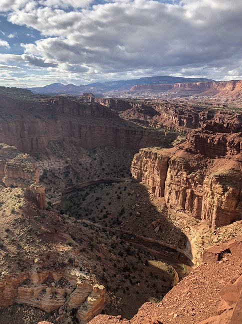
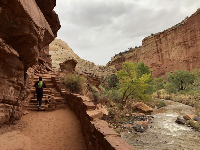
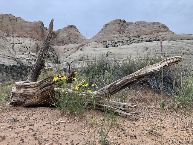
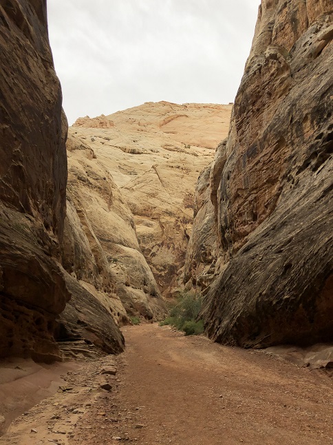
41) Cassidy Arch Trail, Fremont River Trail, Panorama Point, Gooseneck Trail and Sunset Point Trail, Capitol Reef National Park, Torrey, UT, October 6, 2021 - Jonna and Alan jumped in the camper and made a quick mid-week trip over to Utah to explore Capitol Reef National Park. We've driven through this park a few different times in the past but have never stopped to see what it had to offer so this trip was to correct that. And what a great park it is! For our first day we hopped around the park hiking in multiple places. Our first stop, while doing the scenic drive through the park, was at the southern Grand Wash trailhead where we took the Cassidy Arch trail up to its namesake high up on the canyon rim. The views from up there were amazing! After a picnic lunch we took a short hike on the Fremont River Trail which gave us a different view including seeing the historic fruit orchards in the river valley. We cut this hike short to head back to an amphitheater near the trailhead in order to catch a ranger program on the geology of the area. On our drive back to our campground in nearby Torrey we stopped on the western edge of the park: first at Panorama Point to enjoy the 360 views over the landscape and then second at the Gooseneck Trailhead in order to do the short hikes to the Gooseneck Overlook and out to Sunset Point. The Gooseneck is a bend in a deep canyon that the Fremont river has carved through the sandstone and the overlook provided a lovely view down from the rim. Sunset Point, with the sun setting behind us, showed the colorful rock formations throughout the valley to the east. As a bonus we had picked up a small mixed berry pie at the Gifford House back at the orchards which we ate while enjoying the spectacular landscape from Sunset Point. A very, very fine day in a very beautiful place. 6.3 miles of combined hiking with a total elevation gain of around 900 feet.


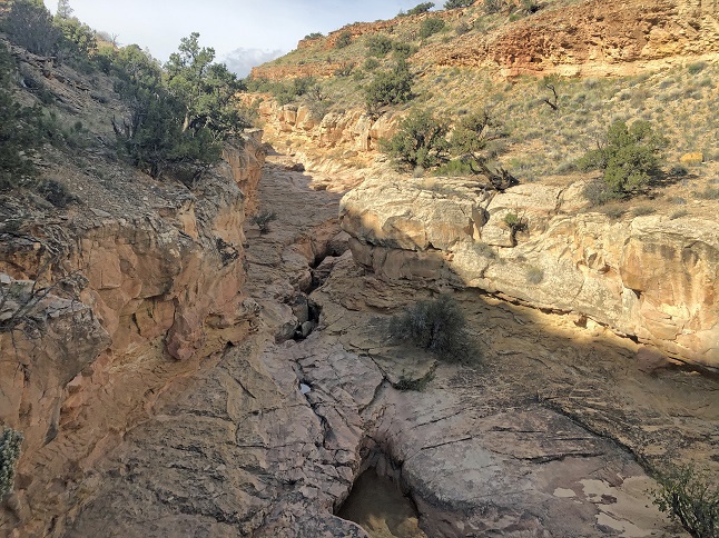
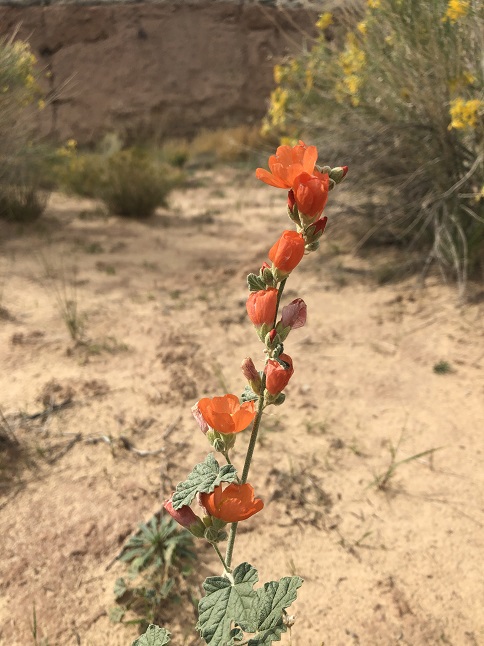
42) Burro Wash Trail, Capitol Reef National Park, Torrey, UT, October 7, 2021 - For our second day of hiking in Capitol Reef we headed to the southeastern edge of the park where we hiked Burro Wash. Our original goal was to get into the slot canyon at the head of the wash but we ended up just barely missing it. After a lengthy hike up the wash, changing from a sandy desert plain into a gradually narrowing canyon, we hit a swimming pool sized pond of water left over from the recent rain which blocked the way. We could have waded through but the cold, deep and muddy water wasn't very appealing. We were within a 1/4 mile of the beginning of the slot canyon but decided to turn back rather than pushing on. Fortunately, there were a lot of Fall wild flowers out in the desert landscape of the wash so we still had great scenery to enjoy during the hike even if we missed out on the slot canyon experience this time around. 5.4 miles out and back with 400 feet of elevation gain.


43) Hickman Bridge Trail and Grand Wash Trail, Capitol Reef National Park, Torrey, UT, October 7, 2021 - Our final day in the Capitol Reef area started off with grey skies and the threat of rain. Undeterred we got an early start to beat the weather forecast and drove straight to the Hickman Bridge Trailhead. We made the climb up and over the sandstone ridge and dropped into a canyon on the backside. From there the trail followed a wash into a bowl with the impressive Hickman Bridge spanning the head of the bowl - a massive 130 foot long arch. The trail made a loop under the bridge, around the back and then dropped back down into the wash for the return. Despite a couple of brief sprinkles when we got back to the trailhead the rain was still holding off so we drove a mile further down the road and stopped at the northern Grand Wash trailhead. From there we hiked through the Grand Wash almost all the way to the southern trailhead we've visited two days early. The Grand Wash is awesome - literally because the sheer canyon walls towering overhead generate that sense of awe that comes with feeling insignificant in the presence of nature's glory. What was also amazing was having the canyon mostly to ourselves since the threat of rain kept the crowds away. After this second hike of the day we drove back to Panorama Point and enjoyed a scenic picnic lunch looking out the camper windows as the incredible panoramic view. A great way to finish our exploration of Capitol Reef. A combined 5.7 miles of hiking with a total of 600 feet of elevation gain.


44) Ice Age National Scenic Trail, Lapham Peak Segment, Southern Kettle Moraine State Forest, Delafield, WI, October 16, 2021 - When the evolving COVID situation scuppered our international travel plans we jumped into our campervan and took off on a six week walk-about. We first headed east from Colorado visiting Jonna's family going through Iowa and Wisconsin. While staying with Jonna's cousin Heath, Abby and their kids Brenna, Hudson & Callen we got out for a hike to enjoy one of Wisconsin's many state parks. Our first stop was the historic Lapham Peak observation tower - site of the first published national weather forecast. Then we headed out into the surrounding forest to enjoy the changing Fall leaves and to hike the National Ice Age Trail along with the Kame Terrace Trail and Moraine Ridge Trail. We strung these trails together to create a loop that gave us a glimpse of the glaciated landscape and the mix of trees that call this part of Wisconsin home. All while enjoying spending time with family. Perfect! A 3.7 mile loop with 100 feet of elevation gain.


45) Waabizheshikana Trail, Duluth Parks & Recreation, Duluth, MN, October 22, 2021 St. Louis River - Our next hiking stop was a big one for Alan - a first visit to Minnesota which also marked the 49th state he's visited! We spent a couple of days in the Duluth area and twice did short hikes on the Waabizheshikana trail which ran right by the campsite where we were staying. For Our second, longer, hike we headed south along the western shore of the St. Louis River Estuary. The Fall colors were at their peak and large groups of migrating waterfowl were taking advantage of the freshwater bays to grab a bite or to float while and rest weary wings. The views over the estuary were very peaceful (though the short section of trail that went past a stinky water treatment pumping station tainted the Fall magic a bit!) 3 miles out and back with basically flat elevation.


46) Wetland and Woodland Edge Trails, William O'Brien State Park, Marine on St. Cruix, MN, October 23, 2021 - We did a second hike in Minnesota thanks to Jonna's long time friend Annie Laurie who invited us to join her for a hike at the William O'Brien State Park along the St. Croix River just east of Minneapolis. Again the Fall leaves were stunning and the crunch underfoot of leaves covered in frozen dew added to the Fall feel. We hiked a loop around the park that brought us through groves of colorful hardwood trees, past misty marshes and along the edge of grassy prairie savanna. A lovely time catching up with a friend in a equally lovely Fall landscape. A 4.1 mile loop with a rolling 420 feet of elevation gain.


47) Nisqually Vista Trail, Paradise Inn Visitor Center, Mt. Rainier National Park, Elbe, WA, October 30, 2021 - After a long drive from the Midwest to the Pacific Northwest we finally slowed down enough to visit a National Park and get out for a hike. A crystal clear day greeted us after rain the night we arrived in the area so we eagerly drove to Mt. Rainier to see the majestic mountain. We had planned to spend a day hiking in Mt. Rainier National Park but 6" of fresh snow blanketed the upper elevations of the park so we confined our outing to a short but challenging snow hike leaving from the Paradise Inn Visitor Center. While all the frantic snow skiers packed the upper lot and charged uphill to make fresh tracks we parked in the empty lower lot and hiked the scenic trails that provided amazing views of the peak. We managed to slide, crunch and squish our way around the Nisqually Vista loop trail as well as a section of another trail in that area before the wind drove enough of a chill into our bones that we retreated back to the camper. A memorable day seeing the icy giant in all its glory. A short but snowy 1.7 mile loop with 480 feet of elevation gain.


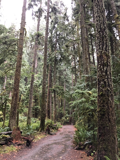
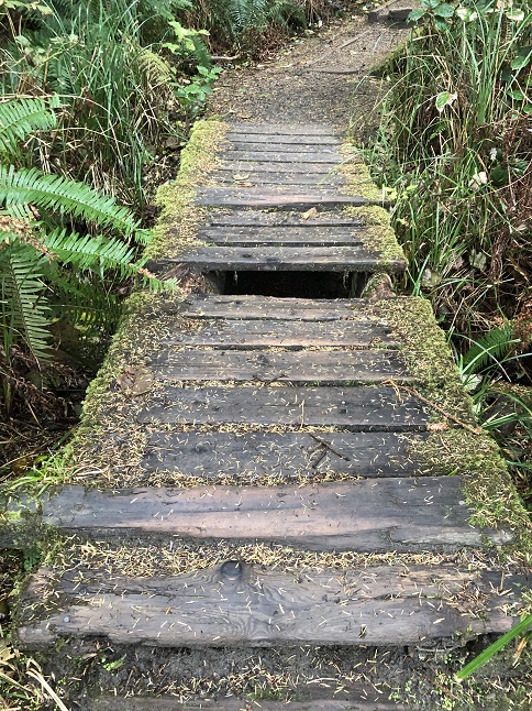
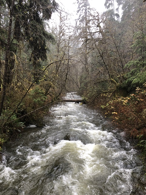
48) Ancient Groves and Marymere Falls Trails, Sol Duc Valley and Lake Crescent Areas, Olympic National Park, Port Angeles, WA, November 2, 2021 - Our next day of hiking set a trend we could continue for most of the next month - doing two short hikes every day so we could see a variety of landscapes. Our first day exploring Olympic National Park was split between the Sol Duc Valley and the Lake Crescent area. Our first hike was a short but spectacular morning loop near the top of Sol Duc Valley through an old growth Douglas Fir forest in a lush wet temperate forest environment. It was truly ethereal - giant trees covered in mosses, vines, ferns and mushrooms. It was a rainy, drippy day which just made the rainforest feel all the more magical. Our second hike was back down out of the valley and along the edge of Lake Crescent were we did a hike from the Visitor Center to see Marymere Falls. It continued to sprinkle rain and clouds of mist floated through the thick forest - again, magical. We crossed a couple of creeks on old log bridges and then climbed up to the viewpoint for the 90' high water fall. A day of forest beauty. Two small hikes make for one decent length one. Both trails totalled 2.3 miles in length and 350 feet of elevation gain.


49) La Push Beaches and Hoh Rain Forest Trails, Olympic National Park, Forks, WA, November 3, 2021 - Our second day in Olympic National Park provided two very different but equally striking landscapes. In the morning we drove to La Push Beach #1 and then stopped at a second spot where we hiked out to La Push Beach #2. Here, near the northwestern corner of the country, the beaches are harsh places. Stony shores punctuated by jagged rocky outcroppings just offshore. The shoreline itself is covered with massive tree trunks driven up to the high water line by crashing waves. The grey, overcast skies and booming wave crashes just added to the drama. From the coast we drove back inland to visit the Hoh Rain Forest. There we stopped at the Visitor Center and, despite the pouring rain, we suited up to hike both the Hall of Mosses and Spruce Nature Trails. Wow! This was just an unreal landscape. The trees were so covered with mosses and lichens that it looked prehistoric. If a dinosaur had popped its head out from behind a tree we wouldn't have been surprised. It was so beautiful that we ended up finding a camp area just outside the park where we could enjoy the landscape for the evening as well. All three trails totalled 6.1 miles of hiking with 460 feet of elevation gain.


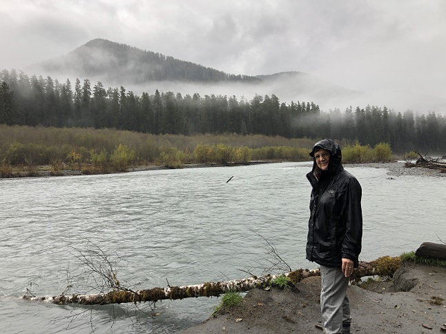
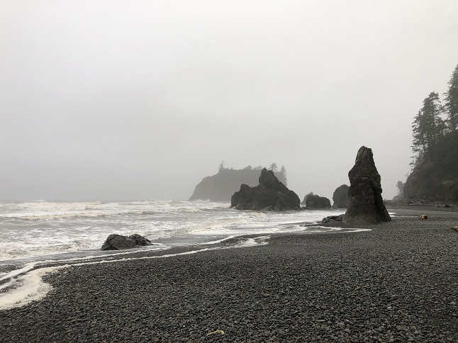
50) Ruby Beach and Lake Quinault Trails, Olympic National Park, Queets, WA, November 4, 2021 - Our third and final day in Olympic National Park was a miniature version of the previous day. Once again we started with a morning hike on a rocky, tree trunk covered beach - this time Ruby Beach in the Kalaloch section of the park. Once again it was a misty, rainy day so the beach felt grey and imposing. The highlight of the beach was watching ducks fly upstream on fast flowing Cedar Creek and then come zooming back downstream riding the rough, rolling current. They were probably fishing but it looked like they were doing the duck equivalent of whitewater rafting. Our afternoon was our wettest yet. We drove back inland to the Lake Quinault area. We started out to hike the lake side trail but quickly found it was flooded out just past historic Quinault Lodge. So instead we headed uphill along Falls Creek to see Cascade Falls. A we hiked the skies unloaded so our back down from the falls was spent testing out rain gear - which put up a good fight but we were both pretty damp by the time we sloshed back into the camper. Combined 1.9 miles with 260 feet of elevation gain.


51) Cape Blanco Lighthouse trail, Cape Blanco State Park, Sixes, OR, November 8, 2021 - Our next hike was also punctuated by weather but this time it was wind rather than rain. We pulled the campground at Cape Blanco just as the sun was setting. As soon as we parked we jumped out of the camper and headed out on the hiking trail that ran behind our campsite to the Cape Blanco lighthouse. The first 1/3 of the trail went through thick forest but then the trail opened out onto a high cliff which was being blasted by strong gusty winds. We both managed to stay upright and fight our way forward all the way out to the lighthouse despite the gale force winds. We even did a side hike down to the beach below the lighthouse to watch the waves crash and get sprayed by the foamy mist whipped around by the wind. The light faded as we worked our way back to the point that navigating the thick forest in the dark was a challenge. Another memorable hike along the dramatic west coast. (Note: the next day we learned that the wind storm had been a major weather event that knocked out power in many towns along the Oregon and California border!) 2.5 miles with 250 feet of elevation gain.


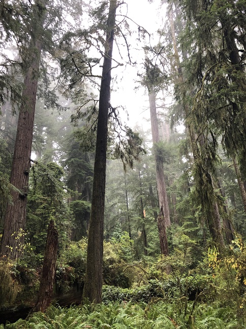
52) Simpson Reed/Peterson Memorial Trails and Lady Bird Grove, Redwood National Park, Crescent City, CA, November 9, 2021 - As we continued our drive south along the coast our next hiking stops were both in Redwood National Park. We again split our exploration into two short hikes: First hiking the Simpson Reed and Peterson loop trails in the northern most part of the park (which is actually shared with California's Jedediah Smith Redwoods State Park. Similar to our experiences in the spring in Kings Canyon and Sequoia National Parks, hiking amongst the giant redwoods is truly humbling. Photos have no chance of capturing how striking these massive trees are. They just tower impossibly high above you when hiking and the striking size of the trunks defies the traditional idea of what a tree looks like. We just walked with our necks craning up and down to try to take in these soaring wonders. Our second stop in the afternoon was more of the same. This time we made the tricky drive up into the coastal mountain range to hike the Lady Bird Grove in the center of the park. While the transmission on the camper cooled from the strenuous drive we hiked the well used loop through this grove of old growth redwoods. More of the same - basically walking through an arboreal cathedral. Amazing! Combined 2.5 miles with 200 feet of elevation gain.


53) Glass Beach and Belinda Point Cove Trails, Ft. Bragg, CA, November 10, 2021 - Our next hikes were two different coastal trails in the town of Ft. Bragg, CA. The first, the Glass Beach trail was a very well used trail that runs from the north edge of town to downtown via the cliffs that make up the ocean coast in this area. We parked the camper on a street and did an out-and-back stroll to enjoy the views of the crashing waves at the base of the cliff. There was also a small section of stony beach where 100 year old glass from an old up-coast trash dump washes ashore. The white pebbled beach was covered in tiny red, green, blue and white pearls of glass - what was once trash is now a protected attraction. For sunset we did a longish hike from our campground out to a small trailhead where we hiked out to the tiny beach below Belinda Point. More crashing waves, rocky haystack rocks, twisted driftwood and beach rocks rolling in the surf. We walked back in the dark listening to frogs croaking in in the roadside fields and watching the locals enjoy their evening neighborly socializing. Both hikes combined for 3.5 miles with 150 feet of elevation gain.


54) Doran Regional Park and Bodega Head, Bodega Bay, CA, November 11, 2021 - We continued the beach hikes as we drove down the California coast but this time on a real, sandy beach. We got to our campsite in Bodega Bay early in the day so we had the Veteran's Day holiday afternoon to enjoy a traditional beach walk. We walked from our campsite at the very tip of Doran spit all the way back to the edge of Doran Regional Park and then back again. Families filled the beach with kites flying, footballs being tossed, kids playing in the surf and groups of people laughing to shared stories. Looking out into Bodega Bay there were surfers catching waves, fishing boats going to and fro and birds wheeling through the air doing their own fishing. After our afternoon at the beach we drove a big loop to get to Bodega Head which overlooks the Doran spit across a narrow channel. We arrived just at sunset and joined the crowd of folks watching the sun dip below the Pacific ocean. We then did a walk up to the highest point on Bodega Head to see the steep cliffs and to look down onto our campsite. 3.2 miles combined with no elevation gain on the beach but about 200 feet going up Bodega Head.


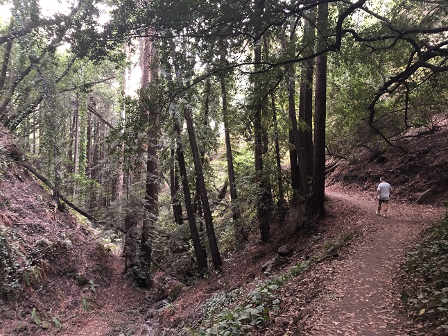
55) Claremont Canyon Trail, East Bay Regional Park District, Berkeley, CA, November 13, 2021 - Every time we visit Jonna's brother Jamie in the Bay Area he brings us on different trails to show off how much hiking there is literally right on the edge of the mega-city that is the San Francisco-Oakland area. Our first hiking outing on this visit started within a frisbie toss of the University of California Berkeley campus. We made a very brief but very steep hike up the Claremont Canyon Trail which was basically climbing a cliff that overlooks both the Berkeley campus and the iconic Claremont hotel. Normally I wouldn't consider such a brief outing a hike but the impressive elevation gain over such a short distance qualifies it as a hike. A short but steer 1.6 mile out and back with 700 feet of elevation gain.


56) Palos Colorados Trail, Joaquin Miller Park, Oakland, CA, November 14, 2021 - Jonna had a lunch get together with friends planned so Jamie brought Alan out to check out another trail that is a regular hike for Jamie but Alan had never seen before. Like so many amazing trails in this area it is on the edge of a dense housing sprawl but within literally a few steps the world is transformed into a redwood forest paradise. As cars zoom by on the CA-13 freeway we walked through an underpass and were transported into a canyon that climbed up into the Joaquin Miller park with moss-covered trees, a cascading creek and fern covered cliffs. The hiking in this area continues to surprise. We made a nice loop by going up the Palos Colorados trail, then turning off onto Sinawik Cabin which we used to climb up to Sunset Loop. We've hiked this trail in the past and followed it around to the Wild Rose trail (another one we've hiked in the past) then used Sequoia Bayview trail to return to Palos Colorados for the decent back down into the hustle and bustle of city life. A 4.4 mile loop with 750 feet of elevation gain.


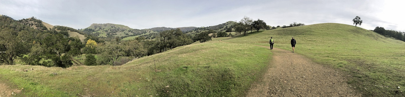
57) Little Yosemite via McCorkle and Canyon View Trails, Sunol Regional Wilderness, Sunol, CA, November 15, 2021 - Our final hike with Jamie was exploring a different landscape. Rather than going up into the redwood forests that overlook Oakland we instead drove east to the edge of the rolling hills that eventually lead to California's central valley. Here the landscape is oak trees, ranches and livestock grazing land. The Sunol Regional Wilderness Park preserves a chunk of this environment centered around the Alameda Creek and contains a canyon area that is called "Little Yosemite". We did had a beautiful day with the perfect cool weather for a hike in the sunshine. The hike followed the rolling terrain going up and down hills before dropping down into the creek valley. Alameda creek was running very low - more of a trickle than a creek, so Little Yosemite lacked the cascading water the presumably earned it the nickname. Despite the dry waterway it was a scenic hike with nice views of creek valley and the surrounding hills. The wildlife highlight was seeing a flock woodpeckers hammering acorns into the trees trailside burning the trunks into polka dotted artwork. Also a wildlife highlight was *not* seeing any of the tarantulas that call the park home. A new and interesting part of the Bay Area to explore. Thanks Jamie! 3.68 mile hike with 800 feet of elevation gain.


58) Joaquin Miller Trails, East Bay Regional Park District, Oakland, CA November 19, 2021 - Our final hike in the Bay Area, and the last of our Fall vacation trip, was with our niece Rosie. Since this was primarily a chance to catch up with her, more than to explore any new trails, we drove to a nearby trailhead in Joaquin Miller Park that we've hiked from before. We made a loop by stringing together the Dunn, Graham, West Ridge and Big Trees trails to wander through the hills above Oakland. This was an afternoon where the coastal fog was thick so the eucalyptus and oak trees were cloaked in milky white clouds which made the forest feel eerie. In tried to sprinkle a few times during the hike but there was never enough water falling from the sky to force us into our rain jackets for more than a few minutes each time. So we wandered through the foggy, misty hills while enjoying each other's company until we made our way back to the car (which thankfully hadn't been broken into which, based on the state of the ground in the area, is a normal occurrence in this area. If Ft Bragg has Glass Beach then Joaquin Miller Park has Glass Trailhead!). A 3.5 mile loop with 500 feet of elevation gain.


59) Betasso Preserve, Boulder County Open Space, Boulder, CO, November 28, 2021 - Our first hike back in Colorado was a post-Thanksgiving weekend get together with our friends Desiree and Gaelin to work off some of the calories we'd all consumed during the holiday meal. We met in the middle at the Betasso Preserve trailhead and hiked counter-clockwise around the loop. We spent a good portion of the hike dodging mountain bikes but we expected that which is why we were hiking in the opposite direction to bike traffic. We have hiked this trail many, many times so we focused more on chatting that sightseeing but we still stopped a few times to enjoy the vistas down the canyon and out over Boulder. 3.7 mile loop with 600 feet of elevation gain.


60) Dry St. Vrain Trail #920, North Saint Vrain Research Natural Area, Arapaho & Roosevelt National Forest, Riverside, CO, December 2, 2021 - After a long break Todd, Rusty pup and Alan got back together to explore a new trail just off the side of South St Vrain canyon. We drove into Roosevelt National Park to the Forest Service 920 trailhead and then quickly headed out to explore...perhaps a little too quickly, as we eventually discovered we'd missed the actual trail completely and had instead wound our way most of the way down to North St. Vrain Creek on a side game trail before running into the main trail near the very end. Nonetheless, it was a pleasant hike down and very scenic once we were down in the creek's canyon. We hiked down the bank of the creek for little ways but Todd had an prior commitment so we didn't explore as much as we normally would. Instead we turned back and returned - this time following the actual trail all the way back to the trailhead. We had both arrived wearing multiple layers ready for a chilly winter hike but the temperature crept up into the low 60s as the sun rose in the sky so we ended up peeling off layers until we were hiking in T-shirts. Great weather for hiking but way too warm for this time of the year! Bring on the snow to get some moisture into these dry mountains! 3.8 miles out and back with 1,100 feet of elevation gain.


61) Mt. Galbraith, Jefferson County Open Space, Golden, CO, December 11, 2021 - Long time (or should I just say "old") buddy Todd was getting together with his nephew Dan do check out the Mt Galbraith trail just outside Golden and invited Alan to join. We met up at a surprising empty parking lot (it is normally crammed full of cars) and immediately started the climb up the side of Mt. Galbraith. The weather was sub-freezing with mostly overcast skies but the trail only had a slight dusting of snow left over after a threatening snow storm late in the week fizzled out to nearly nothing. This trail is right on the edge of the front range of mountains so rather than pure natural scenery you are instead looking down on Arvada to the northeast and then later in the hike looking straight down onto Golden to the east. It is also a trail that goes straight up to the top of the mountain and then comes straight back down so generated body heat on the climb up and then shed sweaty layers on the drop back to the trailhead. Many stories were re-counted, many jokes were exchanged and lots of laughing was the soundtrack of the hike. It also marked the embarrassing occasion where Alan had to admit Todd was right about something...(and Todd being right is so rare that it deserves to be memorialized in a hike write-up.) A 4.5 mile lollipop loop with 1,000 feet of elevation gain.


62) Ceran St. Vrain Trail, Arapaho & Roosevelt National Forests, Jamestown, CO, December 12, 2021 - An afternoon hike is a great way to catch up with friends so Holly, Rick, Jonna and Alan all met up at the Ceran St. Vrain trailhead on a chilly Sunday afternoon for a hike along the frozen South St. Vrain river. The trail is an easy one gently dropping downhill as the river flows north and ending where the hiking trail meets up with the network of National Forest roads that criss-cross the valley. The trail was mostly dry but the river was completely frozen over. A reflection of the lack of snow but the very cold temperatures we've had the past couple of weeks. Nonetheless, the conversations were warm and cheery so just the thing we were all looking for. A 4.1 mile out-and-back trail with 400 feet of elevation gain.


63) Round Mountain Trails, Arapaho & Roosevelt National Forests, Pinewood Springs, CO, December 16, 2021 - Todd, Rusty the hiking pup and Alan headed out from Todd's house so that Todd could show off a new mountain bike trail he'd found this year. It was cold out but the howling wind that had been swirling the previous day's snow around had calmed and the sun was warm in the clear blue sky. We found we were overdressed as sunshine overcame the chill in the air. The first half of the hike was one we'd hiked together many years ago but halfway up Round Mountain a hidden new trail branched off and circled around the side of the peak. Big rock outcroppings and giant boulders covered the eastern side of the mountain with the trail winding through it all. Also in this stretch of trail were views looking down onto Spruce Gulch and the backside of the Hogback ridge on the edge of the plains. As the trail swung around to the north side of the mountain it turned into a straight, steep climb up to a saddle near the peak. We went up and over, then made the drop back down the south face of the mountain all the way to the Little Thompson River. The hike ended with another steep climb to return to Todd's house. A long, strenuous hike but with excellent scenery and fun conversation. 8.3 miles with 2,400 feet of elevation gain.


64) Wheeler Road Trail System, Roosevelt National Forest, Rollinsville, CO, December 19, 2021 - Jonna and Alan wanted to stretch our legs and burn a few calories before heading into the holiday so we drove to nearby Rollinsville so Jonna could check out the Wheeler Road trail system that Alan had explored with Lyle back in September. Due to the dry winter there wasn't much snow on the ground but the air definitely had a December chill to it even in places where the sun was shining through the pines. We hiked the portion of this trail system that runs down a valley will a large aspen grove and then a loop up on a pine covered hillside so we enjoyed a nice mix of Rocky Mountain forest. Now we're prepped for all the holiday spent traveling, sitting and eating. A 2.3 loop with 550 feet of elevation gain.

If you enjoyed these you may also enjoy checking out some photos from our 2020 hikes.
